Download
1 / 28
290 likes | 537 Views
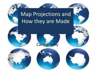
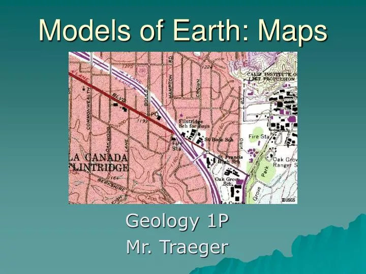
Models of Earth: Maps. Geology 1P Mr. Traeger. What is a Model?. It is a smaller version of the real thing. Just like we build models of airplanes, boats, or cars, we can also build a model of the Earth. We call this model a globe. A globe is an accurate representation of our Earth.

E N D
Models of Earth: Maps Geology 1P Mr. Traeger
Just like we build models of airplanes, boats, or cars, we can also build a model of the Earth.
Unfortunately, globes cannot be stuffed into your pocket when you go hiking.
So, we must take the 3-dimensional Earth and put it into 2 dimensions.
There is a problem with maps compared to a globe. Can you see it?
There is distortion of certain parts of the globe. Notice how Greenland is much bigger in the map version
We call this distortion. We can attempt to overcome distortion by drawing maps in different projections, depending on what it is we are looking at.
A Mercator projection is like wrapping a large cylinder of paper around the middle of the earth. It shows true direction in a straight line, but distorts distance and area near the poles.
A Gnomonic projection is like laying a sheet of paper of a point of Earth’s surface. Land masses away from the center point are distorted. It can be used to plot the shortest distance between two points. See page 45 in your book for a picture.
A Polyconic projection is like taking a cone of paper and wrapping it around the Earth. This is a good projection for mapping the United States. See page 45 in your book for a picture.
The shortcoming of all projections is that they accurately show the land where the center of the page is overlain, but they distort as you go outwards.
Earth is divided into different hemispheres. Northern Western Eastern Southern
Latitude is the angular distance (degrees, minutes, seconds) north or south of the Equator. It goes from 0 to 90 degrees North, and 0 to 90 degrees South.
Longitude is the angular distance (degrees, minutes, seconds) west or east of the Prime Meridian. It goes from 0 to 180 degrees East, and 0 to 180 degrees West.
Click on the link for a song about latitude and longitude. Northern Western Eastern Southern
The map on the left is small scale, 1: 214,464,232. The map on the right is large scale, 1:39,382,653.
Map orientationGood maps always have a scale bar and orientation (north arrow).
Your job right nowUsing graph paper, make a scale map of the classroom.Measure out your dimensions in the room, measure out the dimensions on the paper, and then determine a scale factor. Draw your map on graph paper to scale. Include the tables in the room. Also include the doors. Show all of your work on a separate piece of paper. Tell me what scale your map is, put a north arrow on it, and also draw a scale bar at the bottom.
Topographic Maps Topographic maps are used to represent a 3-dimensional world in 2-dimensions
Topographic Maps Topographic maps use symbols to represent items that they show.