Download
1 / 43
430 likes | 548 Views
OCEANOGRAPHIC DATA AND INFORMATION INITIATIVES IN AFRICA. 1 st African Digital Curation Conference CSIR International Conference Centre, Pretoria, South Africa 12 th -13 th February 2008. Dr. Ing. Alfonse M. Dubi Associate Professor and DIRECTOR

E N D
OCEANOGRAPHIC DATA AND INFORMATION INITIATIVES IN AFRICA 1st African Digital Curation Conference CSIR International Conference Centre, Pretoria, South Africa 12th -13th February 2008 Dr. Ing. Alfonse M. Dubi Associate Professor and DIRECTOR Institute of Marine Sciences, University of Dar es salaam, Zanzibar, TANZANIA
OCEANOGRAPHIC DATA AND INFORMATION INITIATIVES IN AFRICA WHY NOT TALK ABOUT “AFRICAN DATA INITIATIVES? Africa is so wide, having different political and economic groupings, each country doing “their own things”, Data on/about/by Africa would cover many disciplines: natural sciences, engineering, technology, social sciences, etc All Africa Data initiatives would need a separate “CONFERENCE” OCEANOGRAPHIC DATA AND INFORMATION INITIATIVES IS APPROPRIATE
The whole of Africa is surrounded by ocean, which is subjected to both natural and human phenomena • The dynamics of climate ( winds, temperature, barometric pressure, rainfall, etc.) and population affect the dynamics of the ocean. • The dynamics of the ocean (waves, currents, temperature, etc.) affect fisheries, transportation, exploration and exploitation of hydrocarbons and other economic activities • LME’s are important to African economies, e.g Benguela, Agulhas and Somali Currents EARTH AND ENVIRONMENTAL DATA AND INFORMATION 1. INTRODUCTION
EARTH AND ENVIRONMENTAL DATA AND INFORMATION 2. OCEANOGRAPHIC DATA AND INFORMATION INITIATIVES IN AFRICA In 1998, African Countries embarked on“The African Process for the Co-operation for the Development and Protection of the Coastal and Marine Environment”
EARTH AND ENVIRONMENTAL DATA AND INFORMATION 2 Cont’d A Pan-AfricanConference on Sustainable Integrated Coastal Management (PACSICOM) was held in Maputo, Mozambique, in July 1998. The Maputo Declaration recognised the need for further capacity building, especially the following: Training and education in marine sciences and technology and their application to sustainable development; Institutional strengthening; and Sustainable funding.
2 cont’d “The African Process resulted in a Africa-wide Project, i.e. GOOS – AFRICA with the following priorities: • Improved collection of In-Situ Ocean Measurements and Observations, Validation training and education in marine sciences and technology and their application to sustainable development; • The collection and spatial analysis of satellite imagery of the coastal seas for fisheries resource management and coastal planning • development of regional modelling and forecasting capabilities to provide additional protection against regular and extreme events.
3. SOME INITIATIVES • 3.1 Definition: Oceanographic data is divided into : Biological, Chemical, Geological, Physical, and Meteorology • 3.2 There are open access/managed data archives : Oceanographic Data Centres (a) Intergovernmental Data Centers : Established by international agreements to archive and manage and deal with multi-national datasets (b) Research Project Data Centers Data centers established by specific research projects to manage project datasets until final archiving at Intergovernmental Centers or other final disposition
EARTH AND ENVIRONMENTAL DATA AND INFORMATION 3.2 SOME INITIATIVES cont’d (c) Topical & Operational Data Activities - Specially created activity centers that archive and provide data on specific regional or thematic topics, and newly established centers that provide processing and delivery of operational oceanographic products within operational oceanographic systems e.g. sea level: http://sealevel.colorado.edu/current/; UHSLC: University of Hawaii Sea Level Centre: Website: http://www. ilikai.soest.hawaii.edu PSMSL: Permanent Service for Mean Sea Level: Website: http://www.pol.ac.uk/psmsl NODC: NODC: National Oceanographic Data Centre (US): Website: http://www.nodc.noaa.gov JASL:Joint Archive for Sea Level Website: http://www.uhslc.soest.hawaii.edu/uhslc/jasl.html GLOSS: GLOSS: Global Sea Level Observing System: Website: http://www.pol.ac.uk/psmsl/programmes/gloss.info.html TPA: Tanzania Ports Authority Website: http://www.tanzaniaports.com
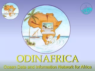
EARTH AND ENVIRONMENTAL DATA AND INFORMATION 3.3. In- Situ Measurements THE ODINAFRICA PROJECT
ODINAFRICA –III Goals • Consolidate the achievements of ODINAFRICA-II and: • improve data flows into the national oceanographic data and information centres in the participating countries, • develop data and information products required for integrated management of the coastal areas of Africa, and • increase the delivery of services to end users.
Specific Activities: highlighted • Strengthen GLOSS network in Africa • Additional sensors on sea level stations • Creation of African Ocean Biogeographic Information System • Data and Information requirements of these and other initiatives, including development of services and products • Reinforcementof capacity of NODCs to better provide better services
The Network Over 40 institutions in 25 countries
The Thematic Work Packages • Coastal Observing Systems • Data Management • Information Management • Products Development and Dissemination
Coastal Observing Systems In-situ measurements • upgrade and expand African network for in-situ measurements and monitoring of ocean variables (e.g. sea-level, temperature, salinity, currents, winds, etc) • [19 sea level stations installed/upgraded, 10 of them fitted with additional oceanographic sensors] • provide near real-time observations of ocean variables, and • building adequate capacity for collection, analysis and management of sea-state variables.
19 Proposed sites -2003. • ANGOLA: Lobito • CAMEROON: Kribi • COTE D’IVOIRE: Abidjan • GHANA: Tema, Takoradi • KENYA: Mombasa • MADAGASCAR: Nosy Be • MAURITANIA: Nouadhibou • MAURITIUS: Port Louis, Rodrigues • MOROCCO: Casablanca, Agadir • MOZAMBIQUE: Inhambane, Pemba • NAMIBIA: Luderitz • NIGERIA: Lagos • SEYCHELES: Pt de la Rue • TANZANIA: Zanzibar • TUNISIA: Sfax
Implementation: Review of Status of Network. • About 40 installed stations, varying operational status, and quality of observations, • Initiatives by other regional initiatives and national institutions to install/upgrade tide gauges, • Indian Ocean Tsunami 26 December 2004, one of the worst marine disasters recorded impacted greatly on the implementation plan developed.
Installed Tide Gauges Takoradi, Ghana Nouakchott, Mauritania
Installed Tide Gauges Djibouti, Djibouti
Other planned locations Pointe Noire, Congo (installation 30 March -6 April 2007) Proposed location at the entrance to the port suitable radar or pressure gauge.
Limbe - Cameroon Limbe port - poor security and potential damage from old cargoes piled up on the very small jetty Numerous passengers from ferries using the jetty. SONARA Oil Refinery Jetty Provides best option-long, Secure, sufficient depth
Nosy Be, Fort Dauphin Nosy Be the jetty has been destroyed and needs to be reconstructed Port security is very limited. Strong swell within the harbour- pressure and radar sensor records difficult to process because of irregular variation in sea level.
Moroni - Comoros Northern part of the new quay slowly sinking in water, south part not enough space and enough water to install the tide house and tide gauge well. Installation north of the island too difficult to realise; very shallow waters do not allow an installation alongside the coast. The only solution would be to build offshore tide gauge huts far from the coastline.
Alexandria - Egypt New tide gauge to be located at NIOF
Dakar - Senegal Repairs of tide gauge housing in progress
Morocco stations Network exist of 9 operational tide gauges, most of them with acoustic sensors, proposal to install new at Casablanca. Old tide gauge location, Casablanca
Mtwara - Tanzania Not among the original sites, but being considered – depending on availability of resources
Configuration of tide gauges • Kalesto radar gauge; • Two pressure sensors; • Logosens-2 datalogger; • OTT HDR DCP satellite transmitter for the Meteosat. (Purchased and configured by Proudman Oceanographic Laboratory, United Kingdom).
Data Management • further development and strengthening of National Oceanographic Data Centres (NODC) to manage data streams from the coastal ocean observing network, • upgrading infrastructure in the NODC’s (including internet access and computer systems) • Integrating biogeographic and hydrological data steams into NODC systems • Building capacity for data and information managers for new NODCs established as part of this project, and • Rescue historical data (especially sea level data)
National Field Data Collections • Enrichment of databases with locally available data • National Marine Atlas • National data CDs
Data Management training • Series of data management training courses Left: Casablanca, Morocco Right:Ostende, Belgium
Training – Application of Satellite Altimetry to Oceanography. • Principle of satellite altimetry and applications to sea level studies • Ocean circulations/currents and eddies from altimetry • Marine gravity and geoid from multi-satellite altimetry and applications • Altimeter waveform tracking for land/ocean use • Bathymetric estimation from altimetry • Improved methods/theories of altimeter data processing • Inland sea/lake monitoring using altimetry • Operational oceanography using altimetry
Public Awareness • TOGO:"Small window on oceanography for students“
Improvement of Internet Access • VSAT installation in Madagascar and Nigeria
The African Marine Atlas. • incorporates existing geo-referenced datasets available in the public domain (but tailored to meet specific scope requirements), and also data products created from national and international marine data collections.. http://iodeweb2.vliz.be/omap/OMAP/index.htm
3.4 COMPUTING AND DECISION SUPPORT TOOLS To build capacity in computer modelling in various applications such as ocean and coastal circulation modelling, marine and coastal ecosystem modelling, ecological modelling taking account of Global Climatic Changes and Variability, Sustainability and Ecosystem Based Management.
3.4.1 STRATEGY FOR ACHIEVING THE OBJECTIVE • Enhance Human Resources Development • Introduce postgraduate training courses (M.Sc.) in Coastal and Marine Geo-informatics (RS, GIS and Computer Modelling) • Introduce punctuated training courses and workshops • Seek national, regional and international Partnerships for FUNDING
3.4.2. POTENTIAL MODELLING APPLICATIONS • Climate Variability and change • Pollution and water quality • Marine-related natural hazards (tsunami, cyclones and storm surges) • Sustainable coastal development • Living resources and management of key habitats • Understanding coastal processes, science and education
3.4.3 PLAN AND PROGRESS • Enhancing Human Resource Development (HRD): • Recruitment of academic and scientific staff, e.g. computer scientists and engineers to form a computer modelling group (www.theissresearch.org ). • Organisation of training workshops • Reorganisation of the Institute into academic 3 departments (MBRM, CEMS and PAMS) • Identification of relevant models The Institute, with funding from Sida-SAREC, has acquired the following computer modelling systems: ROMS, MATLAB, MIKE 21, SMS (ADCIRC) and ArcGIS. To enhance computing power, the Institute has acquired a powerful computer.
3.4.3 PLAN AND PROGRESS cont’d • Establishing formal specialised training: Postgraduate studies at M.Sc. level. • Marine and Coastal Resources Mgt -IMS • Marine and Coastal Geo-informatics -IMS • Oceanography -UCT • Provision of high quality digital bathymetry:(topography of the ocean bottom) for African coastal oceans, e.g. Mike C-MAP for the WIO – Region • Dissemination and Products: Customer-tailored products, e.g. climatologies inventories; extreme values; atlases; value- added specialised forecast are to be archived in a database