Download
1 / 9
100 likes | 256 Views
PREPAREDNESS FOR SOUTH - WEST MONSOON UNDER DHALAI DISTRICT IN 20010-11. 1. INTRODUCTION

E N D
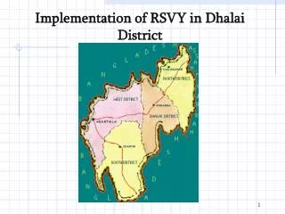
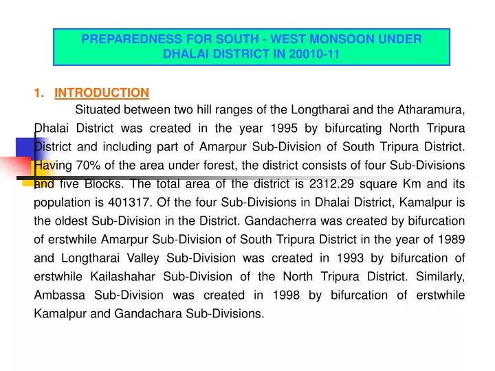
PREPAREDNESS FOR SOUTH - WEST MONSOON UNDER DHALAI DISTRICT IN 20010-11 1. INTRODUCTION Situated between two hill ranges of the Longtharai and the Atharamura, Dhalai District was created in the year 1995 by bifurcating North Tripura District and including part of Amarpur Sub-Division of South Tripura District. Having 70% of the area under forest, the district consists of four Sub-Divisions and five Blocks. The total area of the district is 2312.29 square Km and its population is 401317. Of the four Sub-Divisions in Dhalai District, Kamalpur is the oldest Sub-Division in the District. Gandacherra was created by bifurcation of erstwhile Amarpur Sub-Division of South Tripura District in the year of 1989 and Longtharai Valley Sub-Division was created in 1993 by bifurcation of erstwhile Kailashahar Sub-Division of the North Tripura District. Similarly, Ambassa Sub-Division was created in 1998 by bifurcation of erstwhile Kamalpur and Gandachara Sub-Divisions.
The average annual rainfall in the District is about 220 centimeters. The temperature ranges from 16.9 to 36 degree Celsius in summer and from 5.3 to 28 degree Celsius in winter. The major rivers of the District are Dhalai, Gomti, Khowai and Manu and the major hill ranges are Atharamura, Longtharai, Kalajhari and Sakhantan. The maximum hilly region of the State is located in Dhalai district. The Atharamura, the second largest • hill range of the state is situated between Ambassa and Teliamura. • The Sub-Division wise area and population and population in the TTAADC area are shown below:-
The gross cropped area in the district is 36794 ha and the net sown area is 22728 ha. Out of this the single crop area is 10559 ha and the double crop area is 10272 ha. Based on the Livestock Census, 2007 the total livestock population is: cattle 111082; goats 88786; buffaloes 1656; Pigs 55813 and poultries 429558. There are 3 hospitals, 6 dispensaries and many sub-centers. Of the four Sub-Divisions in Dhalai District flood normally occurs mostly in the low lying areas of Kamalpur and Longtharai Valley and hardly in Ambassa Sub-Division. Thus flood management is required for these areas of the district.
Vulnerability Assessment • Ambassa Sub-Division is situated between Longtharai and Atharamura hill ranges. Most of the revenue villages of this Sub-Division are situated in the hilly as well as low-lying areas. The composition of soil, being gravel mixed with loose sandy and red soil, is prone to land-slides. Tribal people in the hilly areas live in the traditional dwelling houses called ‘Tong Ghar’ or in a temporary with thatched roof /semi-permanent houses. These type of houses being vulnerable to mild storms/cyclones/heavy rains often cause damage. • There is no past history of disaster except damage of private individual properties as well as crops caused due to storm occurred in the year 2004 at Mashuraipara of Kulai R.F of this Sub-Division. Since then there has been no noticeable disaster in the Sub-Division and no warning or forecasting is received so far from any corner.
Gandachara Sub-Division is one of the remotest Sub-Divisions of the state of Tripura in term of illiteracy, backwardness. A substantial proportion of the population is tribal and they depend for their livelihoods upon Govt. Schemes, jhum cultivation and fishing. Almost 85% of the total area of the sub-division is covered with forest with hilly terrain. Gandachara sub-division is about 150 Km away from the state capital, Agartala and 58 Km from the District Head Quarters. The Sub-Division is famous for its vast water area of Dumbur Lake created due to Gomati Hydro Project. Most of the cultivable land falls in catchments area of the project. In the past also the sub-division had experienced disasters like cyclone, flood etc. which had been managed within the available resources and capacity. Approximately 500 to 700 families and 2200 to 3000 people were affected in the sub-division due to the inundation of the said project. However, this Sub-Division being hilly terrain is not prone to flood. In March-April, 2010 Raishyabari, Dhalajhari, Kalajhari, Ramnagar and Sarma areas of the Sub-Division were mostly affected because of the cyclonic storm.
Kamalpur Sub – Division is located between the two big hill ranges-the Atharamura and the Longtharai. Kamalpur Sub – Division is mainly affected by storm, cyclone and flood. Occurrence of drought is rare. No major experience of earth quake has been registered. Some vulnerable areas identified having potential to flood during south west monsoon in the sub-division are: Barasurma, Mahabir, Manikbhander, Halhali, part of Harerkhola mouja, Fulchari, part of Kamalpur Nagar Panchayat, Kamalnagar, Baligoan road area, Malaya, Tilagoan, Goalmara, Ganganagar, Salema and part of Avanga mouja. These are all low lying areas of the sub-division. Longtharai Valley Sub-Divisionis an admixture of hilly terrain and plain area in terms of geographical feature.It had experienced
cyclonic storm and flood in the past. In March-April, 2010 some parts of the sub-division were affected due to cyclonic storm. In terms of vulnerability during south west monsoon the low lying areas of Manu, Mainama (adjacent to National Highway 44-A)under Manu RD Block and Larai Karbaripara, Dhanyaram Karbaripara under Chawmanu RD Block of this sub-division are prone to flood. • Warning System • Review of the existing warning and forecasting system has been made by the Dhalai District Administration for Ambassa, Kamalpur and Longtharai Valley Sub-Divisions for tackling the flood situation. The SDMs of those Sub-Divisions follow up the instruction given by the D.M. & Collector, Dhalai from time to time. No warning system has been established in the District either by the state government or the Government of India. Further there is no Meteorological Department (IMD), Central Water Commission, All India Radio, T.V. except fire service stations in Dhalai District.
However, the District Emergency Operation Centre and the Sub-Divisional Emergency Operation Centres in close coordination fulfills the task of warning system on the basis of the feedback received from any corner. 4. Emergency Response Activities i) Coordination :- For all kinds of coordination, District / Sub-divisional / Block level committees have been formed and the preparedness on disaster management is reviewed from time to time. First mind of coordination meetings at the District/Sub-Divisions levels with line departments such as Health, Police, Fire Service, DWS, PWD, Electricity, Telecommunication and local NGOs will be completed by May, 2010. The SDMs/BDOs have been instructed to conduct the meeting with local line departments of the vulnerable areas weekly basis during the monsoon season.
ii) Rapid Damage Assessment: - A team for rapid damage assessment has been formed in all the sub-divisions under Dhalai District. Teams comprise of the officials like Tehsilders, Revenue Inspectors and offices who are responsible for rapid assessment of damages, if so happens.