Download
1 / 12
120 likes | 236 Views
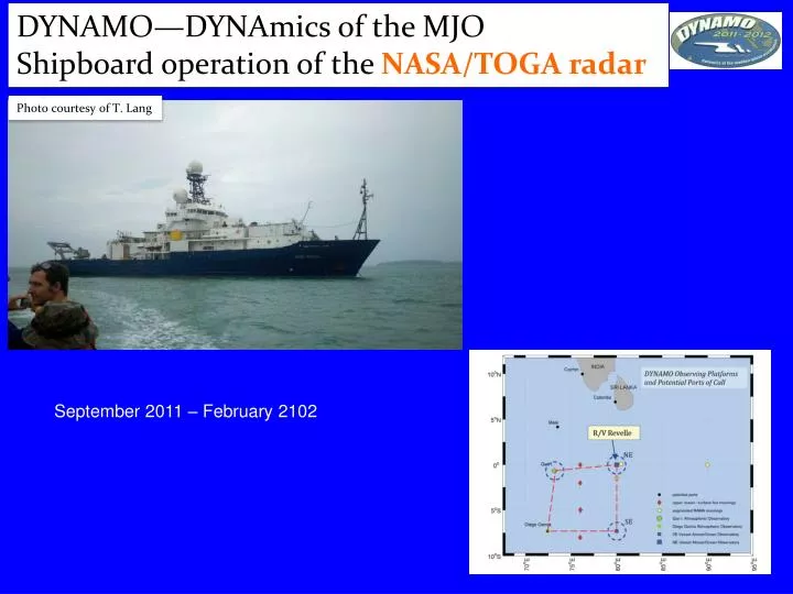
DYNAMO—DYNAmics of the MJO Shipboard operation of the NASA/TOGA radar. Photo courtesy of T. Lang. September 2011 – February 2102. NASA TOGA radar. Strong westerlies in MJO2. SST pattern quite interesting! Ocean really never “ recovered ” after MJO2. SST. AIR.

E N D
DYNAMO—DYNAmics of the MJO Shipboard operation of the NASA/TOGA radar Photo courtesy of T. Lang September 2011 – February 2102
Strong westerlies in MJO2 SST pattern quite interesting! Ocean really never “recovered” after MJO2. SST AIR Prolonged periods (> 24 hours) of negative net flux rare in tropics. These are periods when ocean cools through loss of latent and sensible heat (SST> Tair) and reduction in solar insolation. This is part of the story! Moum et al. 2014
Yoshida-Wyrtki jet, westerly surface current. Mixing promoted by strong vertical shear brings cool, salty water to the surface. Shear induced mixing is significant component for lowering the SST’s, in addition to surface fluxes/insolation. MJO2 resulted in a major cooling of the upper ocean. Did this have an impact on MJO3, which was much weaker? Shallow thermocline in Indian O. allows access to cooler water. Moum et al. 2014
Daily Evolution: Convective Population 1. In phase: RH, Rainrate, Strat. Rain. 2. In phase: SST, Lightning, CAPE. Role of Aerosols?
Kdp proportional to mass content and mass-weighted oblateness ratio A little background… Kdp is a measure of the difference in wave propagation between H and V polarizations; sensitive to non-spherical particles b 50 Rain a 0.5 deg elevation angle 40 Z Reflectivity 30 Based on computations of Z and Kdp from DSD assumptions Oklahoma Differential Reflectivity 0 4 6 2 Kdp deg/km Difference in H,V phase in degrees
Normalized density of points expressed as a percentage Warm rain Colorado and “tropical” events Ice based N-Pol in Oklahoma Results consistent with active coalescence growth and ice-based precipitation. Resulting from higher moisture contents, higher freezing level, collisional breakup, etc. N-Pol data are clearly going to help us better understand DSD variability and the physics leading to the variability. N-POL N-POL
24 Feb 1999 WEST case. Lower CAPE, monsoon-like regime. 26 Jan 1999 EAST case. Stronger convection, higher CAPE. Subtle differences between East and West WEST EAST 0
Pretty much a tropical regime…. KDOX 10/28/2012: Merger of Sandy's outer bands with N/S oriented front. This confluence caused significant precipitation along the western shore of the Chesapeake Bay.