Download
1 / 7
480 likes | 1.46k Views
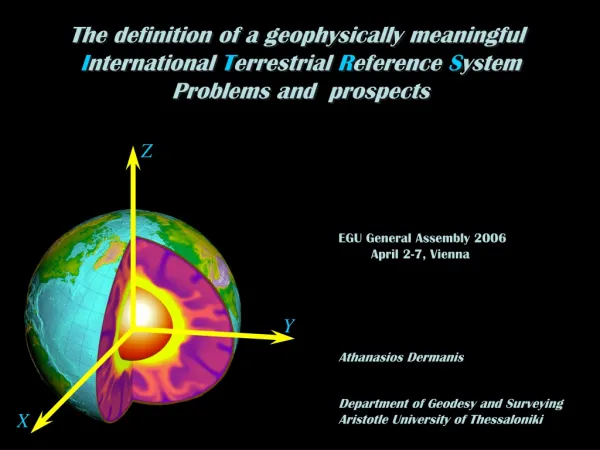
Space Geodesy (1/3). Geodesy provides a foundation for all Earth observations Space geodesy is the use of precise measurements between space objects (e.g., orbiting satellites, quasars) to determine Positions of points on the Earth Position of the Earth’s pole Earth’s gravity field and geoid.

E N D
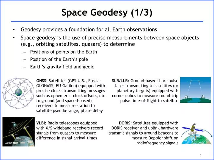
Space Geodesy (1/3) • Geodesy provides a foundation for all Earth observations • Space geodesy is the use of precise measurements between space objects (e.g., orbiting satellites, quasars) to determine • Positions of points on the Earth • Position of the Earth’s pole • Earth’s gravity field and geoid GNSS: Satellites (GPS-U.S., Russia-GLONASS, EU-Galileo) equipped with precise clocks transmitting messages such as ephemeris, clock offsets, etc. to ground (and spaced-based) receivers to measure station to satellite pseudo-range, phase delay SLR/LLR: Ground-based short-pulse laser transmitting to satellites (or planetary targets) equipped with corner cubes to measure round-trip pulse time-of-flight to satellite VLBI: Radio telescopes equipped with X/S wideband receivers record signals from quasars to measure difference in signal arrival times DORIS: Satellites equipped with DORIS receiver and uplink hardware transmit signals to ground beacons to measure Doppler shift on radiofrequency signals
Space Geodesy (2/3) • Data from space geodesy measurements archive are utilized for direct science observations and geodetic studies, e.g., plate motion, gravity field, earthquake displacements, Earth orientation, atmospheric angular momentum, etc. • Data also contribute to the determination of the Terrestrial Reference Frame, an accurate set of positions and velocities • TRF provides the essential stable coordinate system that allows measurements to be linked over space and time; independent of the technology used to define it • Space geodetic networks (GNSS, SLR, VLBI, DORIS) provide the critical infrastructure necessary to develop and maintain the TRF • Data used for Precise Orbit Determination (POD) • SLR and DORIS data used to calculate and verify precise orbits for Earth observation missions (e.g., ERS-1/2, ALOS, Jason-1/2, Envisat, TOPEX, etc.) • SLR data and GPS flight receiver data also utilized for POD efforts for other geophysical missions (e.g., GFO-1, CHAMP, GRACE, ICESat, GOCE, etc.) • Additional products include atmosphere measurements to aid in weather forecasting, etc. • Measurements provide critical information for accurate deep space navigation
Space Geodesy (3/3) • Data • GNSS: 421 sites tracking GPS, GLONASS • Laser Ranging (SLR and LLR): 42 sites tracking 35+ satellites (including the Moon) • VLBI: 39 sites • DORIS: 57 sites tracking 6 satellites • Data provided sub-hourly, hourly, daily, and multi-day basis • Products • Precise network station positions and velocities (for Terrestrial Reference Frame, TRF) • Satellite orbits (for POD) • Station and satellite clocks (for timing) • Earth rotation parameters • Positions of celestial objects (for Celestial Reference Frame, CRF) • Atmospheric parameters (Ionosphere Total Electron Content, TEC; Troposphere Zenith Path Delay, ZPD) • … • Products provided weekly, daily, sub-daily basis
Scientific Contributions of Space Geodesy • Terrestrial Reference Frame (TRF): • Station positions and velocities: GNSS, SLR, VLBI, DORIS • TRF scale and temporal variations: VLBI, SLR • Network densification: GNSS • Homogenous network distribution: DORIS • Celestial Reference Frame: VLBI • Precise Orbit Determination (POD): • Accurate satellite ephemerides: GNSS, SLR, DORIS • Calibration/validation for remote sensing missions, instruments: SLR, GNSS • Sea level monitoring: GNSS, SLR, DORIS • Earth Orientation Parameters (EOP): • Polar motion and rates: VLBI, SLR, GNSS, DORIS • Length-of-day: GNSS, SLR, DORIS • UT1-UTC and long-term stability of nutation: VLBI • Atmosphere: • Tropospheric zenith delays: GNSS, VLBI • Global maps of ionosphere mean electron content: GNSS, DORIS • Limb sounding for global profiles of water vapor: GNSS • Gravity: • Static and time-varying coefficients of the Earth's gravity field: DORIS, SLR • Total Earth mass: SLR • Temporal variations of network origin with respect to Earth center of mass: SLR • Timing: • Station and satellite clock solutions: GNSS • Time and frequency transfer between time laboratories: GNSS • Fundamental Physics: • General relativity and alternative theories: SLR/LLR • Light bending, time dilation: VLBI
IAG Services (1/2) • International GNSS Service (IGS) • International Laser Ranging Service (ILRS) • International VLBI Service for Geodesy and Astrometry (IVS) • International DORIS Service (IDS)
IAG Services (2/2) • Services function as cooperating federations dedicated to a particular space geodesy technique • Provide data and products on an operational basis to geodesy analysts as well as a broader scientific community • Examples of a successful model of community management: • develop standards • self-regulating • monitor performance • define and deliver products using pre-determined schedules • 200+ organizations in 80+ countries • Successful operation through cooperation of many international organizations who leverage their respective limited resources to all levels of service functionality