1 / 28

Planning for and Responding to Natural Disasters using GIS Data

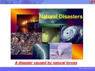
Planning for and Responding to Natural Disasters using GIS Data. E. Stefan Coutoulakis, Capt. Ret. EGFD, R.I. EPA Region 1. RI FLOODS: Cameo as a First Responder Tool. State of R. I. West Warwick, R. I. RT 95 & Rt 295, R. I. (Overview). RT 95 & RT 295, R. I.

mateo
Download Presentation

Planning for and Responding to Natural Disasters using GIS Data

An Image/Link below is provided (as is) to download presentation Download Policy: Content on the Website is provided to you AS IS for your information and personal use and may not be sold / licensed / shared on other websites without getting consent from its author. Content is provided to you AS IS for your information and personal use only. Download presentation by click this link. While downloading, if for some reason you are not able to download a presentation, the publisher may have deleted the file from their server. During download, if you can't get a presentation, the file might be deleted by the publisher.

E N D

Presentation Transcript


  1. Planning for and Responding to Natural Disasters using GIS Data E. Stefan Coutoulakis, Capt. Ret. EGFD, R.I. EPA Region 1

  2. RI FLOODS: Cameo as a First Responder Tool

  3. State of R. I.

  4. West Warwick, R. I.

  5. RT 95 & Rt 295, R. I. (Overview)

  6. RT 95 & RT 295, R. I.

  7. RT 95 & RT 295, R. I. (Flood Zones)

  8. RT 95 & RT 295, R. I. (Flood Zones)

  9. RT 95 & RT 295, R. I. (Flood Zones/Effected Areas)

  10. RT 95 & RT 295, R. I. (Flood zones/Effected Areas)

  11. RT 95 & RT 295, R. I. (Flood Zones/Effected Areas)

  12. Flood Zones/Effected Areas)

  13. Flood Zones/Effected Areas)

  14. Warwick WWTP

  15. Arctic Dam: Using Marplot

  16. Arctic Dam: Using Cameo

  17. Lessons learned: How we applied lessons learned from our flood to help Nashville, Tenn

  18. City of Nashville, Tenn

  19. City of Nashville, Tenn

  20. City of Nashville, Tenn: Bldg Footprints

  21. City of Nashville, Tenn: DFIRM Flood Zone Data 2010

  22. City of Nashville, Tenn: Bldg in Flood Zones

  23. City of Nashville, Tenn: Bldg Footprints/Parcels

  24. City of Nashville, Tenn: Bldg Search within Flood Area

  25. Effected Addresses

  26. This exercise actual occurred with fire and law enforcement resources. It took nearly 5 hours to determine the affected populated areas… • We did it in less than 5 minutes. How was this handled?

  27. Lessons Learned

  28. Develop a tiered system for flood stages • Ensure reverse 911 system is accurate • Educate the public to warning messages • What can be done • What will be done • What will happen if ignored • Deployment of resources based flood stage warnings. Lessons Learned

More Related