Download
1 / 10
100 likes | 234 Views
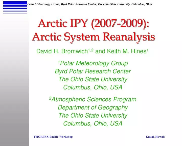
Arctic IPY (2007-2009): Arctic System Reanalysis. David H. Bromwich 1,2 and Keith M. Hines 1 1 Polar Meteorology Group Byrd Polar Research Center The Ohio State University Columbus, Ohio, USA 2 Atmospheric Sciences Program Department of Geography The Ohio State University

E N D
Arctic IPY (2007-2009):Arctic System Reanalysis David H. Bromwich1,2 and Keith M. Hines1 1Polar Meteorology Group Byrd Polar Research Center The Ohio State University Columbus, Ohio, USA 2Atmospheric Sciences Program Department of Geography The Ohio State University Columbus, Ohio, USA
Links Between the Pacific and Arctic • Aleutian Low – especially important for winter • PNA Pattern – ENSO/Wave propagation • Pacific Decadal Oscillation • September 2007 All-Time Minimum in Arctic Sea Ice Extent – concentrated in the Pacific Sector • IPY (2007/9) Overlaps with Wintertime THORPEX-Pacific (Jan.-Mar. 2009)
The Need for Improved Atmospheric Reanalyses The storm of 19 October 2004 as depicted by the NCEP/NCAR global reanalysis. Contours represent isobars of sea level pressure at increments of 3 hPa. [from visualization package of NOAA Climate Diagnostics Center] The Figure shows an intense storm depicted in the NCEP/NCAR reanalysis for 19 October 2004. The storm led to flooding of Nome, Alaska, and has a central pressure of 949 hPa in the reanalysis. The actual central pressure deduced by the National Weather Service was as low as 941 hPa.
Arctic System Reanalysis (ASR)an NSF-Funded IPY Project • Rapid climate change is occurring in the Arctic. An integrated picture of coupled atmosphere/land surface/ ocean interactions is needed on synoptic and climatic time scales. • 2. Global reanalyses encounter many problems at high latitudes. The ASR would use the best available description for Arctic processes and would enhance the existing database of Arctic observations. The ASR will be produced at improved temporal resolution and much higher spatial resolution. • 3. The ASR would provide fields for which direct observation are sparse or problematic (precipitation, radiation, cloud, ...) at higher resolution than from existing reanalyses. • 4. The system-oriented approachprovides community focus including the atmosphere, land surface and sea ice communities. • 5. The ASR will provide aconvenient synthesis of Arctic field programs and integrate Pacific region observations.
ASR Outline A physically-consistent integration of Arctic and other Northern Hemisphere data High resolution in space (<20 km) and time (3 hours) - convenient for synoptic studies Begin with years 2000-2010 (Earth Observing System) Current Participants: Ohio State University - Byrd Polar Research Center (BPRC) - and Ohio Supercomputer Center (OSC) National Center Atmospheric Research (NCAR) Universities of Colorado, Illinois, and Alaska-Fairbanks Also Interested: NOAA (Also provided start-up funds) NASA U.S. Department of Energy
ASR Numerical Model: Polar WRF Weather Research and Forecasting Model • Polar Optimization at the • Byrd Polar Research Center: • Fractional sea ice • Sea ice albedo • Morrison microphysics (2-moment) • Noah LSM modifications • Heat transfer through snow and ice SHEBA 1997/8 Grid January 1998 Results
ASR High Resolution Domain Outer Grid: ~45 km resolution Inner Grid: ~15 km resolution Vertical Grid: ~70 levels ASR will detail the downstream impacts from the Pacific sector
Numerical Experiments within the ASR Framework • The ASR will employ modern, efficient Data Assimilation techniques. • Observing System Experiments (OSEs) are numerical model-based experiments to test the impact of new and existing observations. Sometimes called “data denial” experiments. • Observing System Simulation Experiments (OSSEs) are numerical experiments that test impacts of future observing systems, e.g., new satellite sensors and Automatic Weather Stations •Determine the observations needed to optimize the Arctic observing system.
Other Considerations for the ASR • Impact of Pacific weather on Alaska and the Beaufort Sea, including extreme events • New and improved Data Assimilation in cloudy areas • Optimized numerical modeling for the Arctic (e.g., mixed-phase clouds, variable sea ice characteristics, and realistic Arctic land representation – e.g., permafrost) • Interaction of Ocean and Sea Ice communities with the Atmospheric Reanalysis
Key Points for ASR and THORPEX-Pacific • Synoptic and Climate Applications • Detailing Arctic features downstream of the Pacific Sector • Combining remote sensing, modeling and in-situ observations • High resolution Polar WRF simulations • Advanced Data Assimilation • Expansion to the 1957-2000 period? • ASR Planning Meeting late February at NCAR … consider THORPEX-Pacific contribution?