Download
1 / 43
430 likes | 592 Views
Presented By Donald Ebert Ecologist and Principal ATtILA Programmer EPA GIS Workgroup September 14 - 17, 2004. Analytical Tools Interface for Landscape Assessments (ATtILA). ATtILA. The beginnings…. The Request. “Do you think it is possible to…?” Jim Harrison Environmental Scientist

E N D
Presented By Donald Ebert Ecologist and Principal ATtILA Programmer EPA GIS Workgroup September 14 - 17, 2004 Analytical Tools Interface forLandscape Assessments(ATtILA)
ATtILA • The beginnings…
The Request • “Do you think it is possible to…?” • Jim Harrison • Environmental Scientist • Water Division/Standards, Monitoring and TMDL Branch • EPA Region 4
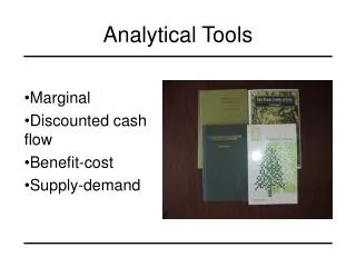
The Request • Provide an easy to use ArcView graphical user interface environment for landscape assessments • Require little to no pre-processing of input data • Include most common landscape/watershed metrics - with emphasis on water quality influences • Make it scale independent (e.g., use with satellite or air photo remote sensed data)
What? More?! • Allow flexibility: give the user a wide choice of data sets, class summaries and cutoff values • Provide means for quick assessment of results • Make it expandable: add more landscape metrics, datasets and analyses as needed
Principal Authors Don Ebert and Tim Wade US Environmental Protection Agency Landscape Ecology Branch Collaborators • Jim Harrison • US Environmental Protection Agency • Region IV • Dennis Yankee • Tennessee Valley Authority • Environmental Research Center
Metric generation user interfaces View/examine results General and specialized tools Provide an easy to use ArcView graphical user interface
Flexible: Selectable Metrics
Flexible: Wide User Choice of Data Sets
Flexible: Wide User Choice of Data Sets
Flexible: Class Summaries and Cutoff Values
Flexible: Land-Cover Classification Systems
Flexible: Land-Cover Classification Systems
Flexible: Land-Cover Classification Systems
Land-cover percentages in watershed Diversity of land-cover Amount of agriculture on steep slopes Forest patch statistics Patch edge/area measures Land-cover fragmentation measures Include most common landscape metrics Landscape Characteristics
Land-cover percentages in areas adjacent to streams Land-cover percentages in areas adjacent to sample points Include most common landscape metrics Riparian Characteristics
Nutrient loading estimates Impervious surface estimates, based on land use/land-cover Impervious surface estimates, based on road density Population density and change Road density measures Stream/road crossings Road area adjacent to streams Include most common landscape metrics Human Stressors
Relative Ranking Column Chart Histogram Provide for quick assessment of results
Indices • Up to 18 indicators • Weights from 0.0 to 10.0 Provide for quick assessment of results Combine Many Metrics to a Single Value
Provide metadata for quality assurance LANDSCAPE CHARACTERISTICS Output File: f:\attila\troubleshoot\working\ATtILA14.shp Project Name: F:/ATtILA/attila4_064.apr Date and Time: Mon Aug 23 08:47:42 2004 Reporting Unit Name: Wtrshd.shp Reporting Unit Src: f:\attila\data\shpfiles\wtrshd.shp Reporting Unit ID Field: Huc Number of Units: 7 Number Selected: 1 Landcover Grid: Lc_mrlc Landcover Grid Src: f:\attila\data\grids\lc_mrlc Cellsize: 30.6618 m Landcover Coding Scheme: NLCD Row Crops { 82 } Pasture { 81 } Urban/Recreational Grasses { 85 } Low Density Residential { 21 } Commercial/Industrial { 23 } High Density Residential { 22 } Man-Made Barren { 32 33 } Natural Barren { 31 } Wetlands { 91 92 } Forest { 41 42 43 } Water and/or No Data { 11 } Landcover Grid Projection: Projection ALBERS Datum NAD83 Zunits NO Units METERS Spheroid GRS1980 Xshift 0.0000000000 Yshift 0.0000000000 Parameters 34 0 0.000 /* 1st standard parallel 38 0 0.000 /* 2nd standard parallel -82 0 0.000 /* central meridian 33 0 0.000 /* latitude of projection's origin 0.00000 /* false easting (meters) 0.00000 /* false northing (meters) Analysis Properties: Mask: none Cell Size: 30.6618 m Extent: Union of Inputs View Projection: None Area and Perimeter: An automatic update was performed on the AREA and PERIMETER fields in the new output theme (ATtILA14.shp). These values may or may not be differentfrom the AREA and PERIMETER values found in the original reporting unit theme.The update was done as a precaution as ArcView does not automatically adjust these values following any feature edits. --------------Forest Fragmentation Metrics-------------- Selected Metrics: Pff PffPtch PffTran PffEdge PffPerf PffIntr Analysis Window: 9 x 9 cell(s) / 275.956 m x 275.956 m Beginning metric run... Metric run completed. ---------------------------------------------------------- Processing Time: 1.47 minutes
Provide metadata for quality assurance Provide metadata for quality assurance LANDSCAPE CHARACTERISTICS Output File: f:\attila\troubleshoot\working\ATtILA14.shp Project Name: F:/ATtILA/attila4_064.apr Date and Time: Mon Aug 23 08:47:42 2004 Reporting Unit Name: Wtrshd.shp Reporting Unit Src: f:\attila\data\shpfiles\wtrshd.shp Reporting Unit ID Field: Huc Number of Units: 7 Number Selected: 1 Landcover Grid: Lc_mrlc Landcover Grid Src: f:\attila\data\grids\lc_mrlc Cellsize: 30.6618 m
Provide metadata for quality assurance Provide metadata for quality assurance Landcover Coding Scheme: NLCD Row Crops { 82 } Pasture { 81 } Urban/Recreational Grasses { 85 } Low Density Residential { 21 } Commercial/Industrial { 23 } High Density Residential { 22 } Man-Made Barren { 32 33 } Natural Barren { 31 } Wetlands { 91 92 } Forest { 41 42 43 } Water and/or No Data { 11 }
Provide metadata for quality assurance Provide metadata for quality assurance Landcover Grid Projection: Projection ALBERS Datum NAD83 Zunits NO Units METERS Spheroid GRS1980 Xshift 0.0000000000 Yshift 0.0000000000 Parameters 34 0 0.000 /* 1st standard parallel 38 0 0.000 /* 2nd standard parallel -82 0 0.000 /* central meridian 33 0 0.000 /* latitude of projection's origin 0.00000 /* false easting (meters) 0.00000 /* false northing (meters)
Provide metadata for quality assurance Provide metadata for quality assurance Analysis Properties: Mask: none Cell Size: 30.6618 m Extent: Union of Inputs View Projection: None Area and Perimeter: An automatic update was performed on the AREA and PERIMETER fields in the new output theme (ATtILA14.shp). These values may or may not be different from the AREA and PERIMETER values found in the original reporting unit theme. The update was done as a precaution as ArcView does not automatically adjust these values following any feature edits.
Provide metadata for quality assurance Provide metadata for quality assurance --------------Forest Fragmentation Metrics-------------- Selected Metrics: Pff PffPtch PffTran PffEdge PffPerf PffIntr Analysis Window: 9 x 9 cell(s) / 275.956 m x 275.956 m Beginning metric run... Metric run completed. ---------------------------------------------------------- Processing Time: 1.47 minutes
Water Quality Landscape Assessments Reference and Sample Site Targeting Critical Area Mapping Teaching Uses of ATtILA
“Predicting Water Quality with Landscape Metrics”2002 Science Fair Project (9th Grade)Katherine Hermann – Boulder HS Intel International Science and Engineering Fair Finalist Boulder Valley Regional Science Fair 1st Place (tied), Best in Show (individual) 1st Place in the Environmental Sciences category (senior division) Regional Winner of the Stockholm Junior Water Prize, (Water Environment Federation) 1st Place (with medal), US Army Science Award 1st Place, US Naval Science Award (senior division) 1st Place, Thorne Ecological Institute Award (senior division) Water Quality Award, City of Boulder US EPA, Region 8 Friend of EPA Award for Environmental Achievement Colorado Science and Engineering Fair 3rd Place in the Environmental Sciences category (senior division) 1st Place, Rocky Mountain Water Environment Association (senior division) CSEF Winner of the Stockholm Junior Water Prize, (Water Environment Federation) 1st Place, The Rocky Mountain Association of Geologists (senior division) 2nd Place, Soil and Water Conservation Society (senior division) United States Army Award Project Recognition, Sustainable Colorado
Benefits of ATtILA • Allows non-GIS professionals to conduct complex analyses • Speeds analyses for both experienced and not-so-experienced GIS users • Eliminates many potential user errors • Allows for easy repeatability • Allows for experimentation
EPA Regions 2, 3, 4, 5, 7, 8, 9, 10 ORD – NCEA, NERL (LEB, EPIC, LCB), NHEERL, NRMRL OEI USDA US Forest Service Agricultural Research Service National Agroforestry Center NOAA C-CAP Army Corps of Engineers Umatilla Tribes Chesapeake Bay Program Tennessee Valley Authority USGS US Fish and Wildlife Service Bureau of Land Management Oak Ridge National Laboratory Federal
Alabama Water Quality Kentucky Water Quality Mississippi Water Quality Florida Water Quality South Carolina Water Quality Tennessee Water Quality Michigan Natural Features Inventory Kentucky Natural Resources and Environmental Protection Cabinet Nevada Department of Environmental Protection Oregon Department of Environmental Quality California Department of Fish and Game California Department of Water Resources Washington Department of Ecology Georgia Department of Natural Resources State
California State University, Monterey Bay Colorado State University Columbia University Columbus State University Cornell University Duke University Franklin and Marshall College Hunter College James Madison University Juniata College Northern Arizona University Pennsylvania State University San Diego State University State University of New York at Syracuse Towson University Utah State University University of California, Davis University of Cincinnati University of Connecticut University of Durham University of Georgia University of Idaho University of Maryland University of Massachusetts, Boston University of Missouri University of Nebraska University of New Hampshire University of Vermont Weber State University West Virginia University IHRMP North Coast GIS Lab Canaan Valley Institute The Wilderness Society The Nature Conservancy Tetra Tech, Inc. Lockheed Martin Zeneca Ag Products Daston Corp. Delaware Valley Regional Planning INDUS Corp. Baltimore County Department of Environmental Protection and Resource Management NatureServe Virginia Institute of Marine Science Concurrent Technologies Corp. Schools and Others
Australia Bureau of Rural Sciences University of Tasmania Austria University of Salzburg Canada Assiniboine Community College Centennial College McMaster University Germany University of Kiel Indonesia Bogor Institute of Agriculture Italy Institute for Environment and Sustainability GECosistema International Center for Pesticides Safety and Health Risk Prevention University of Parma India Indian Institute of Remote Sensing Korea Catholic University of Daegu Seoul National University International
Future Plans • Incorporation of ATtILA along with AGWA into EPA’s Office of Water’s BASINS program • Port ATtILA code to Visual Basic for use with ARC8 or newer applications
“It would be nice to have the ability to run ATtILA without pointing and clicking and entering numbers, etc. Has anyone figured out how to make this happen?If so, is it something you could share with us? Shouldn’t really say