Download
1 / 22
220 likes | 291 Views
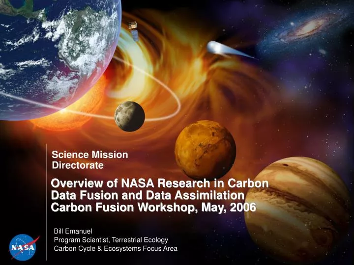
Overview of NASA Research in Carbon Data Fusion and Data Assimilation Carbon Fusion Workshop, May, 2006. Bill Emanuel Program Scientist, Terrestrial Ecology Carbon Cycle & Ecosystems Focus Area. NASA’s Role in Earth Science. 2006 NASA Strategic Plan

E N D
Overview of NASA Research in Carbon Data Fusion and Data AssimilationCarbon Fusion Workshop, May, 2006 Bill Emanuel Program Scientist, Terrestrial Ecology Carbon Cycle & Ecosystems Focus Area
NASA’s Role in Earth Science 2006 NASA Strategic Plan NASA’s Mission: To pioneer the future in space exploration, scientific discovery, and aeronautics research. Develop a balanced overall program of science, exploration, and aeronautics consistent with the redirection of the human spaceflight program to focus on exploration. Study Earth from space to advance scientific understanding and meet societal needs.
Carbon Cycle & Ecosystems Focus Area • Research activities focus on providing data and information derived from remote sensing systems to answer the following science questions: • How are global ecosystems changing? • What changes are occurring in global land cover and land use, and what are their causes? • How do ecosystems, land cover and biogeochemical cycles respond to and affect global environmental change? • What are the consequences of land cover and land use change for human societies and the sustainability of ecosystems? • What are the consequences of climate change and increased human activities for coastal regions? • How will carbon cycle dynamics and terrestrial and marine ecosystems change in the future?
U.S. Climate Change Science Program (CCSP) • President’s Climate Change Research Initiative, June, 2001. • Integrates the research of 13 Federal agencies. • Includes the U.S. Global Change Research Program. • Strategic Plan, July, 2003. • Chapter 7 describes Carbon Cycle research within the CCSP. Atmospheric Composition Climate Variability and Change Global Water Cycle Land-Use/Land-Cover Change Global Carbon Cycle Ecosystems Human Contributions and Responses
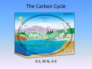
Carbon Cycle and Ecosystems Roadmap Integrated global analyses Report Human-Ecosystems-Climate Interactions (Model-Data Fusion, Assimilation); Global Air-Sea Flux Sub-regional sources/sinks Funded T High-Resolution Atmospheric CO2 Unfunded Southern Ocean Carbon Program, Air-Sea CO2 Flux Process controls; errors in sink reduced Partnership Models w/improved ecosystem functions T= Technology development T Physiology & Functional Types Reduced flux uncertainties; coastal carbon dynamics Coastal Carbon = Field Campaign Global Ocean Carbon / Particle Abundance Reduced flux uncertainties; global carbon dynamics Goals: Global productivity and land cover change at fine resolution; biomass and carbon fluxes quantified; useful ecological forecasts and improved climate change projections T Vegetation 3-D Structure, Biomass, & Disturbance Terrestrial carbon stocks & species habitat characterized Global CH4;Wetlands, Flooding & Permafrost CH4 sources characterized and quantified Knowledge Base Global Atmospheric CO2 (OCO) Regional carbon sources/sinks quantified for planet N. American Carbon Program N. America’s carbon budget quantified Land Use Change in Amazonia Effects of tropical deforestation quantified; uncertainties in tropical carbon source reduced 2002: Global productivity and land cover resolution coarse; Large uncertainties in biomass, fluxes, disturbance, and coastal events Models & Computing Capacity Process Understanding Case Studies Improvements: P Land Cover (Landsat) LDCM Land Cover (OLI) Systematic Observations Ocean Color (SeaWiFS, MODIS) Ocean/Land (VIIRS/NPP) Ocean/Land (VIIRS/NPOESS) Vegetation, Fire (AVHRR, MODIS) Vegetation (AVHRR, MODIS) IPCC IPCC 2008 2010 2012 2014 2015 2002 2004 2006 Global C Cycle Global C Cycle NA Carbon NA Carbon
TransCom Inverse Model Comparisons Inverse model solution indicate a net carbon sink in temperate North America. TransCom. Gurney et al. 2002. Nature 415:626–630. (http://transcom.colostate.edu/)
U.S. North American Carbon Program The central objective of the U.S. North American Carbon Program is to measure and understand carbon stocks and the sources and sinks of CO2, CH4, and CO in North America and in adjacent ocean regions. • Approaching 120 projects. • Involving more than 200 investigators. • About 10 major observation & experimental networks. • A focus for remote sensing observations and research. • Developing collaboration with Mexico & Canada.
NACP Science Plan • Published in 2002 • Prepared by the U.S. Carbon Cycle Science Steering Group • Steven Wofsy and Robert Harriss, Co-Chairs • Describes a broad science questions, goals, and a framework for a North American Carbon Program.
U.S. NACP Science Questions • What is the carbon balance of North America and adjacent oceans? What are the geographic patterns of fluxes of CO2, CH4, and CO? How is the balance changing over time? (Diagnosis) • What processes control the sources and sinks of CO2, CH4, and CO, and how do the controls change with time? (Attribution/Processes) • Are there potential surprises (could sources increase or sinks disappear)? (Prediction) • How can we enhance and manage long-lived carbon sinks ("sequestration"), and provide resources to support decision makers? (Decision support)
U.S. NACP Goals • Develop quantitative scientific knowledge, robust observations, and models to determine the emissions and uptake of CO2, CH4, and CO, changes in carbon stocks, and the factors regulating these processes for North America and adjacent ocean basins. • Develop the scientific basis to implement full carbon accounting on regional and continental scales. This is the knowledge base needed to design monitoring programs for natural and managed CO2 sinks and emissions of CH4. • Support long-term quantitative measurements of fluxes, sources, and sinks of atmospheric CO2 and CH4, and develop forecasts for future trends.
U.S. NACP Approach Observations Dynamic Maps Model-Data Fusion Decision Support Diagnostic Models Experiments Predictive Models Observations & Experiments Science Results Estimates-Uncertainties
Multiple-Scale Observations and Experiments 1000 km Up-scaling Prediction 10 km ha m µm Downscaling Verification
Mid-Continent Geographic Domain USDA Natural Resources Conservation Service (NRCS) Major Land Resource Areas summarize distributions of climatic conditions and soil characteristics across the region.
Mid-Continent Intensive Study • Develop optimized sampling schemes for field and atmospheric measurements to efficiently monitor regional carbon stocks and fluxes. • Use top-down approaches to provide a region-level estimate of net carbon fluxes during short periods (weeks) with an accuracy of 10% by increasing spatial and temporal coverage of atmospheric measurements and by enabling improvements in the parameterization of transport/mixing processes in the lower atmosphere. • Use a variety of bottom-up techniques to provide daily to annual estimates of carbon stocks and fluxes over a region by improving process model structure and parameterization. A hierarchy of field and remote sensing observations should be used for model testing, development of data assimilation techniques, and model parameterization. • Compare the top-down and bottom-up approaches and iteratively improve the independent approaches on daily to annual time scales. • Produce carbon stock and flux maps at various levels of spatial and temporal detail, and compare the results of the top-down and bottom-up approaches to diagnose methods.
Hyperspectral MISR Climate Products (eg Silo) AMSR Advanced Microwave Scanning Radiometer AVHRR LUE, FC, PFT, structure SRTM Shuttle Radar Topographic Mission 22 year Archive Terrain/moisture Ground Obs Ground & atm obs Grazing Disturbance Landsat mosaic CSIRO BRS CRCGA ERS-2 ATSR Fire 1995 - 2002 MODIS MODIS NBAR LST Albedo EVI/NDVI (1km, 500m, 250m) Compare LAI, fPAR, GPP, NPP MODIS cluster 12 Terabyte 16 processor Dynamics Stocks Data Assimilation Approaches – Savanna Systems Data Model-Data assimilation Obs Parameters Forward model