Download
1 / 22
220 likes | 234 Views
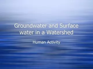
DE Envirothon Aquatics Training: Groundwater – Surface Water Connection. Chris Brown, Hydrologist Delaware DNREC Tank Management Section. Key Online Resources Groundwater & Surface Water. USGS – www.usgs.gov/education - USGS Circular 1139 “Groundwater and Surface Water”

E N D
DE Envirothon Aquatics Training:Groundwater – Surface WaterConnection Chris Brown, Hydrologist Delaware DNREC Tank Management Section
Key Online ResourcesGroundwater & Surface Water • USGS – www.usgs.gov/education - • USGS Circular 1139 “Groundwater and Surface Water” • USGS – “Groundwater & the Rural Homeowner” • DE GS – www.dgs.udel.edu • Water Resources & Water Conditions tabs • DE Environmental Observing System – www.deos.udel.edu “DEOS Geobrowser • National Estuarine Research Reserve System - • http://nerrs.noaa.gov – Research & Monitoring data • CDMO – Get Data – Data Export • Google Earth & Air Photos
At an Eco-Station, consider the following: Where is the water & where is it going? How does the water fit into the eco-system? “Read the land” - what does the topography tell you? Be ready to interpret air photos, topo maps, or sets of water quality data (surface or groundwater) What may influence the flow of the water? What may affect the water quality, and key parameters (D.O., temperature, etc.) How have (or could) humans affect the water quality?
Aquifer • Geologic formation, either sediment or rock, capable of bearing water and supplying water to wells • Coastal Plain aquifers consist of sediment • Piedmont aquifers are generally bedrock
Porosity Void spaces within sediment or rock Between sediment grains Fractures in rock Interconnected Permeability Hydraulic Conductivity Ability of material to transmit a fluid Sand & Gravel – High Clay - Low Groundwater Flow: Where? And How Fast?
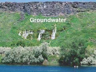
Groundwater Flow: Why and Where? • From high to low elevation – even a few inches • From high to low pressure – pumping wells • In humid regions, like the mid-Atlantic, flow is generally toward a surface water body • Wells and recharge will influence flow
Common Scenarios in Delaware: Surface & Groundwater Connection
Areas free of ice that result from warm ground water (15 degrees C) discharging into cold surface water (5 degrees C) in the Inland Bays
Water Table Sand Pack Screen TYPICAL WELL Vadose Zone Pump
GENERALIZED GEOLOGIC CROSS SECTION OF KENT COUNTY Columbia Aquifer WOODSIDE CHESWOLD CLAYTON DOVER FELTON +50 MILFORD -100 Frederica Aquifer Cheswold Aquifer -200 TD=276' Rancocas Fm. -300 Piney Point Aquifer -400 -500 -600 TD=606' TD=611' TD=626' -700 -800 -900 -1000 TD=955' TD=1168'
Soil Layer Columbia Aquifer Columbia Aquifer • Most susceptible to contamination • Most adversely affected • Most heavily used aquifer • Irrigation • Public water supply • Domestic water supply • 75% of stream flow Delaware Geological Survey
Making the Connection • Remember the groundwater-surface water connection • and the GROUND SURFACE -groundwater connection…