Download
1 / 24
240 likes | 351 Views
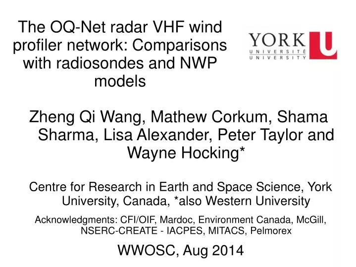
Zheng Qi Wang, Mathew Corkum, Shama Sharma, Lisa Alexander, Peter Taylor and Wayne Hocking* Centre for Research in Earth and Space Science, York University, Canada, *also Western University Acknowledgments: CFI/OIF, Mardoc, Environment Canada, McGill, NSERC-CREATE - IACPES, MITACS, Pelmorex

E N D
Zheng Qi Wang, Mathew Corkum, Shama Sharma, Lisa Alexander, Peter Taylor and Wayne Hocking* Centre for Research in Earth and Space Science, York University, Canada, *also Western University Acknowledgments: CFI/OIF, Mardoc, Environment Canada, McGill, NSERC-CREATE - IACPES, MITACS, Pelmorex WWOSC, Aug 2014 The OQ-Net radar VHF wind profiler network: Comparisons with radiosondes and NWP models
Antenna Array, Egbert, Ontario Environment Canada CARE site
Egbert, Ontario, March 8-10, 2012 Doppler shifts at upper levels, combined with spaced antenna method in lowest 1-2 km. VHF frequency in 40 to 55 MHz range. Basic hourly wind data- available on line: http://www.yorku.ca/oqnet/
Sample Comparisons: Aumond and Maniwaki Radiosonde, Maniwaki: 46.38N, 75.96W: Aumond: 46.45N, 75.90W. Aumond profiler data are 1 hr averages centered on 00 or 12Z.
Differences are generally small and probably due to differences between 1h averages and single profiles. There may also be location differences associated with drift of the radiosonde. Direction differences are generally < 5 degrees. In cases with larger direction differences the radiosonde data shows strong variability with height.
Summary statistics of differences between winds measured at the Aumond wind profiler and radiosonde profiles from Maniwaki. May 2012- April 2013. Wind Speeds.
Summary statistics of differences between winds measured at the Aumond wind profiler and radiosonde profiles from Maniwaki. May 2012- April 2013. Vector Differences and Wind Directions.
Other Profiler-Radiosonde comparisons: Bias (WPR minus Rawin) and standard deviation between the 1290 MHz (UHF) wind profiler at Lindenberg and the rawinsonde for wind speed and wind direction, calculated on the base of 3067 and 3033 comparisons during: November 1994 and October 1996; blue: high mode, red: low mode. From WMO TD 1196 (Dibbern et al, 2003)
Results are comparable with those from J. Dibbern et al, 2003, Operational Aspects of Wind Profiler Radars, WMO/TD No. 1196, 92pp. Histograms of wind speed and direction differences between winds measured at the Aumond wind profiler and radiosonde profiles from Maniwaki.
The average monthly return rates for selected profilers for a 12 month period (April 2011 – March 2012). In cases when entire months of profiler data are missing, this is omitted in the return rates but when less than a consecutive month is missing, it has been included in the return rates. Plots at right illustrate an initial QC problem.
Mean absolute error (MAE) in wind speed between the profiler data and GEM model data. The solid line are the MAE between profiler measurements and 3-48 hour GEM forecasts while the broken lines are the MAE between the profiler measurements and the GEM analysis. 12 months of data, 5 sites.
MAE in wind direction for each of the the profilers compared with GEM model analysis in broken lines and 48 hour forecasts in solid lines.
Bias in wind speed and direction between profilers and forecasts,
Impact of the Assimilation of OQ-Net data on the Numerical Simulation of a Squall Line in Ontario, on 19 July, 2013 • The assimilation of OQ-Net wind data improves the location and intensity of the squall line significantly. • See more experimental details and other cases at Zhan’s poster ‘A numerical study of Southern Ontario Squall Line Event in 2009 with data assimilation’ on Sunday afternoon OBS Radar Reflectivity valid at 22Z 19 July 2013 CONV analysis CONV+OQNET analysis
Profiler – Radiosonde – Model wind direction comparisons • Comparisons with radiosondes satisfactory. • Typical MAE 10º up to 13º at lowest and upper levels. • Comparisons with GEM analyses and forecasts have larger discrepancies, MAE 10-15º at upper levels BUT 20-30º in 2km – 1km height range at most profiler locations. • Earlier studies of wind shear at airport locations (Zhou, MSc thesis) also show typical surface wind direction errors of 30º. • Comparisons with RAP predictions are better (13º) but these were only for Aumond – and Maniwaki radiosonde data would be assimilated.
Conclusions and Questions A regional network of VHF wind profilers has been established and provides hourly wind and other data from 1-12 km on a fairly reliable basis. They compare well with radiosonde winds. The data are assimilated in some European global models (ECMWF, UKMO) and NOAA is looking into assimilating them in US models, Environment Canada ran some tests but seems reluctant to use them - or contribute to our operating costs. We are looking at ways to use the profilers as a network, as against individual stations, in addition to assimilating data into NWP models. Other research is in hand at Western University. Assimilation of data into a regional scale model (WRF) is under way at York (with Pelmorex support) both hindcast and real time – more details in the poster. SCI-POS1075 - A numerical study of Southern Ontario Squall Line Event in 2009 with data assimilation by Zhan Li et al.
Viability Concerns • Basic operating costs for 8 stations include about $50K per year for Hydro. These are regarded as an “Indirect Cost” that NSERC will not allow as a charge against research grants. • Capital cost was about $5M. We need about $100K (2% of capital cost) per year to maintain and operate the network. • Pelmorex (The Weather Network), Mardoc (the profiler manufacturers) and York University hope to cover these costs over the coming year but beyond that network viability is uncertain.