Download
1 / 26
260 likes | 364 Views
GPS-iPaq Workshop. by Kees de Bie NRS / ITC Version Oct’02. Mobile GIS techniques with 10m accuracy !!. GPS-iPaq Hardware Parts. Some relevant info …. Pocket PC

E N D
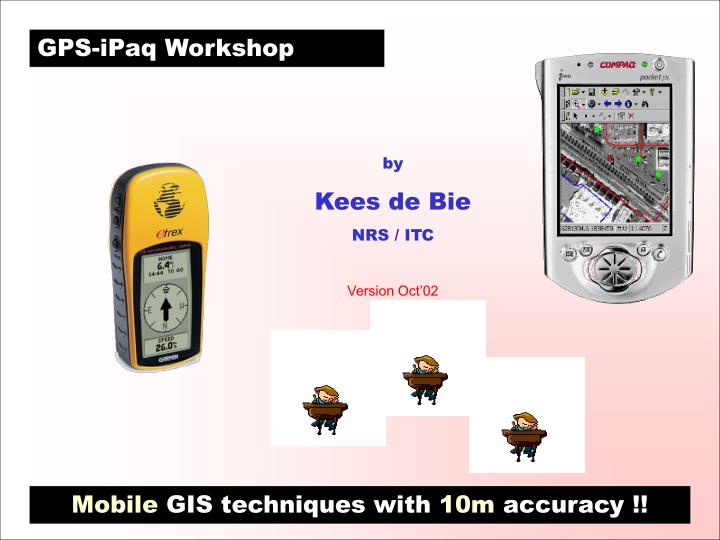
GPS-iPaq Workshop by Kees de Bie NRS / ITC Version Oct’02 Mobile GIS techniques with 10m accuracy !!
Some relevant info … Pocket PC The Compaq-iPAQ pocket PC (64 MB Ram), running at > 200 Mhz under MS-Windows-CE) is able to run ArcPad and to connect to a GPS. The Pocket PC has backlight-features so that in bright sun the screen is still perfectly readable. Arc-Pad Arc-Pad is able to convert GPS readings ‘on-the-fly’ to the required coordinate system. Any image, GT-Sheet, or shapefile can be displayed in Arc-Pad ‘as is’. The GPS position is shown on the loaded maps or images. The user can save the GPS-Tracklog (as lat-long points), or use the GPS to capture shapefiles (point, line, or polygon) in the required projection system. The software allows use of forms (questionnaires), and to draw points, lines, or polygons directly by hand on the screen. Raster images must be converted to SID files using Erdas (v.8.5). Arc-Pad software comes with an extension that loads into Arc-View or Arc-Map.
ArcPad Menu Peshawar City Part of GT-Sheet ForestGIS Office Digitized “on the road” Digitized line of GT-Road and Circular-Road DHV guesthouse Points of Interest 1038m2 RMS boundary 1881m2 2 Fields: Scale: 1:65540 Example-1 … Pakistan Scanned topsheet
Sep. 2002 Digitized “in the field” Jan. 2000 Sep. 2002 Example-2 … India IRS-Image (23m Multi-spectral fused with 6m Pan)
Digitized “in the field” and “on the road” Jul. 2001 Example-3 … Iran Aster-Image, Topsheet, GPS data…All fit !!! Aster-Image(15m Multi-spectral)
Power USB hub Office Connecting Hardware-1
Field Connecting Hardware-2 GPS physical connection A GPS serial connector wire needs to be linked to a serial connector wire attached to the iPaq. Both ends are female and need to be connected through a null-modem connector in which pins 2 and 3 are reversed (welded by me…).
Field Connecting Hardware-2 GPS physical connection A GPS serial connector wire needs to be linked to a serial connector wire attached to the iPaq. Both ends are female and need to be connected through a null-modem connector in which pins 2 and 3 are reversed (welded by me…).
Field Connecting Hardware-2 Connection precaution While cycling, walking or running, the connections must remain firmly in place. Use tape to provide the required solid ‘fix’.
Power Field Connecting Hardware-2 Watch your battery life On the road, a cigarette-lighter wire provides recharge options for the iPaq. Use rechargeable A4 batteries for the GPS. Carry spares with you at all times.
Software installation-1 • Activesync use your CD will establish the required ‘communication’ USB hub
Software installation-2 • Arcpad on your PCrun:
Software installation-3 • Arcpad from your PC to your iPaq install from [Start] - [ArcPad] • Try-out files for Enschede: • copy : ….\ArcPad_Enschede\*.* • to your PC and your iPaq USB hub
Hardware settings: GPS • GPS settings • units’ settings: position format: hddd.dddddo, map datum: WGS 84, and units: metric • ‘interface’ settings: i/o format: NMEA out, and baud rate: 4800.
Hardware settings: ArcPad • Arc-Pad settings • GPS: NMEA protocal, WGS84 Datum • GPS Port: port com1, Baud 4800, Parity none, Data bits 8, Stop bits 1, Break 0.
Projection settings-1 To convert ‘on-the-fly’ coordinates send by the GPS to Arc-Pad, at least one Arc-View shapefile must be loaded as Arc-Pad layer for which a projection file (*.prj) exists in the same directory as from where the shapefile was loaded. Example “Enschede” : PROJCS["ED_1950_UTM_Zone_32N",GEOGCS["GCS_European_1950",DATUM["D_European_1950",SPHEROID["International_1924",6378388,297]],PRIMEM["Greenwich",0],UNIT["Degree",0.0174532925199433]],PROJECTION["Transverse_Mercator"],PARAMETER["False_Easting",500000],PARAMETER["False_Northing",0],PARAMETER["Central_Meridian",9],PARAMETER["Scale_Factor",0.9996],PARAMETER["Latitude_Of_Origin",0],UNIT["Meter",1]]
Projection settings-2 Then, when applicable, the correct datum shift must be selected within ArcPad. Example “Enschede” :
Prepare projection file-1 Select in ArcView a shapefile and start the “ArcView Projection Utility”. • ArcPad 6 supported projections: • Geodetic coords. (Lat-Long) • Alberts Equal Area Conic • Cylindrical Equal Area • (Double) Stereographic • UTM (TM; Gauss-Kruger) • Lambert Conformal Conic • New Zeeland National Grid
Prepare projection file-2 Alternative option to make a *.prj file The next ILWIS release can make *.prj files Start in ArcMap the “ArcPad Tools” wizard and export a *.SID image.
Compress Images Images can be compressed by a factor 25!!! No need is left to prepare clumsy JPG's for ArcPad. MrSID images will do!! They hardly suffer from resolution loss when compressed, and can cover substantial areas ( the original IMG file must be < 50 MB). Example: an AP from Enschede is compressed from 25 to 1 MB. Shown is a fraction of the original image!! SID IMG
Mapping in the Field-1 Performance in Hills Often, main roads are poorly mapped on GT-sheets, while (15m resolution) images of mountainous areas hardly show the roads. Digitizing roads by GPS in hills proved very useful and accurate enough to fill this shortcoming. Digitizing administrative boundaries in hills on foot using a GPS is not considered practical. Roads digitized in Ghazi RMS on top of a GT sheet and on an Aster image (Febr.2001; scale 1:25,000).
Mapping in the Field-2 Performance under trees Cycling to work during a cloudy morning provided the yellow line. It is projected on AP’s, an Ikonos image and the Top-10 of Enschede. Where high trees were present, tracking with the GPS give visible errors. ArcPad can provide accuracy warnings !!!
Mapping in the Field-3 Use of GPS to check Image Geo-Referencing quality Outdated GT-Sheets can create problems while georeferencing images. Through the GPS-Ipaq set, digitized roads can be used to check if images are properly geo-referenced. The geo-referencing of the Aster image (Febr.’01) is clearly not matching required standards. Part of an old GT sheet and the new feeder canal under construction at Tarbela on a recent Aster image (Febr.2001); scale 1:25000.
GPS-iPaq Warnings • Not for GIS amateurs • Requires user to know facts on projection systems ‘properly’ • Requires proper preparation: • of geo-referencing images • of compressing images • of converting shapefiles • of preparing symbologies • of preparing forms • Requires proper GPS-ArcPad software settings Once all is done well….experience shows too many advantages and even a dependancy of using the equipment during fieldwork !!! The ArcPad manual is only 390 pages thick !!! Time for an in-house demo of ‘bells-and-buttons’