Download
1 / 40
410 likes | 565 Views
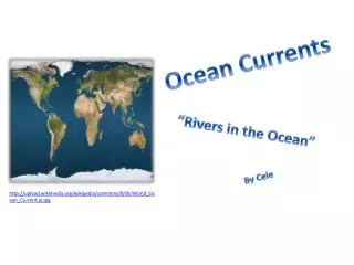
Ocean Currents. Why is Ocean Circulation Important?. Transport ~ 20% of latitudinal heat Equator to poles Transport nutrients and organisms Influences weather and climate Influences commerce. Non-rotating Earth. Convection cell model. Air Density ∝ Air Pressure.

E N D
Why is Ocean Circulation Important? • Transport ~ 20% of latitudinal heat • Equator to poles • Transport nutrients and organisms • Influences weather and climate • Influences commerce
Non-rotating Earth Convection cell model Air Density ∝ Air Pressure
Add rotation and add landmasses unequal heating and cooling of the Earth
Physical properties of the atmosphere: Density • Warm, low density air rises • Cool, high density air sinks • Creates circular- moving loop of air (convection cell)
Physical properties of the atmosphere: Water vapor • Cool air cannot hold much water vapor, so is typically dry • Warm air can hold more water vapor, so is typically moist • Water vapor decreases the density of air (H2O replaces heavier molecules)
90o High pressure, dry climate 60o Low pressure, wet climate High pressure, dry climate 30o ITCZ intertropical convergence zone= doldrums Low pressure, wet climate 0o 30o 60o 90o
The Coriolis effect • The Coriolis effect • Is a result of Earth’s rotation • Causes moving objects to follow curved paths: • In Northern Hemisphere, curvature is to right • In Southern Hemisphere, curvature is to left • Changes with latitude: • No Coriolis effect at Equator • Maximum Coriolis effect at poles
The Coriolis effect on Earth • As Earth rotates, different latitudes travel at different speeds • The change in speed with latitude causes the Coriolis effect
North Pole Buffalo moves 783 mph Quito moves 1036 mph Buffalo 15o N equator Quito Buffalo equator 79oW Quito South Pole
Idealized winds generated by pressure gradient and Coriolis Force. • Actual wind patterns owing to land mass distribution..
Ocean Currents • Surface Currents • The upper 400 meters of the ocean (10%). • Deep Water Currents • Thermal currents (90%)
Wind-Driven and Density-Driven Currents • Wind-driven currents occur in the uppermost 100 m or less • Density differences causes by salinity and temperature produce very slow flows in deeper waters.
Surface Currents • Forces • Solar Heating (temp, density) • Winds • Coriolis
Winds and surface water • Wind blowing over the ocean can move it due to frictional drag. • Waves create necessary roughness for wind to couple with water. • One “rule of thumb” holds that wind blowing for 12 hrs at 100 cm per sec will produce a 2 cm per sec current (about 2% of the wind speed)
Top-down drag • Wind blowing over the ocean can move it due to frictional drag. • Wind acts only on the surface water layer. • This layer will also drag the underlying water, but with less force. • Consequently, there is a diminution of speed downward. • Direction of movement is also influenced by the CoriolisEffect
Currents in the “Real” Ocean Currents rarely behave exactly as predicted by these theoretical explanations due to factors such as • Depth—shallow water does not permit full development of the Ekman spiral • Density—deeper currents moving in different directions influence the overlying surface movement
Current Gyres • Gyres are large circular-moving loops of water • Five main gyres (one in each ocean basin): • North Pacific • South Pacific • North Atlantic • South Atlantic • Indian • Generally 4 currents in each gyre • Centered about 30o north or south latitude
What do Nike shoes, rubber ducks, and hockey gloves have to do with currents?
Duckie Progress • January 1992 - shipwrecked in the Pacific Ocean, off the coast of China • November 1992 - half had drifted north to the Bering Sea and Alaska; the other half went south to Indonesia and Australia • 1995 to 2000 - spent five years in the Arctic ice floes, slowly working their way through the glaciers2001 - the duckies bobbed over the place where the Titanic had sunk • 2003 - they were predicted to begin washing up onshore in New England, but only one was spotted in Maine • 2007 - a couple duckies and frogs were found on the beaches of Scotland and southwest England.
2004-2007 Barber’s Point
North Pacific Subtropical Gyre • “Great Pacific Garbage Patch” • Estimate: 46,000 pieces of floating garbage/mi2.
North Pacific Subtropical Gyre 135° to 155°W and 35° to 42°N
Upwelling and downwelling Vertical movement of water () • Upwelling = movement of deep water to surface • Hoists cold, nutrient-rich water to surface • Produces high productivities and abundant marine life • Downwelling = movement of surface water down • Moves warm, nutrient-depleted surface water down • Not associated with high productivities or abundant marine life
upwelling downwelling
Surface and Deep-Sea Current Interactions Unifying concept: “Global Ocean Conveyor Belt” http://seis.natsci.csulb.edu/rbehl/ConvBelt.htm
Heat Transport by Currents • Surface currents play significant roles in transport heat energy from equatorial waters towards the poles • May serve as “heat sources” to cooler overlying air, “heat sinks” from warmer • Evaporation and condensation participate in latent heat exchanges
Matter Transport and Surface Currents • Currents also involved with gas exchanges, especially O2 and CO2 • Nutrient exchanges important within surface waters (including outflow from continents) and deeper waters (upwelling and downwelling) • Pollution dispersal • Impact on fisheries and other resources
Thermohaline Circulation Global ocean circulation that is driven by differences in the density of the sea water which is controlled by temperature and salinity.
Thermohaline Circulation White sections represent warm surface currents. Purple sections represent deep cold currents
Thermohaline Circulation What effect does global warming play in thermohaline circulation? http://www.youtube.com/v/MZbsMlr9WRI?version=3
Thermohaline Circulation 1 2 3 4 Atmospheric and ocean temp Subtropical evaporation High latitude precipitation & runoff CO2 fossil fuel combustion North Atlantic regional cooling Deep water formation & thermohaline circulation Nordic seas salinity & deep convection Potential feedback of increased tropical salinity 6 5 Global climate interconnections
Inquiry • What is a convection cell? • Which direction do currents get deflected in the Southern Hemisphere? • What depth should the water be for an Ekman spiral to occur? • How are surface currents created? • What is a gyre? • How can an El Nino impact upwelling? • Coriolis Effect is strongest near the _____?