Download
1 / 24
540 likes | 1.39k Views
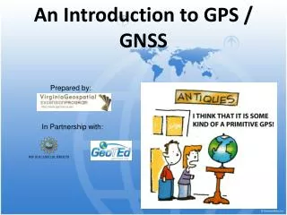
Introduction to GNSS. Outline. GNSS Basics Common Uses Precision Agriculture – Brief History NA/LA/EU Agriculture Applications for West Africa. What is GNSS?. GNSS (Global Navigation Satellite System) Satellite navigation System Accurately and precisely locate a point on Earth

E N D
Outline • GNSS Basics • Common Uses • Precision Agriculture – Brief History NA/LA/EU • Agriculture Applications for West Africa
What is GNSS? • GNSS (Global Navigation Satellite System) • Satellite navigation System • Accurately and precisely locate a point on Earth • US – GPS (Functional) • Russian – GLONASS (Functional) • European – Galileo (Non Functional) • Chinese – COMPASS (Non Functional)
How does it Work? Each GPS satellite transmits data that indicates its location and the current time Satellites can be used if they are in the sight of a receiver as long as they are 25⁰ or greater above the horizon GPS receivers require unobstructed view of the sky and they only receive data, don’t transmit it
How does it Find Location? Trilateration: The process of determining absolute or relative locations of points by measurement of distances, using the geometry of circles or spheres • Can be accomplished using information from 3 separate satellites
How GPS Works • Okay, you’re lost, you have amnesia, and you have absolutely no idea where you are. You go up to someone, and like a good amnesiac you ask, “Where Am I?” This person tells you that you are 180 miles from Chicago. You say, sarcastically, “Wow, that’s some great information. Thanks Buddy.” Chicago
We’re Getting Closer You still have absolutely no idea where you are, so once again you go up to someone and ask, “Where Am I?” This person tells you that you’re 170 miles from Indianapolis. You just scratch your head, but then you start to remember what you learned in GPS class, and, with the US map in your pocket to guide you, you proceed. Chicago Indianapolis
Now We Know! You see a another smiling face and ask “where am I” one more time. This time you get the reply “you are 150 miles from Quincy. The light pops on in your brain. It’s all clear now. You draw three circles extending in the radii of 180 miles from Chicago, 170 from Indianapolis, and 150 miles from Quincy. The circles intersect in Decatur! Aren’t you glad that you took this class? Chicago Indianapolis Decatur Springfield
2D Trilateration Procedure • You know the location of 3 satellites • Given the distance you are from those 3 satellites • Draw a circle, center is the location of the satellite, radius is distance from satellite • Repeat for all satellites • Your location is where the 3 circles intersect
Trilateration (continued) • In 3-D you can use 4 satellites (using spheres opposed to circles) to locate a precise location and include elevation • The more satellites that are in range the more accurate GPS can be, mathematical models are used by GPS units to determine best accuracy
Differential Correction • Raw GNSS is accurate only ~ 5-10Meters • Differential Corrections adjust for errors. • Satellite Based • WAAS/EGNOS • Purchased • Ground Based • Real Time Kinematics
Receiver DGPS Site Satellite Differential Correction
Receiver Radio/Cell DGPS Site RTK Differential Correction
Earth’s Atmosphere Solid Structures Electro-magnetic Fields Metal Signal Interference
Common GNSS Uses • Military (Weapons precision) • Navigation (Civilian or Commercial) • Surveying • Drainage Design • Topography Measurements • Precision Agriculture
Precision Agriculture – Brief History 1983 1991 - 1999 1999-2004 2005-2007 2007-2009 Integrated Applications Finding the market - (20 years) “Wandering in the Wilderness” Guidance adoption balloons GPS guidance ties location and machine controls for integrated business applications Satellite based guidance show payback Reagan announces GPS will be free for civilian use Guidance Prices Decline and Expand Platforms; increasing ROI Customers begin Yield Mapping
Precision Agriculture – Brief History 2010 - 2011 2011 - 2012 Autonomous applications Digital Convergence Autonomy Actionable Information Combining agronomic data and machine info to increase yields Assisting Operators Focus on “on-farm” Connectivity Removing Operators System Worksite
Reasons for Adoption – NA/LA/EU Land Labor • More efficient and productive use of equipment • More efficiency with lower skilled level of labor Lewis, P., et al (1998), Issues, Indicators & Ideas, Longman, South Melbourne. 2008 Eurostat – Agriculture statistics Main Results 2006-2007 Input Costs Gov’t Reg • Reduce in field and end field overlap • Manage business for better compliance Sugar cane burning in Brazil 2009 USDA– NASS - August
Reasons for Adoption Land Water Map out land and soil productivity Determine optimum drainage and leveling Point B Crop Gov’t Policy Real time knowledge of crop conditions and potential yield impact Access to Market Information based upon Location Point A
Not All Precision Agriculture requires GPS Other ways to achieve precision agriculture Off Site Precision/ In Field Simplicity
Other ways to achieve precision agriculture 1-2” in. Ideal Planting Uneven Spacing Uneven Depth Skips Double Plant Hand Planting Seed Tape Proper seed to soil contact, consistent plant spacing and even depth impacts emergence which impacts yield
Seed Tape:Part of a Low-Cost, High Yield Farming Solution • Two parts to seed tape solution • Seed tape “former” • Stationary unit that meters seed and fertilizer into a “tape” that can be planted • Seed tape row unit • Hand pushed row unit that embeds pre made “tape” into the ground • Mechanical toolbar that embeds pre made “tape” into the ground
Other GPS Facts • GPS time is theoretically accurate to about 14 nanoseconds • GPS systems have settled disputes between land owners • GPS data has revealed that Mt. Everest is getting taller!