Download
1 / 18
180 likes | 274 Views
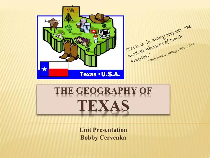
“Texas is, in many respects, the most eligible part of North America.” Mary Austin Holley 1784 -1846. Unit Presentation Bobby Cervenka. The geography of TEXAS.

E N D
“Texas is, in many respects, the most eligible part of North America.” Mary Austin Holley 1784 -1846 Unit Presentation Bobby Cervenka The geography of TEXAS
Students will review map reading skills, charts and graphs interpretive skills, and learn about the four major geographical regions of Texas as well as how those regions are linked to the state’s history. Students will then collaborate in cooperative learning groups to research and prepare graphic maps of Texas which will include extensive information about one of the four regions including resources, climate, population, and historical significance. UNIT SUMMARY
1. Essential Question How are an area’s natural resources and its history connected? 2. Unit Questions How has Texas’ natural resources affected the state’s historical events? How do graphs, charts, and maps help us to understand facts quickly and efficiently? 3. Content Questions What are Texas resources specific to the four regions of Texas? What are some of the historical events which were impacted by the lack of or abundance of available resources? How can we express the knowledge gained about climate, resources, populations and historical events in a graphic way? Curriculum framing Questions
VISION FOR THIS UNIT • Goals for Teacher • Use CFQs to: • help students understand the connection between history and the environment. • encourage effective research practices among the student groups. • provide examples for students to choose from in designing a • graphic way to present and publish their information. • Goals for Students • Gain 21st Century Skills by: • 1. collaborating with others in a cooperative learning group. • 2. researching a specific geographical region of Texas. • 3. organizing researched information. • expressing their knowledge in a clear, informative map, chart, • or other graphic organizer.
Purpose of the Assessment: • To gather information about what students already know about the resources specific to Texas and some of the major events in Texas history. • What I want to learn from my students: • I want to find out what they already know about the Unit Questions and what they know about using graphic organizers, maps and charts. • How I will try to promote higher-order thinking: • I will ask students to engage in research, to find relationships, and to draw conclusions about the connection between geography and history. • How the assessment information helps me and my students plan for upcoming activities in the unit: • If students have different levels of understanding about effective research or how to design a graphic representation of their knowledge, I can provide resources to assist them. We will revisit this assessment throughout the unit. • What feedback or additional ideas I’d like: • I would like ideas about other ways to construct maps and charts other than just using paper and map pencils. Hands-on graphic organizers would be more fun and make more of an impact. Gauging Student Needs Assessment
1. Ask each student to complete a chart or graph using information unrelated to the project (i.e. general population information) 2. Have a general classroom discussion regarding where the students have traveled in Texas and asking them to relate what that part of Texas is like. 3. Use a graphic worksheet asking students to fill in given information correctly on the worksheet. PREASSESSMENT METHODS
ONGOING ASSESSMENT METHODS Students will be asked to journal each day about what they’ve learned and how they contributed to the group’s progress. Teacher will monitor and assist students in the computer lab as they research. Students will have a worksheet to help guide them in finding the information needed for each part of the project. The students will turn those in each day with answers filled in.
FINAL ASSESSMENT METHOD Each group will present a completed map of their region of Texas. The map will be filled with information including population, climate, natural resources, and historical events, as well as other interesting information about their region of Texas. The information will be accompanied by graphic representations of the information as well as related charts and graphs generated by the students.
Find ways to get my students more interested in learning about geography and history. Learn about different kinds of research tools my students and I can use. Share ideas with other teachers. overall teacher goals
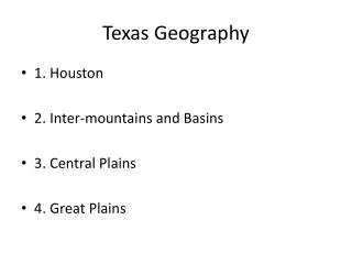
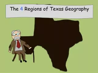
MOUNTAINS AND BASINS GEOGRAPHIC PRINCIPLE MAJOR URBAN SECTION LANDFORMS CENTERS ________________________________________________________________________ West of Pecos River mountains El Paso Upper Rio Grande Valley range land Del Rio Davis Mountains Big Bend Marfa THE GREAT PLAINS GEOGRAPHIC PRINCIPLE MAJOR URBAN SECTION LANDFORMS CENTERS _______________________________________________________________________ Edwards Plateau prairies, canyons Llano Basin rolling hills High Plains ranches
COASTAL PLAINS GEOGRAPHIC PRINCIPAL MAJOR URBAN SECTION LANDFORMS CENTERS _______________________________________________________________________________________ Piney Woods forests Texarkana, Longview Gulf Coast Plain grasslands Houston, Corpus Christi Post Oak Belt hardwood forests College Station, Bryan Blackland Prairie Balcones Escarpment Padre Island South Texas Plain Lower Rio Grande Valley Laredo, Kingsville
NORTH CENTRAL PLAINS GEOGRAPHIC PRINCIPAL MAJOR URBAN SECTION LANDFORMS CENTERS ______________________________________________________________________________________ Cross Timbers hills Wichita Falls Llano Estacado low mountains Grand Prairie Panhandle grasslands Abilene Edwards Plateau plains Fort Worth Caprock Escarpment slopes Carrollton
TEXAS NATURAL REGIONS 1 2 4 3 1. Great Plains 2. North Central Plains 3. Coastal Plains 4 Mountain and Basin