Download
1 / 15
150 likes | 335 Views
Europe and Russia: The Physical Geography. Europe: The Land. Mountains and Plains Plains interrupted by mountains running along interior and southern and northern edge Northwestern mountains rounded by millions of years of erosion and glaciation.

E N D
Europe and Russia: The Physical Geography
Europe: The Land • Mountains and Plains • Plains interrupted by mountains running along interior and southern and northern edge • Northwestern mountains rounded by millions of years of erosion and glaciation. • Ben Nevis- 4,406ft. British Isles. Meseta (Spain’s central plateau) and Massif Central (France’s central highlands) are part of central uplands that extend from Iberian Peninsula to eastern Europe. Low, rounded mountains and high plateaus. • Southern Europe’s mountains are jagged and high. • Pyrenees- formed when plates pushed crust up. Over 11,000 ft. • Alps- created by folding and glaciation. Southern France to Balkans. Mont Blanc- 15,771ft. Rhine and Po Rivers begin here. Separate two climate zones. • Carpathians- eastern Europe from Slovakia to Romania. • Northern European Plain- southeastern England and western France to Poland, Ukraine and Russia. Good for farming. Lots of loess. Coal, iron ore and other minerals led it to be a great source for industrial development. • Great Hungarian Plain- extend from Hungary to Croatia, Serbia, and Romania. Grain, fruit, vegetables, and livestock along the Danube River
Europe: The Land • Seas, Peninsulas, and Islands • Coastline touches Atlantic Ocean and Baltic, North, Mediterranean and Black Seas. • Most of Europe is within 300 miles of coast. Netherlands- 25% is below sea level. Build dikes to keep the North Sea out. Polders- reclaimed land that they had dried out. • Scandinavian Peninsula- scattered fjords (steep sided inlets). Norway and northern Sweden are mountainous. All over there are glacial lakes. • Jutland Peninsula- Denmark. Flat plains and low hills in interior. Sand and gravel cover flat western side and fjords make up the eastern coastline. • Iberian Peninsula- southwestern Europe. Spain and Portugal. Separates Mediterranean Sea from the Atlantic Ocean. 20 miles of water at the Strait of Gibraltar separates it from North Africa. Mostly plateau. Separated from Europe by the Pyrenees. • Italian Peninsula- into Mediterranean Sea. rocky cliffs and beaches. Apennines Mts. Plains cover 1/3rd. • Balkan Peninsula- bound by Adriatic and Ionian Seas on west and Aegean and Black Seas on east. Mountains and valleys from the Danube River. Overland travel difficult.
Europe: The Land • Seas, Peninsulas, and Islands • Iceland- south of Arctic Circle. Astride the Mid-Atlantic Ridge (underwater mountain range). Volcanoes, hot springs and geysers. Large inland plateau and lowlands. • British Isles- two large islands. Great Britain and Ireland. Thousands of smaller islands. Rocky cliffs, deep bays. • Mediterranean Sea- mountains form islands of Sicily, Sardinia, Corsica, Crete and Cyprus. • Mount Etna- highest active volcano. Rises over Sicily. • Balearic Islands off the Spain;. Malta’s five islands. Greece has nearly 2,000 islands in the Aegean Sea.
Europe: The Land • Water Systems • Flow from the mountains to the coasts. Canals connecting the waterways have opened up the availability of water for transportation and other uses. • Scandinavian rivers are short and do not connect cities. Iberian rivers are too narrow and shallow. Thames River is big enough to allow ocean going ships to reach the London port. • Inland rivers are long and provide a connection for transportation. Rhine River (most important in western Europe) flows from the Alps through France and Germany into the Netherlands. Allows goods to be shipped to the port at Rotterdam. • Danube River (most important in eastern Europe) flows from Germany’s Black Forest through Romania to the Black Sea. • Main River- tributary of Rhine. Connected to Danube by the Main-Danube Canal. Links the North and Black Seas.
Europe: The Land • Natural Resources • Good supply of coal and iron. This helped with industrialization. • Rely on coal, oil, gas, and nuclear and hydroelectric power. • North Sea- oil and natural gas • U.K, Germany, Ukraine and Poland- coal • France lacks oil and natural gas reserves so they use nuclear power • Other areas in Europe use peat as an energy source • Iron Ore- Sweden, France and Ukraine. • Bauxite, zinc and maganese
Europe: Climate and Vegetation • Influences on Climate • Northern latitude and proximity to the sea influence its climate and vegetation. It is why it is so varied. • Westerly winds and large mountain ranges also impact climate. • Parts that are located along the oceans experience warm maritime winds. Mild climates. Warmer than areas at same latitude because of warm currents off the North Atlantic Current. • Areas further to the north have colder climates because they are so far away from the currents. • Vegetation is linked to climate.
Europe: Climate and Vegetation • Climate Regions • High-latitude regions • Bitterly cold winters, and short, cool summers. Tundra regions have permafrost. No vegetation except mosses, small shrubs, and wildflowers. Coniferous forest. • Norway and Sweden located in high latitudes but have warmer climates. 90 inches of rain a year. Norwegian Current and North Atlantic Climate. Other parts of Norway, Sweden and Finland are protected by mountains and have humid continental climate. • Mid-latitude regions • Western Europe has marine west coast. North Atlantic Current and westerly winds. Mild winters, cool summers, and lots of rain. Deciduous and coniferous forests. • Southern Europe has a Mediterranean climate. Hot, dry summers and mild, rainy winters. Humid subtropical climate from northern Italy to central part of Balkan Peninsula.
Europe: Climate and Vegetation • Climate Regions • Mid-latitude regions • Western Europe has marine west coast. North Atlantic Current and westerly winds. Mild winters, cool summers, and lots of rain. Deciduous and coniferous forests. • Southern Europe has a Mediterranean climate. Hot, dry summers and mild, rainy winters. Humid subtropical climate from northern Italy to central part of Balkan Peninsula. The Alps keep the rain from falling as much in southern Europe. Mistral can send bitterly cold air into France. Siroccos bring high temps. • Eastern Europe- humid continental climate. Cold, snowy winters and hot summers. More vegetation here. • Alps- highland climate. Cold temps and more rain. Foehns blow down through the valleys and plains. Dry winter winds. Cause avalanches.
Europe: Climate and Vegetation • Climate Regions • Dry regions • Steppe climate in southeastern and southwestern Europe. Hot summers, cold winters. Hungary, Serbia, Montenegro and Romania through Ukraine. • Rainfall varies and is scarce in several parts. Farming is difficult because of this and the eroded soil and harsh winds. • Parts of the Meseta have this climate too. 81,000 square miles. Madrid is in the center.
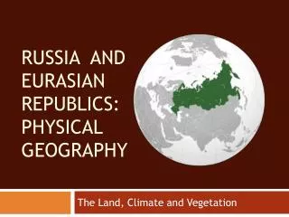
Russia: The Land • Mountains and Plateaus • Ural Mountains mark boundary between European Russia and Asian Russia. 6.6 square miles. Old, worn down mountain ranges average height of 2,000ft. Rich in iron ore, oil and natural gas. • Caucasus Mountains- between Caspian and Black Seas. Mount Elbrus- extinct volcano reaches 18,510ft. Highest point. • Mountains separate Russia from China too. Southeastern edge of the Central Siberian Plateau. • Mountains throughout Siberia to the Pacific. Kamchatka Peninsula- 100 volcanoes. 29 active ones. • Plains Areas • Northern European Plain in the European part of Russia. Northern part is flat and poorly drained resulting in swamps. Southern part has waterways and rich soil known as chernozem. 75% of population lives here. • West Siberian Plain- 1 million square miles. Other side of Ural Mountains. Arctic Ocean to the grasslands of Central Asia. Lowlands have swamps and marshes.
Russia: The Land • Coasts, Seas and Lakes • Longest continuous coastline. 23,400 miles. Pacific and Atlantic. Baltic, Black, and Caspian. Black Sea provides warm water outlet to Mediterranean and Aegean Seas. 3 Turkish controlled waterways- Bosporus, Sea of Marmara and the Dardanelles. • Caspian Sea- largest inland body of water. Salt water. Lake Baikal- southern Siberia. 400 miles long, 40 miles wide and 1 mile deep. 3rd largest lake in Asia and deepest freshwater lake in world. 20% of earth’s freshwater. • Rivers • World’s longest rivers flow here. Drain large portion of land and provide irrigation, transportation and electric power. • 84% of Russia’s water carried there. Most located in Siberia were 25% of population lives. • Volga River- 4th longest. Drain eastern part of Northern European Plain. Canals link river to seas. Hydroelectric power. 2/3rds of water traffic travels along this river. 33% of drinking water comes from here but it is not all usable because of pollution. • Siberian Rivers- Ob’, Irtysh, Yenisey and Lena among largest water systems. North to Arctic. Blocked by ice in north- melt waters flood creating swamps. Amur River- drains eastward. Border between Russia and China for 1,000 miles. Main food producing.
Russia: The Land • Minerals and Energy • Rich in fossil fuels. Large petroleum deposits and 16% of world’s coal reserves. Biggest coal fields in remote eastern Siberia. Natural gas is located in northern Siberia. Leads world in nickel production. Hydroelectric power. • Soil and Forest Land • 10% of land supports agriculture because of climate. Black Earth Belt covers 250 million acres from Ukraine to southwestern Siberia. • 1/5th of world’s forests are here. 75% of them in Siberia. Commercial logging causes their forests to shrink by almost 40 million acres each year. • Fishing • Important to diet and economy. Flourishing fishing industry. World famous for their caviar because of the dams on the Volga River keeping the sturgeon from migration. Fish illegally to meet the demand.
Russia: Climate and Vegetation • High Latitude • Most of Russia has harsh climate. Cold brutal winters. Yakutsk- January temperatures fall below -33°F and July averages 64° F. Verkjoyansk is the coldest place on earth with January temps reaching -90°F. • Tundra in the far north. Lies north of Arctic Circle. Average annual temperature is below freezing. Does get the all day and night light. 10% of Russia. • Subarctic is largest region. South of tundra. 120-150 days a year are snow covered. Supports taiga. World’s largest coniferous forest. ½ of the world’s softwood timber. • Mid-latitude • Humid continental- most of Northern European Plain and parts of Siberia. 9°F to 99°F. mixed forests. Soils are more fertile. Lots of farmland here.
Russia: Climate and Vegetation • War and winter • Winter played a role in the defeat of Napoleon in 1812 and of German forces in WWII. • Napoleon came in with 600,000 men and left with 40,000. The winter forced the Germans to retreat during WWII • Steppe • Area between the Black and Caspian Seas north of the Caucasus Mountains and a band along Russia’s border with Kazakhstan. • Dry summers and long, cold, dry winters. Has good soil. Chernozem. Good fertile soil.