Download
1 / 33
330 likes | 444 Views
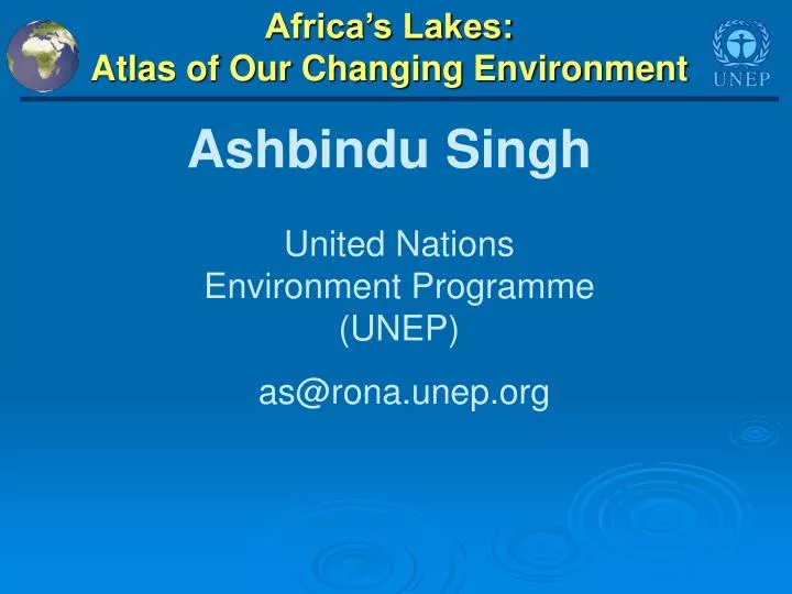
Ashbindu Singh. Africa’s Lakes: Atlas of Our Changing Environment. United Nations Environment Programme (UNEP) as@rona.unep.org. Africa’s Lakes: Atlas of Our Changing Environment. Objectives Provide visual evidence of changes taking place in African lakes;

E N D
Ashbindu Singh Africa’s Lakes: Atlas of Our Changing Environment United Nations Environment Programme (UNEP) as@rona.unep.org
Objectives • Provide visual evidence of changes taking place in African lakes; • Communicating scientific information to a wider audience in an engaging fashion; • Provide resources to educational community. • Assumptions: • Trends over time is the most compelling information • “A picture is worth a thousand words” • “Seeing is believing” Africa’s Lakes: Atlas of Our Changing Environment
The Shrinking African Continent Population per unit area 1950 - 7 people/km2 1960 - 9 people/km2 1970 - 12 people/km2 1980 - 16 people/km2 1990 - 21 people/km2 2000 - 27 people/km2
Africa’s Lakes: Atlas of Our Changing Environment Forest Loss, Invasive Species, Land Degradation, Pollution and Inefficient Irrigation taking their toll • CONTENTS • Over 60 Satellite Images • Over 40 ground photos • 15 Environmental Maps of Africa CONTRIBUTORS 42 Contributors from 16 Organizations and 11 Countries Africa’s LakesAtlas of Our Changing Environment
Africa’s Lakes: Atlas of Our Changing Environment • “Before and after satellite images” • Lesotho Highlands Water Project, • Lake Nakuru, Kenya • Challawa Gorge Dam, Nigeria • Lake Kivu, Congo/Rwanda • Lake Alaotra, Madagascar • Lake Al Wahda, Morocco • Lake Cahora Basa, Mozambique • Lake Chivero, Zimbabwe • Lake Djoudj, Senegal • Lake Ichkeul, Tunisia • Lake Manantali, Mali • Lake Sibaya, South Africa • Songor Lagoon, Ghana • Lake Tonga, Algeria • Case studies • Lake Chad, Nigeria, Niger, Chad, Cameroon • Lake Victoria, Uganda, Kenya, Tanzania • Toshka Project, Egypt Africa’s LakesAtlas of Our Changing Environment
1970 1980 1990 1960 • Lack of good database makes precise number of lakes in Africa unknown, but according to the WORLDLAKE database, there are 677 lakes in Africa (Minnesota State alone is home to 10 000 Lakes) Africa’s Lakes: Atlas of Our Changing Environment • There are 15 natural lakes that cross the political boundaries of two or more countries in Africa • There are 60 transboundary river basins in Africa, covering over 63 per cent of the continent’s land area • Lake Chad’s surface area has shrunk by 95 per cent over the past 35 years Africa’s LakesAtlas of Our Changing Environment
2015 2000 2005 2010 PROJECTED • Uncontrolled damming, the withdrawal of water for irrigation, and climate variability are the major causes of drying up of Lake Tonga in Algeria Africa’s Lakes: Atlas of Our Changing Environment • Population growth around Lake Victoria, the continent’s largest lake, is significantly higher than the rest of Africa • Some lakes in central Africa have become known as “killer lakes,” because of the catastrophic natural events that have occurred in their vicinity Africa’s LakesAtlas of Our Changing Environment
Shrinkage of Lake Chad Persistent drought and diversion of water has shrunk the lake to about a tenth of its former size • 1972: Larger lake surface area is visible in this image • 2001: Impact of drought displays a shrunken lake, comparatively much smaller surface area than in 1972 image Africa’s LakesAtlas of Our Changing Environment
Lake Victoria: Falling Water Levels Concern for Growing Population • Since December 2005, water levels dropped to alarmingly low levels • Current water levels in Lake Victoria are below normal and the lowest level since September 1961 • The lake is a crucial resource to some 30 million people • Lake area is the most densely populated rural region in the world • An estimated 150 000 sq. km. of land have been affected by soil degradation of which 13 per cent has been severely degraded Africa’s LakesAtlas of Our Changing Environment
Population Growth Around Lake Victoria • The population growth around 100 km buffer zone of the Lake Victoria • Population growth around Lake Victoria, East Africa, is the highest in Africa • 2010 and 2015=Projected Africa’s LakesAtlas of Our Changing Environment
Lake Victoria: World’s Fastest Growing Rural Area Around 1 200 people per sq. km. live in and around the lake; average annual income is US$ 250 per capita Africa’s LakesAtlas of Our Changing Environment
Population Growth: Lake Victoria vs. Africa Africa’s LakesAtlas of Our Changing Environment
Mapping falling water levels of Lake Victoria Current water levels are below normal and the lowest level since September, 1961 Africa’s LakesAtlas of Our Changing Environment Source: USDA 2005
Lake Victoria: Height Variations Africa’s largest freshwater lake is now about a meter lower than it was in the early 1990s Africa’s LakesAtlas of Our Changing Environment Source: USDA 2006
Impact of Invasive Species on Lake Victoria, Uganda These images show water hyacinth infestation and control of such invasive species • 1995: Image shows several water-hyacinth-choked bays (yellow arrows) • 2001: A visible reduction of Water Hyacinth from many of the Ugandan bays Africa’s LakesAtlas of Our Changing Environment
Lake Kivu: One of Africa’s “Killer Lakes” These images show dramatic changes before and after the eruption of Mt. Nyiragongo in 2002 • 2001: Before the January 2002 eruption • 2003: Shows the track of the lava flow Africa’s LakesAtlas of Our Changing Environment
Toshka Lakes: Watering the Desert for Farming These images show the desert area transformed into vegetable plots • 1984-87: Image of the area before the desert reclamation project began in mid-1990s • 2000: Four new lakes are visible in this image, faint blue-green areas around the lakes are newly created agricultural lands Africa’s LakesAtlas of Our Changing Environment
Toshka Lakes: Watering the Desert for Farming 2005: New fields are clearly visible in the image Africa’s LakesAtlas of Our Changing Environment
Lesotho Highland Water Project in South Africa These images show the area before and after construction of Katse dam • 1989: Image of the area before the completion of the dam in 1995 • 2001: Katse dam created an enormous reservoir, the extent of which can clearly be seen in this image Africa’s LakesAtlas of Our Changing Environment
Extensive Deforestation Around Lake Nakuru in Kenya These images show the land cover degradation in the lake’s catchment • 1973: The area that hosts the world’s largest concentration of flamingos • 2000: Excision of forest in the Eastern Mau Forest Reserve (white lines) will most likely lead to disappearance of upper catchment forest cover Decline in lake area from 43 skm to 40 skm in 2000 Africa’s LakesAtlas of Our Changing Environment
Impact of Challawa Gorge Dam Nigeria These images show the area before and after construction of the dam • 1990: Image of the area before the completion of the dam in 1993 • 1999: Impact of flooding upstream from the dam; colour of the water in the flooded area indicates high sediments Africa’s LakesAtlas of Our Changing Environment
Severe Flooding Around Lake Alaotra, Madagascar These images show flooding over a wide area • Flooding destroys significant portion of crops • Intensive rice irrigation occurs at the western part of the lake (yellow arrows) Africa’s LakesAtlas of Our Changing Environment
Impact of Al Wahda reservoir in Morocco These images illustrate the change in land cover • 1987: The area before the construction of dams • 2001: The area after the construction of large dams Africa’s LakesAtlas of Our Changing Environment
Cahora Basa: Mozambique’s Largest Dam on the Zambezi River These images show extraordinary changes in the Zambezi River system as a result of the building of Cahora Basa Dam • 1972: The Zambezi River a few years before the dam construction • 1999: This image shows part of the enormous dam and the lake Africa’s LakesAtlas of Our Changing Environment
Invasive Species in Lake Chivero Zimbabwe These images show overall reduction in water weeds • 1989: Weeds show up as green strands along the edges of the lake • 2000: This image shows that water weeds remains a persistent problem Africa’s LakesAtlas of Our Changing Environment
Ecological Changes Around Lake Ichkeul, Tunisia These images show the impact of damming • 1972: Shows the three feeder rivers supplying the lake before they were dammed • 2000: Shows the location of the dams (yellow arrows) Africa’s LakesAtlas of Our Changing Environment
Agricultural Expansion Around Lake Manantali, Mali These images show the expansion of irrigated agriculture • 1977: Shows the original meandering nature of the Bafing River • 1999: Shows the expanded irrigated land and increase in lake water quantity Africa’s LakesAtlas of Our Changing Environment
Lake Sibaya: Wetland of International Importance in South Africa These images show increase in cultivation around the lake • 1991: Lakeshore is home to the only known species of a rare climbing orchid • 2001: The yellow arrows vividly show the increase of cultivation of marginal lands around the lake Africa’s LakesAtlas of Our Changing Environment
Rapid Shrinking of Lake Songor Lagoon in Ghana These images show a conspicuous reduction in the surface area, partly due to intensive salt production • 1990: Appears as solid blue mass of water some 74 sq. km. in size • 2000: Water area dramatically reduced to pale shadow • Lake is home to fish, globally threatened turtles and important bird populations Africa’s LakesAtlas of Our Changing Environment
Changes In and AroundLake Tonga, Algeria These images show the changes brought about by damming of the feeder rivers • 1988: Lake Tonga before the damming of feeder rivers • 2000: Damming increased irrigation and drastically reduced the volume of water entering the lake Africa’s LakesAtlas of Our Changing Environment
Rejuvenation of Djoudj Sanctuary in Senegal These images show the Djoudj Sanctuary before and after the construction of the Diama Dam 23 kilometres from the mouth of the Senegal River • 1979: Shows the impact of drought on the Djoudj Sanctuary • 1999: Rejuvenation of the Sanctuary wetlands due to significant floods Africa’s LakesAtlas of Our Changing Environment
Thank You! Africa’s Lakes: Atlas of Our Changing Environment Free Downloads: www.na.unep.net Purchase: www.Earthprint.com