Download
1 / 23
230 likes | 337 Views
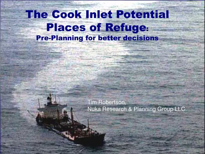
The Cook Inlet Potential Places of Refuge : Pre-Planning for better decisions. Tim Robertson, Nuka Research & Planning Group LLC. Cook Inlet Subarea Potential Places of Refuge Project. Introduction PPOR in the Cook Inlet Subarea Plan Work Group Process Goals and Objectives Web site

E N D
The Cook Inlet Potential Places of Refuge:Pre-Planning for better decisions Tim Robertson, Nuka Research & Planning Group LLC.
Cook Inlet Subarea Potential Places of Refuge Project • Introduction • PPOR in the Cook Inlet Subarea Plan • Work Group Process • Goals and Objectives • Web site • Public Review
Introduction • The T/V Prestige incident in Spain raised the issue • Alaska Regional Response Team Workgroups • Decision-making Guidelines • Pre-incident Planning
Introduction • There are no pre-designated places of refuge • Potential sites are identified and relevant info is collected • Place of refuge selected on an incident specific basis Photo Credit-Unified Command
Introduction • 1996 Perl Island Drill • 1997 Barge Oregon Incident • 2003, 2004 Prince William Sound Tanker Drills • 2004 Ferry LeConte • 2004 M/V Selendang Ayu • 2006 T/V SeaBulk Pride • 2006 M/V Cougar Ace
Introduction Cook Inlet Subarea
Cook Inlet Subarea Committee- 9 PPOR Identified • Anchorage • Nikiski • Drift River • Kachemak Bay • Seldovia • Port Graham • Port Chatham • Seward • Whittier
Workgroup Process-Potential Places of Refuge • Stakeholders • Governments • Resource Agencies • Spill Response Organizations • Mariners • Landowners • General Public Photo Credit-Unified Command
Potential Places of Refuge Workgroup Process Alaska PPOR Workgroups have included: • Alaska Department of Environmental Conservation, • Alaska Department of Natural Resources, • Alaska Department of Fish and Game, • Alyeska Pipeline Service Company • City Governments, • Cook Inlet Regional Citizens Advisory Council, • Environmental Protection Agency (EPA), • Borough governments, • Native Governments • National Oceans and Atmospheric Administration (NOAA), • Prince William Sound Regional Citizens' Advisory Council, • Southwest Alaska Pilots Association, • U.S. Coast Guard, District 17, and • U.S. Department of the Interior • Local Citizens
The Workgroup identifies andconfirms information regarding : • Environmental & economic risks • Port requirements • Available response & repair resources • Water depths, tides, currents, seasonal conditions
Potential Places of Refuge Pre-incident Planning Goals • Identify information needed to assist decision makers during an incident • Discuss and gather information regarding use-conflicts outside of crisis situation • Obtain local knowledge to understand capabilities, limitation, impacts • Identify potential sites acceptable/least offensive to all
Goals & Objectives • PRINCE WILLIAM SOUND-SUBAREA CONTINGENCY PLAN • POTENTIAL PLACES OF REFUGE SECTION • PART ONE INTRODUCTION......……….................. • Purpose and Scope ....................…………....... • How the Document was Developed.................. • How to Use the PPOR Section ........................ • Who to Contact for Input ........…....................... • PART TWO PPOR MAPS ................………............. • Index of PPOR Maps ........................................ • PPOR Maps....................................................... • PART THREE REFERENCES.…........………........... • TABLES AND FIGURES • TABLES • H-1: Key to the Site Assessment Matrix.... ......... • H-2: Site Assessment Matrix .............................. • FIGURES • H-1: Index of PWS PPOR Maps.....................…. • PWS PPOR 1: Port Valdez
Goals & Objectives • PRINCE WILLIAM SOUND-SUBAREA CONTINGENCY PLAN • POTENTIAL PLACES OF REFUGE SECTION • PART ONE INTRODUCTION......……….................. • Purpose and Scope ....................…………....... • How the Document was Developed.................. • How to Use the PPOR Section ........................ • Who to Contact for Input ........…....................... • PART TWO PPOR MAPS ................………............. • Index of PPOR Maps ........................................ • PPOR Maps....................................................... • PART THREE REFERENCES.…........………........... • TABLES AND FIGURES • TABLES • H-1: Key to the Site Assessment Matrix.. • H-2: Site Assessment Matrix .................. • FIGURES • H-1: Index of PWS PPOR Maps.............. • PWS PPOR 1: Port Valdez
Goals & Objectives • PRINCE WILLIAM SOUND-SUBAREA CONTINGENCY PLAN • POTENTIAL PLACES OF REFUGE SECTION • PART ONE INTRODUCTION......……….................. • Purpose and Scope ....................…………....... • How the Document was Developed.................. • How to Use the PPOR Section ........................ • Who to Contact for Input ........…....................... • PART TWO PPOR MAPS ................………............. • Index of PPOR Maps ........................................ • PPOR Maps....................................................... • PART THREE REFERENCES.…........………........... • TABLES AND FIGURES • TABLES • H-1: Key to the Site Assessment Matrix.. • H-2: Site Assessment Matrix .................. • FIGURES • PWS PPOR 1: Port Valdez
Operational & Site Considerations Tables http://www.dec.state.ak.us/spar/perp/pwspor/home.htm
Goals & Objectives-Today • Public Information • Review and Collect Edits to Developed Work Products • Develop Draft List of PPOR in Cook Inlet
Cook Inlet PPOR Website • Web address-www.dec.state.ak.us/spar/perp/cookinletpor/index.htm • Main Page • Work Group page • Geographic Response Strategies for Cook Inlet www.dec.state.ak.us/spar/perp/grs/index.htm
Cook Inlet PPOR Public Outreach Program • Identify and plan outreach program to include a wide range of stakeholders • Educate regarding PPOR and the decision-making process • Obtain additional local knowledge
Conclusions • Decision-making Guidelines and Pre-incident Planning greatly aid the Unified Command during an actual event • Public involvement at the planning stage is critical to success • Planning may reduce the risks and severity of future spills