Download
1 / 43
480 likes | 896 Views
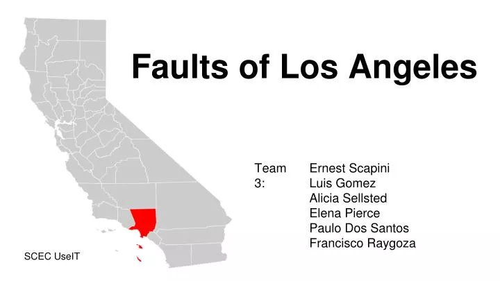
Faults of Los Angeles. Team 3:. Ernest Scapini Luis Gomez Alicia Sellsted Elena Pierce Paulo Dos Santos Francisco Raygoza. SCEC UseIT. Los Angeles: The City of Faults. Ernest Scapini. Faults in Los Angeles. There is a total of 16 faults in Los Angeles

E N D
Faults of Los Angeles Team 3: Ernest Scapini Luis Gomez Alicia Sellsted Elena Pierce Paulo Dos Santos Francisco Raygoza SCEC UseIT
Los Angeles: The City of Faults Ernest Scapini
Faults in Los Angeles • There is a total of 16 faults in Los Angeles • Los Angeles is composed of Reverse, Right lateral, and left lateral faults • They are 7 faults in Los angeles capable of creating a Magnitude 7 earthquake
Significant Faults in Los Angeles • Puente Hills Fault • Compton Thrust Fault • Newport-Inglewood Fault • Raymond Fault • Northridge Thrust Fault • Santa Susana Fault • Sierra Madre Fault Zone • Hollywood Fault
Northridge Thrust • TYPE OF FAULTING: Blind Thrust • TIME: January 17, 1994 / 4:30:55 am PST • MAGNITUDE: MW6.7 • Damage: 40,000 buildings were damaged in Los Angeles, Ventura, Orange, and San Bernardino Counties • LOCATION: 34° 12.80' N, 118° 32.22' W 20 miles west-northwest of Los Angeles 1 mile south-southwest of Northridge • Depth: 18.4 km • Deaths: 57 Northridge Thrust Shake Map
Palos Verde Fault • Largest fault in Los Angeles • Type of Fault: Right Lateral Reverse • Length: Roughly 80 km • Probable Magnitude: MW 6.0-7.0 ( could be greater) It may rupture partially due to the geometry of the fault. • Slip Rate: between 0.1 and 3.0 mm/year • Los Angeles Port is close to the fault Palos Verde Fault
Puente Hills Faults • Type: Blind Thrust • Largest probable magnitude • Was discovered in 1999 • USC is right above the Puente Hills fault • Length: 40 km • Probable Magnitude: MW 7.2 - 7.5 Puente Hills Faults
Compton Thrust • Type: Blind Thrust • Slip Rate: 1.4 ± 0.4 mm/year • Probable Magnitude: MW 7.0 – 7.4 • LAX will be greatly impacted by this fault • Displacement can be from 1.3 to 4.2 m • Length: 60 km • Has had 6 large earthquakes in the past 14,000 years Compton Thrust
Work Cited Dolan, J.F., Sieh, K., and Rockwell, T.K., 2000a, Late Quaternary activity and seismic potential of the Santa Monica fault system, Los Angeles, California: Geol. Soc. America Bull. 112:1559-1581 *Dolan F. James, Eldon M. Gath, Lisa B. Grant, Mark Legg, Scott Lindvall, Karl Mueller, Michael Oskin, Daniel F. Ponti, Charles M. Rubin, Thomas K. Rockwell, John H, Shaw, Jerome A. Treiman, Chris Walls, and Robert S. Yeat Dewell, Henry D. and Willis, Bailey (1925). Earthquake Damage to Buildings. Bulletin of the Seismological Society of America, Vol. 15, No. 4, pp. 282-301, Plates 31b and 42a. Leon, L. A., J. F. Dolan, J. H. Shaw, and T. L. Pratt (2009), Evidence for large Holocene earthquakes on the Compton thrust fault, Los Angeles, California, J. Geophys. Res., 114, B12305, doi:10.1029/2008JB006129. Marquis John “New Study Reveals the Behavior of the Puente Hills Thrust Fault” USC News April 4, 2003. Web 19 Jun. 2014 Shaw H. John, Suppe John 1996 “Earthquake hazards of active blind-thrust faults under the central Los Angeles basin, California” Journal of Geophysical Research vol 101 p8623-8641
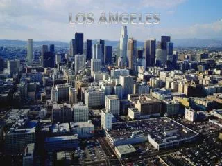
Los Angeles Basin Luis Gomez
Why areas within the “Sedimentary” L.A. basin are more dangerous in earthquakes than areas in the surrounding mountains (San Gabriel, Santa Monica, Santa Ana mountains..)? Luis Gomez “Earthquakes don't kill people, buildings do” - Susan Hough and Lucile Jones
“Sedimentary” Los Angeles Basin • The Center of Los Angeles basin at 33.917466° N, -118.193538° W (Intersection of 105 and 710 FWY) - Deepest spot of basin, ≈ 10 km (6 mi) • Giant Bowl feature has walls consisting of San Gabriel, Santa Monica, Santa Ana mountains, and the Palos Verdes Peninsula • “Bowl of sediment” amplifies the motion of an earthquake in unpredictable ways, somewhat similar to shaking a bowl of Jello
Los Angeles Basin • Basin primarily consists of sand, clay, and silt • ≈81 km (50mi) long • ≈40 km (25mi) wide
Basin Walls • The Palos Verdes Peninsula and mountain ranges line the Los Angeles basin • Shaking from an earthquake in the basin could be 5 or more times intense than in the nearby mountains
Puente Hills Earthquake Simulation 2 sec. 5 sec. 8 sec. 11 sec. 14 sec. 17 sec. 20 sec. 23 sec. 30 sec. 47 sec. http://visservices.sdsc.edu/projects/scec/puente_hills/movies/release_Vpeak_puente_hills_mpeg4.0.mov
References "Earthquake Shaking - Putting Down Roots in Earthquake Country." Earthquake Shaking - Putting Down Roots in Earthquake Country. Southern California Earthquake Center/ USGS/ FEMA/ Cal EMA, 2011. Web. 13 June 2014. "The Los Angeles Basin - A Huge Bowl of Sand." The Los Angeles Basin - A Huge Bowl of Sand. The Los Angeles Almanac, n.d. Web. 13 June 2014. <http://www.laalmanac.com/geography/ge08e.htm>. "Movie: Instantaneous Peak Velocity." Http://visservices.sdsc.edu/. SDSC, n.d. Web. 13 June 2014. http://visservices.sdsc.edu/projects/scec/puente_hills/ Nelson, Stephen A. "EQ Hazards & Risks." EQ Hazards & Risks. N.p., 28 Aug. 2013. Web. 17 June 2014.
The Santa Monica, Hollywood, and Raymond Faults Alicia Sellsted
Santa Monica Fault • Oblique left-reverse fault • 24 km in length • Slip rate ranges from .27-.39mm per year
HollywoodFault • Left-lateral strike slip fault • 14-15 km in length • Slip rate ranges from .33-.75mm per year 4.1
Raymond Fault • Reverse-left-oblique slip fault • 25-26 km in length • Slip rate ranges from .1-.22mm per year
Hollywood and Santa Monica Faults • “Hollywood fault has not been officially mapped, even though the state has known of its existence for decades.” -LA Times • Many buildings have been built on top of these faults because without official state maps the city isn’t required to follow state law.
All three faults are part of the Southern Transverse Ranges fault system. These faults could act co-seismically in an earthquake of magnitude 7 or above because of their proximity to each other. 4.2
References “3.2 Earthquake Hits Hollywood Fault – UPDATE: New 3.4 quake.” Save Hollywood. 4 September 2012. Web.http://www.savehollywood.org/?p=960 “Hollywood Fault.” Southern California Earthquake Data Center. 31 January 2013. Caltech. Web:http://www.data.scec.org/significant/hollywood.html “Raymond Fault.” Southern California Earthquake Data Center. 31 January 2013. Caltech. Web:http://www.data.scec.org/significant/raymond.html “Santa Monica Fault.” Southern California Earthquake Data Center. 31 January 2013. Caltech. Web:http://www.data.scec.org/significant/santamonica.html Dolan, James, “Faults of Los Angeles.” Southern California Earthquake Center:http://www.scec.org/meetings/teacherworkshop/faults_of_LA_field_Guide.pdf Lin II, Rong-Gong, Xia, Rosanna, Smith, Doug. 2013, “Campaign to map earthquake faults has slowed to a crawl.” Los Angeles Times:http://www.latimes.com/local/la-me-adv-earthquake-fault-law-20131020-story.html#page=1
Blind Thrust Faults Elena Pierce
Blind Thrust Faults Basics - A thrust fault that does not rupture all the way to the surface, no evidence on the ground “blind” - May create ridges or anticlines (Fold Belts) - Buried under uppermost layer of rock 5.2
Northridge Blind Thrust Fault Date: January 17, 1994 Time: 4:30 am Magnitude: 6.7 Depth: 18.4 km Killed 57 people $20 Billion in Damage (SCEDC and CNN News) 5.3
Impact if Northridge After the earthquake technology began to advance NASA led agencies towards creating 250 new GPS stations (CNN) 5.4
Puente Hills Blind Thrust Fault - Extends from Northern Orange County to San Gabriel, runs under Downtown to Los Angeles - 11 X greater movement in Sedimentary Basin - Duration said to be 4X longer because energy flows through sediment faster - Dense population makes earthquake damage potential much higher (NBC, LA Times) 5.5
Compton Blind Thrust Fault - average slip rate of 1.4 +/-0.4 mm/ year - active fault in sedimentary basin - found through displacements in the earth - can harm the Los Angeles area
References II, Rong-Gong Lin. "La Habra Quake a Reminder about Dangerous Puente Hills Fault." Los Angeles Times. Los Angeles Times, 29 Mar. 2014. Web. 13 June 2014. Moore, Ireene. "Experts Warn of Dangers on Puente Hills Fault." NBC Southern California. NBC, 1 Apr. 2014. Web. 13 June 2014. "Significant Earthquakes and Faults." Southern California Earthquake Data Center at Caltech. SCEDC, n.d. Web. 10 June 2014.
The San Gabriel Mountains Paulo Dos Santos
How the San Gabriel Mountains were uplifted • Transverse Ranges • SAF Big Bend • Movement of the Plates • Pacific Plate • North American Plate http://eeg.geoscienceworld.org/ SCEC UseIT Intern Paulo Henrique Dos Santos
How the San Gabriel Mountains were uplifted • Fault Zones • San Andreas • San Gabriel • Sierra Madre • Cucamonga http://bulletin.geoscienceworld.org/ SCEC UseIT Intern Paulo Henrique Dos Santos
How the San Gabriel Mountains were uplifted • Transform Faults • Strike-slip • Reverse Faults • Thrust Faults(less than 45°) http://www.hakkinda-bilgi-nedir.com/ SCEC UseIT Intern Paulo Henrique Dos Santos
Work Cited • "California Coast Ranges." Wikipedia. Wikimedia Foundation, 06 Mar. 2014. Web. 16 June 2014. <http://en.wikipedia.org/wiki/California_Coast_Ranges> • Fei, Yongxin. "Formation of the San Gabriel Mountains." Formation of the San Gabriel Mountains. N.p., n.d. Web. 16 June 2014. <http://scec.usc.edu/internships/useit/scec-vdo/animation874> • "Geology of the San Gabriel Mountains." Geology of the San Gabriel Mountains. N.p., n.d. Web. 16 June 2014. <http://www.csun.edu/science/geoscience/fieldtrips/san-gabriel-mts/geology-san-gabriels.html> • "Humboldt County, California." Wikipedia. Wikimedia Foundation, 16 June 2014. Web. 16 June 2014. <http://en.wikipedia.org/wiki/Humboldt_County,_California> • "Transverse Range." Wikipedia. Wikimedia Foundation, 22 Apr. 2014. Web. 16 June 2014. <http://en.wikipedia.org/wiki/Transverse_Range> • McClay, K. R. Thrust Tectonics. London: Chapman & Hall, 1992. Web. <http://ocw.mit.edu/courses/earth-atmospheric-and-planetary-sciences/12-113-structural-geology-fall-2005/lecture-notes/part4_thrst_tect.pdf> • Structural Geology Lab – Week 1, and Attitudes Of Lines And Planes In 3.Structural Geology Lab – Week 1 Attitudes of Lines and Planes in 3-D(n.d.): n. pag. Web. <https://www.wou.edu/las/physci/taylor/es406_structure/RD_chap9lab_Faults.pdf> SCEC 2014 - Team 3 - Question 6 - UseIT Intern Paulo Henrique Dos Santos
The San Fernando and Northridge Earthquakes Francisco Raygoza
1971 San Fernando Earthquake • Magnitude 6.6 occurred on 2/9/1971 at 6AM • The hypocenter was located at a depth of 12-15 km • Losses • 58 deaths • Over 500 million dollars in damages • First major earthquake to be well studied, greatly influenced structural engineering advancement
1971 San Fernando Earthquake • The Earthquake occurred in the San Fernando Fault Zone • On the Santa Susana Fault (maybe) • The fault has an average slant angle of 45 degrees dipping beneath the San Gabriel Mtns • Land movement included strike-slip and over-thrust motion • surface displacements up to 1 meter • The northern block in which the San Gabriel Mtns lie rose an average of 1 meter • around 1.8 meters shortening across Sylmar Fault trace
1994 Northridge Earthquake • Magnitude 6.7 on 1/17/1994 at 4:31AM. • Most damaging earthquake since the 1906 earthquake • Rupture began at a depth of 19 km and ended about 8 km below the surface • It was preceded by 2 clusters of foreshocks • Loss • 60 deaths • 7,000 injured • 40,000 buildings damaged • Over 20 Billion dollars
1994 Northridge Earthquake • Northridge thrust fault • blind thrust part that many consider part of the the Oak Ridge Thrust fault • south-dipping fault below the San Fernando Valley • Rupture resulted from a fault movement of about two meters • Strong shaking above 1.0g felt in the surrounding area • Only physical evidence of is ground deformation with some uplift of the Santa Susana Mountains
What is the Relationship Between the Two Earthquakes? • Earthquakes occurred on faults belonging to a complex system caused by compressional forces due to the Big Bend of the San Andreas Fault • If we consider the Northridge thrust fault part of the Oak Ridge Thrust fault then geographically we can see the earthquake hazard in the occurrence of an earthquake
References • Staff, (1971), The San Fernando Earthquake-- One of the Most Important, Engineering and Science, 34, p. 4-15 • Hauksson, Egill, (1994), The Northridge Earthquake and the “Earthquake Deficit”, Engineering and Science, 57 (4), p. 12-22 • (2004), The Northridge, California Earthquake, Risk Management Solutions • Hough, S., 2004, Finding Fault in California, Mountain Press Publishing Company, p. 42-50