Download
1 / 28
280 likes | 471 Views
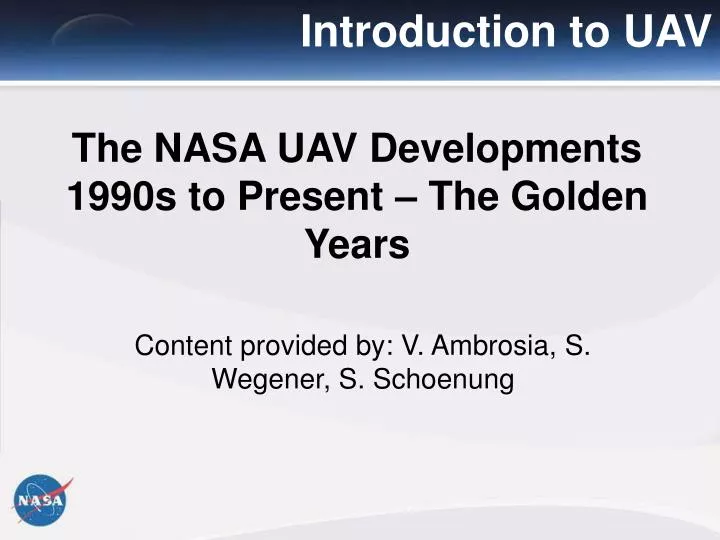
Introduction to UAV. The NASA UAV Developments 1990s to Present – The Golden Years. Content provided by: V. Ambrosia, S. Wegener, S. Schoenung. NASA and UAVs: New Approaches.

E N D
Introduction to UAV The NASA UAV Developments 1990s to Present – The Golden Years Content provided by: V. Ambrosia, S. Wegener, S. Schoenung International Symposium on Remote Sensing of the Environment
NASA and UAVs: New Approaches Add to the understanding and prediction of the Earth system. Suborbital observations fill time and space gap between surface observing networks and orbital platforms. • Objectives • Development of new space sensors and new remote-sensing techniques. • Satellite calibration/validation. • Targeted observations of ephemeral phenomena with variable temporal and spatial scales. • Atmosphere/near-space in-situ observations. • Improvement and validation of predictive Earth process models using satellite data. • Next-generation scientists with hands-on sensor hardware and field experiment experience. Sounding Rocket Program Balloon Program Aircraft & UAS Program International Symposium on Remote Sensing of the Environment
UAVs at NASA-Ames: Heritage 1989: Ames hosts Truckee Workshop which provides science justification and proposed development path of UAS. 1990: Atmospherics Effects of Aviation Program, looks to better understand impact of supersonic aviation on the atmosphere, has UAV component (Perseus A) initiated by Ames. 1993: Environmental Research Aircraft and Sensor Technology (ERAST) Program initiated under Dan Goldin, partly as a Perseus A risk reduction activity. ERAST, headed by Dryden, looked to Ames for science requirements and sensor development leadership. 1993- 96: Ames managed development of nine sensor systems for Perseus, three for ASHOE/MEASA ER-2 campaign, and three for other potential high impact science applications, Held three UAV Sensor workshops addressing miniaturization, thermal, and data and communications. Lead UAV OTH Requirements workshop.
UAVs at NASA-Ames: Heritage 1996 -1999: Ames lead ERAST Outreach activities including AUVSI, Sheppard UAV Europe, AIAA, TAAC, Workshops, Blessings, Open Houses, Dedications, special as needed. User groups engaged AGU, AEAP, RMS, GDIN, ERIM, HTF, FS RS, CalGIS, NSGIC, ASPRS. 1996: Ames demonstrated TDRSS OTH feasibility on Scaled Composites D2 UAV 1997 Ames flew ARTIS payload on Pathfinder demonstrating capability to remotely operate UAV sensor systems in real time. 1997: Ames instrumental in developing science requirements for the ERAST Research Announcement competition resulting in Altair. 2001: Ames leads UAV First Response Experiment (FiRE), producing real time geo-located, calibrated IR data products, via satellite telemetry
NASA and UAVs: ERAST Program ERAST Program The Environmental Research Aircraft and Sensor Technology (ERAST) program was a joint NASA / industry multi-year effort formed in 1993 to develop cost-effective, slow-flying unmanned aerial vehicles (UAVs) that could perform long-duration science missions at altitudes above 60,000 feet. Such aircraft could be used to collect, identify, and monitor environmental data to assess global climate change, weather monitoring and forecasting, remote sensing for Earth sciences studies, hyperspectral imaging for agriculture monitoring, tracking of severe storms, and serving as telecommunications relay platforms. The ERAST project was formally terminated in 2003. International Symposium on Remote Sensing of the Environment
NASA and UAVs: ERAST Alliance ERAST Alliance The ERAST Alliance included Dryden Flight Research Center as the managing center, NASA-Ames Research Center, led the sensor technology development; NASA-Glenn Research Center, and NASA Langley Research Center contributed expertise in the areas of propulsion, structures, and systems analysis. Industry partners in the ERAST Alliance included several high-technology aeronautical development firms, including General Atomics Aeronautical Systems, Inc., Aurora Flight Sciences, AeroVironment, Scaled Composites, Thermo-Mechanical Systems, Hyperspectral Sciences, and Longitude 122 West. NASA GRC NASA LaRC HSI International Symposium on Remote Sensing of the Environment TMS
ERAST Key Platforms General Atomics ALTUS The ALTUS (the name is Latin for "high") is a civil variant of the GNAT-750 and MQ-1 Predator . The Altus was based on and looked much like the Gnat 750 UAV but had a different fuselage and a longer wingspan. The Altus was 7.2 m (23 ft 7 in) long, had a wingspan of 16.9 m (55 ft 4 in), and a takeoff weight of 725 kg (1,600 lbs). It could carry 150 kg (330 lbs) to 13.7 km (45,000 ft) with an endurance of 24 hours. The engine was originally a Rotax 912 with a single stage of turbo-charging. An Altus spent 26 hours above 6,100 m (20,000 ft) in 1996, and spent four hours above 16,800 m (55,000 ft) in 1999 after being fitted with a two-stage turbocharger system, updating it to the Altus II configuration. General characteristics: Capacity: Up to 330 lb (150 kg) in nose compartment Length: 23 ft 7 in (7.2 m) Wingspan: 55 ft 3 in (16.5 m) Height: () Wing area: 131 ft² (12.17 m²) Loaded weight: 2,130 lb (967 kg) Powerplant: 1× Rotax 912 four-cylinder piston engine with a two-stage turbocharger, 100 hp (74.6 kW) Fuel capacity: 92 gal.(US) Performance: Maximum speed: 100 knots (115 mph, 186 km/h) Cruise speed: 70 kt (80 mph, 130 km/h) Range: 400 nm (460 mi, 735 km) Service ceiling: 65,000 ft (19,800 m) Endurance: Approx. 24 hrs, depending on altitude International Symposium on Remote Sensing of the Environment
NASA and UAVs: ERAST Platforms General Atomics ALTUS The ALTUS (the name is Latin for "high") is a civil variant of the GNAT-750 and MQ-1 Predator . The Altus was based on and looked much like the Gnat 750 UAV but had a different fuselage and a longer wingspan. The Altus was 7.2 m (23 ft 7 in) long, had a wingspan of 16.9 m (55 ft 4 in), and a takeoff weight of 725 kg (1,600 lbs). It could carry 150 kg (330 lbs) to 13.7 km (45,000 ft) with an endurance of 24 hours. The engine was originally a Rotax 912 with a single stage of turbo-charging. An Altus spent 26 hours above 6,100 m (20,000 ft) in 1996, and spent four hours above 16,800 m (55,000 ft) in 1999 after being fitted with a two-stage turbocharger system, updating it to the Altus II configuration. General characteristics: Capacity: Up to 330 lb (150 kg) in nose compartment Length: 23 ft 7 in (7.2 m) Wingspan: 55 ft 3 in (16.5 m) Height: () Wing area: 131 ft² (12.17 m²) Loaded weight: 2,130 lb (967 kg) Powerplant: 1× Rotax 912 four-cylinder piston engine with a two-stage turbocharger, 100 hp (74.6 kW) Fuel capacity: 92 gal.(US) Performance: Maximum speed: 100 knots (115 mph, 186 km/h) Cruise speed: 70 kt (80 mph, 130 km/h) Range: 400 nm (460 mi, 735 km) Service ceiling: 65,000 ft (19,800 m) Endurance: Approx. 24 hrs, depending on altitude International Symposium on Remote Sensing of the Environment
NASA and UAVs: ERAST Platforms AeroVironment Pathfinder In 1983, AeroVironment (AV) was funded from an unspecified US agency to secretly investigate a UAV concept designated "High Altitude Solar" or HALSOL. AV developed the Pathfinder (and Pathfinder Plus), which were solar- and fuel cell system-powered UAVs and flew the first of nine HALSOL missions in 1903, AV then modified the Pathfinder for the ERAST program in 1994 as a demonstrator long-term, high-altitude aircraft to perform atmospheric research tasks, remote sensing, and serve as communications platforms. On one of seven flights in the spring and summer of 1997, Pathfinder raised the altitude record for solar-powered aircraft — as well as propeller-driven aircraft — to 71,530 feet (21,800 m) on July 7, 1997. Pathfinder demonstrated earth science imaging capabilities with instruments developed at NASA-Ames. Pathfinder was powered by eight electric motors — later reduced to six — which were first powered by batteries. It had a wing span of 98.4 feet (30.0 m), with solar cells covering the entire upper surface of the wing. The solar arrays provide power for the aircraft's electric motors, avionics, communications and other electronic systems. Pathfinder also had a backup battery system that can provide power for between two and five hours to allow limited-duration flight after dark. International Symposium on Remote Sensing of the Environment
NASA and UAVs: ERAST Platforms AeroVironment Centurion Centurion was originally built for the 100,000 ft (30,000 m) altitude on solar power milestone specified by the ERAST project. An aircraft based on the Pathfinder/Pathfinder Plus concept would be the lowest risk approach of achieving the altitude goal. The Centurion's maiden flight took place at Rogers Dry Lake on November 10, 1998, and lasted a total of 1 hr and 24 minutes. The Centurion looked like the Pathfinder, but with a much longer wingspan of 206 ft (62.8 m). Although the Centurion shape resembled the Pathfinder, the structure was designed to be stronger and capable of carrying numerous payloads (up to 600 pounds (272.2 kg)) more efficiently. Its wing incorporated a redesigned high-altitude airfoil and the span was increased to 206 feet (62.79 m). The number of motors was increased to 14 and the number of under-wing pods rose to four. International Symposium on Remote Sensing of the Environment
NASA and UAVs: ERAST Platforms AeroVironment Helios The Centurion was modified into the Helios Prototype configuration by adding a sixth 41 feet (12.5 m) wing section and a fifth landing gear and systems pod. The larger wing on the Helios Prototype accommodated more solar arrays to provide adequate power for the sun-powered development flights that followed. The aircraft's maiden flight was on September 8, 1999. The two goals of the Helios Prototype were: 1) sustained flight at altitudes near 100,000 feet (30,480 m) and 2) endurance of at least 24 hours, including at least 14 of those hours above 50,000 feet (15,240 m). The Helios, electrically powered and constructed of carbon fiber, graphite epoxy, Kevlar, styrofoam, and a thin, transparent plastic skin, has a wingspan of longer than that of the U.S. AF C-5 military transport or the Boeing 747. International Symposium on Remote Sensing of the Environment
NASA and UAVs: ERAST Platforms AV Helios On August 14, 2001, the Helios Prototype reached an world record altitude of 96,863 ft (29,523.8 m). The altitude reached was more than 11,000 ft (3,352.8 m) —above the previous altitude record for sustained flight by a winged aircraft. The aircraft spent more than 40 min. above 96,000 ft (29,260.8 m). On June 26, 2003, the Helios Prototype broke up and fell into the Pacific Ocean ~10 mi (16 km) off of Kauai, Hawaii during a systems checkout flight. Most of the vehicle structure was recovered except the hydrogen-air fuel cell pod and two of the ten engines, which sank into the ocean. The investigation identified two-root causes of the accident: 1) "Lack of adequate analysis methods led to an inaccurate risk assessment of the effects of configuration changes leading to an inappropriate decision to fly an aircraft configuration highly sensitive to disturbances." 2) "Configuration changes to the aircraft, driven by programmatic and technological constraints, altered the aircraft from a spanloader to a highly point-loaded mass distribution on the same structure significantly reducing design robustness and margins of safety." International Symposium on Remote Sensing of the Environment
UAVs at NASA-Ames: Heritage 1998 – 2003: Ames, supporting Suborbital Science Program under UAV Science Demonstration Program (UAV SDP), leads the development of NRA looking to demonstrate UAVs in science and applications missions. Supports the HQ solicitation, and selection activities, the development of UAV Mission Implementation Plans, the final selections. Close oversight of mission development activities, and science flight operations in 2002. Ames lead the UAV SDP Lessons Learned activity. Ames brought UAVs into Earth Science Airborne Research. These activities laid the foundation for the UAV Applications Center, WRAP Western States Fire Mission, Intelligent Mission Management, and UAV Sensor web projects highlighted elsewhere.
NASA and UAVs: FiRE Mission FiRE Mission - 2001 The First Response Experiment (FiRE) was a 2000-2001 UAV Science Demonstration Project to demonstrate the efficacy of UAS platform imaging in support of disaster management. The FiRE mission objectives were to mature concepts for real-time imagery to be delivered from a UAV, operating over a fire event. On 6 September 2006, the ALTUS UAV took off from El Mirage Airfield in southern California to image a small controlled burn to a large group of spectators, scientists and media personnel. Six passes over the fire over a 1.5 hour period were made at an altitude of 3000 ft. (1000 m). A number of mission capabilities were demonstrated successfully: Inmarsat satellite data telemetry transmission was made in 1-2 minutes; Fire image data was made available to Internet within 2-3 minutes of collection; Geo-correction and re-distribution to Internet in 7 minutes, providing a total time (from collection to distribution) of ~10-15 minutes. International Symposium on Remote Sensing of the Environment
NASA and UAVs: SDP UAV Science Demonstration Program During and following ERAST, NASA continued to look towards funding efforts that pushed the envelope for scientific or applications uses of UAVs. In 2001, the agency solicited proposals from the scientific community; eleven (11) proposals were selected for further scrutiny and two were selected for implementation based on low cost after funding cuts to the overall program (SDP cancelled). One of which was the UAV Coffee Project in Kauai, Hawaii from 2001 to 2003. International Symposium on Remote Sensing of the Environment
NASA and UAVs: SDP ACES Payload ACES Project - 2002 In the summer of 2002, he Altus II served as the airborne platform for the Altus Cumulus Electrification Study (ACES), led by NASA Marshall Space Flight Center. The ACES experiment focused on the collection of electrical, magnetic and optical measurements of thunderstorms. Data collected helped scientists understand the development and life cycles of thunderstorms, which in turn may allow meteorologists to more accurately predict when destructive storms may hit. The experiments were undertaken with the Altus operating out of Key West, Florida. An innovative real time weather system was used to identify and vector the aircraft to selected thunderstorms and safely fly around these storms, while, at the same time monitor the weather near our base of operations. Altus at Key West, Florida • Two typical views with aircraft track. Lightning strikes are “-” and “+” signs (right picture) • Information from: • GOES Weather Satellite (left) • Ground Base Radar Info (right) • Other Sources are also available International Symposium on Remote Sensing of the Environment
NASA and UAVs: Study Approach Review / Refine / Validate • Requirements Sources: • SMD Strategic Plan • Suborbital Science Program Annual Report • Recent Workshops /Reports • Focus Area Roadmaps • Altitude • Range • Duration • Payload • Flight Rates • Instrument Resolution/ Bandwidth, Etc Synthesize Complete Science Requirements Translate to Suborbital Capability Requirements • Number and types of Systems Required. Postulate Total Suborbital Capability Specification • GAP ASSESSMENT • Develop Roadmap For Acquisition COMPARE • Number and types of Systems Available Document Existing Suborbital Capabilities Results must be reviewed, refined and subjected to Cost Effectiveness Analysis International Symposium on Remote Sensing of the Environment
NASA and UAVs: Workshops International Symposium on Remote Sensing of the Environment
NASA and UAVs: Workshops • Suborbital Science Missions of the Future workshop (2004) • Produced nearly 50 mission descriptions for UAS • Civil UAS Assessment (2005) • Series of workshops • Report in 3 volumes • Suborbital Science Capabilities Requirements report (2007) • Major Airborne Science Program report • Includes manned and unmanned aircraft • Decadal Survey requirements report (2009) • Companion to Suborbital Science Requirements Report • Focused on airborne requirements for Decadal Survey missions • Instrument test, algorithm development, cal/val • Includes manned and unmanned aircraft International Symposium on Remote Sensing of the Environment
NASA and UAVs: Workshops International Symposium on Remote Sensing of the Environment
NASA / NOAA and UAVs UAS Demonstrations to Date International Symposium on Remote Sensing of the Environment
NASA / NOAA and UAVs In April – November 2005, NOAA and NASA conducted the Altair Integrated System Flight Demonstration Project on the General Atomics-built Altair UAS. A key goal was to evaluate UAVs for science related to oceanic and atmospheric research, climate research, marine sanctuary mapping and enforcement, nautical charting, and fisheries assessment and enforcement. Payload included remote and in situ instruments for ocean color measurements and atmospheric composition and temperature. Measurements included ozone, halocarbons, and nitrous oxide. Water vapor vertical distribution was measured with passive microwave sensors. Five flights of 45.3 total flight hours plus 20.6 on integration flights at altitudes of 45,000 ft and 18.4 hours duration were completed. Fight objectives included sampling low-level jets in the eastern Pacific Ocean; sampling regions of high potential vorticity at mid-latitudes that result from transport of polar air; and imaging of the Channel Islands National Marine Sanctuary (CINMS) to examine shorelines and evaluate the potential for marine enforcement surveillance. International Symposium on Remote Sensing of the Environment
NASA / NOAA and UAVs Hurricane Ophelia - 2005 On September 16th 2005, NOAA, NASA and Aerosonde partners successfully flew into tropical storm Ophelia. This landmark event marked the first time an autonomous vehicle was flown into the core of a mature tropical system. At the time, Ophelia was a 55kt tropical storm and was located off the North Carolina coastline. The primary objective of this mission was to utilize the unique capabilities of the Aerosonde platform in order to document areas of the hurricane environment that are either impossible or impractical to routinely observe. A major success of the Ophelia flight was its immediate operational impact. The Aerosonde was able to provide critical near-surface wind speed measurements to the National Hurricane Center in real time. In addition, high-resolution thermodynamic and kinematic observations within Ophelia’s low-level inner core were also collected. International Symposium on Remote Sensing of the Environment
NASA / NOAA and UAVs Maldives AUAV Campaign: 2006 In March 2006, NOAA and NASA deployed small UAS over the N. Indian Ocean to study atmospheric pollution and their impact on climate, including global warming. The mission required multiple UAVs, stacked below, in, and above clouds to measure different particles in the layers. The campaign logged over 120 flight hours, including 55 takeoffs and 18 science mission. The science missions collected data on pollution and dust transported from S. Asia, Arabian and SW Asian deserts and their impacts on global dimming at the sea surface, the energy absorbed in the atmosphere and cloud properties. About half of the missions were 3-UAV stacked flights. The below-cloud UAV flew at ~1500 - 1800 ft; the in-cloud UAV at ~2200 - 3000 ft; and the above-cloud UAV between 5000 - 10000 ft. International Symposium on Remote Sensing of the Environment
NASA / NOAA and UAVs Fire Mission: 2006 During the 2006 Western States UAS Mission flights NOAA's Earth System Research Laboratory (ESRL) provided the Chromatograph for Atmospheric Trace Species (UCATS) instrument. The instrument measured water vapor (H2O) by tunable diode laser spectroscopy, and carbon monoxide (CO), methane (CH4), and hydrogen (H2) on one of its two gas chromatographic channels. The other channel measured nitrous oxide (N2O) and an indicator of electrical power distribution, sulfur hexafluoride (SF6). A precise ultraviolet ozone (O3) photometer was also installed. These trace gases, excluding SF6, measured by UCATS are produced during forest fires. Biomass burning trace species: H2O, CO, CH4, and N2O Tropospheric folds: Stratospheric down-welling into the troposphere. Man-made tropospheric pollution tracers: SF6, CO, and O3 Aura Validation Trace Species (H2O, O3, N2O, CH4, CO). Stratosphere age of the air (SF6) International Symposium on Remote Sensing of the Environment
NASA / NOAA and UAVs Hurricane Noel : 2007 NASA and NOAA flew an Aerosonde UAS into the eye wall of Hurricane Noel on at altitudes as low as 300 feet. The UAS was launched from NASA’s Wallops Flight Facility on 2 November 2007. The 17:27 hour flight duration was a record for unmanned aircraft hurricane missions. The unmanned aerial system flew in winds reaching 80 mph in the core of the storm for approximately 7.5 hours providing real-time detailed observations of the near surface, high wind environment to NOAA forecasters at the National Hurricane Center, Miami. The Aerosonde was flown until ran out of gas, continuously taking measurements. International Symposium on Remote Sensing of the Environment
NASA / NOAA and UAVs: 2010 GLOPAC Missions 2010 The Global Hawk Pacific Missions (GloPac) are designed to support of the Aura Validation Experiment (AVE). The mission will operate out of Dryden Flight Research Center and cover the entire offshore Pacific region with four / five 30 hour flights, designed to address science objectives: 1. Validation with NASA Aura satellite; 2. Observations of stratospheric trace gases in the upper troposphere and lower stratosphere from the mid-latitudes into the tropics; 3. Sampling of polar stratospheric air and the break-up fragments of the air that move into the mid-latitudes; 4. Measurements of dust, smoke, and pollution that cross the Pacific from Asia and Siberia; 5. Measurements of streamers of moist air from the central tropical Pacific that move onto the West Coast of the United States (atmospheric rivers). International Symposium on Remote Sensing of the Environment
NASA and UAVs: 2010 SIERRA UAS The Systems Integration Evaluation Remote Research Aircraft (SIERRA) is a medium-class, UAS for remote sensing and atmospheric sampling missions. Designed by the U.S. Naval Research Laboratory and developed at NASA’s Ames Research Center, the SIERRA can carry up to 100 pounds of scientific instruments for up to 600 miles. Its scalable nose payload bay supports a broad range of optical or radar imaging and air sampling missions. On-board data processing enables real-time data streams and on-the-fly geo-rectification. Communications links feature a primary LOS radio/modem system, operating at 900 MHz and up to one watt within a 10-mile range. A OTH communications link is implemented through the Iridium SatCom constellation, providing communications at up to 2.4 bits/sec bandwidth. The autopilot uses a set of coordinates to perform waypoint navigation and allows real-time course changes. SIERRA Specifications Wing Span: 20 ft. Length: 11.8 ft. Height: 4.6 ft. Empty Weight: 215 lbs Gross Weight: 350 lbs Payload: 50 lbs Max Speed: 80 kts. Cruise Speed: 55 kts. Range: 600 nm. Endurance: 11 hours International Symposium on Remote Sensing of the Environment