Download
1 / 42
420 likes | 494 Views
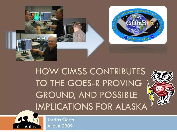
How CIMSS Contributes to the GOES-R Proving Ground, and Possible Implications for Alaska. Jordan Gerth August 2009. 3 YEARS of WFO-DIRECT RESEARCH TO OPERATIONS. Research to Operations: Our Distribution. MODIS Visible (Band 1) Snow/Ice (Band 7) Cirrus (Band 26) 3.7 µ m (Band 20)

E N D
How CIMSS Contributes to the GOES-R Proving Ground, and Possible Implications for Alaska Jordan Gerth August 2009
3 YEARS of WFO-DIRECT RESEARCH TO OPERATIONS
Research to Operations:Our Distribution • MODIS • Visible (Band 1) • Snow/Ice (Band 7) • Cirrus (Band 26) • 3.7µm (Band 20) • Water Vapor (Band 27) • IR Window (Band 31) • 11µm – 3.7µm (Fog) • Land Surface Temperature • Normalized Diff Veg Index • Total Precipitable Water • Cloud Phase • Cloud Top Temperature • Sea Surface Temperature • MODIS (continued) • Lifted Index • Total Totals • K Index • True Color Sectors • Orbit Itinerary • GOES Sounder • Total Column Ozone • Conv Available Potl Energy • GOES Mesoscale Winds • CRAS (NWP Model) • Standard model output • Synthetic IR imagery • Synthetic WV imagery
The most important part of an end-to-end research to operations endeavor is to bridge the gap and engage the operational forecasters in a long-lasting, two-way conversation about how they might deliver a better forecast using new science and technology. The forecaster may know a problem, but not how to solve it, or what to solve it with. This requires making an initial effort to show interest in the forecaster’s job and following up after a transitioned item has been implemented to consider improvement. There are multiple ways to do this: Short, anonymous, multiple choice surveys conducted over the Internet Formal or informal discussions with forecasters on site or over the phone Ask
In general, how useful are MODIS images and products in daily operations? A total of 24 National Weather Service forecasters at five offices were sampled in this 2007 survey. Participation was optional. “I love the MODIS product but I only get one picture PER SHIFT which really doesn't make it totally useful. I wish we could get MODIS pictures at least every 30 minutes, but every 15 would be excellent.” From National Weather Service Forecast Office in Indianapolis, Indiana
What MODIS images and products in AWIPS do you use most frequently? A total of 24 National Weather Service forecasters at five offices were sampled in this 2007 survey. Participation was optional. “This is a great dataset for WFO Operations. We would love to continue to see more and more data get into AWIPS. The Fog product I have found to be especially useful, as well as the Snow/Ice Band 7. Great stuff!” From National Weather Service Forecast Office in La Crosse, Wisconsin
There are five points of consideration: What are the available data resources, and which apply to the issue at hand? How can the identified problem be remedied for presentation in the most efficient manner possible? What, if anything, is presently available to the forecaster to assist with this problem, and does the remedy add value over it? Will the proposed solution be both reliable and consistent in delivery? How can that be assured? The lack of reliability and consistency poses a significant barrier to widespread use in operations! What will the future hold? Assess
There are three types of product development for research to operations projects: Implementation of imagery or well-established derived products existing in a research capacity with little or no modification The creation of a new product based on research not yet transferred to operations Assure any new product validates prior to implementation. Research to operations projects should not be used for validation, only functionality and usability. Infusing new or existing data into an algorithm or model for expected improvement Specifically, using high-resolution data in adequate numerical weather prediction arrangements to better the initial conditions, create better forecasts Develop
Information Extracted from Satellites Brightness temperature from initial model fields Brightness temperature from model fields after assimilation Radiance Assimilation Radiances Direct assimilation (3Dvar) Requires knowledge of errors Scale dependence Surface type restrictions GOES brightness temperatures Motion Cloud track, bright temperature Geo and Polar Height assignment errors Radiance tracking (4Dvar) Retrieved parameters Dependent variable assimilation (1,3Dvar) Requires knowledge of retrieval errors Physical accuracy, non-linearity Bypass surface type restrictions Slide credit: Robert Aune, NOAA/NESDIS
Experimental data is delivered to the National Weather Service Forecast Offices using a server with the Local Data Manager (LDM) software provided by Unidata. Some is also posted to the Internet, including particularly new data. However, the preferred method is to make it available in the software the forecasters use most. The LDM sends and retrieves files over an event-driven stream consisting of defined feeds between active servers. We use the EXP and SPARE feeds. Files are first sent on a feed to an LDM server at the regional headquarters, then passed onto any requesting offices within that region. Offices can limit the number of files ingested from a given feed. Files are all delivered in an AWIPS-readable format. LDM is format unaware. Deliver
A New Way to Deliver? • What will happen to the SBN once GOES-R increases the deliverable data 60-fold? • What about now? Lessons learned from AVHRR? • What can welearn from howAlaska Regionhandles polarsatellite data?
Web Transitioning http://cimss.ssec.wisc.edu/cras/ NOAA Collaborator: Robert Aune
GEMPAK/N-AWIPS is meteorological data display software developed by the National Centers for Environmental Prediction (NCEP) and supported by Unidata with analysis and product generation capabilities for viewing archived and real-time data. Active development of the software has ended. It contains both graphical user interfaces (GUIs) and standard input applications with graphical output to disk or display. GEMPAK/N-AWIPS
GEMPAK/N-AWIPS • It is employed by the National Centers (such as Storm Prediction Center, Tropical Prediction Center, etc.) to produce operational Redbook Graphics and other text forecast products which are disseminated over the Satellite Broadcast Network. • CIMSS uses N-AWIPS to produce web graphics for the CRAS and deliver/quality-control convective initiation and cloud top cooling products to the Storm Prediction Center (SPC).
20090429 2015 UTC Instantaneous CI Nowcast CI Occurring "CI Occurring" is associated with cloud that has recently transitioned to a thick ice cloud top "CI Likely" is associated with growing supercooled water or mixed phase cloud "Pre-CI Cloud Growth" is associated with growing liquid water cloud CI Likely CI Possible Slide credit: Wayne Feltz
The Advanced Weather Interactive Processing System (AWIPS) is Linux-based software used exclusively by the National Weather Service that consists of a data management structure and display tool for raw weather information transmitted over the Satellite Broadcast Network (SBN). AWIPS can be customized to a local area and special datasets can be added. Raw data from the SBN is acquired and decoded into special netCDF files and stored until purged, when the data reaches expiration. AWIPS
AWIPS • CIMSS delivers AWIPS-ready netCDF files via the LDM of experimental satellite imagery and products. We have developed this software for use locally with builds from the NWS WDTB and produced “ AWIPS local applications” for the field. • The graphical user interface (GUI) which serves as a front-end for data access is Display Two-Dimensions (D-2D). Data is limited to 8 bits (256 possible values). AWIPS has essentially no command-line interface except the localization scripts. • Users can create procedures for easy loading.
WV SST/VIS IR
Fx-Net/Fx-Collaborate • CIMSS has previously acquired the Fx-Net/Fx-C software package for potential use in research to operations activities (similar to our product transitions in AWIPS). • There was some early interest from NWS WSO Barrow about using the Fx-Net mechanisms to deliver and display data from MODIS to remote WSOs in the Alaska Region. • We are interested in assessing the bandwidth and limitations of the software to determine feasibility and timeliness of this approach. • The future of Fx-Net/Fx-C appears uncertain with the integration of collaboration tools in the new migrated AWIPS infrastructure.
GFE • All forecast preparation is done using the Graphical Forecast Editor (GFE) for the National Digital Forecast Database. • CIMSS has implemented a local version of the GFE in order to explore possible applications for satellite data in the spatial and temporal visual forecast process. • We have tested the capabilities of the software with adding satellite datasets (such as MODIS) to the GFE databases and evaluating how new SmartTools can use satellite products to modify gridded values, especially for short range predictions. • In addition, CIMSS is producing a module which will add the CRAS to the list of gridded data sources. CRAS runs are produced twice daily (00Z, 12Z). Domains include Alaska, Hawaii, CONUS, and the Midwest.
CIMSS Regional Assimilation System CRAS The Cooperative Institute for Meteorological Satellite Studies (CIMSS) uses the CIMSS Regional Assimilation System (CRAS) to assess the impact of space-based observations on numerical forecast accuracy. CRAS is unique in that, since 1996, it’s development was guided by validating forecasts using information from GOES. Slide credit: Robert Aune, NOAA/NESDIS
CRAS • CIMSS is particularly interested in implementing a sky cover algorithm in the CRAS post-processor to produce a gridded product for the GFE. • We are in the early stages of defining a celestial dome and perform a geometric calculation such that the output sky cover expresses coverage over nine adjacent grid cells. • The hope is to eliminate the bi-modal appearance and relative humidity reliance of many model output sky cover products, without significantly smoothing the gradients of the predictions. • Is “sky cover” another “probability of precipitation”?
Sky Cover Prediction We respond! Pre-release commentary from National Weather Service Science Operations Officers: “[The] field really does need something to help with the sky grids.” “Obviously great potential for (the) NDFD!”
Sky Cover Prediction Some Problems:What is 100% sky cover? Both celestial domes are completely covered with cloud. Do we use an incoming light standard? If so, what do we do at night? What about smoke and fog? Photos courtesy of National Weather Service Southern Region Headquarters
CIMSS has configured the CRAS for Anchorage, Alaska. It uses precipitable water and cloud-top pressure from MODIS and from the GOES-11 sounder to initialize water vapor and clouds. The domain is a superset of the AWIPS 216 grid so forecast products can be transferred directly to AWIPS. Shown at right are some comparisons between 18-hour CRAS forecast images and images from the GOES-11 imager. The 6.7u CRAS images are generated using the GOES-11 radiative transfer model to generate clear sky brightness temperatures. The 11u CRAS images are computed using the predicted cloud mixing ratio to attenuate the predicted skin temperature. Note: The map projection on the GOES-11 images are slightly different than on the CRAS images. 24 and 48-hour forecasts of 6-hour accumulated precipitation, 1000hPa – 500hPa thickness and mean sea-level pressure valid 12UTC 04Dec08 CRAS Forecast Products for the Alaska Region 18-hour forecast sky cover (0% - 100%) valid 18UTC 02Dec08
IC4D • CIMSS was recently informed that the Alaska Region is developing and using IC4D for the visualization of meteorological datasets and fields. • Though we know it is similar and based on the GFE, we have not established the full extent to which IC4D is applied in the fields and relevant to satellite data display and dissemination. • In order to meet the needs of our Alaskan interests, we are interested in obtaining a copy of the IC4D if it is expected to remain a viable software package during and following the AWIPS migration process.
The AWIPS Technology Infusion (ATI) project is ongoing and consists of two primary parts: Transitioning the existing AWIPS baseline functionality into a new Java-based service-oriented architecture Extending and expanding AWIPS II components to allow for the migration of N-AWIPS and WES functionality AWIPS II will also enhance online collaboration through new visual tools, data delivery with smart push/pull, information generation, and visualization through three dimensions and streamlined zooming. AWIPS II is currently undergoing beta testing with an initial deployment scheduled in 2010. AWIPS II
AWIPS II • Per an action item from our annual PG meeting, CIMSS is currently waiting to participate in the Technical Interchange Meeting (TIM) involving the transition of AWIPS I experimental products to the migrated AWIPS environment. • The new data storage structure of AWIPS II will not allow for the AWIPS I method of sending individual netCDF files for the various bands and products. • CIMSS has demonstrated a new process for experimental satellite product visualization in AWIPS II. • We are preparing to work on the migration of our “local applications” into the AWIPS II environment, and will hopefully participate in NCLADT meetings and workshops this upcoming fall.
The Weather Event Simulator (WES) is a two-part interface for reviewing archived weather data (in the form of netCDF files) from AWIPS: The front-end GUI D-2D operating on static data Tools developed by the Warning Decision Training Branch (WDTB) for replaying data and annotating a case The WES is primarily a National Weather Service training tool to allow forecasters to use their decision-making skills with real datasets and examine data from a recent event. WES cases can be created with pop-up annotations in the form of text, still images, and videos synchronized to certain times to give the WES user a real-time feel. CIMSS is developing a GOES-R simulated ABI WES case. Weather Event Simulator
Sample Visible and Near-IR Bands of the GOES-R Advanced Baseline Imager in AWIPS/WES Slide credit: Kaba Bah
Sample IR Bands of the GOES-R Advanced Baseline Imager in AWIPS/WES Slide credit: Kaba Bah
Comments or Questions? • jordang@ssec.wisc.edu • Jordan.Gerth@noaa.gov http://cimss.ssec.wisc.edu/goes/blog/