Download
1 / 21
210 likes | 288 Views
EXPLORING THE POTENTIAL OF MARITIME SPATIAL PLANNING IN THE MEDITERRANEAN SEA. Gijon – 19 May 2010. THE POTENTIAL OF MSP IN THE MEDITERRANEAN SEA Objectives and outcomes. Main goals to be achieved. Outcomes. Support the ongoing debate on Maritime Spatial Planning launched by the EC Roadmap

E N D
EXPLORING THE POTENTIAL OF MARITIME SPATIAL PLANNING IN THE MEDITERRANEAN SEA Gijon – 19 May 2010
THE POTENTIAL OF MSP IN THE MEDITERRANEAN SEAObjectives and outcomes Main goals to be achieved Outcomes • Support the ongoing debate on Maritime Spatial Planning launched by the EC Roadmap • Form the basis for the launch of a test project in the Mediterranean, encouraging concrete cross-border practices as announced in the Commission’s Communication ‘Towards an Integrated Maritime Policy for better governance in the Mediterranean’ • Identify potential areas in the Mediterranean Sea for the application of Maritime Spatial Planning • Analyse obstacles to the application of Maritime Spatial Planning in this specific sea basin • Suggest possible responses for its concrete application in specific sub-regions or sea areas The project was started in October 2009 and runs for 12 months Policy Research Corporation
AGENDA • Selection of potential areas for the application of MSP • Sub-regions regions in the Mediterranean • Selection methodology & outcomes • Identified areas & area characteristics • Adriatic Sea • Alboran Sea • Area surrounding Malta • Western Mediterranean • Actions forward Policy Research Corporation
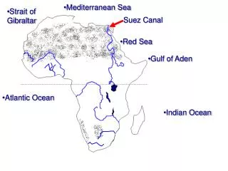
COUNTRY-BY-COUNTRY ANALYSIS- Sub-regions in the Mediterranean - • The Western Mediterranean Sea: Spain, France (incl Monaco), Italy, Morocco, Algeria and Tunisia • The Adriatic Sea: Italy, Slovenia, Croatia, Bosnia and Herzegovina, Montenegro and Albania • The CentralMediterranean Sea: Greece, Italy, Malta and Libya • The Aegean-Levantine Sea: Greece, Turkey, Cyprus, Lebanon, Syria, Israel and Egypt 2 1 4 3 Source: Directive 2008/56/EC of the European Parliament and of the Council of 17 June 2008 establishing a framework for community action in the field of marine environmental policy The Mediterranean Sea covers an area of 2.5 million km2 and borders twenty-one states in three different continents Policy Research Corporation
POTENTIAL AREAS FOR CROSS-BORDER MSP INITIATIVES- Eight regions eligible for MSP application - FR SI HR IT 1 5 BH CS AL ES 7 GR 6 TR 4 3 MT 8 CY LB SY TN 2 MA IL DZ LY EG In order to identify potential areas for cross-border MSP initiatives, the Mediterranean Sea basin was divided into 8 cross-border marine areas • Adriatic Sea (Italy, Slovenia, Croatia, B&H, Montenegro, Albania) • Area Southeast of Cyprus (Egypt, Israel, Lebanon) • Alboran Sea (Spain, Morocco, Algeria) • Area surrounding Malta • Western Mediterranean Sea (Spain, France, Italy) • Aegean Sea (Greece, Turkey) • Libyan Sea (Tunisia, Libya, Egypt) • Northern part of the Levantine Sea (Cyprus, Turkey) Policy Research Corporation
METHODOLOGY FOR IDENTIFYING AREAS WITH MARITIME SPATIAL PLANNING POTENTAL: 10 KEY PRINCIPLES These principles were developed in the EC Roadmap for MSP: Achieving common principles in the EU; the methodology is based on these principles • Using MSP according to area and type of activity; • Defining objectives to guide MSP; • Developing MSP in a transparent manner; • Stakeholder participation; • Coordination within Member States – Simplifying decision processes; • Ensuring the legal effect of national MSP; • Cross-border cooperation and consultation; • Incorporating monitoring and evaluation in the planning process; • Achieving coherence between terrestrial and maritime spatial planning; • A strong data and knowledge base. Policy Research Corporation
POTENTIAL OF MARITIME SPATIAL PLANNING (1/2) - Three important aspects - These criteria incorporate the principles from the roadmap • The potential of Maritime Spatial Planning in these eight areas was subsequently analysed on the basis of three aspects: • Purpose of MSP in the area: • Type and intensity of uses • Ecological value of the marine area • Feasibility of MSP in the area: • Scientific data / knowledge base • Institutional capacity • Legal and administrative supportive framework • Stakeholders involvement • Conditions for cross-border / international cooperation • In case the marine area falls beyond national jurisdiction – which is mostly the case for marine areas in the Mediterranean Sea basin Policy Research Corporation
POTENTIAL OF MARITIME SPATIAL PLANNING (2/2) - Methodology consisting of seven criteria - The analyses of the eight areas showed to what extent the statements were applicable to each of these areas • Purpose: • The area is intensively used and is (or will be) subject to competing human activities (and/or human activities that compete with ecology) • Feasibility: • There are sufficient scientific data available or the knowledge and tools are available to generate this data • There is a national or regional institutional framework available for marine policy or coastal planning • The countries/regions concerned possess a supportive legal framework • The countries/regions concerned strive to integrate coastal and marine planning • Specific platforms are available through which MSP could be introduced • Cross-border / international cooperation: • The countries concerned are open to cross-border / international cooperation Policy Research Corporation
IDENTIFYING AREAS WITH POTENTIAL FOR MSP- Selection criteria and scores - On the basis of the current insights, four areas qualified for further research to explore the potential for the application of MSP; this does not imply that the other four areas will not be selected for MSP projects in the future * As far as Cyprus concerns ** As far as Turkey concerns Policy Research Corporation
IDENTIFYING AREAS WITH POTENTIAL FOR MSP- Regions qualifying for in-depth analysis - FR SI HR IT 1 4 • Adriatic Sea • Alboran Sea • Area surrounding Malta • Western Mediterranean Sea BH CS AL ES GR TR 2 MT 3 CY SY LB TN MA IL DZ LY EG Green: Areas with more potential for cross-border/international MSP Red: Areas with less potential for cross-border/international MSP The four selected areas are: the Adriatic Sea, the Alboran Sea, the area surrounding Malta and the Western Mediterranean Policy Research Corporation
AGENDA • Selection of potential areas for application of MSP • Areas that were selected • Selection methodology • Identified areas & area characteristics • Adriatic Sea • Alboran Sea • Area surrounding Malta • Western Mediterranean • Actions forward Policy Research Corporation
ADRIATIC SEA- Key elements: scope, purpose, feasibility - Conflicting human activities put pressure on valuable ecosystems of the Adriatic Sea basin; several platforms for international cooperation already exist • Scope • Countries bordering the Adriatic Sea are Italy, Slovenia, Croatia, Bosnia and Herzegovina, Montenegro and Albania • Purpose • Human activities that currently put pressure on the Adriatic Sea areshipping, potential new energy terminals (LNG), tourist-recreational use and fishery • The Adriatic Sea is characterised by a large marine biodiversity;it is expected to be placed on the IMO list of particularly sensitive sea areas • Feasibility • Regional ICZM strategies have been developed by several Italian regions and Slovenia (South-Primorska) • Several platforms for international cooperation have been established, such as: • The Trilateral Commission of Italy, Slovenia and Croatia • The IPA Adriatic Cross-border Cooperation Programme to fund cross-border initiative • The Adriatic Ionian Initiative: cooperation in the development and safety of the whole area • Project proposal Shape ‘Shaping a holistic approach to protect the Adriatic environment between coast and sea’ Policy Research Corporation
ALBORAN SEA- Key elements: scope, purpose, feasibility - Conflicting human activities put pressure on valuable ecosystems of Alboran Sea; awareness and willingness for more cross-border cooperation is present • Scope • Countries bordering the Alboran Sea are Spain, Morocco and Algeria • Purpose • Environmental pressures on the Alboran Sea are shipping (marine pollution resulting from among others dumping and / or spills, especially in the Strait of Gibraltar), fishing and sand extraction • The Alboran Sea is characterised by a large marine biodiversity (e.g. seagrass, cetaceans and sea turtles) which makes it a genuine laboratory for the training of researchers and scientific observers • Feasibility • Spain adopted a national ICZM strategy in 2007, mainly focused on onshore activities; in 2009, a national study of the Spanish Coast identifying suitable areas for offshore wind farms was a concrete step in the direction of MSP • Spain, Morocco and Algeria have created a platform to discuss the conservation and sustainable development of the Alboran Sea and creating trust amongst potential stakeholders involved • Several Spanish institutions collect data on the flora and fauna of the Alboran Sea (The Spanish Institute for Oceanography (Malaga) and the Junta de Andalucia) • Prof. Suarez de Vivero (University of Seville) produces maps of the Alboran Sea (geographical information and maritime activities) Policy Research Corporation
AREA SURROUNDING MALTA- Key elements: scope, purpose, feasibility - The area surrounding Malta is intensively used; national planning legislation is well-organised in Malta, but cross-border marine projects do not (yet) exist • Scope • The area surrounding Malta borders three countries: Italy, Tunisia and Libya • Purpose • Main maritime activities surrounding Malta are maritime transport, fisheries and hydrocarbons • The northern area surrounding Malta (north of Malta and south of Sicily) is characterised by majorshippingroutes and intensive maritime traffic • The area between the south of Malta and the coast of Libya is intensively used for hydrocarbon activities • Feasibility • In the area surrounding Malta the majority of sea uses are regulated but there is no coordinated approach that aims to reduce conflicts between activities • In Malta, existing planning legislation seems to provide the necessary framework for developing plans and to issue development permits to regulate sea uses • The Integrated Coastal Zone Management strategy of Malta is linked to maritime and terrestrial spatial planning; moreover, the Maltese government considers spatial planning as a tool that can assist in identifying a strategic approach towards sustainable development of the coastal environment • Also Tunisia sees ICZM as a high priority Policy Research Corporation
WESTERN MEDITERRANEAN SEA- Key elements: scope, purpose, feasibility - In the Western Mediterranean Sea area, countries are advanced in coastal planning and cross-border marine projects already exist • Scope • The countries bordering the Western Mediterranean Sea are Spain, France (including Monaco) and Italy • Purpose • Human activities that currently put pressure on this region seem to be shipping, potential new energy terminals, tourist-recreational use and fishery • The marine area between Spain, Italy and France has multiple Marine Protected Areas and ecological zones • Feasibility • The marine area between France (incl. Monaco) and Italy has some cross-border initiatives: the Corsica Sardinia marine reserve and the Pelagos Sanctuary • Spain adopted a national ICZM strategy in 2007, mainly focused on onshore activities; in 2009, a national study of the Spanish Coast identified suitable areas for offshore wind farms, which was a concrete step in the direction of MSP (also including the Alboran Sea) • France developed a National strategy for the sea and oceans (Livre Bleu, December 2009) and has the intention to evolve from Integrated Coastal Zone Management towards Integrated Management of the coast and the sea • Regional ICZM strategies have been adopted by several Italian regions (e.g. Emilia-Romagna and Marche) Policy Research Corporation
EXAMPLE OF CROSS-BORDER PLANNING ITALY-FRANCE- The Pelagos Sanctuary for Mediterranean marine mammals - The Pelagos Sanctuary is the only cross-border (France, Italy and Monaco) MPA in the Mediterranean High Sea • What? • Area with high ecological value: contains important habitats for cetacean species (e.g. whales, dolphins) • Agreement among France, Italy and Monaco • Listed as a Specially Protected Area of Mediterranean Importance (SPAMI) under the Barcelona Convention in 2001 becoming world’s first High Seas MPA • Objectives • Address local threats to cetaceans • Create highly protected conservation zones • Channel the area’s intense maritime traffic along established corridors • Systematically address fishery impacts on cetaceans • Implement a systematic monitoring programme • Increase public awareness • Problems • The Agreement Secretariat, foreseen as management body, is undermanned, has insufficient power, means and human resources to prevent or control activities Policy Research Corporation
EXAMPLE OF CROSS-BORDER PLANNING ITALY-FRANCE- The Pelagos Sanctuary for Mediterranean marine mammals - The Pelagos initiative failed to fulfil its objectives; a zoning / MSP scheme might be a solution • Consequences • Pelagos failed to significantly improve the conservation status of mammal populations • Possible solutions to solve Pelagos’ problems • Ecosystem-based Management (EBM) approach to mitigate human pressures • Control land-based and maritime sources of pollution • Integrated coastal zone/ocean management • Adaptive management approach that would deal with changing patterns of use as well as with technological, socio-economic, political and natural change • Among others, proper management would include • Creating a zoning scheme to optimise conservation • Regulating maritime traffic along established corridors • Establishing precise regulations to address and mitigate impacts exerted on cetaceans populations • Introducing an MSP (zoning) scheme in order to manage the Pelagos area Policy Research Corporation
PRESENTATION SUMMARYFour areas with potential for MSP MSP might be the solution in these areas if it enforces/stimulates: (1) propercoordination of areas, not just national parts (2) the creation of a consistentknowledge base and (3) regular monitoring and evaluation of (policy) actions taken • The four areas that are currently under extensive investigation are: the Adriatic Sea, the Alboran Sea, the area surrounding Malta and the Western Mediterranean • Each of the four areas is characterised by: • The involvement of multiple countries; • Intensive human activity, providing vital economic impact for its coastal and inland communities; • Marine environmental heritage and related environmental issues; • Adequately set up ICZM and/or cross-border initiatives; • A lack of a proper coordination system on the transnational region; • A lack of consistent knowledge bases. Policy Research Corporation
AGENDA • Selection of potential areas for application of MSP • Areas that were selected • Selection methodology • Identified areas & area characteristics • Adriatic Sea • Alboran Sea • Area surrounding Malta • Western Mediterranean • Actions forward Policy Research Corporation
ACTIONS FORWARD (1/2) Completed tasks Task 1: Review previous experiences and initiatives Task 2: Establish the elements that should be taken into consideration for the identification and characterisation of potential areas for the application of MSP Actions forward Task 3: Description of the selected areas and draw up a list of authorities and stakeholders concerned with MSP in these areas Task 4: Analysis of potential obstacles and difficulties with regard to the application of MSP in the Mediterranean, in particular in these areas Task 5: Identify aspects of applying the 10 key principles for MSP that are specific to the Mediterranean Policy Research Corporation
ACTIONS FORWARD (2/2) • The following countries will be visited in the coming weeks: • Italy (Adriatic part and Sicily) • Tunisia • Morocco • If you have any valuable information for the four cases studies and/or you are willing to speak to us during one of our field visits, please contact Policy Research • Also if you have suggestions about organisations or people to contact, please inform Policy Research Tom Thijssens Director Policy Research Corporation Tom.Thijssens@policyresearch.be Policy Research Corporation