Download
1 / 15
150 likes | 254 Views
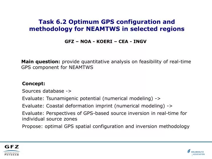
Task 6.2 Optimum GPS configuration and methodology for NEAMTWS in selected regions. GFZ – NOA - KOERI – CEA - INGV. Main question: provide quantitative analysis on feasibility of real-time GPS component for NEAMTWS . Concept: Sources database ->

E N D
Task 6.2 Optimum GPS configuration and methodology for NEAMTWS in selected regions GFZ – NOA - KOERI – CEA - INGV Main question: provide quantitative analysis on feasibility of real-time GPS component for NEAMTWS Concept: • Sources database -> • Evaluate: Tsunamigenic potential (numerical modeling) -> • Evaluate: Coastal deformation imprint (numerical modeling) -> • Evaluate: Perspectives of GPS-based source inversion in real-time for individual source zones • Propose: optimal GPS spatial configuration and inversion methodology
Why GPS for tsunami early warning Requirement: A modern near-field* Tsunami Early Warning System needs to provide a qualified tsunami warning in 5-10 minutes after an earthquake Traditional approach is seismic-based: 1) Localize earthquake, estimate magnitude 2) Then use decision matrix or retrieve pre-computed scenario (variants: assemble scenario from precomputed Greens' functions; compute on-the-fly) *)near-field means that the source-to-coast distance is comparable with the source size
Why GPS for tsunami early warning Why not to be happy with traditional, seismic-based tsunami early warning? Argument No.1: seismic methods tend to underestimate magnitudes in first minutes after an earthquake This is especially true for earthquakes which generate tsunamis: either very large (like Sumatra 2004 M9.1, Tohoku 2011 M9.0), or so-called slow ‘tsunami earthquakes’ (e.g., Java 2006 M7.8, Mentawai 2010 M7.8) Argument No.2: seismic methods provide not enough source parameters in first minutes after an earthquake Preliminary seismic parameters describe source as a point-source: magnitude + location (epicenter, later – centroid). However, for a qualified tsunami early warning we need much more – we need a finite fault source model.
Replaying the Tohoku 2011 event Replaying the Tohoku 2011 event ‘Replaying’ means: simulate the situation as it might have taken place in a Warning Center connected to the GEONET GPS-array. Procedure: On input: a stream of raw GPS-observations (30-sec RINEX-O) for about 500 online GEONET stations. • GPS-processing: convert GPS-obseravtions into displacements.EPOS-RT PPP real-time processing software. Use predicted orbits. t < 15 sec. • Source inversion: invert displacements into co-seismic slipPrecomputed displacement Green’s functions for layered (IASP) halfspace (PSGRN/PSCMP code by Wang et al., 2006). 1 <t < 60 sec. • Estimate tsunami impact: compute wave propagation and coastal impact using the inverted source.In linear approximation untill 50-100 m depth, then -- Green’s law. t < 15 sec. Constanty keep repeating pp. 1-to-3 … GEONET GPS-array operated by Geospacial Information Authority of Japan (GSI) Slab geometry: Gudmundsson and Sambridge (1998)
Replaying the Tohoku 2011 event O.T. = 120 seconds Mw = 9.02 Max slip = 32 m GPS data and source model Warning perspecive
Replaying the Tohoku 2011 event So, how good ‘quick-shot’ forecasting might have been? Warning proposal available already after 3 minutes (+ processing time) Mw = 9.0 … differs not much from the final one Mw = 9.0
Replaying the Tohoku 2011 event So, how good ‘quick-shot’ forecasting might have been? Looking at warning level forecasting only Mw = 8.5 Mw = 8.7 Mw = 9.0 Mw = 9.0 Mw = 9.0 and final … and projected from field studies Mw = 9.0
How about smaller magnitudes? Tohoku 2011 was a giant M=9 event producing extreme surface displacements. What about smaller but still tsunamigenic earthquakes? (e.g., with M ~ 7-7.5) Would a ‘GPS-Shield’ see them? Resolution studies are needed for specific GPS-array configuration.
Accuracy of Tsunami Source Inversion with Real-time GPS Methodology: (1) compute a databank of GPS-'fingeprints' for virtual earthquakes with Mw from 6.5 to 8.9. (2) For each scenario perturb GPS-signals with random noise – simulate “trial” scenario. (3) Invert trial displacements into databank by best-fit. Repeat 50 times for each scenario. If “trial” scenario was successfully recognized in 90% of cases, then declare an earthquake of given magnitude at given location "resolvable" by given GPS-array and given GPS accuracy. (Mw) < 0.2 (Epi) < 50 km GPS- accuracy: 1 cm H / 3 cm V 2 cm H / 6 cm V 4 cm H / 12 cm V Resolution of the GEONET (GSI) GPS-array relative to Mw and epicenter
Accuracy of Tsunami Source Inversion with Real-time GPS: A Chilean Perspective Resolution of the virtual Chilean coastal GNSS network Assumed GPS-accuracy: 1 cm H / 3 cm V Simple linear GPS-array of 48 stations with 0.5° spacing. 3D-megathrust plate interface. 1D-layered Green's functions. Inversion criteria: (Mw) < 0.2 (Epi) < 50 km
Task 6.2 To do: GFZ – NOA - KOERI – CEA - INGV Main question: provide quantitative analysis on feasibility of real-time GPS component for NEAMTWS Concept: • Sources database -> • Evaluate: Tsunamigenic potential (numerical modeling) -> • Evaluate: Coastal deformation imprint (numerical modeling) -> • Evaluate: Perspectives of GPS-based source inversion in real-time for individual source zones • Propose: optimal GPS spatial configuration and inversion methodology
Task 6.2: Data sources and tools - Most important: Datasets on tectonic sourcesResults from SHARE; DISS; Basili et al. (= INGV+WP2+WP3)To do: Contact with INGV a.s.a.p. • - Bathymetry: GEBCO for LSW-equationsTools: GFZ (easyWave-GPU, RuptGen, EDCMP) - Available/planned GPS networksNOA, KOERI, CEA(?),…. • Real-time GPS processing characteristicsGFZ section 1.1