Download
1 / 32
320 likes | 518 Views
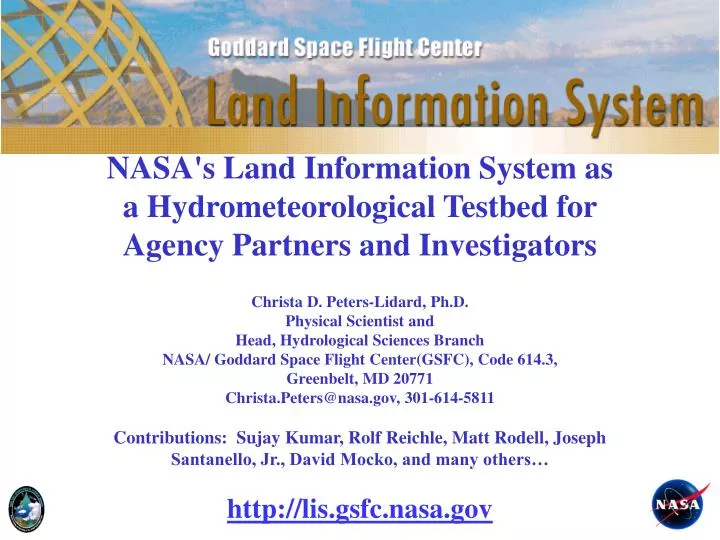
NASA's Land Information System as a Hydrometeorological Testbed for Agency Partners and Investigators Christa D. Peters-Lidard, Ph.D. Physical Scientist and Head, Hydrological Sciences Branch NASA/ Goddard Space Flight Center(GSFC), Code 614.3, Greenbelt, MD 20771

E N D
NASA's Land Information System as a Hydrometeorological Testbed for Agency Partners and Investigators Christa D. Peters-Lidard, Ph.D. Physical Scientist and Head, Hydrological Sciences Branch NASA/ Goddard Space Flight Center(GSFC), Code 614.3, Greenbelt, MD 20771 Christa.Peters@nasa.gov, 301-614-5811 Contributions: Sujay Kumar, Rolf Reichle, Matt Rodell, Joseph Santanello, Jr., David Mocko, and many others… http://lis.gsfc.nasa.gov
Outline • LIS Background • LIS Architecture & Design • Hydrometeorologic modeling support • LIS transition for AFWA/AGRMET • LIS transition for NOAA/NCEP/GLDAS • NLDAS Drought Example • Data Assimilation Examples • Soil Parameter Estimation Example • LIS/WRF Coupled Modeling Example • Future enhancements
Motivation: Observations Snow cover fraction (MODIS, VIIRS, MIS) Vegetation/Carbon (AVHRR, MODIS, DESDynI, ICESat-II, HyspIRI, LIST, ASCENDS ) Snow water equivalent (AMSR-E, SSM/I, SCLP) Surface soil moisture (SMMR, TRMM, AMSR-E, SMOS, Aquarius, SMAP) Water surface elevation (SWOT) Precipitation (TRMM, GPM) Terrestrial water storage (GRACE) Ensemble-based land data assimilation system Radiation (CERES, CLARREO ) Land surface data for research and applications: Comprehensive view of land surface water/energy/carbon cycle. Learn about processes, characterize errors, improve models. Enhance weather and climate forecast skill. Develop improved flood prediction and drought monitoring capability. … Land surface temperature (MODIS, AVHRR,GOES,… )
LIS Motivation: Exploit moderate (e.g., MODIS) and high-res (Landsat) data 25km 5km 1km
LIS Heritage: NLDAS and GLDAS North American LDAS 1/8 Degree Resolution Mitchell et al., JGR, 2004 Global LDAS 1/4 Degree Resolution Rodell et al., BAMS, 2004 Land Information System (http://lis.gsfc.nasa.gov) Multi-Resolution Ensemble LDAS Software Framework Kumar et al., EMS, 2006
Land Data Assimilation at NASA/GSFC • Land Information System (LIS) • Lead: Christa Peters-Lidard (614.3) • Award-winning, modular, high-performance software • Multiple land surface models • GEOS-5 land assimilation modules • Used and co-developed by NOAA/NCEP, AFWA, JCSDA, • and many others • Global & North American Land Data Assimilation Systems (GLDAS, NLDAS) • Leads: Matt Rodell/David Mocko (614.3) • Project for land assimilation research and applications • Data archive at GES-DISC • Uses LIS software • Contributes to GEOS-5 seasonal forecast initialization • GEOS-5 ($ by NASA Modeling, Analysis & Prediction Program) • Lead (for land assimilation): Rolf Reichle (610.1) • Comprehensive atmos./ocean/land modeling & assimilation system • Quasi-operational weather and seasonal forecasts • MERRA reanalysis • Development of ensemble-based land assimilation
Atmospheric Models (WRF/GCE/ GFS/GEOS) Estuary /Coastal /Ocean Models Land Surface Models (LIS) LIS Vision: Land Component for Earth System Models
LSM Initial Conditions LIS Running Modes Uncoupled or Analysis Mode Coupled or Forecast Mode Station Data WRF/ GFS/ GCE Global, Regional Forecasts and (Re-)Analyses ESMF Land Sfc Models (Noah, Catchment, CLM, VIC, HYSSiB) Satellite Products Kumar, S. V., C. D. Peters-Lidard, J. L. Eastman and W.-K. Tao, 2008. An integrated high-resolution hydrometeorological modeling testbed using LIS and WRF. Environmental Modelling & Software, Vol. 23, 169-181.
LIS Uncoupled/Analysis Mode Inputs Physics Outputs Applications Topography, Soils Land Surface Models Soil Moisture & Temperature Weather/ Climate Water Resources Agriculture Drought Military Ops Natural Hazards Land Cover, Vegetation Properties Evaporation Sensible Heat Flux Meteorological Forecasts, Analyses, and/or Observations Runoff Data Assimilation Modules Snow Soil Moisture Temperature Snowpack Properties
LIS Architecture Kumar, S. V., C. D. Peters-Lidard, Y. Tian, P. R. Houser, J. Geiger, S. Olden, L. Lighty, J. L. Eastman, B. Doty, P. Dirmeyer, J. Adams, K. Mitchell, E. F. Wood and J. Sheffield, 2006. Land Information System - An Interoperable Framework for High Resolution Land Surface Modeling. Environmental Modelling & Software, Vol. 21, 1402-1415.
LIS Design • Earth System Modeling Framework (ESMF) to interoperate with other Earth system model components (e.g., the Weather Research and Forecasting Model, WRF) • ESMF tools are also used to enable interoperability within the LIS components (e.g., Data Assimilation, Parameter Estimation, Land Surface Models) • I/O standards • ALMA (Assistance for Land Modeling Activities) • CF (Climate and Forecasting) • I/O Formats Supported • GRIB, NetCDF, HDF-EOS, Binary, Ascii
Hydrometeorological Modeling Activities • LIS transition for AFWA/AGRMET • LIS transition for NOAA/NCEP/GLDAS • NLDAS Drought Example • Data Assimilation Examples • Soil Parameter Estimation Example • LIS/WRF Coupled Modeling Example
AFWA/AGRMET Background • LIS Development and Tech Transition Projects Funded by AFWA Since FY05 • LIS Benchmarking as Next Generation AGRMET • LIS EnKF Design and Implementation • AGRMET Precipitation Enhancements (Joint w/OSU, C. Daly/W. Gibson) • LIS/WRF Coupling (Joint w/NCAR, F. Chen) • Combined MODIS SCA- AMSR-E SWE Product • LIS Assimilation Enhancements: MODIS SCA, MODIS LST, and JCSDA CRTM (Joint w/NCEP, JCSDA, K. Mitchell) • LIS/AGRMET IOC-February, 2009
JCSDA LIS-GFS-CRTM System Concept Uncoupled or Analysis Mode Coupled or Forecast Mode Satellite Radiances (CRTM) LIS Station Data GFS+ WRF= NEMS Global, Regional Forecasts and (Re-)Analyses ESMF Satellite Products LSM Physics (Noah)
NLDAS Drought Monitor Example http://ldas.gsfc.nasa.gov/drought
LIS Data Assimilation Examples GMAO Catchment model NCEP/AFWA Noah model Surface Soil Moisture Improvement • NASA/GMAO-developed capabilities for sequential data assimilation have been implemented in the NASA/HSB Land Information System (LIS) framework. • LIS is a comprehensive system that integrates the use of various land surface models, assimilation algorithms, observational sources for users at NASA, AFWA, NOAA, USDA and other agency investigators. Root Zone Soil Moisture Improvement Figure 1: Soil Moisture Assimilation Open Loop No Bias Correction Kumar, Sujay V., Rolf H. Reichle, Christa D. Peters-Lidard, Randal D. Koster, Xiwu Zhan, Wade T. Crow, John B. Eylander, and Paul R. Houser, 2008: A Land Surface Data Assimilation Framework using the Land Information System: Description and Applications, In press, Advances in Water Resources, Special Issue on Remote Sensing. doi:10.1016/j.advwatres.2008.01.013. Temperature RMSE (K) With Bias Correction Figure 2: Skin Temperature Assimilation
Assimilate AMSR-E surface soil moisture (2002-06) into NASA Catchment model Soil moisture assimilation Validate with USDA SCAN stations (only 23 of 103 suitable for validation) • Assimilation product agrees better with ground data than satellite or model alone. • Modest increase may be close to maximum possible with imperfect in situ data. • Use data assimilation for generation of SMAP “Level 4” product. Reichle et al. (2007) J Geophys Res, doi:10.1029/2006JD008033.
Soil-Moisture-Active-Passive (SMAP) mission design Skill improvement of assimilation over model (ΔR) (root zone soil moisture) Q: How uncertain can retrievals be and still add useful information in the assimilation system? A: Synthetic data assimilation experiments. AMSR-E (Δ): ΔR=0.06 SMMR (□): ΔR=0.03 Skill (R) of model (root zone soil moisture) Skill measured in terms of R (=anomaly time series correlation coefficient against synthetic truth). Each plus sign indicates result of one 19-year assimilation integration over Red-Arkansas domain. Skill (R) of retrievals (surface soil moisture) • Results • Assimilation of (even poor) soil moisture retrievals adds skill (relative to model product). • Published AMSR-E and SMMR assimilation products consistent with expected skill levels. Reichle et al. (2008) Geophys Res Lett, doi:10.1029/2007GL031986.
Multi-model soil moisture assimilation How does land model formulation impact assimilation estimates of root zone soil moisture? Normalized ROOT ZONE soil moisture improvement from assimilation of surface soil moisture Catchment and Mosaic work better for assimilation than Noah or CLM. Catchment or MOSAIC “truth” easier to estimate than Noah or CLM “truth”. Stronger coupling between surface and root zone provides more “efficient” assimilation of surface observations. Kumar et al. (2008) J. Hydromet., submitted.
Assimilationof GRACE terrestrial water storage (TWS) Validation against observed groundwater: RMSE = 23.5 mm R2 = 0.35 RMSE = 18.5 mm R2 = 0.49 Assimilation disaggregates GRACE data into snow, soil moisture, and groundwater. Assimilation estimates of groundwater better than model estimates. Zaitchik, Rodell, and Reichle (2008) J. Hydrometeorol., doi:10.1175/2007JHM951.1
Advanced rule-based MODIS snow cover assimilation • Forward-looking “pull” algorithm (smoother): • Assess MODIS snow cover 24-72 hours ahead • Adjust air temperature (rain v. snowfall, snow melting v. frozen) snow water equivalent, mm Sep-05 Jan-06 May-06 Sep-06 Jan-07 May-07 Zaitchik and Rodell, J. Hydromet., doi:10.1175/2008JHM1042.1, in press.
Simulatingirrigation based on MODIS observations Difference (%) in evapotranspiration between irrigation and control runs, Aug-Sep 2003 MODIS-derived intensity of irrigation control run irrigation run observations Max surface temperature (K) (irrigated site) Innovative algorithm models irrigation based on MODIS data, crop type, time of year, soil dryness, and common irrigation practices improved model fluxes. Ozdogan and Gutman (2008) Remote Sens Environ Ozdogan, Rodell, and Kato (2008) J Hydrometeorol, in preparation
2003 county irrigation totals cubic km 0.0 1.2 2.4 4.8 6.0 3.6 Simulating irrigation based on MODIS observations Reported by USGS Modeled in this study Ozdogan, Rodell, and Kato (2008), J Hydrometeorol, in preparation
LIS Soil Parameter Estimation Example LIS+SSURGO OBS LIS+PEST Peters-Lidard C. D., D. M. Mocko, M. Garcia, J. A. Santanello Jr., M. A. Tischler, M. S. Moran, Y. Wu (2008), Role of precipitation uncertainty in the estimation of hydrologic soil properties using remotely sensed soil moisture in a semiarid environment, Water Resour. Res., 44, W05S18, doi:10.1029/2007WR005884. Santanello, J.A., Jr., C. D. Peters-Lidard, M. Garcia, D. Mocko, M. Tischler, MS. Moran, and D.P. Thoma, 2007: Using Remotely-Sensed Estimates of Soil Moisture to Infer Soil Texture and Hydraulic Properties across a Semi-arid Watershed, Remote Sensing of Environment, 110(1), 79-97, DOI=http://dx.doi.org/10.1016/j.rse.2007.02.007.
LIS-WRF Coupled Example 2:0-10 cm initial soil moisture (%)(1200 UTC 6 May 2004) Eta soil moisture LIS soil moisture • Much more detail in LIS (as expected) • LIS drier, especially over N. FL & S. GA • LIS slightly more moist over Everglades Difference (LIS – Eta) LIS Substantially Drier 27
LIS-WRF Coupled Example 2: Sea Breeze Evolution Difference(1800 UTC 6 May to 0300 UTC 7 May) Case, Jonathan L., William L. Crosson, Sujay V. Kumar, William M. Lapenta, Christa D. Peters-Lidard, 2008. Impacts of High-Resolution Land Surface Initialization on Regional Sensible Weather Forecasts from the WRF Model. In press, Journal of Hydrometeorology. 28
LIS-WRF Coupled Example 2: Sea Breeze Evolution Difference(Meteogram plots at 40J and CTY) 29
Land data assimilation Snow cover fraction (MODIS, VIIRS, MIS) Vegetation/Carbon (AVHRR, MODIS, DESDynI, ICESat-II, HyspIRI, LIST, ASCENDS ) Snow water equivalent (AMSR-E, SSM/I, SCLP) • SUMMARY • Abundance of land surface satellite observations offers new perspectives on the global water, energy, and carbon cycle. • Assimilation products better than model or satellite data. • Obs. can be extrapolated and downscaled (space & time). • Key applications: forecast initialization, monitoring of current conditions (e.g. drought), process understanding, ... • PLANS • Prepare for new NASA sensors that offer high-res. precipitation, soil moisture, snow, water surface elevation, … • Assimilation system contributes to mission design & products. • As land surface models evolve, model parameters will become model states (e.g. dynamic vegetation models – 614.4 & GISS). • Multi-variate “Integrated Earth System Analysis” • (atmosphere + ocean + land) Surface soil moisture (SMMR, TRMM, AMSR-E, SMOS, Aquarius, SMAP) Water surface elevation (SWOT) Precipitation (TRMM, GPM) Terrestrial water storage (GRACE) Ensemble-based land data assimilation system Radiation (CERES, CLARREO ) Land surface data for research and applications: Investigate land surface water/energy/carbon cycle. Learn about processes, characterize errors, improve models. Enhance weather and climate forecast skill. Develop improved flood prediction and drought monitoring capability. … Land surface temperature (MODIS, AVHRR,GOES,… )
References • Case JL, Crosson WL, Kumar SV, Lapenta WM, Peters-Lidard CD (2008) Impacts of High-Resolution Land Surface Initialization on Regional Sensible Weather Forecasts from the WRF Model. J Hydrometeorol, doi:10.1175/2008JHM990.1, in press. • Crow WT, Reichle RH (2008) Adaptive filtering techniques for land surface data assimilation. Wat Resour Res, in press. • De Lannoy GJM, Reichle RH, Houser PR, Pauwels VRN, Verhoest NEC (2007) Correcting for Forecast Bias in Soil Moisture Assimilation with the Ensemble Kalman Filter. Wat Resour Res 43:W09410, doi:10.1029/2006WR005449. • Kumar SV, Reichle RH, Peters-Lidard CD, Koster RD, Zhan X, Crow WT, Eylander JB, Houser PR (2008a) A Land Surface Data Assimilation Framework using the Land Information System: Description and Applications. Adv Water Resour,doi:10.1016/j.advwatres.2008.01.013, in press. • Kumar SV, Peters-Lidard C, Tian Y, Reichle RH, Alonge C, Geiger J, Eylander J, Houser PR (2008b) An integrated hydrologic modeling and data assimilation framework enabled by the Land Information System (LIS). IEEE Computer, submitted. • Kumar SV, Reichle RH, Koster RD, Crow WT, Peters-Lidard CD (2008c) Role of subsurface physics in the assimilation of surface soil moisture observations. J. Hydromt, submitted. • Ozdogan M, Gutman G (2008) A new methodology to map irrigated areas using multi-temporal MODIS and ancillary data: An application example in the continental US, Remote Sens Environ 112:3520-3537. • Ozdogan M, Rodell M, Kato H (2008) Impact of irrigation on LDAS predicted states and hydrological fluxes, J Hydrometeorol, in preparation. • Reichle RH, Koster RD (2003) Assessing the impact of horizontal error correlations in background fields on soil moisture estimation. J Hydrometeorol 4(6):1229-1242. • Reichle RH, Koster RD (2004) Bias reduction in short records of satellite soil moisture. Geophys Res Lett 31:L19501, doi:10.1029/2004GL020938. • Reichle RH, Koster RD (2005) Global assimilation of satellite surface soil moisture retrievals into the NASA Catchment land surface model. Geophys Res Lett 32(2):L02404, doi:10.1029/2004GL021700. • Reichle RH, McLaughlin D, Entekhabi D (2002a) Hydrologic data assimilation with the Ensemble Kalman filter. Mon Weather Rev 130(1):103-114. • Reichle RH, Walker JP, Koster RD, Houser PR (2002b) Extended versus Ensemble Kalman filtering for land data assimilation. J Hydrometeorol 3(6):728-740. • Reichle RH, Koster RD, Liu P, Mahanama SPP, Njoku EG, Owe M (2007) Comparison and assimilation of global soil moisture retrievals from AMSR-E and SMMR. J Geophys Res 112:D09108, doi:10.1029/2006JD008033. • Reichle RH, Crow WT, Koster RD, Sharif H, Mahanama SPP (2008a) The contribution of soil moisture retrievals to land data assimilation products. Geophys Res Lett 35:L01404, doi:10.1029/2007GL031986. • Reichle RH, Crow WT, Keppenne CL (2008b) An adaptive ensemble Kalman filter for soil moisture data assimilation. Wat Resour Res, doi:10.1029/2007WR006357, in press. • Reichle RH, Bosilovich MG, Crow WT, Koster RD, Kumar SV, Mahanama SPP, Zaitchik BF (2008c) Recent Advances in Land Data Assimilation at the NASA Global Modeling and Assimilation Office, In: Data Assimilation for Atmospheric, Oceanic, and Hydrologic Applications, Seon Ki Park (ed), Springer, New York, NY, in press. • Rodell M, Houser PR (2004) Updating a land surface model with MODIS-derived snow cover. J Hydrometeorol 5:1064-1075. • Rodell M, Houser PR, Jambor U, Gottschalck J, Mitchell K, Meng C-J, Arsenault K, Cosgrove B, Radakovich J, Bosilovich M, Entin JK, Walker JP, Toll DL (2004) The Global Land Data Assimilation System. Bull Amer Meteorol Soc 85:381-394, doi:10.1175/BAMS-85-3-381. • Zaitchik BF, Rodell M, Reichle RH (2008) Assimilation of GRACE terrestrial water storage data into a land surface model: Results for the Mississippi River basin. J Hydrometeorol, in press. • Zaitchik BF, Rodell M (2008) Forward-looking Assimilation of MODIS-derived Snow Covered Area into a Land Surface Mode. J Hydrometeorol, doi:10.1175/2008JHM1042.1, in press.
LIS Integrates Observations, Models and Applications to Maximize Impact • Observations 2. Modeling and Data Assimilation 3. Applications