Download
1 / 19
200 likes | 300 Views
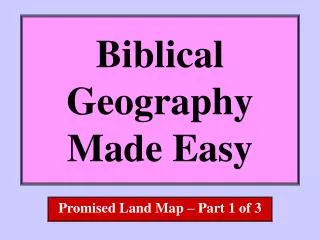
Biblical Geography Made Easy. Bible World Map. N. What do you do?. Fold the paper two times in each direction. Make your folds precise and your crease sharp!. Unfold and smooth the paper. The crease lines are your guide-lines for drawing the map. What do you need?.

E N D
Biblical Geography Made Easy Bible World Map
N What do you do? • Fold the paper two times in each direction. Make your folds precise and your crease sharp! • Unfold and smooth the paper. The crease lines are your guide-lines for drawing the map. What do you need? • blank 8-1/2 x 11 paper • pencil • Up is north. • straight edge
5 SEAS Black Sea • Along the top, on the edges of the two boxes upperleft, find halfway points as shown. • Draw a half circle connecting this halfway points. • You have drawn the bottom half of the first of five seas that framed the biblical world. • This sea is not mentioned in the Bible. • Today we know this sea as the BLACKSea.
5 SEAS Black Sea Caspian Sea • Along the top, on the edges of the two boxes upperright, find halfway points as shown. • Draw another half circle connecting this halfway points. • You have drawn the bottom half of the second of five seas that framed the biblical world. • This sea is also not mentioned in the Bible. • Today we know this sea as the CASPIANSea.
5 SEAS Black Sea Caspian Sea • Mark the center of the NW corner box. • Along the left side edge, find the middle two boxes. Great Sea (Mediterranean) • Mark the halfway points right and left of each box. • Mark the center point of the next two boxes to the right. • You have drawn the third of five seas that framed the biblical world. • Connect your marks in the shape of a mitten with a thumb pointing up. • This sea is the eastern end of the GREATSea. We call this sea the MEDITERRANEAN.
5 SEAS Black Sea Caspian Sea Great Sea (Mediterranean) • Mark the center of bottom of your map. • Draw a line NW from your point. The line should approach the Great Sea, then loop back and return to the bottom of your map at a point to the right of where you started. Red Sea • You have drawn the fourth of five seas that framed the biblical world. • This sea is the northern end of the REDSea.
5 SEAS Black Sea Caspian Sea • Mark the lower right corner of your map. Great Sea (Mediterranean) Eastern Sea(Persian Gulf) • Draw a line NW from your point. Imitate the shape of the Red Sea. The line should loop back and return to the right edge of your map at a point above where you started. Red Sea • You have drawn the fifth of five seas that framed the biblical world. • This is the northern end of the EASTERNSea. • Today this sea is called the PERSIAN GULF.
5 EUROPE SEAS Black Sea Caspian Sea ASIA • On your map draw waves on the surface of the five seas. Great Sea (Mediterranean) Eastern Sea(Persian Gulf) • The land between these seas is the biblical world of the Old Testament. AFRICA Red Sea • The land between the five seas is the place where Asia, Europe and Africa meet. • REVIEW: the five seas are. . . the BLACK . the CASPIAN. the GREAT. the RED. the EASTERN .
2 MOUNTAINS MountArarat • Where the folds meet in the center on top draw a mountain. MountSinai • On the land bridge between the Red Sea and the Great sea draw a mountain. • Across the top from the “thumb” to the Persian Gulf draw mountains. • Noah’s ark rested on Mount ARARAT. • God gave his Word to his people on Mount SINAI. • Old Testament believers knew that mountains stretched across the top of the world they knew.
4 RIVERS • From Ararat to the top of the Eastern Sea draw a curved line that skirts the mountains. Tigris • You have drawn the first of the four major rivers of the Bible world. It is the TIGRIS.
4 RIVERS • From Ararat to the top of the Eastern Sea draw a curved line that mirrors the Tigris. Euphrates • The Tigris and Euphrates cradled the earliest civilization • You have drawn the second of the four major rivers of the Bible world. It is the EUPHRATES.
4 RIVERS • Mark the place where fold lines cross below the Great Sea. • Draw a line up the fold line to this spot. • From this spot draw a “V” that reaches the Great Sea. Nile • The Nile cradled the other earliest civilization. • You have drawn the third of the four major rivers of the Bible world. It is the NILE.
4 RIVERS • Mark a place to the right of the Great Sea on the center fold line. Jordan • Mark another spot halfway down to the Red Sea. • Join the two. • The city of Jericho in the Jordan Valley is the oldest known city to be lived in continuously up to the present day. • You have drawn the fourth of the four major rivers of the Bible world. It is the JORDAN.
MOUNTAINS & RIVERS Mount Ararat Euphrates Jordan Tigris Mount Sinai Nile the TIGRIS • REVIEW: the two mountains Mount ARARAT the EUPHRATES and the four rivers . . . Mount SINAI the NILE the JORDAN
1 HABITAT • Mark a place where the Nile leaves the map at the bottom Fertile Crescent • Mark another place where the Tigris and Euphrates enter the Easter Sea. • Shade a crescent shaped strip of land between the two points as shown • This strip of land was well watered either by rivers, or by rain falling on the eastern coast of the Great Sea. In this crescent of fertile land early civilization flourished. • Historians have named this the FERTILE CRESCENT.
3 J A P H E T H SONS OF NOAH • After the Flood people spread out . • The offspring of SHEM moved southeast. S H E M • The offspring of HAM moved southwest. H A M • The offspring of JAPHETH spread east and west north of the mountains. • Below the Fertile Crescent was desert,the Sahara Desert in Africa,the Arabian Desert in Asia,and the Sinai Desert in between.
6 Nations 5 Seas 4 Rivers 3 Sons of Noah 2 Mountains REVIEW One Learning Categories 1 Habitat
6 Nations Egypt Canaan Aram Assyria Babylonia Persia 5 Seas Black Caspian Great Red Eastern Tigris Euphrates 4 Rivers Nile Jordan Shem Ham 3 Sons of Noah Japheth REVIEW Two Learning what’s in the categories Ararat 2 Mountains Sinai 1 Habitat Fertile Crescent
6 Nations Egypt Canaan Aram Assyria Babylonia Persia 5 Seas Black Caspian Great Red Eastern Tigris Euphrates Nile Jordan 4 Rivers Shem Ham Japheth 3 Sons of Noah Ararat Sinai 2 Mountains REVIEW Three Checking 1 Habitat Fertile Crescent