Download
1 / 19
190 likes | 436 Views
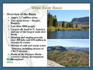
An Analysis of the Rhône River Basin through Lyon, France. Felicia James November 27, 2001. Where is Lyon?. Lyon. Project Objectives. To learn how to locate GIS data for anywhere in the world To obtain data for a specific country related to water resources and water quality

E N D
An Analysis of the Rhône River Basin throughLyon, France Felicia James November 27, 2001
Where is Lyon? Lyon
Project Objectives • To learn how to locate GIS data for anywhere in the world • To obtain data for a specific country related to water resources and water quality • To use ArcGIS software to organize and manipulate the data acquired
Procedure • Search the World Wide Web using www.google.com to develop a list of websites for downloading GIS data • Review the references in earlier term papers for this course (GIS in Water Resources) for additional website sources • Download the available data • Convert the data to a uniform projection • Manipulate the GIS data using skills gained in this course for using ArcGIS • Manipulate the data using engineering principles
Useful data sources • Climate Data • River discharge data • HYDRO1k Data
Climate Data • Climate Data- http://www.worldclimate.com
River Discharge Data • River discharge datafrom the Oak Ridge National Laboratory, Distributed Active Archive Center of the Earth Observing System Data Information System as part of the National Aeronautics and Space Administration's (NASA) Earth Science Enterprise program, whew! http://www-eosdis.ornl.gov/rivdis/STATIONS.HTM
GIS Data • HYDRO1k Datafrom the United States Geological Survey -http://edcdaac.usgs.gov/gtopo30/hydro/europe.html
Correct DEM grid • The DEM by HYDRO1k is an image file • Convert to ARC/INFO grid • Arc: Imagegrid eu_dem demgrid cubic • Correct for negative values • Grid: eu_demgrid = con(demgrid >= 32768 demgrid – 65536 demgrid) • Set ocean mask values to null values • Grid: demgridnull = setnull(eu_demgrid eq –9999, eu_demgrid)
Project Data • Coordinate System: Lambert Azimuthal Equal Area • Units: (meters) • Pixel Size: 1000 meters • Radius of sphere of influence = 6,370,997 meters • Longitude of Origin = 20 00 00 E • Latitude of Origin = 55 00 00 N • Sphere: GCS Sphere ARC INFO • Datum: D Sphere ARC INFO • Prime Meridian: 0 Maidment lecture notes 9/18/01
Oops! • But, make sure you also match the coordinate system of the data frame to that of the layers!
Now the fun can start! Test out the skills learned…
Isolate the Rhone River Valley • Use map of France to identify location of Rhone River • Select point on river to obtain identification number • Export all segments with Level4 = 9114 • Export all related basin segments
1st limit extent of raster • Since the raster covers all of Europe it is rather large. • Limit its extent by going to layer properties and matching the data frame view.
Create Contours • Add digital elevation data, stream system, country boundary, and basin delineations to the view • Use spatial analyst to create contours… • Unfortunately the system locks up at intervals of 100 m or less
Fill Sinks • The DEM data from HYDRO1k has already identified natural sinks and filled all unidentified sinks.
Hydrology Modeling • Unfortunately, with the large DEM the spatial analyst functions do not work.
Moving On… • Attempt to use HEC-RAS with the GIS river network • Identify populated areas along the river • Assume a pollutant discharge from these populated areas • Estimate water quality in the river • Compare GIS calculated river flows with gage data