Download
1 / 18
180 likes | 331 Views
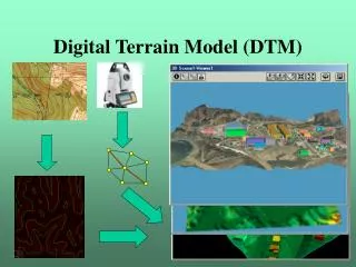
DTM tasks: generation. Buy global or national data set Collect data. Buy global or national data set. Examples Topographic Data. [Eidenbenz et al, 1997]. (*) completed. DTM tasks: generation. Main steps Data capture Data Sampling Choice of data source Data acquisition techniques

E N D
DTM tasks: generation • Buy global or national data set • Collect data Digital Terrain Models by M. Varshosaz
Buy global or national data set Digital Terrain Models by M. Varshosaz
Examples Topographic Data [Eidenbenz et al, 1997] (*) completed Digital Terrain Models by M. Varshosaz
DTM tasks: generation • Main steps • Data capture • Data • Sampling • Choice of data source • Data acquisition techniques • Model construction • Establishment of topological relations • Defining a suitable interpolation method
Data • Data for a DTM should consist of: • Elevation Data: • Observations about terrain elevations. • Morphological Information: • Information about phenomena that significantly influence the shape of the terrain surface (i.e. structural features such as drainage channels, ridges and other surface discontinuities). • Key issue: • The selection of a particular data acquisition technique for any given application considering the available/required efficiency, cost, and technological maturity.
Sampling techniques • Choice of sampling technique • Terrain shape • Available instrumentation • Required accuracy • Techniques: • Random/Selective • Systematic/grid based • Progressive • Composite
Selective Sampling • Capture topographic break lines. • Advantage: • Capture all the morphological information associated with the surface. • Elevation data are collected whenever needed. • Disadvantage: • Requires experienced human operator. • Automation is very difficult.
Random/Selective sampling • Selection of significant points by the operator • Usually results in less points • More thought should be given to the structuring and management of the measured data • Can not be automated
Systematic/grid based • Systematic pattern of spot heights • Can be squares, rectangles, triangles, or hexagonal • Sampling patterns are arranged as profiles or regular geometric shapes. • Fixed sampling distance is used: • Need to determine the optimal sampling interval.
Grid Sampling: Discussion • Location of the required grid node is preprogrammed and driven under computer control. • Advantage: • Can easily be programmed • May be applied in a semi-automated or automatic mode. • Disadvantages: • Too many points are sampled in low relief regions. • Too few points are captured in rugged terrain.
Progressive Sampling: Procedure • The sampling process is initiated by measuring a low-density grid. • The accuracy of the sampled data is then analysed • Wherever necessary, the sampling grid is recursively densified until the required accuracy level is reached.
Progressive Sampling: Discussion • Advantage: • Fewer points are needed to accurately represent the DTMs. • Disadvantage: • Details may still be disregarded in the first run • Still more points than necessary • Too many points in terrain breaks • May fail in areas with sharp discontinuities
Composite Sampling • Composite Sampling = Progressive sampling / Systematic sampling + selective sampling: • Selective sampling is used to capture abrupt surface changes. • Progressive sampling yields the data for the rest of the terrain. • Advantage: • Recursive refinement of progressive sampling is kept to a minimum and terrain discontinuities are represented accurately. • Disadvantage: • Requires human intervention (partial automation).
Composite • Combines grid based and selective techniques • Can only partially be automated
Data capture • The choice of data source • Size of the area to be modelled • Required accuracy • Type of the data to be extracted • Cost and technological maturity
Data capture techniques • Data capture techniques • Ground surveying • Photogrammetry • Digitising cartographic data sources • RADAR, LIDAR (or Laser Scanning), and sonar.