Download
1 / 36
370 likes | 506 Views
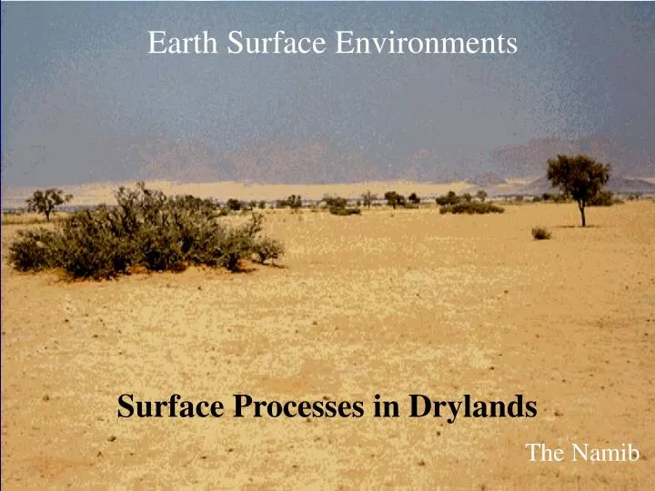
Earth Surface Environments. Surface Processes in Drylands. The Namib. When/where are my practicals and fieldtrip? A summary. Unique times and locations for all….so please make a careful note. Learning Outcomes. Provide an informed definition of drylands

E N D
Earth Surface Environments Surface Processes in Drylands The Namib
When/where are my practicals and fieldtrip? A summary Unique times and locations for all….so please make a careful note
Learning Outcomes • Provide an informed definition of drylands • Locate major deserts & explain their occurrence • Outline the major generic earth surface processes typical in dryland environments (particularly the relationship between grain size and erosion) • Outline how and why degraded soils can be used as a major carbon sink
Baobab Tree, Central Botswana
The Tsodilo Hills, North West Botswana
What are Drylands? Aridity Index (UNEP, 1992) Dry sub-humid 0.5 - < 0.65 Semi-arid 0.2 - <0.5 Arid 0.05 - <0.2 Hyper Arid <0.05 AI = P PET 40-50% earth’s surface
Temperature Variability Hot - Central Sahara, Arabia Mild - Kalahari, Simpson Cool - Atacama, Mojave Cold - Gobi
Global Extent of Drylands Central Sahara Arabian Kalahari Namib Atacama Mojave Gobi Simpson
Selected Environmental Characteristics 1. Dry 2. Sandy & crusted soils 3. Dust storms 4. Floods Saharan dune ripples
Why are they dry? Low annual and high inter-annual variability of rainfall Four factors: 1. Atmospheric - descending stable air 2. Continentality - too far from rain-bearing winds 3. Topography - rain shadow 4. Cold Ocean Currents - low evaporation & precipitation
Select Environmental Characteristics 1. Dry 2. Sandy & crusted soils 3. Dust storms 4. Floods Kalahari Sands
Why are they sandy? Predominance of physical and absence of chemical weathering • Insolation Temperature changes Volumetric coefficient thermal expansion 1.6 - 3.0 x 10⁻⁵ K Granite: 50oC vol 0.12% Spalling
Why are they sandy? Insolation increased in presence of moisture Salt weathering significant Fines blown by wind Namib fog (NASA) Chott el Jerid, Tunisia
Soils Entisols (c. 13% globe) Aridisols (c. 11% globe)
Soils • Upward movement of limited water: • Few horizons • Few organics & nutrients • Salts • Old • Crusts • Vulnerable to degradation • Chemical • Biological • Physical Kalahari, Botswana
Physical & Biological Soil Crusts • Physical Crusts: • Compaction • Raindrop impact • Clay dispersal x950 USGS • Biological Crusts: • Bacteria & Cyanobacteria • (Microcoleus, Nostoc spp.) • Succession
Select Environmental Characteristics 1. Dry 2. Sandy & crusted soils 3. Dust storms 4. Floods Sahara, Tunisia
Particle entrainment by wind 1. Forces: • Wind produces shear forces on bed • Expressed as shear velocity: u* = o / a (m s-1) o = shear force (g cm-1 sec -2) a = density of air (g cm-3)
Particle entrainment by wind Resistance: 1. Gravity (related to d3) 2. Interparticle cohesion
Grains in motion 3 major processes: Creep, saltation and suspension
Thresholds • Size limit of particles carried by wind of given v or u* • Distinct relationship between particle-size and u*
Selected Environmental Characteristics 1. Dry 2. Sandy & crusted soils 3. Dust storms 4. Floods
Floods High magnitude, low frequency rainfall Low infiltration rates: Shallow soils Stony surfaces Crusts 100mm rainfall in 3 hours, nr. Las Vegas, USA
Learning Outcomes • Provide an informed definition of drylands • Locate major deserts & explain their occurrence • Outline the major generic earth surface processes typical in dryland environments (particularly the relationship between grain size and erosion)
Journal Review • 4 spread through term • Complements lectures/practical/fieldwork • Good habit • Key to successful degree
Dr Kate Rowntree, Institute For Water Research, Rhodes University, South Africa Publications:32 articles in international journals, books & conference proceedings Rowntree, K., Duma, M., Kakembo, V. and Thornes, J., 2004, Debunking the Myth of Overgrazing and Soil Erosion. Land Degradation and Development, 15 (3), 203-214. http://www3.interscience.wiley.com/cgi-bin/jtoc/6175/
The Assignment Full reference Aims and objectives Brief methods (if applicable) Main findings and conclusions (or use the paper headings) Be succinct Work over 1 page of A4 will not be marked, 11pt font minimum In words understandable to an interested 14 year old Use bullet points where/if appropriate Paper 1 Summary due in on the 14th February
Introduction Summary • Overgrazing is often said to be a major cause of land degradation and soil erosion • Erosion rates are affected by vegetation cover (and thus the interaction between climate, soils, topography and grazing levels) • To understand how grazing affects erosion need to understand the link between ecology of grazing lands and erosion proceses