Download
1 / 12
130 likes | 433 Views
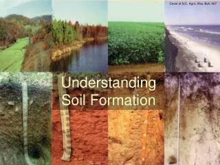
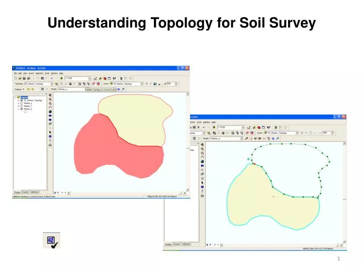
Understanding Topology for Soil Survey. Topology – What is it ?. For Our Purposes : Topology defines the spatial relationship between individual features, i.e. individual soil polygons , within the same data layer Soil polygons have simple relationships to each other

E N D
Topology – What is it? For Our Purposes: Topology defines the spatial relationship between individual features, i.e. individual soil polygons, within the same data layer Soil polygons have simple relationships to each other No two polygons may occupy the same space – No Overlaps (We cannot have two soils map units in the same location) 2) Holes or spaces between polygons are NOT allowed – No Gaps
Topology Readthis Analogy: Visualize the soil survey as a jigsaw puzzle and each soil polygon as a puzzle piece. Matching pieces have exactly the same shape at their boundaries. When snapped together, there are no gaps between the pieces, nor do pieces overlap each other. When put together correctly, the puzzle is a seamless surface (no gaps) on a single plane (no overlaps). The topology function identifies when the “jigsaw puzzle” is not put together correctly and it assists you in fixing the errors.
Topology Continuing this Analogy: If a piece is removed from the center of a finished puzzle, a hole - in the same shape as the piece - appears in the puzzle. Similarly, you could delete a soil polygon from the center of the data and create a hole (a data gap in the same shape as the polygon) in the middle of the data. If an unused puzzle piece sits on top of the finished portion of the puzzle, you have stacked the puzzle pieces. Similarly, you could digitize a new polygon on top of an existing soil polygon and produce stacked soil polygons, i.e. overlapping polygons Both of these situations represent Topology Errors and should be avoided!
Working with Topology We develop and maintain the topology using: Topology Object 2. Topology Toolbar
Working with Topology • Topology Object • Must be created in a Feature Dataset • Typically applies only to soil polygon feature class • Contains user-defined rules (no gaps\overlaps) • Added to Table of Contents when Editing • (symbolize errors, can be turned on\off) • Provides Summary Error Report
Topology Object: How does it work? EXAMPLE of BAD topology: Three crude Overlapping polygons with a Gap in the Center
Topology Object: How does it work? Topology “object” or layer in Table of Contents. After checking topology, errors are shown in red: Three Overlaps and Two Gaps… …why two gaps?
Four “island” polygons results in four Gap “Errors” If a polygon edge does not have an adjoining polygon, it will be a Gap.
Topology Errors and Editing • To avoid confusion between Gap Errors in the data and the Gaps around island polygons as illustrated in that last slide, we start editing within a large polygon instead of in blank, empty space. • We start with a large polygon like a soil survey area or quad boundary and Cut polygons into that initial layer. • Using this method, we will maintain only one Gap Error corresponding to the survey or quad boundary.
Topology Tools IMPORTANT : ArcGIS allows the user to define topology rules to aid in the development and maintenance of consistent data. The software searches the data for errors and provides various tools to help locate and fix errors. ArcGIS does NOT: Prevent Topology Errors or Automatically Correct Errors Only you can prevent Topology Errors!!
Topology Toolbar • Editing tools that maintain topology • Edit Topology Tool • Modify Edge Tool • Reshape Edge Tool • Clear Selected Topology Elements • Topology Validation Tools • Validated Topology Tools • Fix Topology Tool • Error Inspector • (a tabular list of errors) A E B F C G D E A B C D F G TIP: Tools indicated with arrows are generally not used for soil data development. They may be removed using the toolbar Customize Mode to reduce clutter in ArcMap. Result * For Explanation of the Topology Toolbar and Tools See the Editing Module.