Download
1 / 55
550 likes | 694 Views
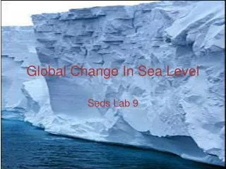
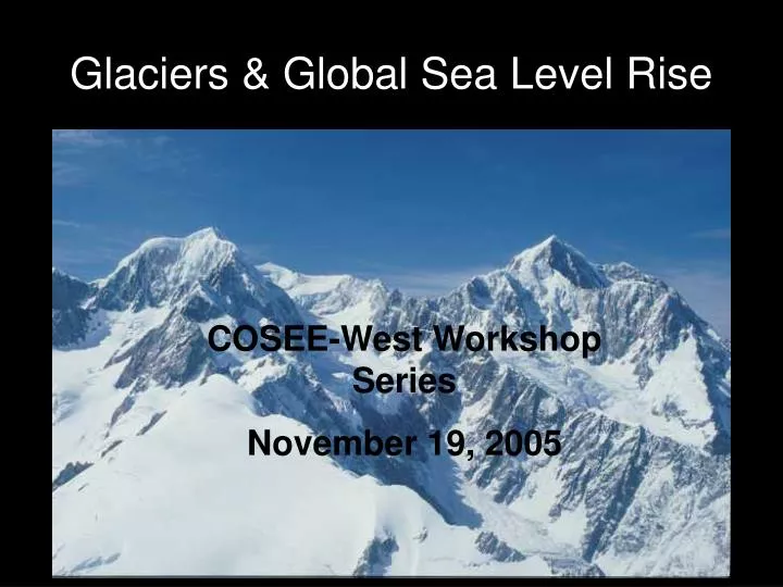
Glaciers & Global Sea Level Rise. COSEE-West Workshop Series November 19, 2005. What is a glacier?.

E N D
Glaciers & Global Sea Level Rise COSEE-West Workshop Series November 19, 2005
What is a glacier? • A huge mass of ice slowly flowing over a land mass, formed from compacted snow in an area where snow accumulation exceeds melting and sublimation, usually having an area larger than one tenth of a square kilometer Taku Glacier winds through the mountains of southeastern Alaska, calving small icebergs into Taku Inlet. This photograph dates from 1929. (U. S. Navy photograph at the World Data Center for Glaciology, Boulder)
Mountain Glaciers: a glacier that is confined by surrounding mountain terrain Muddy River Glacier winds through forested mountains near Frederick Sound in southeast Alaska. Typical of mountain glaciers, it is constrained on all sides by mountainous terrain. (United States Navy photograph at the World Data Center for Glaciology, Boulder)
CIRQUE GLACIER: glacier that resides in basins or amphitheaters near ridge crests Most cirque glaciers have a characteristic circular shape, with their width as wide or wider than their length. NICHE GLACIER: a glacier that resides in a small recess of the terrain Also called a pocket glacier.
PIEDMONT GLACIER: large ice lobe spread out over surrounding terrain, associated with the terminus of a large mountain valley glacier The massive lobe of Malaspina Glacier in Alaska is clearly visible in this photograph taken from a Space Shuttle flight in 1989. Agassiz Glacier is the smaller glacier to the left. The Malaspina Glacier is one of the most famous examples of this type of glacier, and is the largest piedmont glacier in the world. Spilling out of the Seward Ice Field (visible near the top of the photograph), it covers over 5,000 square kilometers as it spreads across the coastal plain. (Photograph courtesy of SPACE.com and NASA.)
SUBPOLAR GLACIER: a glacier whose temperature regime is between polar and temperate; usually predominantly below freezing, but could experience extensive summer melt • POLAR GLACIER: glacier whose temperatures are below freezing throughout, except possibly for a thin layer of melt near the surface during summer or near the bed • Polar glaciers are found only in polar regions of the globe or at high altitudes.
ROCK GLACIER: a glacier whose motion and behavior is characterized by a large amount of embedded or overlying rock material A rock glacier may be composed of: • Ice-cemented rock formed in talus that is subject to permafrost. • Ice-cemented rock debris formed from avalanching snow and rock. • Rock debris that has a core of ice; either a debris-covered glacier or a remnant end moraine.
Frying Pan Glacier, Colorado, is almost entirely covered by rocks and debris in this photograph from 1966. (George L. Snyder photograph at the World Data Center for Glaciology, Boulder)Larger photograph (50k).
BRANCHED-VALLEY GLACIER: glacier that has one or more tributary glaciers that flow into it; distinguished from a simple valley glacier In this photograph from 1969, small glaciers flow into the larger Columbia Glacier from mountain valleys on both sides. Columbia Glacier flows out of the Chugach Mountains into Columbia Bay, Alaska. (United States Geological Survey photograph at the World Data Center for Glaciology, Boulder)
TIDEWATER GLACIER: mountain glacier that terminates in the ocean • CATCHMENT GLACIER: a glacier that receives nourishment from wind-blown snow
HANGING GLACIER: a glacier that terminates at or near the top of a cliff On the far left side of this photograph from 1894, a hanging glacier clings to the steep slope of the Matterhorn in Switzerland. The larger glacier in the middle occupies a cirque, or bowl-shaped hollow, on the side of the mountain. In fact, the shape of Matterhorn itself was literally carved out by years of glacial erosion. (Unattributed photograph at the World Data Center for Glaciology, Boulder)
SURGING GLACIER: a glacier that experiences a dramatic increase in flow rate, ten to one hundred times faster than its normal rate • Usually surge events last less than one year and occur periodically, between fifteen and one hundred years.
The Columbia Glacier in Alaska surged during the early part of this century. This photograph from 1909 shows the terminus of the glacier knocking over trees as it advances. (Unattributed photograph at the World Data Center for Glaciology, Boulder)
In 1941, Hole-in-the-Wall Glacier surged, also knocking over trees during its advance. (Unattributed, but possibly a W.O. Field photograph at the World Data Center for Glaciology, Boulder)
ICE CAP: a dome-shaped mass of glacier ice that spreads out in all directions • An ice cap is usually larger than an icefield but less than 50,000 square kilometers (12 million acres). Ice cap complex atop a volcanic mountain in Iceland.
ICEFIELD: a mass of glacier ice, similar to an ice cap. • An icefield usually smaller than an ice cap, somewhat controlled by terrain, and often does not have a dome like shape. • Kalstenius Icefield, located on Ellesmere Island, Canada, shows vast stretches of ice. The icefield produces multiple outlet glaciers that flow into a larger valley glacier. The glacier in this photograph is three miles wide. (Royal Canadian Air Force photograph at the World Data Center for Glaciology, Boulder)
ICE SHEET: a dome-shaped mass of glacier ice that covers surrounding terrain and is greater than 50,000 square kilometers (12 million acres) (e.g., Greenland and Antarctic ice sheets)
ICE SHELF: portion of an ice sheet that spreads out over water The Larsen Ice Shelf, off the coast of Antarctica, from a November 1998 image. The Antarctic Peninsula stretches across the left side of the picture, and the ice shelf is the large mass of white ice extending over the ocean. This image uses the thermal band, meaning that the darker portions are warmer (such as the ocean), and the lighter portions are cooler (such as the ice shelf). Over the past several years, NSIDC has used satellite imagery to track the breakup of the Larsen Ice Shelf. (AVHRR 5km thermal satellite image, National Snow and Ice Data Center.)
ICEBERG: a piece of ice that has broken off from the end of a glacier that terminates in water
Glacier Terminus • The lowest end of a glacier • Also called the glacier toe or glacier snout. Glacier at the head of Canon Fiord, Ellesmere Island, Canada.
CREVASSE: open fissure in the glacier surface Two nineteenth century explorers approach a crevasse on Za-Da-Zan Glacier in the Pennine Alps in 1894. (H.F. Reid photograph at the World Data Center for Glaciology, Boulder) Explorers examine a crevasse on Lyman Glacier in 1916. (United States Forest Service Photograph at the World Data Center for Glaciology, Boulder)
CALVING: process by which ice breaks off a glacier's terminus • Usually the term is reserved for tidewater glaciers or glaciers that end in lakes, but it can refer to ice that falls from hanging glaciers. • The following four images show a large pinnacle of ice calving from the Perito Moreno Glacier in Argentina. The calving pinnacle is most clearly visible in the center of the first photograph. The terminus of the glacier is about 150 feet high, and the photographs were taken while looking across the lake at the glacier.
Perito Moreno Glacier photo series taken February 2001. Perito Moreno Glacier beginning to calve. The ice pinnacle that is about to fall from the face of the glacier is in the center of the photograph. (Photograph courtesy of Martyn Clark)
Ice pinnacle separating from Perito Moreno Glacier. (Photograph courtesy of Martyn Clark)
Impact splash made from the ice pinnacle falling from Perito Moreno Glacier. (Photograph courtesy of Martyn Clark)
Ice pinnacle has finished calving from Perito Moreno Glacier and is completely submerged under the lake surface. Notice how blue some of the glacier ice appears. Glacier ice is slightly different from other ice. Years of compression make the ice so dense that it absorbs every other color of the spectrum, thus appearing blue. (Photograph courtesy of Martyn Clark)
GLACIER TABLE: a rock that resides on a pedestal of ice; formed by differential ablation between the rock-covered ice and surrounding bare ice Talefre Glacier on Mont Blanc Massif in the European Alps sported a prominent glacier table when this undated photograph was taken. The rock protected the ice directly below it from melting, resulting in the characteristic pedestal that remains after the surrounding ice melts. For scale, note the man standing behind and to the left of the pedestal. (Cairrar photograph at the World Data Center for Glaciology, Boulder)
GLACIER SEASONS • ABLATION SEASON: period during which glaciers lose more mass than gain; usually coincides with summer • ACCUMULATION SEASON: period during which a glacier gains more mass than it loses; usually coincides with winter
Once a mass of compressed ice reaches a thickness, around 18 meters it becomes so heavy that it begins to deform and move. • The weight of the ice, combined with gravity's influence, causes glaciers to flow very slowly. • Ice may flow down mountain valleys, fan across plains, or in some locations, spread out to the sea. • Movement along the underside of a glacier is slower than movement at the top due to the friction created as it slides along the ground's surface.
GLACIAL ADVANCE: when a mountain glacier's terminus extends farther down-valley than before • Glacial advance occurs when a glacier flows downvalley faster than the rate of ablation at its terminus. • GLACIAL RETREAT: when the position of a mountain glacier's terminus is farther up-valley than before • Glacial retreat occurs when a glacier ablates more material at its terminus than it transports into that region.
PARALLEL STRIATIONS & BEDROCK FRACTURE trends (across the left side of the image) are clearly visible in this photo. • Striated Graywackie, Yale Glacier, Alaska. 1997.
GLACIAL GROOVES in rock panels, Churchill, Manitoba, Canada. The row of plants in the center of the photo follows a glacial groove in the rock. The grooves and striations (glacial scratches), along with other ice indicators, show the glacier flowed toward the front of the photograph.
Western Brook glacial trough, Newfoundland, Canada. • The sheer walls of this glacial trough soar up to700 m high, and the glacial basin is 500 m deep in places.
CHATTERMARKS Striations or marks left on the surface of exposed bedrock caused by the advance and retreat of glacier ice Close up of chatter marks, Mt. Sirius, Antarctica. Lens cap in the photo is five centimeters across.
Approximate Worldwide Area Covered by Glaciers (square kilometers) • Antarctica 11,965,000 (without iceshelves and ice) • Greenland 1,784,000 • Canada 200,000 • Central Asia 109,000 • Russia 82,000 • United States 75,000 (including Alaska) • China and Tibet 33,000 • SouthAmerica 25,00 • Iceland 11,260 • Scandinavia 2,909 • Alps 2,900 • New Zealand 1,159 • Mexico 11 • Indonesia 7.5 • Africa 10 Total glacier coverage is nearly 15,000,000 square kilometers, or a little less than the total area of the South American continent. (The numbers listed do not include smaller glaciated polar islands or other small glaciated areas, which is why they do not add up to 15,000,000.
Glacial ice can be several hundred to several hundreds of thousands years, making it valuable for climate research. • To see a long-term climate record, an ice core is drilled and extracted from the glacier. • Scientists analyze various components of cores, particularly trapped air bubbles, which reveal past atmospheric composition, temperature variations, and types of vegetation. • This is how scientists know that there have been several Ice Ages. Past eras can be reconstructed, showing how and why climate changed, and how it might change in the future.
Scientists are attempting to answer questions about global warming with clues from glaciers. • How much does our atmosphere naturally warm up between Ice Ages? • How does human activity affect climate? • Glaciers are so sensitive to temperature fluctuations accompanying climate change, direct observation may help answer questions. • Since the early 20th century, with few exceptions, glaciers around the world have been retreating at unprecedented rates. • Some scientists attribute this massive glacial retreat to the Industrial Revolution. Some ice caps, glaciers and even an ice shelf have disappeared altogether in this century. • Many more are retreating so rapidly that they may vanish within a matter of decades.
The 1991 discovery of the 5,000 year-old "ice man," preserved in a glacier in the European Alps, fascinated the world. Tragically, this also means that this glacier is retreating farther now than it has in 5,000 years. • Scientists, still trying to piece together all of the data they are collecting, want to find out whether human-induced global warming is tipping the delicate balance of the world's glaciers.
Antarctic ice is over 4,200 meters thick in some areas. • In the United States, glaciers cover over 75,000 square kilometers, with most of the glaciers located in Alaska. • The land underneath parts of the West Antarctic Ice Sheet may be up to 2.5 kilometers below sea level, due to the weight of the ice. • North America's longest glacier is the Bering Glacier in Alaska, measuring 204 kilometers long.