Download
1 / 50
500 likes | 609 Views
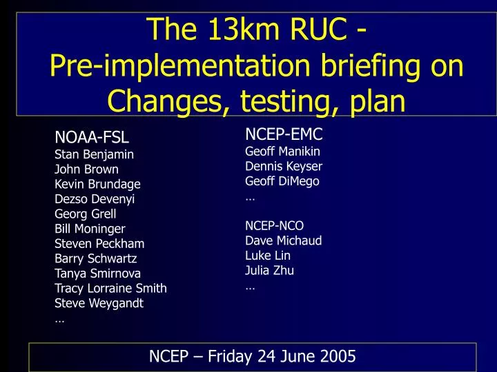
NCEP-EMC Geoff Manikin Dennis Keyser Geoff DiMego … NCEP-NCO Dave Michaud Luke Lin Julia Zhu …. The 13km RUC - Pre-implementation briefing on Changes, testing, plan. NOAA-FSL Stan Benjamin John Brown Kevin Brundage Dezso Devenyi Georg Grell Bill Moninger Steven Peckham

E N D
NCEP-EMC Geoff Manikin Dennis Keyser Geoff DiMego … NCEP-NCO Dave Michaud Luke Lin Julia Zhu … The 13km RUC - Pre-implementation briefing onChanges, testing, plan NOAA-FSL Stan Benjamin John Brown Kevin Brundage Dezso Devenyi Georg Grell Bill Moninger Steven Peckham Barry Schwartz Tanya Smirnova Tracy Lorraine Smith Steve Weygandt … NCEP – Friday 24 June 2005
- Implementation of 13km RUC in operations at NCEP • Assimilation of new observations • - GPS-precipitable water • - METAR cloud/vis/current weather • - Mesonet temp/dewpoint • - Soil moisture/temp nudging • Model changes – New versions of • - mixed-phase cloud microphysics (NCAR-FSL) • - Grell-Devenyi convective parameterization • - Revised radiation – cloud effects • - Corrected treatment of frost formation • Improved post-processing – visibility, precip type, add sfc-based CAPE/CIN (previously only Best CAPE) • Hourly forecasts to be extended to 9h from 3h duration • (at 01z, 02z, 04z, 05z, …)
AREA FORECAST DISCUSSION...UPDATE NATIONAL WEATHER SERVICE GOODLAND KS 1155 AM MDT SUN MAY 8 2005 .UPDATE... A SHORTWAVE TROF WAS EVIDENT THIS MORNING AT BOTH 700 AND 500 MB OVER SOUTHEAST WYOMING...SPREADING TOWARD THE TRI STATE AREA IN NORTHWESTERLY FLOW ALOFT. THE ETA/NAM WAS HANDLING THIS FEATURE WELL. THE RUC IS A BIT TOO DRY. • What is different qualitatively in precip/surface behavior with the RUC13? • Definitely a ‘wetter’ model than the previous RUCs • - Surface dewpoint, moisture aloft • - CAPE • - Precipitation • But ‘drier’ over warm oceans
2005 - 13km RUC implementation plan February-May 2005 - Real-time parallel testing – EMC - Intercomparison RUC13 vs. RUC20 by EMC, FSL - daily inspection w/ graphics, statistics (raob, surface) - Transfer afterward to NCEP/NCO May-June 2005 - Real-time parallel testing – NCO - 4-week field test evaluation – NCEP Centers, NWS CR - Retrospective testing (at NCEP) for cold season - Report on testing to NCEP directors Tuesday 28 June 2005 - Planned operational implementation
13km RUC Terrain elevation - 100 m interval • Improvements expected from 13km RUC • Improved near-surface forecasts • Improved precipitation forecasts • Better cloud/icing depiction • Improved frontal/turbulence forecasts NCEP computer upgrade allows RUC13 to run in same time as current RUC20
RUC History – NCEP (NMC) implementations • - First operational implementation of RUC • - 60km resolution, 3-h cycle • 1998 – 40km resolution, 1-h cycle, • - cloud physics, land-sfc model • 2002 – 20km resolution • - addition of GOES cloud data in assimilation • 2003 – Change to 3dVAR analysis from previous OI • (April) • 2004 – Vertical advection, land use (April) • PBL-depth for surface assimilation (September) • 2005 – 13km resolution, new obs, new model physics • (June) • 2007 – WRF-based Rapid Refresh w/ GSI to replace RUC
20km RUC 13km RUC Soil moisture – 22z - 21 Feb 2005 Dark blue = water More detailed coastline with 13km resolution
RUC Analysis Goals • Initial fields that yield very accurate • short-range forecasts (down to 1-h): • - upper-level wind forecasts • - aviation hazards (turbulence, icing, ceiling/visibility) • - surface sensible weather forecasts • Hourly assimilation of all conventional observations, including surface observations • Close analysis fit to all observations, especially METAR and rawinsonde RUC 3DVAR development/testing
13-km 3DVAR running at FSL since summer 2004 • 4 aspects of RUC13 3DVAR analysis: • 1. New observations assimilated • 2. Cloud analysis(GOES, adding METAR ceiling/vis/curr-wx) • 3. Revised control variable for moisture(pseudo-RH) • 4. Soil moisture/temp nudging
Observations used in RUC Data Type ~Number Freq. -------------------------------------------------- Rawinsonde 80 /12h NOAA profilers 30 / 1h VAD winds 110-130 / 1h Aircraft (V,temp) 1400-4500 / 1h Surface/METAR 1500-1700 / 1h Buoy/ship 100-150 / 1h GOES precip water 1500-3000 / 1h GOES cloud winds 1000-2500 / 1h GOES cloud-top pres 10 km res / 1h SSM/I precip water 1000-4000 / 6h -------------------------------------------------- GPS precip water ~300 / 1h Mesonet ~5000 / 1h METAR-cloud-vis-wx ~1500 / 1h -------------------------------------------------- Cloud analysis variables NCEP RUC20 operational RUC13 (at NCEP June 2005)
RUC Cloud Analysis • Use multiple data types to modify cloud, • hydrometeor, and moisture fields: • -- GOES cloud-top pressure/temp • (implemented in 2002 w/ RUC20) • -- Surface METAR (clouds, weather, visibility) • (2005 w/ RUC13) • Construct 3-d logical arrays (YES/NO/UNKNOWN) • for clouds and precipitation from all info • Clear/build moisture, cloud, precipitation fields • Safeguards for known problems (marine stratus, • convective clouds, snow, nocturnal inversion)
Background (previous 1h fcst) Cloud water mixing ratio Sample modification of cloud water from METAR cloud/weather/ visibility observations 1700 UTC 27 Jan 2004 400 Pres (mb) -500- -600- -700- -800- -900- 1000 analysis – with METAR cloud/ visibility obs Cloud water mixing ratio Relative Humidity
LIFR IFR MVFR VFR CLR Sample ceiling analysis impact Analysis WITH cld/wx/ vis obs Ceiling from RUC hydrometeors Observations 1800 UTC 17 Nov 2003 Aviation Flight Rules Analysis NO cld/wx/ vis obs cloud ceiling height (meters)
12Z Cloud Analysis 5-19-05 RUC20 RUC13 Improved ceiling/cloud With RUC13
GPS precipitable water observations ~200-300/h - All-weather obs
3h forecast fit to GPS precipitable water obs over CONUS Bias RMS difference RUC20 RUC13
Revised moisture analysis design in RUC13 – pseudo-RH • Current RUC20 • Separate analyses of in-situ moisture observations and precipitable water obs with recalculation of obs innovations • Use of log (water vapor mixing ratio-qv) as analysis control variable for moisture. • Some good characteristics (continuous in 3-d space, will not go negative) but not ‘responsive’ to increase RH (e.g., from 10% to 50%) • Related to summer 2004 RUC analysis fixes to avoid CAPE noise problems • Revised RUC13 • Fully integrated moisture analysis with both in-situ and precipitable water obs treated together • Uses pseudo-RH (RH relative to background sat qv) as analysis control variable
RUC13 matches moisture profiles much better than OperRUC20 • Use of pseudo-RH moisture control variable instead of • Log (water vapor mixing ratio) used in RUC20. obs RUC13-exp RUC20-ops TUS analysis soundings – 12z 18 April 2005
Oper RUC20 2m dewpoint - 00z 22 Apr 05 - excessive dryness in RUC20 6h fcst valid 00z Analysis valid 00z 36h after restoration of oper RUC20 soil moisture Para RUC13
RUC13 analysis – includes nudging of soil moisture and temperature • Dependent on: • 2m T/Td 1h forecast errors • Only in daytime (zen angle > 0.3) with no clouds or precipitation (defined after METAR/GOES cloud assimilation) • Developed as part of NOAA New England High-Resolution Temperature (NEHRT) Program • - FSL, ETL, NSSL, NCEP/EMC Oper RUC20 Para RUC13
Oper RUC20 Typical CAPE effect from improved soil moisture and moisture analysis in RUC13 12h forecasts Valid Thur evening 00z- 5 May 05 Para RUC13
0-12h prec Oper RUC20 CAPE Para RUC13 More convective precip in RUC13 over land (less over ocean – due to conv scheme change – more later) Typical CAPE effect from improved soil moisture and moisture analysis in RUC13
Oper RUC20 2m Td – obs Valid 0z – 20 Jun 2m Td – 9h fcsts Valid 0z – 20 Jun Typical improvement in 2m Td forecasts from RUC13 … Para RUC13
Oper RUC20 CAPE – 9h fcsts Valid 0z – 20 Jun 2m Td – obs Valid 0z – 20 Jun Para RUC13 … resulting in improved sfc-based CAPE forecasts
RUC13 Model Physics Changes (cont) • -Convection (Grell-Devenyi scheme) • * Empirically estimated ensemble weights to improve • quantitative precipitation forecasts • RUC20 - dCAPE/dt • - Kain-Fritsch – CAPE relaxation • - low-level vertical velocity • - moisture convergence • RUC13 - adds Arak-Schu scheme for cloud work fn • - no KF over ocean, reweighted all closures • Addition of convection-inhibition ensemble members • CAPE dp – 25, 75, 125 mb – fn ( TKE) • Does not produce significant outflows (slightly more in RUC13) • Still no shallow convection in RUC13 Grell-Dev scheme • Still much less sounding modification than NAM/BMJ • Eliminated extreme surface drying showing up in certain • situations
RUC13 Model Physics Changes (cont) • Microphysics [NCAR and FSL] • Overall goal: To incorporate best understanding of • “warm-rain” and mixed-phase processes important • for cold-season aviation operations (inflight icing, pre-takeoff • deicing requirements, low ceiling, visibility) into operational • NWP models. • Major changes for RUC13 • • Dropsize distribution now transitions • between drizzle and rain • • Replace Kessler with Barry-Reinhardt autoconversion • (collision-coalescence cloud droplets to rain) • Correct ice-particle accretion (ice snow more readily) • Ice particle fall speed no longer set to 1 m/s
EAST COAST BOMB 22-23 JAN 2005 RUC13 9h Forecast for 0900 UTC 23 Jan Sfc wind, 3-h pcpn Precipitation type, 3-h pcpn X-sec Snow Rain
Hydrometeor Mixing Ratios (Cont) RUC 9h Forecasts for 0900 UTC 23 Jan RAIN WATER (qr) RUC13 Oper - RUC20 Atlantic MA ME More rain in RUC13 – different rain processes
Hydrometeor Mixing Ratios (Cont) RUC 9h Forecasts for 0900 UTC 23 Jan SNOW (qs) Oper RUC20 RUC13 Atlantic MA ME More snow in RUC13 – modified ice-particle accretion
Hydrometeor Mixing Ratios (Cont) RUC 9h Forecasts for 0900 UTC 23 Jan GRAUPEL (qg) Oper RUC20 RUC13 Atlantic MA ME Less graupel in RUC13 More supercooled liquid water (important for icing/aviation)
2004/05 - 13km RUC testing • Fall 2003 - 13km RUC model real-time testing started • - Initialized from 20km analysis, run 4x daily • May 2004 – Full 1-h cycle testing started • Evaluation • - FSL verification – against raobs, sfc, precipitation obs • - 13km RUC vs. backup RUC – raob • - NOAA New England High-Resolution Temp Project • - ETL, NSSL evaluation • - June-Sept 2004 • - Experimental use in NWS Central and Eastern Region WFOs • - July 2004 – current • - NCEP pre-implementation testing started – Jan 05
RUC139h fcst - valid 03z- 31Mar05 RUC209h fcst - valid 03z - 31 Mar 05 Obs radar - 0235z - 31 Mar 05
RUC2012h fcst - valid 03z- 12May05 Obs radar - 0115z - 12 May 05 RUC1312h fcst - valid 03z- 12May05
CAPE Oper RUC20 + ICT Para RUC13 + 21 April 2005 – 12z Improved moisture analysis in RUC13 – pseudo-RH instead of ln-qv - use of GPS PW
ICT - analysis soundings – 12z – 21 Apr 05 RUC13-exp RUC20-ops ICT sounding comparison – 21 Apr 05 – 12z
Oper RUC20 Radar summary – 1400z Exp RUC13 Thursday 21 April 2005 – 12z Improved moisture analysis in RUC13 – pseudo-RH, GPS PW
RUC20 vs. RUC13 precipitation forecast (12h) verification Winter –Jan-Feb 05 (verified w/ NCEP 24h precip analysis) • RUC13 • higher equitable threat score • bias closer to 1 • Improved initial conditions • Improved precip physics • Higher horizontal resolution
RUC20 vs. RUC13 precipitation forecast (12h) verification Spring/sum – Mar-Jun 05 (verif w/ NCEP 24h precip analysis) • RUC13 • Slightly higher equitable threat score • bias closer to 1 • Improved initial conditions • Improved precip physics • Higher horizontal resolution
Upper-level stats • - Better fit to obs w/ RUC13 • Equal or slightly worse fcsts • Better surface forecasts RUC13 – dashed RUC20 - solid RUC13 vs. RUC20 Analysis fit - raobs wind RH 38-day – 14 May – 21 Jun 05 temp height
RUC13 – dashed RUC20 - solid 3h 3h RUC13 vs. RUC20 3h/12h fcst - raobs 38-day – 14 May – 21 Jun 05 wind temp 12h 12h
RUC13 – dashed RUC20 - solid 3h 3h RUC13 vs. RUC20 3h/12h fcst - raobs 38-day – 14 May – 21 Jun 05 RH height 12h 12h
RUC13 – dashed RUC20 - solid 0h 0h RUC13 vs. RUC20 0h/12h fcst - raobs Winter-retro-15-day – 15-30 Nov 04 height temp 12h 12h
12-h surface forecasts verified vs. METAR obs 25 Nov 2004 – 18 Jan 2005 - every 3 h (00z,03z,…21z) 20-km RUC (oper) vs.13-kmRUC • METARs in RUC domain (East/West of 100° W) • RUC13 uses 13km mini topography field derived from 3.3km topo
12-h surface forecasts verified vs. METAR obs 20 May– 24 Jun05 (valid 12z) RUC13 vs. RUC20(oper) RMS 2m temp bias RMS 2m RH bias
Participants in RUC13 evaluation • AWC – Steve Silberberg • SPC – Steve Weiss • OPC – Joe Sienkiewicz • HPC – Pete Manousos • NWS Central Region – Tom Hultquist • AWC summary • Looked at wind speed, icing diagnostics, stability/moisture, cloud base • Improved in all categories, also enthusiastic on addition to 9h hourly forecast • Strongly supports RUC13 implementation, would also like 24h forecasts every 3h. • OPC summary • Concentrated on visibility over ocean • ParaRUC slightly better but needs further improvement
SPC summary • Improved 2m Td, CAPE, moisture structure in RUC13 • RUC13 precip often better but more false alarms • Very enthusiastic about hourly 9h forecasts • Supports implementation • HPC summary • Improved height, surface fields, • Extremely useful w/ higher resolution, hourly output • Supports implementation • NWS Central Region • Much better 2m T/Td in Great Lakes region, supportive
2005 - 13km RUC implementation plan February-May 2005 - Real-time parallel testing – EMC - Intercomparison RUC13 vs. RUC20 by EMC, FSL - daily inspection w/ graphics, statistics (raob, surface) - Transfer afterward to NCEP/NCO May-June 2005 - Real-time parallel testing – NCO - 4-week field test evaluation – NWS regions, AWC, SPC… - Retrospective testing (at NCEP) for cold season - Report on testing to EMC and NCEP directors ~ 28 June 2005 - Planned operational implementation
5 km NDFD Analyses RUC13 post -outputs on NDFD 5km Grids - 10 fields
RUC13 output grids • ~Same products/fields as for RUC20 and RUC40 • Add sfc-based CAPE/CIN to best-300mb CAPE/CIN, T-skin • NDFD 5km background field output for RTMA • 20km and 40km look-alike grids • Native, isobaric, surface files (as before) • Continuing RUC web forum for questions (under RUC web site) • Continuing RUC hot backup at FSL –transition to 13km
- Implementation of 13km RUC in operations at NCEP • Assimilation of new observations • - GPS-precipitable water improved moisture forecasts • - METAR cloud/vis/current weather improved ceiling and vis fcsts • - Mesonet, RASS temperatures • Soil moisture/temp nudging • Improved moisture analysis – pseudo-RH instead of log q • Model changes – New versions of • - mixed-phase cloud microphysics (NCAR-FSL) • - Grell-Devenyi convective parameterization • - Revised radiation – cloud effects • - Corrected treatment of frost formation • improved icing and convection forecasts, cloud/sfc temp, vis forecasts • Improved post-processing – visibility, precip type, sfc-based CAPE/CIN • Hourly forecasts to be extended to 9h from 3h duration • (at 01z, 02z, 04z, 05z, …) • (12h forecasts to be continued at 00z, 03, 06… init times)