Download
1 / 1
10 likes | 183 Views
Estimates of Arctic Wetland Extent Using Ground Penetrating Radar Stefan Schultheiss 1 ; Christoph E. Geiss 2 ; Phil Camill 5 ; Mark B. Edlund 4 ; Charles E. Umbanhowar 3

E N D
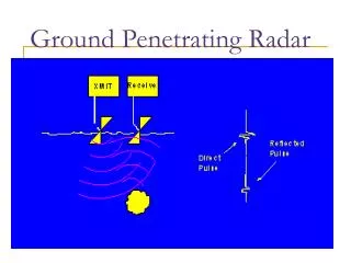
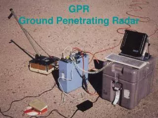
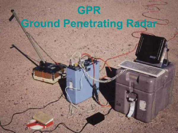
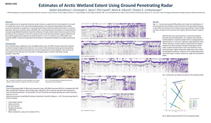
Estimates of Arctic Wetland Extent Using Ground Penetrating Radar Stefan Schultheiss1; Christoph E. Geiss2; Phil Camill5; Mark B. Edlund4; Charles E. Umbanhowar3 1TRICON Geophysik und Systemtechnik GmbH, München, Germany; 2Deptof Physics, Trinity College, Hartford, CT; 3Deptof Biology, St.Olaf College, Northfield, MN; 4St. Croix Watershed Res. Station, Science Museum of Minnesota, Marine on St. Croix, MN; 5Deptof Ecology and Evolutionary Biology, Bowdoin College, Brunswick, ME NS23A-1452 Abstract Arctic wetlands are an important terrestrial carbon reservoir, a potential sink for atmospheric CO2 as well as a significant source of CH4. We collected approximately 2 km of ground-penetrating-radar profiles across nine wetlands to supplement or borehole-based study of Holocene wetland formation in northern Manitoba. Data were acquired using a SIR-3000 radar unit (Geophysical Survey Systems Incorporated) and analyzed using ReflexW (Sandmeier Scientific Software). All radar profiles clearly show the position of the permafrost horizon between 25 and 50 cm depth as well as the boundary between organic sediment and the underlying glaciofluvial deposits at depths between 1 and 1.5 m. Based on our GPR profiles most wetlands exhibit a simple basin geometry which allows for interpolation between our widely spaced peat cores. Introduction Arctic wetlands play a significant role in the global carbon cycle, but little is known about their response to climate change throughout the Holocene. Our study of Arctic wetlands employs ground-penetrating radar to extend existing borehole data and constrain the geometry of small wetlands. Here we focus on our analyses of five transects from Lake 396, a small glacial lake in northern Manitoba, Canada (59.58°N., -98.57°W). • Results • Figs. 3 – 7 show the processed GPR profiles and include the identification of the permafrost horizon (blue) as well as the base of the peat deposits (gray). In all profiles the transition from unfrozen peat to permafrost is clearly visible, but does not obscure the transition from organic (frozen) sediment to glacial till. • GPR velocities were estimated from comparisons between borehole data and GPR profiles. Our analyses show that the studied wetland is relatively shallow with an average depth of approximately 1 m and has a relatively simple geometry with a relative level base. Further studies to determine the relation between the observed signal strength (amplitudes) and the water contend should be done. Due to the thickness of the measured layers ,higher frequencies might show more clearly the identified boundaries. However, the increased attenuation of this GPR signal at higher frequencies might limit penetration depth. • Fig. 7 summarizes our depth estimates for all analyzed profiles. Fig. 3: Transect 1 – depth to permafrost, base of peatland as well as some deeper structures are indicated. The depth to glacial till is approximately 1 m. Fig. 4: GPR data for Transect 2 Fig. 5: GPR data for Transect 3 Fig. 1: Location of Lake 396 in northern Manitoba, insert shows location of GPR transects in wetland on NE shore of Lake 396. Fig. 2: The studied wetland, looking south from the northwestern end of profile T1. • Methods • Ground Penetrating Radar Profiles were measured using a SIR-3000 instrument (GSSI Inc.) equipped with 400 MHz and 200 MHz antennas. Most profiles were collected at 10 cm step size and each trace represents a stack of 256 measurements. For two profiles (T1 and T2) we did not employ stacking, but used a horizontal step size of 2 cm. • Data were processed using ReflexW software (Sandmeier Scientific Software, v. 5.6). The processing steps for all files included: • Trace header editing • Static correction • DC-shift removal • background removal • spatial filter • Mean-subtraction, using a time window of 4 ns Fig. 6: GPR data for Transect 4 Fig. 7: GPR data for Transect 6 Fig. 8: Depth to glacial sediment for all analyzed profiles.