Download
1 / 23
230 likes | 230 Views
Consultant for the City of Elliot Lake, coordinating and reporting on all requirements for the government to acquire land for the Phase II Waterfront Development Project.

E N D
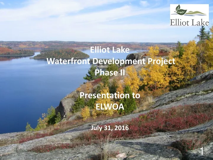
Elliot Lake Waterfront Development Project Phase IIPresentation to ELWOAJuly 31, 2016
What I do • Consultant to the City of Elliot Lake for Phase II of the Waterfront Development Project. • My role is to co-ordinate, and report on, all requirements (archaeology, Natural Heritage Assessment, Water Quality, Claims etc.) for Government Ministries and Departments so that the City can buy the land from the crown.
What I Don't Do Do not deal with operational items such as: • Taxes • Roads • Garbage • Boat Launches • Sales
Why is Elliot Lake developing waterfront lots? • Respond to the significant loss of 4,500 jobs and approximately $90 million in employment income • A key element of economic development to attract new residents to this area. • To stimulate economic activity within Elliot Lake and across the north shore.
Steps • City of Elliot Lake acquires the land from the province • Elliot Lake Residential Development Commission develops the infrastructure and sells the lots • City of Elliot Lake is then responsible for building permits, infrastructure maintenance etc.
Construction Impact for Phase II EL Region Ontario $248 m $636 m Initial Expenditures, Gross Output, Value Added, Wages & Salaries $32 m $61 m Federal, Provincial & Municipal Taxation 1,085 2,050 Employment (person years)
Sustainable Impact for Phase II EL Region Ontario $51 m $83 mAnnual Expenditures, Gross Output, Value Added, Wages & Salaries $5.8 m $10 mFederal, Provincial & Municipal Taxation $4.8 mProvincial benefit from sale of crown land 146 263 Employment (person years) Other benefits will include increase in housing prices and an increase in services within the community.
Process • Due to overwhelming success of Phase I decided to pursue a phase II • All proposed lakes were studied at the same time due to their interdependency • A comprehensive watershed-based phosphorus mass balance model for 177 area lakes, in the Serpent River Watershed, was developed to determine the amount of shoreline development that area lakes could sustain without impairing water quality • Yearly spring Total Phosphorus water samples on 25 lakes and fall Dissolved Oxygen on 12 lakes. • At the same time, a financial model was developed to determine the cost - revenue implications on all lakes being considered. • The final number of lots proposed for each lake was the result of optimizing the results of these models (watershed and financial) with each other.
An extensive survey of each lake was then performed to determine where the lots might be located. Once the locations were determined Tulloch Environmental was contracted to perform Natural Heritage (NH) investigations. Reports include: • NH Records Review • NH Site Investigation • NH Wetlands Evaluations • NH Species at Risk (SAR) • Archaeology
Other reports developed at this time include: • Waterfront Development Plan - includes Disposition Request and Project Summary • Considering Provincial Policy Statement • Municipality Environmental Assessment Act Coverage • Public Engagement (including Government Agencies) • Aboriginal Engagement • Education Manual (included within Property Guide) • Take the Plunge - A guide to Stewardship of Ontario’s Waters • A Guide to Stewardship Planning for Natural Areas • On the Living Edge -Your Handbook for Waterfront Living • City By-laws • City Council Resolutions • City Official Plan
Public Engagement Correspondence with Government Agencies: • Ministry Northern Development Mines Elliot Lake & Sudbury • Ontario Provincial Police • Fisheries and Oceans Canada • Ministry of Transportation Corridor Control Office • Ministry of Municipal Affairs and Housing Community Planning and Development • Ministry Natural Resources and Forestry • Ministry of the Environment and Climate Change • Canadian Heritage • Ministry of Tourism, Culture and Sport • Algoma District School Board • ConseilScolaire de district du Grand Nord de I'Ontario • Huron-Superior Catholic District School Board • Le conseilscolaire de district Catholic du Nouvel-Ontario • Hydro One Networks Inc. Real Estate Services, Land Use Planning • Ontario Power Generation • Infrastructure Ontario Land Use Planning • Environment Canada
Contact with local mining companies and claim holders • Dension Mines Corp & Rio Algom Ltd (BHP Biliton) - Legacy Companies • Regular meetings • Rio Algom turned over mining claims to City • City dropped lots on Quirke due to dam breach concerns from Rio Algom • City dropped lots on Quirke due to safety of proposed boat launch • Denison changed claim status to accommodate waterfront development • Denison taking care of on-going correspondence with CNSC • City dropped lots on Quirke that conflicted with Denison operations • City included mine site and tailings information within Education Manual (information supplied by Rio and Denison) • City agreed to participate in Hazard Identification Risk Assessment requested by Rio and Denison • Pele Mountain Resources has interests in the Pecors Lake area. The City has a lease agreement with Pele as they pursue resource extraction and solar farm • Claim Holder "A” • 30 claims in conflict with Waterfront Development Project • city has proposed dropping lots for consent on other lots • negotiations continuing
Local water power generating companies • Xeneca Power Development Inc. has two proposed waterpower sites on the Serpent River Neither of these sites are in conflict with waterfront development. • Pecors Power has a proposed waterpower site where the Serpent River meets Pecors Lake. Closest waterfront development lot would be at least 110 m from the power station. This did not pose any problems for either the City or Pecors Power. A power plant close by may be beneficial to both projects. Forest Harvesting • Continuous contact with Northshore Forest Inc. to discuss mutual interests • Continuous contact with local logging companies
Existing Road/Trail User Groups Looking at helping snowmobile club reroute trail Elliot Lake Waterfront Owners Association • Suggestions from experiences of phase I - road names, civic addresses • Education Manual • Waterfront not Cottage Other Local Outfitters, lodge owners and guides Elliot Lake Chamber of Commerce Fur Harvesters Baitfish Harvesters Penokean Hills Field Naturalists Rod & Gun Club All Anglers Fishing Club Coureurs de Bois Outdoors Club Voyageur Hiking Trails ATV Club Serpent River Regional Environmental Committee Sharp Shooters Anglers & Hunters Club Resource Management Advisory Committee Elliot Lake Friends of East Algoma Cross Country Ski Club East Algoma Stewardship Council North Shore Fisheries Association North Shore Anglers & Hunters Algoma Paddlers Canoe & Kayak Ducks Unlimited Snow Riders, Voyageur Trail Association
Public Open House to inform public and answer questions • Elliot Lake Centre For Development sent out over 1000 notices from their distribution lists encouraging people to participate • Booth at local trade shows to continue public information • Letters to local residents that live close to development keeping them up to date • Result of Public Consultation removing 75 lots on Quirke and all 8 on Marsh • Mining companies, public input about safety of Quirke Lake and MNRF concerns • More opportunity for Public input during Plan of Subdivision Process • City Council hearing for Plan of Subdivision • Appeal Period – Planning Act, 20 - 50 days • City Council meeting to enact By-law to authorize Purchase of Crown land
Aboriginal Engagement • Entire project is within Serpent River watershed Serpent River First Nation May 2014 First 3x3 Negotiating Committee Meeting April 2015 3x3 Committee presents draft agreement to SRFN and City of Elliot Lake councils Agreement is in the hands of lawyers for both sides • Mississauga First Nation • Sagamok Anishnawbek First Nation • Metis Nation of Ontario & North Channel Metis Council • As reports are finalized they are shared with SRFN, MFN, SAFN, MNO & NCMC
Next Steps • MNRF has asked us to take a "cascade" approach • each lake will be assessed and approved as the previous lake nears completion • this will assure we are meeting up to date standards with recent data • Consent for claims • Aboriginal Agreement • CLUPA - Canadian Land Use Policy Atlas - changes to land designations
Dunlop Lake 5 lot relocation - sell lots fall 2016 • All reports are complete and approved • Only holdup is consent from claim holder
Quirke Lake 25 - sell lots spring 2017 • NH Records Review – completed • NH Site Investigation – completed • NH Wetlands Evaluations – completed • NH Species at Risk (SAR) – completed • Archaeology – completed • Municipality Environmental Assessment Act Coverage – completed • Education Manual – completed • City By-laws – completed • City Council Resolutions – completed • Waterfront Development Plan - includes Disposition Request and Project Summary - final draft • Public Engagement (including Government Agencies) - final draft, on-going • Aboriginal Engagement - final draft, on-going • City Official Plan - in process • Plan of Subdivision - after land is transferred
May Lake 99 - sell lots fall 2017 • NH Records Review – completed • NH Site Investigation - final draft • NH Wetlands Evaluations – completed • NH Species at Risk (SAR) – completed • Archaeology – completed • Municipality Environmental Assessment Act Coverage – completed • Education Manual – completed • City By-laws – completed • City Council Resolutions – completed • Public Engagement (including Government Agencies) - final draft, on-going • Aboriginal Engagement - final draft, on-going • Waterfront Development Plan - includes Disposition Request and Project Summary - first draft • Canadian Land Use Policy Atlas - in process • City Official Plan - in process • Plan of Subdivision - after land is transfered