Download
1 / 35
350 likes | 352 Views
Learn about the Ouranos Consortium's climate modeling and its application examples in this informative presentation. Topics include regional climate change impacts, the Canadian Regional Climate Model (CRCM), and validation and projection data.

E N D
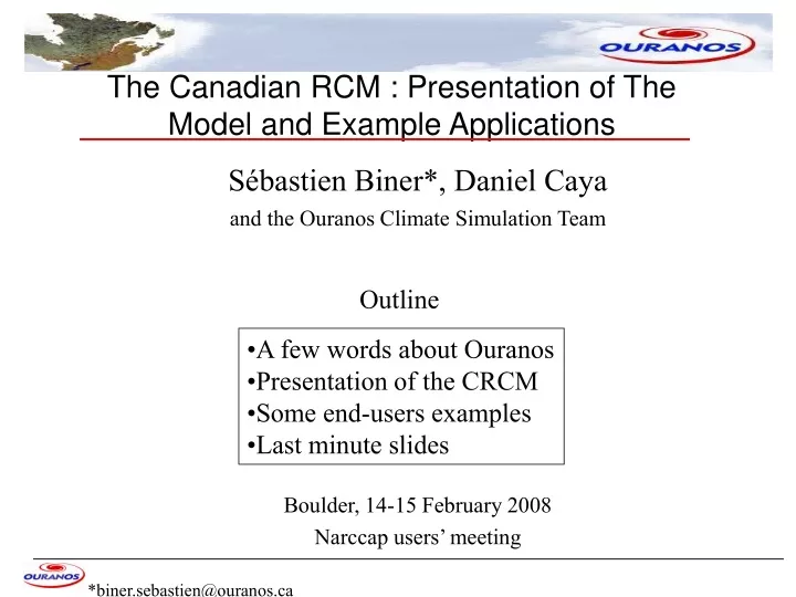
The Canadian RCM : Presentation of The Model and Example Applications Sébastien Biner*, Daniel Caya and the Ouranos Climate Simulation Team Boulder, 14-15 February 2008 Narccap users’ meeting *biner.sebastien@ouranos.ca Outline • A few words about Ouranos • Presentation of the CRCM • Some end-users examples • Last minute slides
The Ouranos Consortium : Unique in Canada 550 Sherbrooke West Montréal www.ouranos.ca (near UQÀM, McGill, INRS, HQ …) 18th and 19th floors, 1800 m2 • Coordination of interdisciplinary research • 90 scientists, students and professionals working together at the same location • Access to an extensive network of experts, users and true stakeholders
Consortium on Regional Climatology and Adaptation to Climate Change MISSION From the Ouranos’ Strategic Plan 2004-2009 • The mission of Ouranos is to acquire and develop knowledge on climate change and its impacts, as well as on socio-economic and environmental vulnerabilities, so as to inform decision makers on evolution of the climate and to provide advice on the identification, evaluation, promotion, and implementation of local and regional adaptation strategies.
Impacts Linked to Climate Change in Quebec • Permafrost • Coastal erosion • Energy and Forestry • Urban Infrastructures • Water resources • Other economic sectors • Health, Public Safety and Extreme events • Ecosystems and Biodiversity Ouranos Strategic Plan, 2006
Ouranos Climate Simulation Team and Equipment AMNO 201x193 QC 112x88 • Team of 8 climate simulation specialists • Two Cray-SX vector computers • Two SGI front ends (Sun – coming soon ) • One data server (tape + robot) • One main tool to produce climate data : the Canadian Regional Model (CRCM)
CRCM4 AMNO 201x193 AMNO 201x193 QC 112x88 Usual set-up: • 45km resolution • 29 levels • 15min timesteps Special features: • precipitation available at every timestep • Large scale nudging • CLASS land surface scheme with explicit layer for snow cover
Other grids… AMNO 201x193 Narccap vs AMNO AMNO 201x193 QC 112x88 ENSEMBLE 109x109 @50km 209x209 @25km ICTS DX=50km
CRCM operational set-up at Ouranos CRCM CGCM2 CGCM3 NCEP rean1 NCEP rean2 ERA40C … Ensemble of Climate simulations for validation and projection CRCM Different grids Different CRCM Versions Different IC Different scenarios
A few examples of CRCM data use • Water budget and snow analysis • Precipitation extremes
The Great Lakes Superior Huron Michigan Erie Courtesy of Guay and Frigon
Annual land runoff [mm/y] • acw: ERA40d driven • ade: NCEP driven Courtesy of Caya, Frigon and Music
CRCM validation summary 1961-1999 land basin runoff validation Courtesy of Caya, Frigon and Music
Hydrology over bassin 45km CRCM grid-size mesh Courtesy of Slivitzky and Frigon
Annual runoff bias 1961-1999 Runoff ~ 1,5 mm/d runoff bias (CRCM-obs) [mm/d] Courtesy of Slivitzky and Frigon
Churchill Falls Reservoir 1961-1999 Maximum snow water equivalent (mm) Courtesy of Slivitsky and Frigon
Lac Saint-Jean 1961-1999 Maximum snow water equivalent (mm) Driven by : Era40 NCEP rean 2 Courtesy of Slivitsky and Frigon
Precipitation Extremes airport Courtesy of Mailhot, Duchesne and Simard
Cumulative distribution for 24 h extreme – RCM vs Mtl airport Courtesy of Mailhot, Duchesne and Simard
Cumulative distribution for 12 h extreme – RCM vs Mtl airport Courtesy of Mailhot, Duchesne and Simard
Cumulative distribution for 6h extreme – RCM vs Mtl airport Courtesy of Mailhot, Duchesne and Simard
Cumulative distribution for 2 h extreme – RCM vs Mtl airport Courtesy of Mailhot, Duchesne and Simard
Cumulative distribution for 1 h extreme – RCM vs Mtl airport Courtesy of Mailhot, Duchesne and Simard
Validation climat 1961 - 1990 CRCM4 (45km) OBS CRU2 (0,5x0,5o) Été (JJA)température 1961-1990 (°C) DifférenceMRCC4moinsOBS CRU2
Validation climat 1961 - 1990 CRCM4 (45km) OBS CRU2 (0,5x0,5o) Précipitation d’été spatialement plus bruitée que les observations Été (JJA)précipitation 1961-1990 (mm/d) DifférenceMRCC4moinsOBS CRU2
A Poor’s Man Ensemble for North-America 1971 - 1990 vs 2041 - 2060 From Plummer, Caya, Frigon, Côté, Giguère, Paquin, Biner, Harvey, de Elía J. Climate 2006
Plummer et al. J. Climate 2006 Climate Change over North America as simulated by the CRCM Changement climatique moyen de la température entre les périodes 1971-1990 et 2041-2060, et l’écart-type des quatre projections climatiques.
Uncertainty is everywhere ? Sponsored by Daniel Caya
Drought index 250 km radius: CRCM: 112 tiles Observations: 13 stations GCMs: closest tile • Operational drought index (function of Tmax and precipitation) computed with different time series CRCM4 grid CGCM3 grid Courtesy of Logan, Chaumont and Caya
Drought index 50 km radius MRCC: 5 tiles Observations: 1 stations GCMs : closest tile 250 km rayon: MRCC: 112 tiles Observations: 13 stations GCMs: closest tile • Operational drought index (function of Tmax and precipitation) computed with different time series CRCM4 grid CGCM3 grid Courtesy of Logan, Chaumont and Caya
Drought index Radius of 250 km : 13 stations, 112 tuiles MRCC, 1 tuile MCG Jours depuis 1er avril Radius de 50 km : 1 station, 5 tuiles MRCC, 1 tuile MCG 50 km rayon MRCC: 5 tiles Observations: 1 station GCMs : closest tile Jours depuis 1er avril • Operational drought index (function of Tmax and precipitation) computed with different time series CRCM4 grid CGCM3 grid Courtesy of Logan, Chaumont and Caya
Drought index change for the Boreal forestMRCC4 - MCCG3 A22040-2069 à 1961-1990 Drought index units
Soil temperature Annual cycle of simulated soil temperature (1961-1990) Observation sites of MRNF MRCC-Class FORHYM2 without organic layer FORHYM2
Summary • The climate simulation team at Ouranos has produced a noticable amout of regional climate simlation (validation and projection) • Narccap to increase our pool of regional climate data (other RCMs, driving GCM, …) • Users at Ouranos are using more and more direct RCM outputs in their I&A studies