Download
1 / 13
130 likes | 232 Views
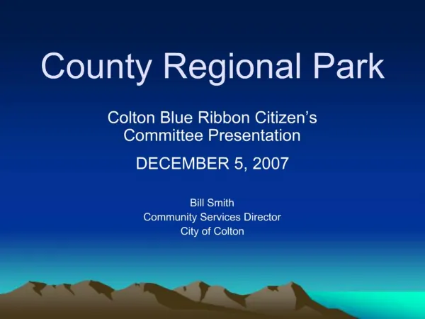
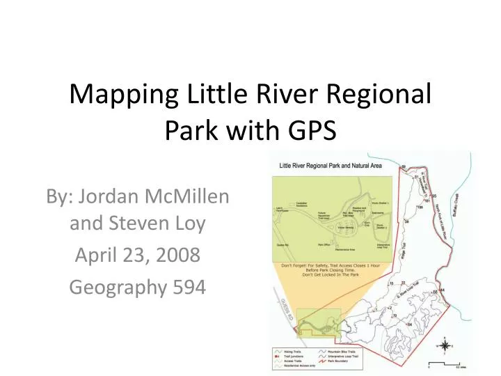
Mapping Little River Regional Park with GPS. By: Jordan McMillen and Steven Loy April 23, 2008 Geography 594. Overview. Produce accurate, usable map of advanced mountain bike section Important Steps: Data dictionary Data collection Data processing Correction, smoothing Outputs. Site.

E N D
Mapping Little River Regional Park with GPS By: Jordan McMillen and Steven Loy April 23, 2008 Geography 594
Overview • Produce accurate, usable map of advanced mountain bike section • Important Steps: • Data dictionary • Data collection • Data processing • Correction, smoothing • Outputs
Site • About half of LRRP adv. mtn. bike trail • Moderately hilly, pine and hardwood tree cover, many animals • Qualifiers, informational markings
Data Dictionary and Collection • Previsit to determine needs, scope, potential problems • Collection visit to get data • 2 Trimble GEO XT/XH receivers • One used for line only, one for points only
Data Dictionary and Collection (cont.) • Difficulties: • Tree cover limiting accuracy • Non standardized protocol for some features • Using Data Dictionary • Improvements: • External antennas, keypad inputs • Greater planning, coordination, testing
Differential Correction Code processing... Selected 4677 positions for post-processing Corrected 4560 positions Failed to correct 96 positions 95 of these were due to insufficient satellites for position fix 1 of these were due to unknown receiver type Excluded 22 positions 22 of these were due to high DOP values Filtered out 118 uncorrected positions --------Base Data Details:-------------------- Using reference position from base provider: Name: COOP_CORS, Durham, NC Position: 35°59'46.15538"N, 78°53'58.04671"W, 116.21 m Source: C:\Documents and Settings\geoglab319-01\My Documents\GPS Projects\Default\Base\COOP_CORS, Durham, NC durh100u.zip Local time: 4/9/2008 3:59:46 PM to 4/9/2008 4:59:41 PM Position: 35°59'46.12951"N, 78°53'58.03734"W, 117.47 m, 0.00 m Antenna height Distance from base provider: 0.83m durh100v.zip Local time: 4/9/2008 4:59:46 PM to 4/9/2008 5:59:41 PM Position: 35°59'46.12951"N, 78°53'58.03734"W, 117.47 m, 0.00 m Antenna height Distance from base provider: 0.83m --------Coverage Details:-------------------- Rover file: LR_04092008.SSF Local time: 4/9/2008 4:04:52 PM to 4/9/2008 5:51:51 PM 100% total coverage 51% coverage by durh100u.zip 49% coverage by durh100v.zip Range Percentage ---------- ---------- 0.5-1m 1.9% 1-2m 39.8% 2-5m 50.5% >5m 7.8%
Data Corrections Manual Edits 1. Merge Process 2. Editor Toolbar
Data Correction Continued… Generalization Importance of Maximum allowable offsets
Editting Process Smoothing Methods of smoothing Chosen method and reasoning
Final Results Final Layout and Calculated Lengths Yellow – Parks original estimate Gray – As collected Blue – Manually and generalized Red – Final Trail
Further Improvements • More data collection • Greater input from park staff, users • What information is important? • Run trial/test before main collection • Use other methods to calculate distance • Bicycle or human pedometer, measuring wheel • Publish data to users in easy to use format • Web, Google Earth, Paper Maps
Google Earth Test • Arcmap 9.2 has *.kml output • Other applications can do this too • Small file size, easily shared and used • Built in topo features • Overlay with other data
Sources and Credits • LRRP Staff and data • Trimble • Geog594 Class