Download
1 / 56
570 likes | 766 Views
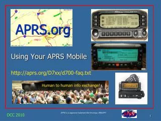
APRS. Mobile Satellite Operations. APRS Applications in Space. Dayton 2008. What is APRS?. APRS = Automatic Packet Reporting System

E N D
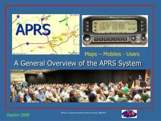
APRS Mobile Satellite Operations APRS Applications in Space Dayton 2008
What is APRS? • APRS = Automatic Packet Reporting System • APRS was developed in the early 1990's for local tactical digital communications, situational awareness and TWO-WAYinformation exchange using Amateur radio. • Not just Vehicle Tracking!
What is APRS all about? • Immediate local digital and graphical information exchange between all participants in a local area or event. This includes: • Positions of all stations and objects • Status of all stations • Messages, Bulletins and Announcements • Weather data and telemetry • DF bearings and signal strengths for quick transmitter hunting • RF Connectivity plots of all stations • Local OBJECTS on a common map display for all users • Local Freqs, Nets, Meetings • Typical applications are: • Routine local awareness of all ham radio events and assets around you • Marathons, races, events and public service • Search and rescue • Family communications and tracking and one-line emails • Mobile-to-mobile global messaging • Weather data exchange and display • Efficient multi-user Satellite communications
Scope of APRS • APRS consists of a very large land based wireless network. Almost 30,000 users around the world. • This network works via RELAYS every 20-30 miles called “digipeaters.” And Globally via IGates to the internet. • APRS is also used via some of the Amateur Satellites. • It is also used to monitor telemetry values of weather stations for the National Weather Service (NWS) • APRS has the capability to quickly relay telemetry values to research centers without the Internet. But, only 2% of local situation… (a side show)…
APRS MisConceptions! SeeAPRS-tactical.html • That APRS is just Vehicle Tracking instead of a Real-Time Information Distribution System. • That APRS is dependent on GPS for its value (GPS is not needed. See Objects). • Failure to use the APRS built-in Mile-Marks for tracking all other non-APRS mobiles. • Using APRS clients that only do maps and ignored too many of the APRS fundamentals. • Ignored the fundamental Decay Algorithm to accelerate new data, and decay old data! • Failure to understand the importance of OBJECTS: . See Objects 101 and Operations • Failure to use real-time messaging: . See Messages 101 and Message Operations • Failure to implement the original APRS Centralized Common Bulletin Board concept. • Not understanding the APRS operator’s role as a Data Input(Objects, Bulletins and Messages) • Not using the D7 and D700 as data entry and clipboard display units at field events. • Too much focus on Large ScreenDisplays –vs- Individual Operator displays for events. • Failure to display APRS symbols with all their attributesand colors without clicking them • Failure to manage the network by adjusting the local digipeater for the situation at hand. • Not realizing the importance of Voice Operatingfrequencies in APRS.
APRS, maps and events That APRS is dependent on GPS for its value (GPS is not required to put things on maps).
Simple DTMF memory - One button puts you in APRS (Position, Frequency and Status)! DTMF on voice freq translated to packet on APRS channel (or direct to APRS-IS) Position is 10 mile ambiguity using repeater posit (or 60 mile ambiguity out west) Frequency in packet is Frequency of Repeater If Echolink or IRLP, APRS packet includes node number! APRStt (Touchtone) Seeaprstt.html
DTMF Report shows on APRS! CALLSIGN with date and time Position in vicinity of repeater or APRStt entry point Voice Operating Frequency, Tone and other info Node number if Echolink or IRLP, or reverse patch number if Repeater APRStt (Touchtone) Seeaprstt.html 147.105MHz T107 R30m
APRStt (Touchtone) Seeaprstt.html For big events, put one at each checkpoint or venue. See who is operating where, on what frequency and when
Various APRS Stations (two-way) APRS is a Network intended for real-time Tactical INFORMATION exchange. This means TWO-WAY.
TRACKERS (two-way) One-way APRS is not normally recommended. APRS is a Network. We want good communications among all participants for maximum utility. Trackers have no APRS data display. So the receiver should be tuned to a beaconed Voice frequency so the operator can be involved in the Net! One-way trackers are good for non-manned assets at large movement events.. Not as the only APRS asset for a ham. Trackers should be his 3rd,4th,5th etc tools for APRS support…
Kenwood TM-D700A Mobile/Portable Satellite Terminals • Dual band 144/440 MHz 50/35 Watts • Built-in 1200/9600 bps TNC including digipeater • Built-in screen display of other APRS stations and front-panel send/receive messaging. • Other APRS station locations are sent to the attached GPS map for display. Kenwood TH-D7A(G) TM-D710 • Adds operation Freq to every posit ! • Auto tunes to others with Freq! • Shows local Voice Repeaters !
Alinco DR-135T/EJ-41U Allows direct input from any standard GPS. Basic 1200/9600 bps TNC • Basic 2 M Radio with optional TNC. (Opentrack makes a drop in tracker module) • Unlike the Kenwood radios, it requires a PC to set it up, and there is no APRS display directly on the radio.
Yeasu VX8R ? • “APRS” ? • Bluetooth enabled? • Wireless GPS? • Nothing about receipt, display or messaging?
APRS Voice Alert! * (For all mobiles!) • Voice Alert is effectively 3rd Radio channel for the D7 and D700 APRS radios • By setting the APRS Band, A, to PL-100, but keeping the volume turned up: • You wont hear any packets on 144.39 * • But you will hear a voice call using PL-100 on 144.39 • And you will hear* an occasional Ping packet if another D700 comes in line-of-site to you, like a proximity radar alerting you to local presence. • Great for long haul traveling and meeting other APRS users.
APRS – IS - Local Info! But via Satellite, Local is all of the USA! Last 100 stations! Mobiles and HT are 100% compatible Direction & Distance Frequency and Tone
The APRS Network An APRS satellite is just a very high Digi! Aa Digipeaters And to the Internet Gateway Multiple Hops
The New-N Paradigm 2005 Factor of 3 to 5 improvement! • APRS Generic Paths evolved over 13 years and the presence of many old legacy formats and procedures were really bogging down the network making it saturated and unreliable in busy areas. • In 2005 all old paths were declared obsolete (RELAY & WIDE) and the entire APRS system in the US was then focused only on the WIDEn-N type of generic paths with small values of N. • A WIDEn-N path goes N hops outward in all directions. • N=2 in most areas colored on next slide
APRS (Range Circles) From space, covers all of the USA at once!
APRS (ALOHA circle and digipeater hops)[Your ALOHA circle is your 100% saturated channel range]
APRS – Traffic Speed Posts Shows speed of traffic past special points
APRS Event Data Entry How to use APRS HT’s for keypad entry of Troop data at camporees. 20 stations, 40 troops, 800 scores all day long. Use keypads!
APRS Event Data Entry Score Message Sent Score Data Received
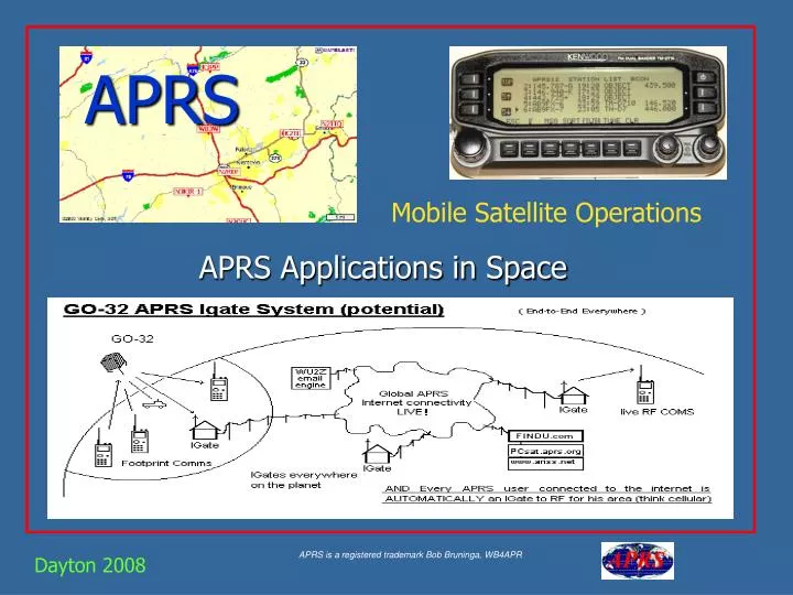
APRS IGates (Global APRS!) • An IGATE is a local APRS station that utilizes the APRS-Internet network to pass all packets heard on their local RF back to the Internet.(Gives global views to local activity. • Also act as two-way gateways for ALL APRS MESSAGES worldwide (Internet RF).
APRS-Internet (Satellites) Google for “USNA Buoy” Select USNA-1 www.arris.net - Downlink from ISS Pcsat.aprs.org - Downlink from PCSAT http://mangrove.findu.com/cgi-bin/pcsat.cgi - GO32, AO51, PCSAT & situational awareness This data is LIVE
APRS-IS (FINDU –Stations Near) Google for “USNA Buoy” Select USNA-1
APRS-IS (FINDU – Near Map) Google for “USNA Buoy” Select USNA-1
APRS-IS (FINDU - Messages) Google for “USNA Buoy” Select USNA-1
APRS for Special Uses • Bicycle rallies, races • Walk-a-thons, Parades • Skywarn • Weather Nets • Crime prevention patrols • Damage assessment • Direction Finding – Foxhunts • Voice for communications, APRS for visual mapping • Now integrating into APRN (Automatic Picture Relay Network)
Sensor Buoy Prototype See Buoy Location and Telemetry at http://www.ew.unsa.edu/~bruninga/buoy.html Piggrem
Findu.com Telemetry Plots Google for “USNA Buoy” Select USNA-1
Into Space… PCSAT • The Prototype Communications Satellite, is a US Naval Academy Aerospace student project. ANDE and RAFT in Dec 2006 • APRS space frequency is published as 145.825
APRS via Space • APRS space frequency is 145.825 MHz • Also via GO-32 on 435.225 downlink, 145.85MHz up
PCSAT Satellite • Launched Sept 2001 from Kodiak Alaska • The first APRS satellite, and has since been joined by 5 other such satellites • It still works during mid-day sunny passes. • Can capture Emergency /Priority messages from THD7 / D700 radios anywhere on the globe and retransmit these signals on the USA VHF 144.39 APRS frequency. See live downlink on http://pcsat.aprs.org
International Space Station • ARISS supports APRS on 145.825 too! • Use digipeater path VIA ARISS. • PCSAT2 was also on ISS 2005-2006 PCSAT2, was the second APRS digipeater satellite. See live downlink on www.ariss.net
Now GO-32TECHSAT-1b • GO-32 now supports APRS on its 435.225/145.85 packet system. • APRS up on 145.85 (PC’s and messages) • Mic-E up on 145.93 (D7 and D700’s) 9600 Baud! See live downlink on www.ariss.net
GO32 -EZ - MOBILE SatellitePrediction and Tracking http://www.ew.usna.edu/~bruninga/MobileLEOtracking.html • No computer needed • Two or more solid TX/RX passes every day • Two additional TX passes 100m before and after! Fri 26 Oct is day8
GO32 -EZ - MOBILE SatellitePrediction and Tracking No computer needed Two or more solid TX/RX passes every day Two additional TX passes 100m before and after! http://www.ew.usna.edu/~bruninga/MobileLEOtracking.html Fri 26 Oct is day8
Tracking ECHO (AO51) too! http://www.ew.usna.edu/~bruninga/MobileLEOtracking.html • No computer needed • Two or more solid passes every day Friday October 26th is day 4!
LEO Pass Geometry • Bottom line: • 10 dB gain Horizon-to-horizon • 98% of all in-view times • Using $75 TV rotator only