Download
1 / 60
600 likes | 771 Views
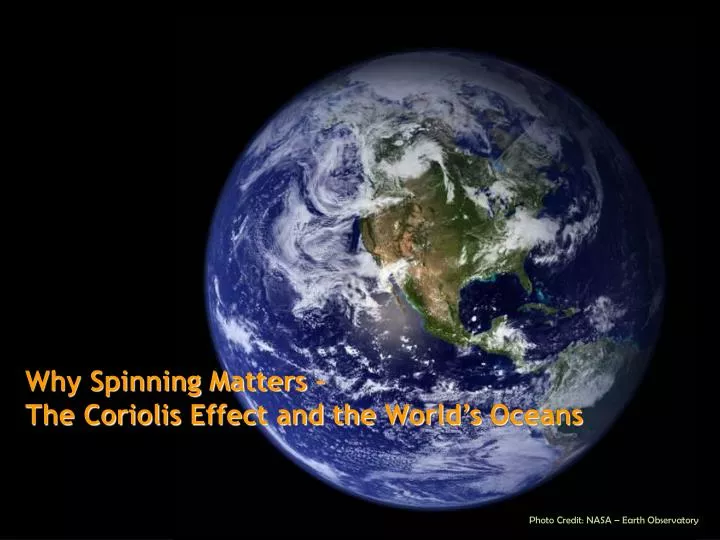
Why Spinning Matters – The Coriolis Effect and the World’s Oceans. Photo Credit: NASA – Earth Observatory. What is Convection?. Movement that results when heat is transferred in a fluid

E N D
Why Spinning Matters – The Coriolis Effect and the World’s Oceans Photo Credit: NASA – Earth Observatory
What is Convection? • Movement that results when heat is transferred in a fluid • First, warmed fluids (like water or air) become less dense and will rise opposite to the force of gravity. • Next, cooler fluid will move to replace the rising warm fluid and it will be warmed itself. • This cycle repeats to mix the fluid.
What on Earth?Descriptions of Earth’s Convection Edmond Halley 1656-1742 • Reasoned that intense solar radiation heated the air near the Equator and caused it to expand and rise up. • This rising air is replaced by cooler air converging on the Equator from the northern and southern hemispheres. • Circulation of the air is driven by a pressure-gradient force, which causes high-pressure (cooler, more dense) air to move into regions of low-pressure (warmer, less dense) air. • Predicted a flow of air from the poles to the Equator where the air masses converge.
Another View of Convection Note that it is the sinking of cold, dense air NOT the rising of warm air that drives the circulation pattern. Image credit: NASA
What on Earth?Descriptions of Earth’s Convection George Hadley 1685-1768 • English lawyer and amateur meteorologist • First to describe the reason the equatorial trade winds preferentially blow westward. • Hadley realized that Earth's rotation played a crucial role in the direction taken by a moving airmass. He provided a description of the equatorial trade winds that was essentially correct. • Model of Earth’s convection termed the ‘Hadley cell’ in his honor.
The Coriolis Effect Gustave Gaspard de Coriolis 1792 - 1843 • French mathematician, mechanical engineer, and scientist • Determined simple rules for the direction of moving objects on the surface of a rotating sphere, now known as the Coriolis effect: • Because the earth is rotating, anything that moves over its surface tends to turn a little rather than moving in a straight line. • A balance of forces causes objects traveling in the Northern Hemisphere to curve to the right. • A balance of forces causes objects traveling in the Southern Hemisphereto curve to the left.
Visualizing the Coriolis Effect • Earth rotates at different speeds at different latitudes. A B C http://www.uwf.edu/atc/projects/coriolis/main.swf
Visualizing the Coriolis Effect • UWF - http://www.uwf.edu/atc/projects/coriolis/main.swf • NOAA Ocean Service - http://oceanservice.noaa.gov/education/kits/currents/05currents1.html • YouTube – • http://www.youtube.com/watch?v=aeY9tY9vKgs (First 2 minutes) • http://www.youtube.com/watch?v=mcPs_OdQOYU • Exploring Earth- http://www.classzone.com/books/earth_science/terc/content/visualizations/es1904/es1904page01.cfm • Merry -Go_Round - http://ww2010.atmos.uiuc.edu/(Gh)/guides/mtr/fw/gifs/coriolis.mov • MIT - http://video.mit.edu/watch/the-coriolis-effect-4407/ • NASA - http://weather.about.com/gi/o.htm?zi=1/XJ&zTi=1&sdn=weather&cdn=education&tm=5&gps=139_10_1280_891&f=21&su=p284.13.342.ip_&tt=3&bt=1&bts=1&zu=http%3A//www.nasa.gov/audience/forstudents/brainbites/nonflash/bb_home_corioliseffect.html
Major Wind Patterns • The direction and location of these wind belts are determined by solar radiation and the rotation of the earth. • The three primary circulation cells are known as the: Hadley cell; Ferrel cell; and Polar cell. • Circulation cells produce wind patterns on earth including: • Tradewinds – strongest/steadiest • Westerlies • Easterlies - most variable
Another Look at the Wind Belts Significance of Wind Belts? • Guide weather and storms • Jet Stream • 100 mph • Between 30-60º • Above friction zone • Influences Sailing & Navigation • Deserts @ 30º
Ekman’s Contribution Vagn Walfrid Ekman (1874-1954) • Swedish oceanographer • First to describe the Ekman spiral – the movement of ocean currents in response to the rotation of the Earth (Coriolis effect) • direction of wind • Effective force of wind on the sea surface • Coriolis force (effect) • Effective direction of the current flow (Ekman transport) • (Based on observations by Norwegian Fridtjof Nansen (1861-1930) on the Fram expedition). • Extends to a depth of 100-150 meters • Limited by surface turbulence, diurnal cycles • Depth of effect is termed Ekman layer
The Ekman Layer • Direction of Ekman transport varies with ocean depth (15º in shallow waters) • Pycnocline can be a boundary • Can pile up water in the ocean causing pressure gradients. Background - Ekman Transport Animation - http://mysciencespace.com/Oceans/ekman_deepwater.htm
Global Surface Currents • As trade winds move towards the Equator, the water being pushed by the winds travels at a 90⁰ angle to the winds….
Global Surface Currents: GYRES • When you combine the effect of the trade winds with the effects of the westerlies, you experience huge, circular surface current called a gyre. Animated - http://mysciencespace.com/Oceans/wind_circ1-5.htm
Geostrophic Flow Ekman transport causes surface waters to move toward the central region of a subtropical gyre. • A gyre is a large, nearly circular system of wind-driven surface currents that center around latitude 30º in both hemispheres. • produces a broad mound of water • Steepening gyre causes a horizontal pressure gradient. Water flows “downhill” • The Coriolis effect acts on the “downhill” sliding parcels of water • When the outward-directed pressure gradient force balances the apparent force due to the Coriolis effect then the water parcels flow around the gyre along contours of sea surface elevation. The horizontal movement of surface water arising from a balance between the pressure gradient force and the Coriolis force is known as geostrophic flow. Ocean Basin Model
Worldwide Surface Currents • Equatorial currents • East to west under influence of tradewinds • Western Boundary currents • South to north (Northern Hemisphere – opposite in the Southern Hemisphere) • Coriolis effect piles up water on the Western sides of oceans • Moves very fast (25 -75 mi/day) – smaller channel to move through • Transports large amounts of heat – keeps north Europe habitable Pictured above is the East Coast of the United States, in grey, with the Gulf Stream, in yellow and orange, revealed through Sea Surface Temperature data (SST), made from the MODIS instrument on the Terra satellite. In this image, blue represents the coldest temperatures (between 1-10 °C) and orange and yellow represent the warmest temperatures (between 19-30°C). The Gulf Stream is readily visible as the warmest water in the image.
Eastern Boundary Currents • Bring cool water from high latitudes • Cool, moist – bring rain and fog
Up and Down in the Oceans • Coastal upwelling occurs where Ekman transport moves surface waters away from the coast; surface waters are replaced by water that wells up from below. • Brings nutrient rich waters to the surface • Increases biological productivity • Influences weather patterns • i.e California ‘s summer fogs • Coastal downwelling occurs where Ekman transport moves surface waters toward the coast, the water piles up and sinks. • Sends oxygen-rich waters to the deep sea • Decreases biological productivity
El Niño – Southern Oscillation • El Nino – Southern Oscillation – periodic event that reduces or reverses the Pacific Equatorial Current
El Niño El Nino Animation– from NOAA – Earth System Research Laboratory
Work Cited Castro, Peter & Michael E. Huber. Marine Biology. 5th. New York: The McGraw-Hill Companies, 2005. “Ekman_spirale.svg” Wikimedia commons. 5 Jan 2008. Chabacano. 6 Mar 2008 <http://commons.wikimedia.org/wiki/Image:Ekman_spirale.svg> “El Nino and La Nina Ocean Temperature Patterns” National Weather Service Climate Prediction Center. 19 Dec 2005 <http://www.cpc.noaa.gov/products/analysis_monitoring/ensocycle/ensocycle.shtml> Gore, Pamela. "Wind and global wind systems." 01 Apr 2005. Georgia Perimeter College. 5 Mar 2008 <http://gpc.edu/~pgore/Earth&Space/GPS/wind.html>. "Hadley cell circulation and the trade winds." 5 Mar 2008 <http://www.newmediastudio.org/DataDiscovery/Hurr_ED_Center/Easterly_Waves/Trade_Winds/Trade_Winds.html>. "In the zone." Getting the global picture. 2003. University of Wisconsin, Board of Regents. 4 Mar 2008 <http://whyfiles.org/174earth_observe/4.html>. Madl, Pierre. The El Nino (ENSO) Phenomenon. 01 Dec 2000. Environmental Physics , 437-503 retrieved 07 Mar 2008 from <http://www.sbg.ac.at/ipk/avstudio/pierofun/atmo/elnino.htm> "Pressure and winds." 5 Mar 2008 <http://atschool.eduweb.co.uk/kingworc/departments/geography/nottingham/atmosphere/pages/pressureandwindsalevel.html>. Srinivasan, Margaret. "Ocean surface topography from space." Overview - climate. NASA - Jet Propulsion Laboratory - California Institute of technology . 4 Mar 2008 <http://sealevel.jpl.nasa.gov/overview/climate-earth.html>. "Traveling on a rotating sphere." Ocean motion and surface currents. NASA. 4 Mar 2008 <http://www.oceanmotion.org/guides/cf_2/cf_student_2.htm>.
Tides NOAA Ocean Service Education November 30, 2010 (http://oceanservice.noaa.gov)
What are Tides? • A tide is defined as a periodic rise and fall of the sea surface • very-long period waves noticeable only at the shoreline • originate in the open ocean • High tide – wave crest reaches the shoreline • Low tide – wave trough reaches the shoreline
Tidal Range & Tidal Currents • Tidal range - the difference in water height between high and low tides • varies from a few cm to up to 48 feet (14 m) at the Bay of Fundy in Canada • Tidal current – horizontal movement of water that accompanies the rising and falling tide • incoming current is a flood current • outgoing is an ebb current • strongest during high or low tides, weakest in between the two • Weak currents in the open ocean, strongest at estuary entrances, straights and inlets • Animation • Blue planet video segment
What Causes Tides? • Result from the gravitational pull of the moon and sun on the Earth. • Newton’s law of universal gravitation • More massive an object, greater its gravitational pull • Varies inversely as the square of the distance between objects • Tide generating force • vary inversely as the cube of the distance from the tide generating object. • Therefore the moon has a greater effect on the tides due to its proximity
Gravity, Inertia, and the Two Bulges Moon • Two tidal bulges (high tides) form • Bulge on the moon side • caused by gravitational attraction of moon and Earth exerted on the fluid (oceans) • largest bulge • overcomes inertia of water • Bulge on the “far side” of the Earth opposite the moon • caused by inertia – the tendency of moving objects to continue moving in a straight line • inertia exceeds gravitational force here Gravitational force Earth Inertia
Changing Angles and Changing Tides • Moon revolves around the Earth • Its declination - angle relative to the equator - increases and decreases • Varies the height and intensity of tides • Monthly variation • Animation
Changing Angles and Changing Tides • Because of Earth’s tilted axis, the sun’s relative position (declination) to the equator changes throughout the year • Minimum (spring/fall equinoxes) • Maximum (summer/winter solstices)
Frequency of Tides – The Lunar Day • Lunar day – time it takes for a specific site on Earth to rotate from an exact point under the moon to the same point under the moon • Lunar day – 24 hours, 50 minutes • The lunar day is 50 minutes longer than a solar day because the moon revolves around the Earth in the same direction that the Earth rotates around its axis. So, it takes the Earth an extra 50 minutes to “catch up” to the moon • Lunar Tides Animation Lunar Orbit – 29.5 days
The Frequency of Tides • Because the Earth rotates through two tidal “bulges” every lunar day, coastal areas experience two high and two low tides every 24 hours and 50 minutes. High tides occur 12 hours and 25 minutes apart. It takes six hours and 12.5 minutes for the water at the shore to go from high to low, or from low to high.
Tidal Variations • Solar tide (1/2 as large as lunar one) • When both in alignment spring tides occur. When moon not in alignment, neap tides. • Solar Tide Animation
Continents in the Way .. Again Land masses can create three different tide patterns • Diurnal - only one high and one low tide each day • Semidiurnal - two highs and two lows, about the same height • Mixed semidiurnal - high and low tides differ in height
Other factors affecting tides… • Shoreline and coastline topography • Continental margins • Islands • Shape of bays and estuaries • Funnel Shaped especially • Narrow, shallow waters dissipate the water • Tidal rivers lessen the effect of incoming water • Local wind and weather patterns
Tide Resources McNish, Larry. "RASC Calgary Centre - A Complete Guide to." 17 Dec 2007. 29 Oct 2008 <http://calgary.rasc.ca/radecl.htm>. "Tides and Water Levels." NOAA Ocean Service Education. 25 Mar 2008. National Oceanic and Atmospheric Association, U.S. Department of Commerce. 29 Oct 2008 <http://www.oceanservice.noaa.gov/education/kits/tides/welcome.html>.