Download
1 / 48
560 likes | 820 Views
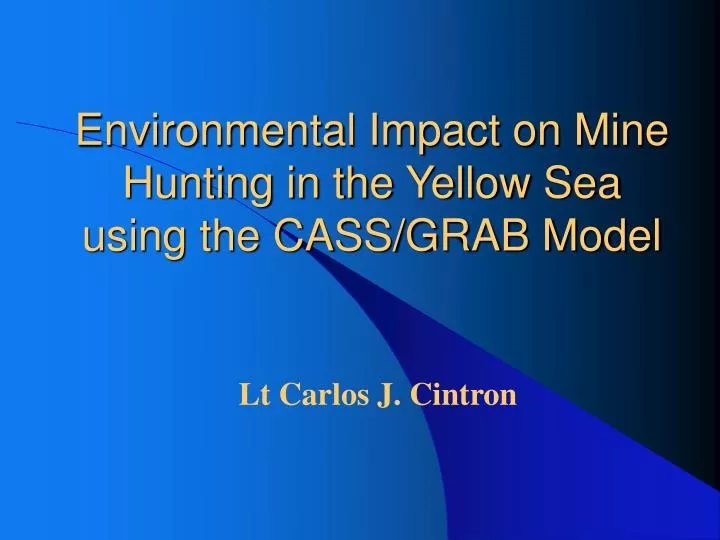
Environmental Impact on Mine Hunting in the Yellow Sea using the CASS/GRAB Model. Lt Carlos J. Cintron. Purpose of this study is to determine the necessity of a near real time ocean modeling capability such as MODAS for Mine Hunting applications in shallow water regions. Purpose.

E N D
Environmental Impact on Mine Hunting in the Yellow Sea using the CASS/GRAB Model Lt Carlos J. Cintron
Purpose of this study is to determine the necessity of a near real time ocean modeling capability such as MODAS for Mine Hunting applications in shallow water regions. Purpose
AN/SQQ-32 Mine Hunting Sonar System • The CASS/GRAB Acoustic model input file used in this study was designed to simulate the Acoustic Performance of the AN/SQQ-32. • The AN/SQQ-32 is the key mine hunting component of the U.S. Navy’s Mine Hunting and Countermeasure ships.
Yellow Sea Bottom Sediment Chart • Four Bottom Sediment types were chosen for this Study • Mud • Sand • Gravel • Rock
Yellow Sea Bottom Topography • Water depth in most of the region is less than 50 m. • Within 50 km of the Korean coastline the average water depth is 20 m.
Seasonal Temperature Profile Structures • (a) Winter and Fall Temperature Profile Structure. • Isothermal • (b) Spring and Summer Temperature Profile Structure. • Multi-layer • Mixed layer • Thermocline • Deep Layer
Oceanographic Data Sets • Master Oceanographic Observational Data Set (MOODS) • Generalized Digital Environmental Model (GDEM) • Modular Ocean Data Assimilation System (MODAS)
Master Oceanographic Observational Data Set (MOODS) • Historical world wide observational oceanographic profile data base dating back to 1920. • Consist of: • Temperature only profiles • Both Temperature and Salinity Profiles • Sound Speed profiles • Surface Temperatures • Biggest limitation is its irregular distribution over time and space.
Generalized Digital Environmental Model (GDEM) • Gridded Climatological Data derived from MOODS. • Global GDEM has a 30’ resolution • U.S. Navy’s Operationally important areas contain resolutions of 20’ and 10’. • Contains 3, 6, and 12 month data sets.
Modular Ocean Data Assimilation System (MODAS) • Climatological MODAS (Static) • Gridded Climatological Data derived from MOODS • Near real time Synthetic MODAS (Dynamic) • Inputs Satellite SST and SSH into Climatology via model algorithms to produce synthetic Temperature and Salinity fields which are in turn used to produce 3-Dimensional Sound Speed Fields. • MIODAS becomes degraded in shallow water regions because SSH is not entered into the model. • Altimetry is not entered into the MODAS model in waters less the 150 m due to satellite orbit errors and other model corrections which amplify the error levels near land.
Comprehensive Acoustic Simulation System/Guassian Ray Bundle (CASS/GRAB) • CASS/GRAB is an active and passive range dependent propagation, reverberation, and signal excess acoustic model that has been accepted as a Navy Standard for the frequency bands of 600 Hz to 100 kHz.
CASS/GRAB Model Description • The CASS model is the range dependent improvement of the Generic Sonar Model (GSM). CASS performs signal excess calculations. • The Grab model is a subset of the CASS model and its main function is to compute eigenrays and propagation loss as inputs in the CASS signal excess calculations.
Comprehensive Acoustic Simulation System/Guassian Ray Bundle (CASS/GRAB) • In the GRAB model, the travel time, source angle, target angle, and phase of the ray bundles are equal to those values for the classic ray path. • The main difference between the GRAB model and a classic ray path is that the amplitude of the Gaussian ray bundles is global, affecting all depths to some degree whereas classic ray path amplitudes are local. GRAB calculates amplitude globally by distributing the amplitudes according to the Gaussian equation
Generic Sound Speed Profile • Mixed layer • Surface duct may be generated with a negative shift in SST • Main Thermocline • Deep Sound Channel Axis • Deep Isothermal Layer
Monthly and Annual Mean Sound Speed comparison for Sand bottom for all 12 months • Sound Speed profiles transition from Isotherm in the winter to Multi-layer in the Summer
AN/SQQ-32 Concept • Variable depth high frequency sonar system • Sonar can be place at various positions in the water column to optimize the detection of either a moored or bottom mines. • In complimenting the AN/SQQ-32 mine hunting sonar system concept in this Study • Two source depths were chosen. • 25 ft (Above the Mixed Layer if present) • 125 ft (Within or below the Mixed Layer if present)
GDEM Seasonal Variability for Signal Excess GDEM /January/ Sand/ SD = 25 ft GDEM /June/ Sand/ SD = 25 ft
GDEM Seasonal Variability for Signal Excess GDEM /January/ Sand/ SD = 125 ft GDEM /June/ Sand/ SD = 125 ft
Acoustic Transmission Under Severe Weather Events • Track of Tropical Depression Kai-Tak over the Yellow Sea for 10-11 July 2000
Satellite Images of Tropical Depression Kai-Tak July 9, 2000 Tropical Cyclone over the Northern East China Sea July 8, 2000 Tropical Cyclone over the East China Sea July 10, 2000 Tropical Depression over the Yellow Sea July 11, 2000 Tropical Depression over the Northern Yellow Sea
Sound Speed and Maximum Detection Range Differences for a Mud Bottom region and a Source Depth of 25 ft
Sound Speed and Maximum Detection Range Differences for a Mud Bottom region and a Source Depth of 125 ft
Sound Speed and Maximum Detection Range Differences for a Sand Bottom region and a Source Depth of 25 ft
Sound Speed and Maximum Detection Range Differences for a Sand Bottom region and a Source Depth of 125 ft
A Significant Acoustic Difference in detection range as Defined by the Mine Warfare Community: A Significant Acoustic Differences in detection ranges as Defined by the Mine Warfare Community: Position of Detection ranges of Mine relative to Source Position of Detection ranges of Mine relative to Source A significant Acoustic Difference exists if: A significant Acoustic Difference exists if: If Both Detection Ranges are less than 600 yards If Both Detection Ranges are less than 600 yards D Detection Ranges > 100 Yards D Detection Ranges > 100 Yds If either of THE DETECTION Ranges are greater than or equal to 600 yards If either of The Detection Ranges are greater than or equal to 600 yards D Detection Ranges > 200 Yards D Detection Ranges > 200 Yds Significant Acoustic Differences in detection ranges as Defined by the Mine Warfare Community
Target Depth Target Depth Source Depth = 25 ft Source Depth = 25 ft Mud Mud Sand Sand July 10 – July 7 July 10 – July 7 July 15 – July 10 July 15 – July 10 July 10 – July 7 July 10 – July 7 July 15 – July 10 July 15 – July 10 26 ft 26 ft Lat 36.5N Lon 124.0E 490 yds Lat 36.5N Lon 124.0E 490 yds Figure 62 and 63 Lat 36.5N Lon 124.0E 490 yds Figure 62 and 63 Lat 36.5N Lon 124.0E 490 yds None None None None Bottom Bottom None None None None None None None None Maximum Significant Acoustic Difference in detection ranges for MODAS before and after the Tropical Depression (SD =25ft)
Target Depth Source Depth = 125 ft Mud Sand Target Depth Source Depth = 125 ft July 10 – July 7 Mud July 15 – July 10 July 10 – July 7 Sand July 15 – July 10 July 10 – July 7 July 15 – July 10 July 10 – July 7 July 15 – July 10 26 ft None None None None 26 ft None None None None Bottom Lat 36.5N Lon 124.0E 790 yds Figure 64 and 65 Lat 36.5N Lon 124.0E 810 yds Figure 66 and 67 None None Bottom Lat 36.5N Lon 124.0E 790 yds Lat 36.5N Lon 124.0E 810 yds None None Maximum Significant Acoustic Difference in detection ranges for MODAS before and after the Tropical Depression(SD=125ft)
Temperature and Sound Speed Comparisons • Slight Decrease in SST of 0.4 o C was observed between July 7 and 10 • -Possibly due to no SST input into the MODAS model from MCSSTS due to heavy cloud cover during the Tropical Depression. • A decrease in SST of 1.9 o C was observed between July 10 and 15. • -SST from MCSSTS may have been available for input for July 15, but effects of the Tropical depression on SST may have weaken by then. • The absence of SSH from Satellite Altimeters may have not allowed MODAS to capture the storms effect to the mixed layer
Ray Traces of Profiles with Significant Acoustic Differences Moored Mine Source Depth = 25 ft July 7, 2000/ Mud / DDR = 490yds July 10, 2000/ Mud/ DR = 770 yds July 15, 2000/ Mud /DDR =490yds
Signal Excess Contours of Profiles with Significant Acoustic Differences July 7, 2000/ Mud /DDR = 490yds Moored Mine Source Depth = 25 ft July 10, 2000/ Mud/ DR = 770 yds July 15, 2000/Mud/DDR = 490yds
Ray Traces of Profiles with Significant Acoustic Differences July 7, 2000/Mud/DDR = -775 yds Bottom Mine Source Depth = 125 ft July 10, 2000/ Mud/ DR = 0 yds July 15, 2000/Mud/DDR = -810 yds
Signal Excess Contours of Profiles with Significant Acoustic Differences July 7, 2000/Mud/DDR = -775yds Bottom Mine Source Depth = 125 ft July 10, 2000/ Mud/ DR = 0 yds July 15, 2000/Mud/DDR = -810yds
Target Depth 26 ft Target Depth = 26 ft Source Depth = 25 ft Source Depth = 25 ft Month Month Mud Mud Sand Sand 1999 1999 2000 2000 1999 1999 2000 2000 February February Lt 35.0N Ln 123.5E 760 yds Lt 35.0N Ln 123.5E 760 yds Lt 35.0N Ln 123.5E 760 yds Lt 35.0N Ln 123.5E 760 yds Lt 35.9N Ln 125.8E 840 yds Lt 35.9N Ln 125.8E 840 yds Lt 35.9N Ln 125.8E 840 yds Lt 35.9N Ln 125.8E 840 yds May May Lt 35.0N Ln 123.0E 795 yds Lt 35.0N Ln 123.0E 795 yds Lt 35.0N Ln 123.0E 780 yds Lt 35.0N Ln 123.0E 780 yds Lt 35.9N Ln 126.0E 795 yds Lt 35.9N Ln 126.0E 795 yds Lt 35.9N Ln 126.0E 810 yds Lt 35.9N Ln 126.0E 810 yds August August Lt 35.9N Ln 124.4E 545 yds Lt 35.9N Ln 124.4E 545 yds Lt 35.9N Ln 124.4E 535 yds Lt 35.9N Ln 124.4E 535 yds Lt 35.9N Ln 124.8E 820 yds Lt 35.9N Ln 124.8E 820 yds Lt 35.9N Ln 124.8E 815 yds Lt 35.9N Ln 124.8E 815 yds November November Lt 36.5N Ln 123.0E 840 yds Lt 36.5N Ln 123.0E 840 yds Lt 36.5N Ln 123.0E 840 yds Lt 36.5N Ln 123.0E 840 yds Lt 35.9N Ln 125.8E 765 yds Lt 35.9N Ln 125.8E 765 yds Lt 35.9N Ln 125.8E 765 yds Lt 35.9N Ln 125.8E 765 yds Maximum Significant Acoustic Differences in detection ranges for MODAS versus MOODS
Target Depth = 26 ft Source Depth = 25 ft Month Mud Sand Target Depth = Bottom Source Depth = 25 ft Month 1999 Mud 2000 1999 Sand 2000 February Lt 35.0N Ln 123.5E 760 yds 1999 Lt 35.0N Ln 123.5E 760 yds 2000 Lt 35.9N Ln 125.8E 840 yds 1999 Lt 35.9N Ln 125.8E 840 yds 2000 February Lt 35.0N Ln 123.5E 900 yds Lt 35.0N Ln 123.5E 890 yds None None May Lt 35.0N Ln 123.0E 795 yds Lt 35.0N Ln 123.0E 780 yds Lt 35.9N Ln 126.0E 795 yds Lt 35.9N Ln 126.0E 810 yds May None None None None August Lt 35.9N Ln 124.4E 545 yds Lt 35.9N Ln 124.4E 535 yds Lt 35.9N Ln 124.8E 820 yds Lt 35.9N Ln 124.8E 815 yds August None None None None November Lt 36.5N Ln 123.0E 840 yds Lt 36.5N Ln 123.0E 840 yds Lt 35.9N Ln 125.8E 765 yds Lt 35.9N Ln 125.8E 765 yds November None None None Maximum Significant Acoustic Differences in detection ranges for MODAS versus MOODS None
Target Depth = 26 ft Target Depth 26 ft Source Depth = 50/ 75/ 125 ft Source Depth = 25 ft Month Month Mud Mud Sand Sand 1999 1999 2000 2000 1999 1999 2000 2000 February February Lt 35.0N Ln 123.5E 495 yds Lt 35.0N Ln 123.5E 760 yds Lt 35.0N Ln 123.5E 510 yds Lt 35.0N Ln 123.5E 760 yds None Lt 35.9N Ln 125.8E 840 yds None Lt 35.9N Ln 125.8E 840 yds May May Lt 36.3N Ln 125.0E 620 yds Lt 35.0N Ln 123.0E 795 yds Lt 36.3N Ln 125.0E 620 yds Lt 35.0N Ln 123.0E 780 yds NA Lt 35.9N Ln 126.0E 795 yds NA Lt 35.9N Ln 126.0E 810 yds August August None Lt 35.9N Ln 124.4E 545 yds None Lt 35.9N Ln 124.4E 535 yds Lt35.9N Ln124.6E 545 yds Lt 35.9N Ln 124.8E 820 yds Lt35.9N Ln124.6E 545 yds Lt 35.9N Ln 124.8E 815 yds November November Lt 35.0N Ln 123.0E 445 yds Lt 36.5N Ln 123.0E 840 yds Lt 35.0N Ln 123.0E 445 yds Lt 36.5N Ln 123.0E 840 yds Lt36.0N Ln124.8E 495 yds Lt 35.9N Ln 125.8E 765 yds Lt 36.0NLn124.8E 495 yds Lt 35.9N Ln 125.8E 765 yds Maximum Significant Acoustic Differences in detection ranges for MODAS versus MOODS
Target Depth = 26 ft Target Depth Bottom Source Depth = 50/ 75/ 125 ft Source Depth = 25 ft Month Month Mud Mud Sand Sand 1999 1999 2000 2000 1999 1999 2000 2000 February February Lt 36.4N Ln 124.4E 1000 yds Lt 35.0N Ln 123.5E 760 yds Lt 35.0N Ln 123.5E 760 yds Lt 36.4N Ln 124.4E 1000 yds Lt 35.9N Ln 125.8E 840 yds None None Lt 35.9N Ln 125.8E 840 yds May May Lt 36.3N Ln 125.0E 225 yds Lt 35.0N Ln 123.0E 795 yds Lt 35.0N Ln 123.0E 780 yds Lt 36.3N Ln 125.0E 315 yds Lt 35.9N Ln 126.0E 795 yds NA NA Lt 35.9N Ln 126.0E 810 yds August August None Lt 35.9N Ln 124.4E 545 yds Lt 35.9N Ln 124.4E 535 yds None Lt 35.9N Ln 124.8E 820 yds Lt35.9NLn 125.8E 265 yds Lt 35.9N Ln 125.8E 225 yds Lt 35.9N Ln 124.8E 815 yds November November None Lt 36.5N Ln 123.0E 840 yds Lt 36.5N Ln 123.0E 840 yds None Lt 35.9N Ln 125.8E 765 yds Lt35.9NLn 124.6E 205 yds Lt 35.9N Ln 124.6E 205 yds Lt 35.9N Ln 125.8E 765 yds Maximum Significant Acoustic Differences in detection ranges for MODAS versus MOODS
MODAS versus MOODS Target Depth = 26 ft Source Depth = 25 ft Month Mud Sand February for Mud Bottom Type 1999 2000 1999 2000 1. Oceanographic Difference between MODAS and MOODS Differences are due to a deficiency in the MODAS climatology, which gives the MODAS profiles a near bottom positive gradient. (See Text) February Lt 35.0N Ln 123.5E 760 yds Lt 35.0N Ln 123.5E 760 yds Lt 35.9N Ln 125.8E 840 yds Lt 35.9N Ln 125.8E 840 yds 2. How did this affect the Acoustic Model This near bottom positive gradient produced up bending near the bottom. When the Source was at hull depth both moored and bottom mines detection ranges were over predicted. When the Source was at 125 ft moored mines detection ranges were over predicted and bottom mines detection ranges were under predicted. May Lt 35.0N Ln 123.0E 795 yds Lt 35.0N Ln 123.0E 780 yds Lt 35.9N Ln 126.0E 795 yds Lt 35.9N Ln 126.0E 810 yds August Lt 35.9N Ln 124.4E 545 yds Lt 35.9N Ln 124.4E 535 yds Lt 35.9N Ln 124.8E 820 yds Lt 35.9N Ln 124.8E 815 yds 3. Prevalence of Problems if any in the Yellow Sea or North East China Sea This problem was present in approximately 15 % of the MODAS profiles in the Yellow Sea. November Lt 36.5N Ln 123.0E 840 yds Lt 36.5N Ln 123.0E 840 yds Lt 35.9N Ln 125.8E 765 yds Lt 35.9N Ln 125.8E 765 yds Oceanographic Difference between MODAS and MOODS
Near Bottom Positive Gradient Error Mud bottom/ February/ 35.0 N 123.5 E/ Source Depth = 125 ft MODAS MOODS
Near Bottom Positive Gradient Error Mud bottom/ February/ 35.0 N 123.5 E/ Source Depth = 125 ft MODAS MOODS
Target Depth = 26 ft MODAS versus MOODS Source Depth = 25 ft Month Mud Sand November/ Mud Bottom 1999 2000 1999 2000 1. Oceanographic Difference between MODAS and MOODS Differences were due to the presence of a surface duct when the source depth was at 25 ft. When there was a surface duct in both profiles, it was much stronger in the MOODS profile for most cases. In most cases, MODAS produced surface ducts that were weaker than would be expected. MODAS weakens the gradients in the thermocline. February Lt 35.0N Ln 123.5E 760 yds Lt 35.0N Ln 123.5E 760 yds Lt 35.9N Ln 125.8E 840 yds Lt 35.9N Ln 125.8E 840 yds May Lt 35.0N Ln 123.0E 795 yds Lt 35.0N Ln 123.0E 780 yds Lt 35.9N Ln 126.0E 795 yds Lt 35.9N Ln 126.0E 810 yds 2. How did this affect the Acoustic Model The surface ducts produce greater detection ranges for a moored mine. The weaker surface ducts produced by MODAS sometimes under predicted the detection range of a moored mine. No significant acoustic differences were observed for a bottom mine due to the presence or absence of a surface duct. When the source depth was within the thermocline the weaker thermocline gradients produced by MODAS caused less down bending of sound propagation. This produced weaker caustics due to less focusing of sound propagation, which in turn caused an under prediction of moored mines. (See Text) August Lt 35.9N Ln 124.4E 545 yds Lt 35.9N Ln 124.4E 535 yds Lt 35.9N Ln 124.8E 820 yds Lt 35.9N Ln 124.8E 815 yds November Lt 36.5N Ln 123.0E 840 yds Lt 36.5N Ln 123.0E 840 yds Lt 35.9N Ln 125.8E 765 yds Lt 35.9N Ln 125.8E 765 yds 3. Prevalence of Problems if any in the Yellow Sea or North East China Sea The weaker surface ducts found in the MODAS profiles cannot be determined to be a problem without performing a study of the MODAS climatology. Weaker MODAS thermocline gradients were observed in approximately over 75 % of the MODAS profiles used in this study. Oceanographic Difference between MODAS and MOODS
Weakening of Surface Duct Mud bottom/ November/ 36.5 N 123.0 E/ Source Depth = 25 ft MODAS MOODS
Weakening of Thermocline Mud bottom/ November/ 35.0 N 123.0 E/ Source Depth = 125 ft MODAS MOODS
Target Depth = 26 ft Target Depth = 26 ft Target Depth Target Depth Source Depth = 125 ft Source Depth = 25 ft Source Depth = 25 ft Source Depth = 25 ft Mud Mud Month Month Mud Mud Sand Sand Sand Sand Error (m/s) Error (m/s) 1999 1999 2000 2000 Error (m/s) Error (m/s) 1999 1999 2000 2000 1 1 February February Lt 35.0N Ln 123.5E 760 yds Lt 35.0N Ln 123.5E 760 yds 5 5 10 10 Lt 35.0N Ln 123.5E 760 yds Lt 35.0N Ln 123.5E 760 yds 1 1 Lt 35.9N Ln 125.8E 840 yds Lt 35.9N Ln 125.8E 840 yds 5 5 Lt 35.9N Ln 125.8E 840 yds Lt 35.9N Ln 125.8E 840 yds 10 10 26 ft 26 ft Lt35.4N Ln 124.4E 735 yds Lt 35. 0N Ln 123.5E 390 yds Lt 36.4N Ln 124.4E 885 yds Lt 35.4N Ln 124.4E 735 yds Lt 35.4N Ln 124.4E 735 yds Lt 35.9N Ln 124.4E 885 yds Lt 36.3N Ln 125.0E 845 yds None Lt 35.9N Ln 125.9E 390 yds Lt 36.3N Ln 125.0E 845 yds Lt 36.3N Ln 125.0E 845 yds Lt 35.9N Ln 124.6E 565 yds May May Lt 35.0N Ln 123.0E 795 yds Lt 35.0N Ln 123.0E 795 yds Lt 35.0N Ln 123.0E 780 yds Lt 35.0N Ln 123.0E 780 yds Lt 35.9N Ln 126.0E 795 yds Lt 35.9N Ln 126.0E 795 yds Lt 35.9N Ln 126.0E 810 yds Lt 35.9N Ln 126.0E 810 yds Bottom Bottom None Lt 36.4N Ln 124.4E 1000 yds Lt 35.1N Ln 124.3E 875 yds Lt 35.4N Ln 124.4E 1000 yds Lt 35.0N Ln 123.5E 990 yds Lt 35.4N Ln 124.4E 1000 yds None Lt 36.4N Ln 124.6E 115 yds Lt 35.9N Ln 125.9E 320 yds None Lt 36.4N Ln 124.6E 210 yds Lt 35.9N Ln 124.6E 665 yds August August Lt 35.9N Ln 124.4E 545 yds Lt 35.9N Ln 124.4E 545 yds Lt 35.9N Ln 124.4E 535 yds Lt 35.9N Ln 124.4E 535 yds Lt 35.9N Ln 124.8E 820 yds Lt 35.9N Ln 124.8E 820 yds Lt 35.9N Ln 124.8E 815 yds Lt 35.9N Ln 124.8E 815 yds November November Lt 36.5N Ln 123.0E 840 yds Lt 36.5N Ln 123.0E 840 yds Lt 36.5N Ln 123.0E 840 yds Lt 36.5N Ln 123.0E 840 yds Maximum Acoustic Difference in detection ranges for MODAS Versus MODAS plus Gaussian error in Sound speed February
Target Depth = 26 ft Target Depth Target Depth Target Depth = 26 ft Source Depth = 125 ft Source Depth = 25 ft Source Depth = 25 ft Source Depth = 25 ft Mud Mud Month Month Mud Mud Sand Sand Sand Sand Error (m/s) Error (m/s) 1999 1999 2000 2000 Error (m/s) Error (m/s) 1999 1999 2000 2000 1 1 February February Lt 35.0N Ln 123.5E 760 yds Lt 35.0N Ln 123.5E 760 yds 5 5 10 10 Lt 35.0N Ln 123.5E 760 yds Lt 35.0N Ln 123.5E 760 yds 1 1 Lt 35.9N Ln 125.8E 840 yds Lt 35.9N Ln 125.8E 840 yds 5 5 Lt 35.9N Ln 125.8E 840 yds Lt 35.9N Ln 125.8E 840 yds 10 10 26 ft 26 ft Lt 35.4N Ln 124.4E 550 yds None None Lt 35.4N Ln 124.4E 560 yds Lt 35.4N Ln 124.4E 600 yds None Lt 36.4N Ln 125.9E 810 yds Lt 36.4N Ln 124.4E 530 yds Lt 36.4N Ln 125.9E 785 yds Lt 36.4N Ln 124.6E 440 yds None Lt 36.4N Ln 124.4E 380 yds May May Lt 35.0N Ln 123.0E 795 yds Lt 35.0N Ln 123.0E 795 yds Lt 35.0N Ln 123.0E 780 yds Lt 35.0N Ln 123.0E 780 yds Lt 35.9N Ln 126.0E 795 yds Lt 35.9N Ln 126.0E 795 yds Lt 35.9N Ln 126.0E 810 yds Lt 35.9N Ln 126.0E 810 yds Bottom Bottom None None Lt 36.4N Ln 124.4E 595 yds None None None None Lt 36.4N Ln 124.6E 340 yds Lt 35.9N Ln 124.6E 590 yds Lt 36.4N Ln 124.6E 375 yds Lt 36.4N Ln 124.6E 755 yds None August August Lt 35.9N Ln 124.4E 545 yds Lt 35.9N Ln 124.4E 545 yds Lt 35.9N Ln 124.4E 535 yds Lt 35.9N Ln 124.4E 535 yds Lt 35.9N Ln 124.8E 820 yds Lt 35.9N Ln 124.8E 820 yds Lt 35.9N Ln 124.8E 815 yds Lt 35.9N Ln 124.8E 815 yds November November Lt 36.5N Ln 123.0E 840 yds Lt 36.5N Ln 123.0E 840 yds Maximum Acoustic Difference in detection ranges for MODAS Versus MODAS plus Gaussian error in Sound speed August
Histograms of the Acoustic Difference Distribution throughout the Water Column for Source Depth = 125 ft, Mud bottom February 15, 2000 August 15, 2000
Effect of Sound Speed Error at Source Depth No Error +1 m/s Error -1 m/s Error
Conclusion • Capability of CASS/GRAB model … • Strong seasonal variability in acoustic transmission (detection range, signal excess) …. • Effect of the tropical cyclone on acoustic transmission … • Error propagation from sound speed profile to signal excess • Capability of MODAS • Weakness of MODAS • Future Work