Download
1 / 33
330 likes | 403 Views
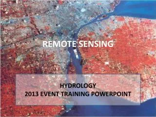
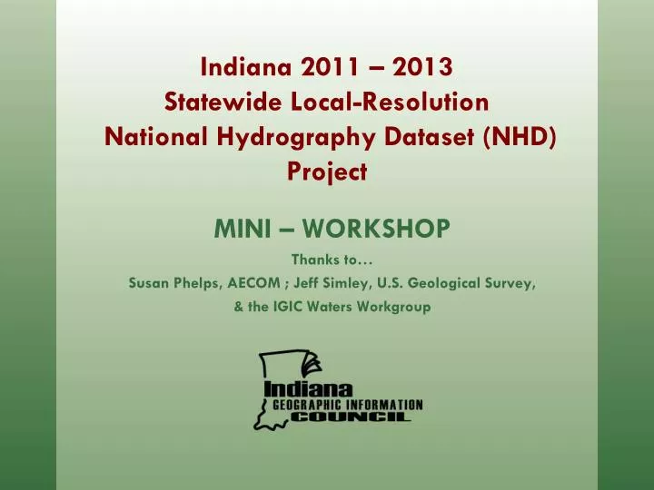
MINI – WORKSHOP Thanks to… Susan Phelps, AECOM ; Jeff Simley, U.S. Geological Survey, & the IGIC Waters Workgroup. Indiana 2011 – 2013 Statewide Local-Resolution National Hydrography Dataset (NHD) Project. Topics. Project Background Approach Project Tasks Conversion Conflation

E N D
MINI – WORKSHOP Thanks to… Susan Phelps, AECOM ; Jeff Simley, U.S. Geological Survey, & the IGIC Waters Workgroup Indiana 2011 – 2013Statewide Local-Resolution National Hydrography Dataset (NHD) Project
Topics • ProjectBackground • Approach • Project Tasks • Conversion • Conflation • Status / Next Steps
What is the USGS National Hydrography Dataset (NHD)? • Feature-based database of nation’s surface water drainage system maintained by the USGS • Network of streams, rivers, and other flowlines; lakes, ponds, and other waterbodies • Suitable for modeling water flow & geocoding local features and events
What is the USGS NHD? • Flowline (Stream/River, Canal/Ditch, Artificial Path) • Waterbody (Lake/Pond, Swamp/Marsh, Reservior) • Areas (Large Stream/River, Large Canal/Ditch) • Points (Gaging Station, Well) • Lines (Dams)
Data Organized into Hydrologic Units • Hydrologic Units Codes (HUC) assigned to each
Data Organized into Hydrologic Units • HUC & WBD Maintained by USGS with the help of StatedataStewards
Background Streams – the fundamental core of the NHD
Background Flow Direction – giving intelligence to the data
Background Navigation – Creating fundamental knowledge
Background Navigation – Where does a toxic spill go?
Background Linear Referencing – Stream “Reaches”
Background Linear Referencing – Stream addresses
Improving the NHD for Indiana Current: • Features in current NHD based upon 1:24,000 USGS Topographic Quad Maps • Most users require data at better scale • Features have changed since Maps were created Update NHD using 2005 Ortho & DEM products: • Updates of physical features (existence, location) • New (Local-res) Data would be at scale of 1:2,400
Local-Resolution NHD Example High-resolution NHD 1:24,000 Scale (1”=2,000’) Local-resolution NHD 1:2,400 Scale (1”=200’)
Local-Resolution NHD Example Production done by HUC 8 (Subbasins) Existing 1:24,000 High-Resolution NHD
Local-Resolution NHD Example New 1:1,200 or 1:2,400 Local-Resolution NHD Developed for 6AC Sub-catchment derived from 2005 DEM
Local-Resolution NHD Example New 1:1,200 or 1:2,400 Local-Resolution NHD Developed for 6AC Sub-catchment derived from 2005 DEM and matched to 2005 orthophotography
Local-Resolution NHD Example End Result = New 1:1,200 or 1:2,400 scale Local-Resolution NHD
Approach Pilot study conducted in Summer 2009 • Small watershed in Hamilton County(Morse Reservoir and agricultural land) • Broad representation of the waterfeatures to be included in the statewideproject • Designed to provide a basis for streamlocation accuracy and upstreamdrainage area limit assessments • Results = Impressive Results andBaseline budget established (15% more local-resolution hydro captured than what County GIS maintained)
Approach Statewide project completed by HUC-8 watershed sub-basin in phases: • AECOM Selected for Contractwith the State in 2010 • Local subcontractors will assistwith hydrography development(Cripe & Pinnacle) • Upper Eel will be first sub-basin completed • Linework will undergo QC and approval by IGIC Waters workgroup prior to conflation • Attribute conflation will undergo QC and approval by IGIC Waters workgroup and USGS before work begins on additional sub-basins • 37 additional sub-basins in state (28 funded by OCRA, 8 remaining – future GLI or other funding)
Approach • Creation of local-resolution hydrography • 5 feature types collected • Flowline (Stream/River, Canal/Ditch, Artificial Path) • Waterbody (Lake/Pond, Swamp/Marsh, Reservior) • Area (Large Stream/River, Large Canal/Ditch) • Point (Gaging Station, Well) – pass through from high-resolution • Line (Dams) - pass through from high-resolution
Approach • Base Data • Imagery • 2005 one foot and/or half foot pixel RGB orthophotography • Terrain (Contours, DEMs, Hillshades) • 2005 five foot post-spacing DEM (ISTAR) • Supplemented by newer and/or more accurate local data where available (e.g. 2011 -2013 Ortho/LiDAR)
Approach • Reference Files • Local Hydrography provided by the State • National Wetlands Inventory (NWI) • INDNR Dams • Karst Dyelines • DOT Bridges • 24K NHD
Project Tasks - Conversion • Hydro-correct elevation data • Generate 6 acre basins and streams for reference (guidance for upstream limits and stream location) • Generate contours, DEMs, hillshades for reference
Project Tasks - Conversion • Digitize NHD features • Create 1:2,400 or 1:1,200 scale hydrography layer (dependent upon imagery source) to the 6 acre upstream drainage limit • Imagery will be primary source for data conversion, terrain data used where features are not visible • 1:24K NHD used as referenceto ensure all features havebeen incorporated • Hydrography edge-matched to1:24K NHD along state borders
Project Tasks - Conversion • Prep data for conflation • The NHDinGeo version 2.0 database schema will be used • Combination of USGS scripts, and ArcGIS 9.3 tools to check: • Topology • Flow direction • FCode population • Artificial paths • Connectors
Project Tasks - Conflation • Conflation of1:24K NHD attributes and data population for new features • USGS NHD GeoConflation Toolset • Reach codes, GNIS info conflated from 1:24K NHD, and generated for new features using the USGS NHD tools • Intermittent/Perennial designations conflated for1:24K attributes only
Project Tasks - Conflation • 5. Quality Control of conflation • Most performed through NHD GeoConflation queues at various stages • After permanent reach codes assigned, checks for gapped or branched reach codes • Checks for gapped or branched GNIS names • Subsequent processing steps cannot proceed until potential problems have been resolved * Close coordination with and approval by State & USGS
Project Tasks - Conflation • Waters Workgroup will check out 1:24K NHD sub-basins as conflation occurs to avoid any other edits being made to the sub-basin • Feature level, FGDC compliant metadata generated for each sub-basin
Status / Next Steps • Status • Completed conflation training with USGS • Base data received for Upper Eel pilot area • Next Steps • Complete conversion and conflation tasks for Upper Eel pilot area • 3 iterations of QC performed by Indiana’s QC team • Prioritize work, outline schedule for remaining sub-basins