Download
1 / 22
220 likes | 327 Views
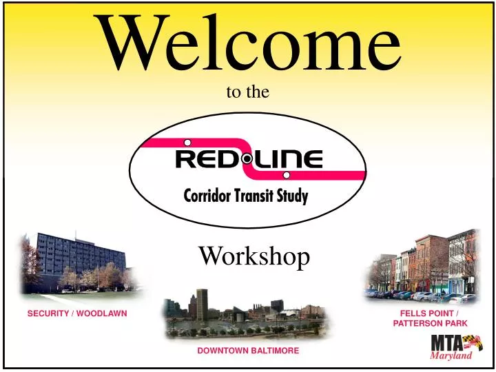
Welcome to the. Workshop. SECURITY / WOODLAWN. FELLS POINT / PATTERSON PARK. DOWNTOWN BALTIMORE. Red Line Study. Today’s Meeting. Welcome Presentation………………….. 30 Minutes Station Break-out Tables……. 60 Minutes Report Back…………………... 20 Minutes

E N D
Welcome to the Workshop SECURITY / WOODLAWN FELLS POINT / PATTERSON PARK DOWNTOWN BALTIMORE
Red Line Study Today’s Meeting • Welcome • Presentation………………….. 30 Minutes • Station Break-out Tables……. 60 Minutes • Report Back…………………... 20 Minutes • Open House…………………... 30 Minutes
Red Line Study Improving our Quality of Life • Quality transit can contribute to a better quality of life for citizens in the Baltimore region. • Support Neighborhoods and Communities • Stimulate the Local Economy • Provide Better Access to Jobs • Improve Existing Transit • Provide Choices to Driving • Reduce Congestion • Improve Air Quality – Reduce Auto Emission
Red Line Study MTA – Committed to improving what we have today • Bus System • Greater Baltimore Bus Initiative • Light Rail System • Completion of Double Track Facilities • Metro System • Overhaul of Rail Cars • MARC Service between Baltimore and Washington • Expanded Parking
PRIORITY PROJECTS Red Line between Social Security and Fells Point Green Line from Johns Hopkins Medical Campus to Morgan State University How can MTA Expand To Make Transit Better Baltimore Region Transit Plan: Adopted 2002
How can MTA Expand To Make Transit Better Why we are studying the Red Line: • Create a more comprehensive regional transit system • Improve transit in an already heavily used transit corridor – east and • west Baltimore City and western Baltimore County • Improve connections to existing north-south transit – Bus, Metro, • Light Rail, and MARC • Improve access to major job centers: • SSA / CMS • University of Maryland Complex • Downtown Baltimore • Inner Harbor East • Fells Point / Canton • Reduce Congestion
How can MTA Expand To Make Transit Better Guiding Principles of the Red Line • The Red Line should provide simple to use, reliable, frequent and rapid transit service along the corridor. • The transit experience needs to be a convenient and positive experience – at departure, during the ride, and upon arrival. • The Red Line should benefit the communities it travels through. It should foster economic development that will create jobs, build community wealth, and improve the quality of life. • The MTA will plan the Red Line to minimize the potential for community residents and businesses to be displaced or reduced in value. • The MTA will seek to mitigate construction impacts to the maximum extent possible.
Activities / Input To Date Baltimore Region Transit Plan:Plan Completed. Red Line and Green Line identified as priority projects. Summer 2002 Project Scoping:Formal public initiation of project. Public and Agency scoping meetings held. Spring 2003 Public Meetings:Initial corridor concepts presented at seven Open House Meetings. Fall 2004 Fall 2004 - Spring 2005 Community Working Groups:Community Working Groups formed in five areas to focus on the project at the community level. Public Meetings:Team presented preliminary recommendations on alignments to retain or eliminate and received public input of alternatives under consideration. Spring 2005 Alternatives Analysis:Study Team technical analysis and solicitation of feedback from local governments and the public. Ongoing (started in Spring 2005) Public Workshops:Presented reduced set of alternatives at workshops. Meetings provided opportunity for the public to express comments about the alternatives. November 2005 Ongoing Speakers Bureau:Study Team has attended community meetings to provide project information and learn about local priorities and concerns. (35 meetings have occurred to date)
Activities / Input To Date Comments from Open Houses • The following represents the kinds of things we heard from the • community at previous Public Meetings: • The Red Line must connect to other bus and rail lines • The Red Line must be efficient and easy to use • The Red Line should fit in with the existing community’s needs including parking, aesthetics, and safety • People are concerned with how businesses and residences could be impacted during construction • People are concerned with private property impacts and acquisition. • The Red Line should place an emphasis on pedestrian accessibility (specifically children and seniors) and safety at station locations • People are concerned with how the surface options will affect traffic and parking • People are interested in how commuter parking will be provided at each end of the line • People are concerned about noise and vibration • People showed a general preference for tunnels and want to understand how a tunnel fits within the community ALL OF THESE ISSUES AND COMMENTS WILL BE ADDRESSED AS PART OF OUR PUBLIC REPORTS.
Activities / Input To Date Additional Segments Dropped • As the study has progressed, we have continued to refine and drop segments. Since the November 2005 Open Houses the following segments have been dropped. • I-70 West Park & Ride and connections • Alignment and station across the middle of the Social • Security Complex • Eutaw Street / Paca Street Couplet • These segments are shown in the Open House Displays.
Activities / Input To Date Alternatives • Previous meetings have shown numerous segment pieces. The individual segments have been connected to develop end to end alternatives. A total of 8 alternatives have been development for detailed analysis. These include different combinations and lengths of: • Shared Use Surface Transit Way • Dedicated Surface Transit Way • Tunnels
Activities / Input To Date Alternatives • The 8 Alternatives include: • Alternative 1: No-Build • Alternative 2: Bus Transportation System Management • Alternative 3A BRT / 3B LRT: Dedicated Surface • Alternative 4 BRT: Surface • Alternative 5 BRT: Downtown Tunnel and Shared Use Surface • Alternative 6A BRT / 6B LRT: Downtown Tunnel and Dedicated • Surface • Alternative 7A BRT / 7B LRT: Downtown and Cooks Lane Tunnel and • Dedicated Surface • Alternative 8A BRT / 8B LRT: Tunnels from I-70 to Patterson Park • and Dedicated Surface These Alternatives will be outlined within our public reports. The final selected alternative may be one of these alternatives or a combination of features from several alternatives. These segments are shown in the Open House Displays and can be found on the project website.
Activities / Input To Date Maintenance Facilities • With any Alternative, Maintenance Facilities need to be • analyzed in order to accommodate the following types of activities: • Routine Vehicle Inspections • Vehicle Cleaning • Maintenance Activities • Material / Equipment Storage • Based on the capacity of the current MTA Maintenance Facilities, • the Red Line may require new facilities to accommodate newer • Vehicles.
Red Line Study Red Line Project Timeline Timeframe 2003 - 2007 2007 - 2010 2010 – 2014 * • Planning / Environmental Phase • Engineering Phase • Construction Phase - Subject to Funding *
Station Planning Process Stations The planning of stations will be critical to the overall success of the Red Line. Stations will be designed to meet community and transit needs.
Station Planning Process Determine the number and general location of stations Define the type of station: Walk-up Station, Park-N-Ride Station, or Transit Center Public Involvement Identify specific station location Conceptual Design community friendly stations
Social Security Administration / Woodlawn Center for Medicare and Medicaid Services (CMS) Residential Communities – East and West Baltimore City and County West Baltimore Rail Station (MARC) University Center (Medical Center and University) Connection to existing Metro, Bus and Light Rail Downtown Baltimore Tourism and Stadium Events Inner Harbor East Fells Point and Canton Auto Commuters using I-70 and I-695 Station Planning Process Key Areas to Service with Transit SECURITY / WOODLAWN FELLS POINT / PATTERSON PARK DOWNTOWN BALTIMORE
Neighborhood Walk-Up Station Neighborhood Walk-Up Station with Parking Station with Bus Connections Downtown Walk-up Station Station with Parking for Regional Access Tunnel Station Station Planning Process Types of Stations
Station Planning Process Items to Consider as Part of Developing Stations Character of Station: The architecture of the stations should reflect the neighborhoods. They will be consistent with existing master plans. Interconnectivity: Transfers between modes should be designed to provide a seamless ride. Pedestrian Access: Pedestrian connections to the station areas should be safe and convenient between the community and transit station. Safety: Safety at station areas should be addressed with adequate lighting, security, and station maintenance. Parking: Each station will be identified for either commuter parking, local parking, or no parking.
Station Planning Process Stations and Community Planning • Community Planning is intended to: • Strengthen existing communities and guide future growth • Provide types of development, or no development, as appropriate to communities • Promote and encourage transit ridership • Provide for walkable connections between the community and transit stops • Be car-accessible, but not car-dominated Owings Mills, Maryland State Center, Maryland A Residential Neighborhood, Dallas
Station Tables for Today’s Meeting West Baltimore MARC Harlem Park / Poppleton Station Area University Center Central Business District (2 tables) Charles Center Inner Harbor Inner Harbor East Inner Harbor East Pier 5 Central Avenue How can the Red Line benefit your community? Where should the Station be located? Station Planning Process Station Break-Out Sessions
Red Line Study Today’s Meeting • Welcome • Presentation …………………. 30 Minutes • Station Break-out Tables ……….. 60 Minutes • Report Back ……………………… 20 Minutes • Open House ……………………... 30 Minutes Thank you for your participation!