Download
1 / 24
240 likes | 242 Views
A regional project aimed at improving tropical cyclone track forecast skill over the North Western Pacific through the use of ensemble data. Accessible online with password protection.

E N D
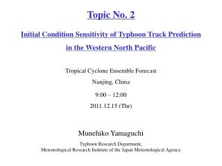
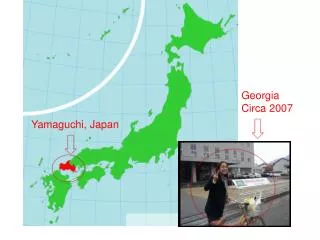
Topic No. 6 North Western Pacific Tropical Cyclone Track Ensemble Forecast (NWP-TCTEF) Tropical Cyclone Ensemble Forecast Nanjing, China 9:00 – 12:00 2011.12.15 (Thr) Munehiko YamaguchiTyphoon Research Department, Meteorological Research Institute of the Japan Meteorological Agency
WWRPNorth WP TC Ensemble Forecast ProjectA WWRP Research Development Project ❖A five-year regional project with both a research and operational component that will feed into national efforts such as for the Shanghai MHEWS Project and Landfall Typhoon Forecast Demonstration Project. ❖Intent is to make GIFS-TIGGE typhoon track data available to ESCAP/WMO Typhoon Committee members including RSMCs in real time beginning May 2010 via a password protected web site ❖Training for operational forecasters and evaluation of the utility of such data sets in a forecast environment ❖Research efforts will attempt to develop and extract useful information from TIGGE ensemble data and develop products where appropriate Courtesy of T. Nakazawa
Cyclone XML (CXML) Homepage The NWP-TCTEF project intends to build on the TIGGE concept and take advantage of the TIGGE CXML data provided by multiple organizations for improving TC track forecast skill over the North Western Pacific. Courtesy of T. Nakazawa
TIGGE CXML Data Accessibility Courtesy of T. Nakazawa
NWP-TCTEF Homepage The Meteorological Research Institute of the Japan Meteorological Agency (MRI/JMA) created a website for the NWP-TCTEF project. URL: http://tparc.mri-jma.go.jp/cyclone/ Main Page Send e-mail to thorpex@mri-jma.go.jp to get ID and password
List of available products - TC track - Deterministic forecast Ensemble forecast Strike Probability Point Strike Probability
Deterministic TC track forecast Track forecasts from ECMWF, JMA, MSC and NCEP are available as of December 2011. Red: 0-24h forecast Green: 24-48h forecast Purple: 48-72h forecast Blue: 72-96h forecast Best track Six-hourly plotted
Ensemble TC track forecast -MCGE- Track forecasts from CMA (ensemble size is 15), ECMWF (51), JMA Typhoon EPS (11), JMA One-week EPS (51), KMA (17), MSC (21), NCEP (21), STI (9) and UKMO (24) are available as of December 2011. Ensemble TC track forecast by all ensemble member of all centers. (Ensemble TC track forecast by each center is also available)
Strike probability map Probability that the center of a storm will pass within 120 km of a location during a 96 hour time interval is shown. Contour levels shown are 5-20% (green), 20-40% (yellow), 40-60% (orange), 60-80% (red) and 80-100% (purple).
Point strike probability map Time series of strike probability at a selected location (city). Y-axis on the left shows the strike probability at city ILAGAN, and the Y-axis on the right shows the distance between ILGAN and a TC center. Time
Severe Weather Forecasting Demonstration Project (SWFDP) WMO • Vision for improving severe weather forecasting and warning services in developing countries (Cg-XV, 2007) • “NMHSs in developing countries are able to implement and maintain reliable and effective routine forecasting and severe weather warning programmes through enhanced use of NWP products and delivery of timely and authoritative forecasts and early warnings, thereby contributing to reducing the risk of disasters from natural hazards.” • WMO Strategic Thrusts • Improved Service Quality and Service Delivery • Improved delivery and access to high quality weather, water, related environmental predictions, information, and services • Reduced risks and potential impacts of hazards • Strengthening Capacity Building Courtesy of Y. Honda
SWFDP Regional Subprojects The regional subprojects have been conducted and proposed over the globe.
Proposed SWFDP – Southeast Asia The Severe Weather Forecasting Demonstration Project (SWFDP) is an good opportunity to evaluate the usefulness of GIFS-TIGGE products in operational forecasting. The NWP-TCTEF project is willing to provide the NWP-TCTEF products for the SWFDP. WMO • SWFDP – Southeast Asia status/progress • Focus on strong winds and heavy precipitation (mainly TC-related) and associated hazards (e.g. flooding, landslides, storm surges, swell) • Domain: 10°S, 40°N, 80°E and 140°E • Global Centres: CMA, JMA and KMA (NWP guidance material, satellite products) and DWD (regional NWP technical support) • Regional Centres: Viet Nam (Regional Forecast Support), RSMC Tokyo and RSMC New Delhi (TC forecasting support), and HKO (training and technical support) • NMCs:Cambodia, Lao PDR, Thailand and Viet Nam • Start-up in April 2012 for 1 year Courtesy of Y. Honda
Products on severe weather potential -heavy precipitation- Case for Thailand flood in 2011 MCGE stands for Multi Center Grand Ensemble If the 4 EPSs (ECMWF, JMA, NCEP and UKMO EPSs) predict heavy precipitation simultaneously, the area is plotted in red.
Definition of the “heavy” precipitation The rate of ensemble members that predict heavy precipitation is plotted The heavy precipitation is defined as precipitation above 90th, 95th or 99th percentile of the climatology. The climatology is the model climatology, not the climatology in the real atmosphere, being created for each NWP center using the TIGGE dataset. Note that the users can change the threshold of the percentile (90th, 95th, or 99th) on the website.
Comparison with observations Observation: Precipitation (mm/day) based on SYNOP Reports 10/02 Potential of heavy precipitation was predicted with a lead time of 3 to 4 days After Harada and Adachi (CPD/JMA)
Website http://tparc.mri-jma.go.jp/TIGGE/tigge_SWFDP.html
How to use the GIFS-TIGGE products for SWFDP • 1. Tropical cyclone track in the western North Pacific • is available in near-real time and • offers products with better performance. • 2. Severe weather potential such as heavy precipitation • allows the user to make a quick assessment of the high-risk areas. • However • needs more verification; and • is available with 48-hour delay. While the TC track products are recommendable for the real-time operation of the SWFDP, the products on severe weather potential would be useful for the post evaluation due to the availability time issue of the TIGGE data.
Summary • WWRP Research Development project, North Western Pacific Tropical Cyclone Track Ensemble Forecast (NWP-TCTEF), started as a five-year project in 2009. • The NWP-TCTEF project intends to build on the TIGGE concept and take advantage of the TIGGE CXML data provided by multiple organizations for improving TC track forecast skill over the North Western Pacific. • The NWP-TCTEF project provides the GIFS-TIGGE products on TC track to ESCAP/WMO Typhoon Committee members and research and forecasting project such as SWFDP. • For this purpose, the MRI/JMA created a website in which the GIFS-TIGGE products on TC track are available with password protection.