Download
1 / 35
350 likes | 465 Views
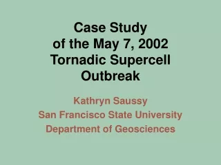
Documentation of a Tornadic Supercell Thunderstorm in the San Joaquin Valley, California. Ted B. Schlaepfer Department of Geosciences San Francisco State University. At approximately 1:00 PM. November 22, 1996. Tornado!. Purpose of this study*. Provide complete case study of this storm

E N D
Documentation of a Tornadic Supercell Thunderstorm in the San Joaquin Valley, California Ted B. Schlaepfer Department of Geosciences San Francisco State University
At approximately 1:00 PM November 22, 1996
Purpose of this study* • Provide complete case study of this storm • Study the evolution of the storm structure on basis of analyses of satellite & Doppler radar imagery • Compare buoyancy and shear values to those observed for other tornadic supercell storms • Compare the synoptic/subsynoptic pattern to that observed with past Central Valley tornadoes *Omitted some meteorological details from this presentation for simplicity
What is a supercell? • A thunderstorm • Persistent (~15 min.) updraft core • Rotation through a third of the depth of the storm • Summarized : A Supercell is a convective storm that possesses a deep, persistent mesocyclone
Why is the Lemoore Storm Unique? • First documentation of a right-moving supercell in CA using photographic, satellite and WSR-88D radar information • Tornado occurred in close proximity to WSR-88D radar at Hanford (KHNX) • High-quality low-elevation (0.5 degree) radar imagery of storm
November 21, 1996, The previous day • Progressive frontal system • Two post-frontal troughs • Second trough associated with comma-cloud • Trough along CA coastline at 4 AM November 22
Broad Area of Upward Vertical Motion over CA • Stronger field of UVM centered over Central CA
11 AM November 22 • Meso-low in the Sacramento Valley • Lee-side trough in Central Valley • Southeast winds east of the lee-side trough axis • STRONGER low-level & deep-layer shear east of trough axis • H20 convergence along trough axis
Schematic Showing Pattern Associated w/ Valley Tornadoes • Nov. 22 pattern had similar synoptic features • Focus was south in S.J.V. (stronger 0–6-km shear)
Visible Satellite Image 12 PM Cloud-free area
Convective Available Potential Energy • Definition: The maximum energy available to an ascending parcel • “Bull-eyes” region near Lemoore Naval Air Station
Lemoore Naval Air Station Sounding • Increased CAPE due to sensible heating and moisture convergence.
Deep-layer Shear (0–6-km) • Moderate over entire valley • Strong over the Central San Joaquin Valley • “Bulls-eye” between Lemoore and Fresno
Focus Area (Shear and CAPE) • Combined shear and CAPE was strongest over Central San Joaquin Valley • “Bulls-eye” at Lemoore
Lemoore (KNLC) Hodograph • Created from VAD wind profile from from KHNX at tornado genesis • Long length hodograph • Strong low-level shear (leads to the development of the low-level mesocyclone and possibly a tornado)
How does the Lemoore Storm Compare? Lemoore Storm Positive Shear Level • Strong shear in the lowest levels • 0–2-km and 0–3-km pos. shear within F1/F2 shear category • Shear at all levels at least F0 strength
Visible Satellite Image 1:00 PM Visible Satellite Image 12:30 PM
2 PM November 22 12 PM November 22
2:30 PM November 22 3 PM November 22 2 PM November 22 1 PM November 22 • Convergence zone near Lemoore • Expanding outflow in forward and rear flanks
1:37 PM November 22 • Supercell structure • Hook Echo • 68 dBZ updraft core • WSR-88D Mesocyclone algorithm detected rotation • Weak low-level velocity couplet • No Rear Flank Downdraft (RFD) yet
2:00 PM November 22 • Reformation stage • New Hook Echo • New updraft core • Old Core move into the Rear Flank • No Rear Flank Downdraft (RFD) yet
2:00 PM November 22 • Cross-Section • 2 areas of strong returns (>65 dBZ) • Lower region is updraft core • Upper region is suspended large hail • Elevated returns indicate wrap-around flow around hook-echo
2:06 PM November 22 • Large hail falling through updraft • New Updraft core • Mesocyclone indicated by algorithm • Bounded Weak Echo Region (BWER)Evident adjacent to updraft
2:23 PM November 22 • Knob-shaped hook echo of strong returns • Inbound return in vicinity of hook echo • Rear Flank Downdraft (RFD) initiated • Weak low-level velocity couplet
2:29 PM November 22 • Inbound velocities increase in vicinity of hook echo • Simultaneous strengthening of the low-level mesocyclone • A Tornado Cyclone Signature detected on Relative Velocity Scan • F0 Tornado on ground
2:34 PM November 22 • F0 Tornado dissipating • Mesocyclone detected by the WSR-88D • TCS weakened on velocity scan • New Core Updraft in center of storm • Very strong returns in hook echo region
2:40 PM November 22 • Reflectivities decrease within hook echo • New RFD initiated (storm-scale occlusion downdraft) • Inbound velocities increase in hook region • Weak Echo Region (WER) adjacent to hook echo
2:46 PM November 22 • Core updraft moved into rear flank • BWER develops adjacent to updraft • Low-level mesocyclone strengthens again • Mid-level mesocyclone detected by WSR-88D • Cell developing on right flank of storm
2:52 PM November 22 • F1 Tornado in Lemoore Naval Station grounds • BWER associated with very sharp hook echo • Strong Low-level mesocyclone • Mid-level mesocyclone weakened • Strong TCS detected
2:58 PM November 22 • F1 Tornado about to dissipate near Hwy 198 • Low-level mesocyclone weakened • TCS weakened • Adjacent cell merged with hook echo region of Lemoore Storm • Lemoore Storm begins to dissipate
F1T Lemoore Storm Rotation Event Meso TCS How strong was the storm rotation? Storm Rotation = 2 Vr / D where Vr = |Vi| + |Vo| / 2 F0T F1M F0M • Mesocyclone rotational shear within range for tornadoes • F1 TCS in the range of strong/violent mesocyclones outside CA
Summary and Conclusions • Buoyancy and Shear were within ranges observed with other tornadic storms in CA and elsewhere • November 22 weather pattern generally fit the synoptic/subsynoptic schematic assoc. with a typical C.V. severe weather outbreak • An example of topographically induced stronger wind shear F1 tornado event • First documentation of a TCS in CA
What Can Be Gained from this Study? • Damaging tornadoes do happen in CA • Usefulness of WSR-88D in identifying and analyzing severe storms in CA • Heightened awareness of weather patterns that can lead to severe weather and tornadoes in CA
Documentation of a Tornadic Supercell Thunderstorm in the San Joaquin Valley, California I gratefully acknowledge Steven Mendenhall, MIC and Dan Gudgel, WCM, WFO Hanford for their support and help. All of the radar plots, photographs of the tornado and parent cumulonimbus, damage track, and official storm reports obtained for this study were provided by Mr. Gudgel. I also thank SOO Larry Greiss and all of the Lead Forecasters at WFO Hanford for their encouragement and help in this endeavor.