Download
1 / 50
520 likes | 809 Views
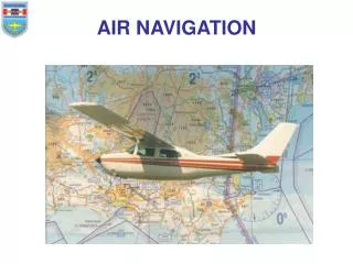
Air Navigation. By IP. Billy. Air Navigation. การนำเครื่องบินไปถึงจุดหมายปลายทาง ตามเวลาที่กำหนด ด้วยความปลอดภัย. Word Navigation. Two Latin words: NAVIS: ship AGERE: to direct or move. Dimensions of Navigation. Position Direction Distance Time. Position.

E N D
Air Navigation By IP. Billy
Air Navigation • การนำเครื่องบินไปถึงจุดหมายปลายทาง • ตามเวลาที่กำหนด • ด้วยความปลอดภัย
Word Navigation • Two Latin words: • NAVIS: ship • AGERE: to direct or move
Dimensions of Navigation • Position • Direction • Distance • Time
Position • The place where the aircraft stay with respect to the reference point • 25 NM Radian 360 degree from U-Tapao airport • Lat 12 °59.0’N Long 102°59.3’E
Direction • Angular Distance between one point and reference point , measures clockwise start from reference point as 0°to 360° • HDG 180°= angular distance 180° from magnetic north • True Direction (TD) • Magnetic Direction (MD) • Compass Direction (CD)
Direction use in Air Navigation • Track (TR) is the actual horizontal direction made by the aircraft over the earth (due to wind) or actual path • Course (C) is the intend horizontal direction or travel. There are TC, MC, CC (Gyro Compass Course) = Track Made Good • Heading (HDG) is the horizontal direction in which the A/C is pointed. There are TH, MH, CH
Direction use in Air Navigation • Bearing: The direction of an object from an airplane is called the bearing of the object. • Bearing are angular measurements from 0° through 360° • True Bearing is measured clockwise from true north • Relative Bearing is measured clockwise from the heading of the airplane • TH + RB = TB
Direction use in Air Navigation • The North Datum Line • 3 kinds of North used as reference lines for measuring direction • True North (TH) any meridian of long point to TN TN True direction = 050° measure clockwise y 50
The North Datum Line 2. Magnetic North (MN) is measured the north magnetic poles from the observer point TN MN y 050° 045° Magnetic Direction 045° True Direction 050° VAR=5°E
The North Datum Line 3. Compass North (CN) : Electricity and magnetic field deviate the compass to CN TN MN CN y 040° Compass Direction 040° Magnetic Direction 045° True Direction 050° VAR=5°E DEV=5°E
VARIATION (VAR) • The difference in angular measurement between true north and magnetic north, use true north as reference line • Expressed as an angle east or west of true north • When the compass needle points east of true north, the variation is said to be East • When the compass needle points west of true north, the variation is said to be West • Isogonic Line: the line that equal VAR • Agonic Line: the line that VAR equal to zero
Agonic Line คือ เส้นที่ลากผ่านตำบลที่มี VAR เป็น 0 Isogonic Line คือ เส้นที่ลากผ่านตำบลที่มี VAR เท่ากัน
Deviation (DEV) • The angle between MN and CN use MN as reference line • East of MN, it is deviation east • West of MN, it is deviation west • VAR WEST Magnetic Best + • VAR EAST Magnetic Lest – • DEV WEST Magnetic Best + • DEV EAST Magnetic Lest –
Direction • Cardinal Point (N, S, E, W) and intercardinal point (NE, SE, SW, NW) • Numerical system divided the horizon in to 360° starting with 000° (N) clockwise to 090°(E) , 180°(S) and 270°(W) and back to N • The circle of direction called Compass Rose
Dimensions of Navigation • Deviation = มุมที่ต่างกันระหว่าง Magnetic North กับ Compass North ซึ่งจะเปลี่ยนแปลงไปตามทิศหัว บ. และจะเปลี่ยนไปตามสถานที่ • Compass Swing • DEV East, Compass Least • DEV West, Compass Best
Magnetic heading = 095º DEV 5º E Find Compass heading ? • DEV East, Compass Least • Compass heading = 090º
A pilot maintain compass heading of 270O , but the deviation in aircraft compass card correction is 5O E, and the magnetic variation around here is 8OW. What is the true heading? a. 273O b. 267O c. 283 O d. 276 O • OK
Distance (Air Navigation) • A partial separation between two points and measured by the length of line joining them • 1 NM = 1 ลิปดาของ Great circle = 6,080.20 ฟุต • 1 SM = 1.6 KM • 1 NM = 1.85 KM • 1 SM = 0.87 KM
Time • The time of the day • Zulu time • Local time • An elapsed interval
Dimensions of Navigation • Longitude/The Equator • Meridians/Anti-Meridians • Prime Meridian • Time +E -W Local Time = UTC Local Conversion Factor • การหา Local Conversion Factor= 1+2+3 • Longitude(องศา)/15= ชั่วโมง ( ไม่คิดเศษ) • นำเศษขององศามาคูณด้วย 4 = นาที • นำค่าลิปดามาคูณ 4 หารด้วย 60 = นาที
เช่น GMT 0200 hrs, 30 June, local longitude 68 degrees 21 minutes E. • 68/15 = 4 เศษ 8 = 4 ชั่วโมง • 8*4 = 32 นาที • 21*4/60 = 1.4 นาที หรือ 1 นาที 24 วินาที Local Conversion Factor= 1+2+3= 4 ชั่วโมง 33 นาที 24 วินาที Local Time = UTC Local Conversion Factor = 02:00 +04:33:24 = 06:33:24 +E -W
Local time 2000 hrs, 15 February, local long 137 degrees 15 minutes W. What is UTC ( Conversion factor is +9) a. 1100 hrs, 15 February. b. 1100 hrs, 16 February. c. 0500 hrs, 15 February. d. 0500 hrs, 16 February. • OK UTC = Local Time + Conversion Factor = 2000+9=2900 = 2400 + 0500 = + 1 วัน เวลา 0500
Twilight. คือ แสงเงินแสงทองที่เกิดขึ้นก่อนดวงอาทิตย์ขึ้นและหลังดวงอาทิตย์ตก แบ่งออกเป็น 3 ช่วง
6O Civil Twilight. เริ่มต้นหรือสิ้นสุดลงเมื่อศูนย์กลางของดวงอาทิตย์อยู่ต่ำกว่าขอบฟ้า 6O
12O Nautical Twilight. เริ่มต้นหรือสิ้นสุดลงเมื่อศูนย์กลางของดวงอาทิตย์อยู่ต่ำกว่าขอบฟ้า 12O
18O Astronomical Twilight. เริ่มต้นหรือสิ้นสุดลงเมื่อศูนย์กลางของดวงอาทิตย์อยู่ต่ำกว่าขอบฟ้า 18O
10O Observational Twilight. เริ่มต้นหรือสิ้นสุดลงเมื่อศูนย์กลางของดวงอาทิตย์อยู่ต่ำกว่าขอบฟ้า 10O
Sunrise = ขอบบนของดวงอาทิตย์สัมผัสกับขอบฟ้า Sunset = ขอบล่างของดวงอาทิตย์สัมผัสกับขอบฟ้า
Unit of Speed • Rate of change of the position of the object • Speed = Distance / Time • Ft/sec • Mph • Knot (NM/hr) • Km/hr
Type of Navigation • Dead reckoning navigation • Piloting navigation or Map Reading • Radio and radar navigation or electronic navigation • Celestial navigation or astro navigation
Dead Reckoning (DR) • Determine where the aircraft should be or will be, based on the wind applied to its true heading and true airspeed from the last known position. • PDDT • P – Position or coordinate (Lat, Long) • D – Direction (Truth North) • D – Distance (NM) • T – Time
Piloting Navigation or Map Reading • The identification of landmarks from their representation on a chart and the utilization of this information to fix the position of the aircraft or to establish lines of position. • Checking Dead Reckoning • Cannot be used when the ground is obscured by clouds or when flying over water
Radio and Radar Navigation or Electronic Navigation • Determine the aircraft position by intersecting of position line which radiated by the radio compass • VOR, ADF/NDB, TACAN, LORAN
Celestial Navigation • Stars move in relation to each other, but slowly that today almost the same in ancient Greece • Main propose is to provide a means of positioning the aircraft and checking the aircraft heading • Required for celestial LOP (Almanac and Sight Reduction Table)
THE EARTH’S SURFACE • The primary instrument in navigation is a map of the earth’s surface The Shape of the Earth • Earth’s size and shape: Oblate Spheroid • For air navigation : Perfect Sphere • Earth Rotation as Spinning Ball • Axis of rotation as axis of the earth • The ends of the axis of the earth are pole, North pole and South pole • Midway between them lies the great circle is the equator
Polar Diameter = 6,864.57 nm • Equatorial Diameter = 6,887.91 nm The difference between Polar Diameter and Equatorial Diameter is 23.34 nm • Ellipticity (Ratio) = 23.34 / 6887.91 = 1/295
Axis of the earth is inclined gives 4 seasons 23 1/2° 6864.57nm 6887.91nm 66 1/2° Oblate Sphere Perfect Sphere
Earth and Coordinates Circle on a Sphere • Great Circle • Plane can pass through the center of the sphere • Meridian of Longitude or a meridian • Half of a great circle passing through the poles is The Meridian of Longitude or meridian • Prime meridian is the great circle passing through Greenwich, England • Longitudeis measured around The earth both eastward and west ward from Prime meridian, through 180°
Small Circle • Any circle formed by a plane which does not pass through the center of the sphere • Latitude or Parallel of Latitude except Equator 0° • Latitude range from 0° at the equator to 90°N and 90°S at the pole • Any of latitude other than the equator is a small circle parallel to it “Parallel of Latitude” “Parallel” 0° 0°
Segments of a circle, called arcs, are measured in degrees, minutes, and seconds • Any circleis divided into 360 equal parts , each curved arc would be 1° in length • A degree is divided into 60 equal parts forms arcs of 1 minute each, and one sixtieth of minute is a second • For very fine measurement beyond a second, decimal parts are used • 8°40’7.18’’ • All meridians intersect at right angles with parallels of latitude
“A small circle is formed on the surface of the earth by intersection of a plane which dose not pass through the center of the earth.” “Great circle – Pass through the center of the earth” เส้นเกลียว(Rhumb line) คือ เส้นที่ตัดเส้นเมอริเดียนถัด ๆ ไป ด้วยมุมคงที่
MAP and CHART • MAP is a small scale, flat surface representation of some portion of the earth surface such a representation design for NAV. • Term maps and charts are used interchangeably. • A map is to look at, a chart is to work on. • Enroute charts, approach charts
Map Projection • A round surface cannot be flattened without some stretching, wrinkling, or tearing called “Distortion” • To minimize errors • The framework of meridians and parallels on any map is called “the Graticule”
Definition of Map Terms • Statue Mile (s.m.): a distance as 5,280 ft • Nautical Mile (n.m.) : a distance as 6,080 ft or 1.15 s.m. It is the length of a minute of arc on the equator ; since the equator is a great circle, one minute of arc will be a nautical mile on any Great Circle, and hence distance can be measured along any meridian.