Download
1 / 21
210 likes | 288 Views
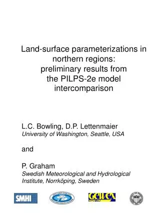
Land-surface parameterizations in northern regions: preliminary results from the PILPS-2e model intercomparison. L.C. Bowling, D.P. Lettenmaier University of Washington, Seattle, USA and L.P. Graham Swedish Meteorological and Hydrological Institute, Norrköping, Sweden. PILPS.

E N D
Land-surface parameterizations in northern regions: preliminary results from the PILPS-2e model intercomparison L.C. Bowling, D.P. Lettenmaier University of Washington, Seattle, USA and L.P. Graham Swedish Meteorological and Hydrological Institute, Norrköping, Sweden
PILPS... Project for Intercomparison of Land Surface Parameterization Schemes
PILPS 2e: Arctic Model Intercomparison Experiment • a multi-year intercomparison of hydrology and land surface transfer schemes in northern regions. • a joint activity of GEWEX, and the Arctic Climate System Study (ACSYS). • part of the Global Land Atmosphere System Study (GLASS), a GEWEX project which aims to coordinate the evaluation of LSSs in their different applications.
PILPS-2e Science Questions • What is the ability of the participating models to estimate runoff in gauged and ungauged catchments? • How would Arctic river runoff respond to spatial and temporal variations in climate forcings? • What are the effects of permafrost on the surface water and energy cycles, and their related impacts on carbon sequestration at high latitudes? • What is the feasibility of using land surface models to assess the hydrologic impacts in Arctic drainage basins via long-term climate simulations?
PILPS 2e Stages • Stage 1: Torne/Kalix Rivers 58 000 km2 – Sweden/Finland • Stage 2 (proposed): Mackenzie River 1 800 000 km2 • Stage 3 (proposed): Lena River 2 400 000 km2
PILPS 2e Stage 1: Torne/Kalix Rivers 58 000 km2 river system in Sweden and Finland Baltic Sea Drainage Basin
PILPS 2e Stage 1 Participants 21 models participating: • 11 different countries (Australia, Canada, China, France, Germany, Japan, Netherlands, Russia, Sweden, U.K., U.S.A.) • Final results are currently available for 19 of the models
Experimental Design • resolution - 1/4 degree grid boxes • meteorological forcings at hourly time step • model spin-up: 1979 - 1988 • simulation period: 1989 - 1998
PILPS 2e Forcing Data • Precipitation • Gridded from SMHI station data • Lapsed for elevation and adjusted for gauge undercatch per SMHI recommendations • Statistically disaggregated to hourly • Air temperature • Gridded from SMHI daily station data • Lapsed for elevation • Disaggregated to hourly based on nearest station • Pressure, specific humidity, cloud cover • Interpolated from 1o gridded SMHI dataset that was optimally interpolated from station data
PILPS 2e Forcing Data • Wind Speed • NCEP/NCAR Reanalysis ‘surface wind’ fields • Longwave Radiation • Calculated from air temperature • Adjusted for observed cloud cover • Shortwave Radiation • Originally estimated using Tennessee Valley Authority (1972) method to estimate clear-sky transmittance • Replaced with estimate using Eagleson (1970) method calibrated to station data
Average annual sensible versus latent heat flux Rnet = 41 W/m2 Rnet = 16.5 W/m2 Estimated = 23.7 W/m2
Average annual latent heat flux }Group 1 }Group 2a }Group 2b }Group 3
Snow water equivalent (1995) 24.625 E, 66.625 N }Group 1 }Group 2a }Group 2b }Group 3
Average February SWE (mm) Group1 Group 2a Group 2b Group 3
Average annual runoff Group1 Group 2a Group 2b Group 3
Average monthly runoff }Group 1 }Group 2a }Group 2b }Group 3
Change in total moisture storage (soil and surface) }Group 1 }Group 2a }Group 2b }Group 3
Preliminary Conclusions • At high latitude, latent heat is limited by available net radiation rather than available water. • There is a direct connection between winter sublimation rates and annual water yield: • High latent heat leads to lower total SWE • Low SWE translates to low annual runoff • Increasing total storage (subsurface or surface) primarily changes runoff timing, not volume.
www.hydro.washington.edu/Lettenmaier/ CurrentResearch/PILPS-2e/index.htm