Download
1 / 21
210 likes | 437 Views
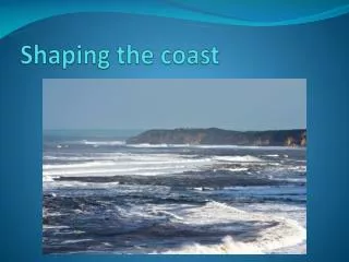
The Coast. Section 6 Part II. Isostasy. “weighing the same” Buoyant properties of layers of rocks that float on other layers (due to density and thickness) Crust ‘floats’ on denser, underlying layer. Continental shelf.

E N D
The Coast Section 6 Part II
Isostasy • “weighing the same” • Buoyant properties of layers of rocks that float on other layers (due to density and thickness) • Crust ‘floats’ on denser, underlying layer
Continental shelf • Continental shelf – gently sloping region surrounding continents (sea is relatively shallow) • Covered in sediments (erosion of continents) • Part of continent was above sea level during ice age (sea level was lower then) • Water depth over continental shelf depends on 2 factors: • Isostatic changes in land height • Changes in sea level
Principle of Isostasy • Crust is higher where it is thicker and less dense • Lower = thinner and denser Highest density
Continental crust – mostly made of granite (less dense rock) • Granite: igneous rock made with ~20% quartz • Oceanic crust – basalt (more dense rock) • Basalt: igneous rock less than 20% quartz, mostly volcanic • So, continental plates ride on the denser oceanic plates
Littoral Zone • Land meets sea • Nature of shore factors: • Geology of adjacent land • Exposure to erosion by sea • Area of coast between high water mark and lowest part of submerged shore
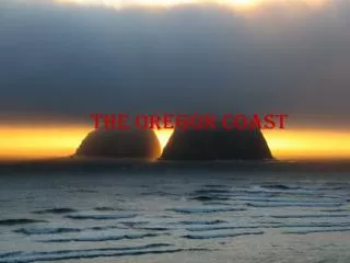
Rocky Shore • Rock exposed to sea erosion • Variety sized boulders, stones and pebbles • Granite = resistant to weathering • Sandstone = easily broken down
Rocky Shore • Most exposed type of shore • Most resistant to erosion • Largest boulders left at the top of the shore due to pounding waves • Very steep cliffs to horizontal flat rocks with a wave-cut platform
Limiting Factors Rocky Shore • Support wide range of organisms • Stable substrate • Large rocks and stones – firm surface • Algae • Mollusks and cnidarians (and sea anemones) • Rock pools retain water when tide recedes
Rocky Shore • Environmental Factors that influence communities: • Desiccation (extreme drying) • Species near top of shore exposed to air for longer periods • Temperature • Wave action • Light intensity • Aspect • Slope • Nature of substrate
Sandy Shores • Erosion of sandstone • Deposition of sand by the sea • Silica and other minerals • Slope gradually toward sea
Sandy Shores • Unstable • Fine particles are easily moved by winds and tides • Not a suitable substrate • Sea weeds • No shelter for organisms at surface • Under: burrowing organisms • Ghost crabs, bivalve mollusks, annelid worms (ragworms and lugworms) • If sand mixed with muddy deposits, more stable and supportive
Muddy Shores • Least exposed to erosion • silt particles can settle • Very fine mineral sediments • Organic remains • Little slope • Can form mud flats
Estuary • Semi-enclosed body of water • Freshwater meets sea water • Muddy substrate – slow flow of water allows suspended particles to settle
Delta (∆) Get their name from the Greek letter • River carrying suspended sediments reaches large body of water (lake or ocean) • River increase in width = flow rate decreases • Suspended sediments settle • Accumulate into a fan-shaped structure over time • River divides to form distributary channels • 2 examples (next page)
Mangroves (Swamp, Forest) • Trees and shrubs in tropical/subtropical saline coastal habitats • Between 25⁰N and 25 ⁰S • Form woodland or shrub land habitat (coastal/estuarine conditions where sedimentation of silts occur) • Specifically adapted to: • Wide range of salinity • Low oxygen concentrations in sediments
Mangroves • Pneumatophores - specifically adapted root-like structures that obtain oxygen directly from air • Extensive root systems: • Trap particles suspended in water • Reduce water flow • Increases deposition of sediments • Dissipates wave energy • Protects coastal area from erosion • Habitats for: • Algae, oysters, crabs, barnacles and other crustaceans, sponges, fish