Download
1 / 26
260 likes | 348 Views
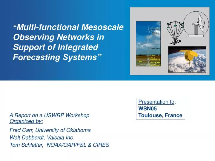
“ Multi-functional Mesoscale Observing Networks in Support of Integrated Forecasting Systems”. Presentation to : WSN05 Toulouse, France. A Report on a USWRP Workshop Organized by: Fred Carr, University of Oklahoma Walt Dabberdt, Vaisala Inc. Tom Schlatter, NOAA/OAR/FSL & CIRES.

E N D
“Multi-functional Mesoscale Observing Networks in Support of Integrated Forecasting Systems” Presentation to: WSN05 Toulouse, France A Report on a USWRP WorkshopOrganized by: Fred Carr, University of Oklahoma Walt Dabberdt, Vaisala Inc. Tom Schlatter, NOAA/OAR/FSL & CIRES
Presentation Outline • Workshop goals and background • Recommendations of the Modeling & Data Assimilation Workgroup • Recommendations of the Nowcasting Workgroup • Recommendations of the Testbed Workgroup • Existing and Planned Testbeds -- Domestic and International • Recommendations of the Implementation Workgroup • Overarching Recommendations
Workshop Goals • Develop a roadmap that leads to designing, testing and implementing integrated mesoscale observing-forecasting systems that: • yield improved mesoscale forecasts • utilize optimal observing system configurations • serve multiple applications • recognize the capabilities, interests and resources of the public, private and academic sectors • Explore appropriate business models that will support and enable these systems
Workshop Factoids Domestic Int’l. Total 37 4 41 49 3 52 25 4 29 111 11 122 • Academia and NCAR • TOTAL PARTICIPANTS • Public Sector • Nowcasting -- • Pat Welsh, NOAA/NWS (now U.No.Florida) • Jim Wilson, NCAR • Modeling and Data Assimilation -- • Steve Koch, NOAA/OAR • Xiaolei Zou, Florida State University • Private Sector Dates: 8-10 Dec. 2005 Working Group Leaders: • Test Beds -- • Marty Ralph, NOAA/OAR • Dave Jorgensen, NOAA/OAR • Implementation -- • Joe Friday, University of Oklahoma (ret.) • Maria Pirone, AER, Inc.
Presentation Outline • Workshop goals and background • Recommendations of the Modeling & Data Assimilation Workgroup • Recommendations of the Nowcasting Workgroup • Recommendations of the Testbed Workgroup • Existing and Planned Testbeds -- Domestic and International • Recommendations of the Implementation Workgroup • Overarching Recommendations
Modeling & Data Assimilation Recommendations:Scope • What is the optimal mix of observations at the meso-, storm- and urban scales? • Examples of mesoscale forecast applications requiring improved observing capabilities include: • severe weather systems in both cold and warm seasons; • air quality and chemical emergency response; • aviation, marine and surface transportation; and • hydrology and more. • Modelers should be involved in theobserving network decision process by designing observing system experiments to determine: • the most important variables to measure; • the minimum spacing and resolution requirements (network design); • adaptive and targeted sampling strategies; and • data assimilation techniques to effectively use these new measurements.
Modeling & Data Assimilation Recommendations: Remedy Deficiencies in Current Observational Networks • Most desirable additional measurements: • Lower tropospheric measurements: • Mass, winds, moisture fields (3D) ~10 km horizontal; ~200 m vertical; 1-3 hrs • PBL turbulent fluxes, PBL heights • Turbulent flow and stability ~2 km; 15 min • Aerosols, chemical tracers, emissions data • Quantitative precipitation estimate: • Better accuracy, good and consistent quality control • Upper tropospheric measurements: • State variable measurements at 100 km spacing (0.5 km vertical), 1-3 hours • improved winds from satellite and regional aircraft • vertical profiling of state variables and hydrometeors in cloudy regions • increased vertical resolution from satellite • ozone profiling; • tropopause topology • Land surface properties: • Soil moisture and temperature profiles, snow cover and depth, SST, vegetation type/state updated daily • Radiative transfer inputs: • Ozone, CO2, water vapor, clouds
Modeling & Data Assimilation: Overarching Recommendations • It may be more cost effective to sample only the boundary layer with denser coverage than to similarly enhance observations in the upper troposphere for improving mesoscale analysis and prediction. • It may be cost effective to deploy intermittent, targeted observations at high resolution.Testbeds built around prototype observing networks need to be in place to provide real-data tests of proposed strategies
Presentation Outline • Workshop goals and background • Recommendations of the Modeling & Data Assimilation Workgroup • Recommendations of the Nowcasting Workgroup • Recommendations of the Testbed Workgroup • Existing and Planned Testbeds -- Domestic and International • Recommendations of the Implementation Workgroup • The Helsinki Testbed
Advanced Operational Nowcasting – Scope • Forecast Period: 0-6 hr • Forecast High Impact Events • Winter weather: heavy precipitation (precipitation type – major challenge), high winds, icing • Summer weather: high winds, heavy rain, lightning, hail • Air quality; dispersion of airborne toxins • Forecast Techniques • Extrapolation • Statistical • Numerical (process models) • Expert systems • Observing Systems - “All” • Important parameters to measure: low-level moisture; detection of sharp gradients; boundary-layer height; strength of capping inversion; energy potentially available for convection
Nowcasting Recommendations • Top priority: Establish a national mesonetwork of surface stations. • NOAA should take the lead to establish this network, and set standards for data quality. • Resolution needed: 5min and 10-25km (topography-specific). • Basic measurements: • winds • temperature • humidity • pressure • precipitation amount and liquid equivalent • Application-specific options: • precipitation type and size distribution • soil temperature and moisture • radiation fluxes • ceiling height • visibility
Nowcasting Recommendations • Priority Radar Recommendations: • NWS should proceed without delay with the (approved) addition of dual polarization capability to the WSR-88D network. • Pursue the National Research Council Study recommendation to integrate other radars into the WSR-88D network. • Support studies to investigate means for improving boundary-layer coverage in the future through the use of closely spaced X-band radars. • NWS should pursue vigorously plans for a national expansion of the NOAA Profiler Network with emphasis on boundary-layer observations. • A research field project should be conducted that tests the utility of radar refractivity measurements to improve nowcasting. • Other Priority Recommendations: • Continue support for collaborative research projects aimed at using total lightning data to improve severe weather warnings and nowcasts. • Provide real-time near-surface water vapor fields to demonstrate how high-resolution water vapor fields can improve nowcasting. • Establish testbeds for very short period forecasting (0-6 hr, nowcasting) of high impact weather.
Presentation Outline • Workshop goals and background • Recommendations of the Modeling & Data Assimilation Workgroup • Recommendations of the Nowcasting Workgroup • Recommendations of the Testbed Workgroup • Existing and Planned Testbeds -- Domestic and International • Recommendations of the Implementation Workgroup • The Helsinki Testbed
Mesoscale Weather Forecasting -- Testbeds • Testbed Definition: “A working relationship in quasi-operational framework among forecasters, researchers, private-sector, and government agencies aimed at solving operational and practical regional problems with a strong connection to end-users.”
Testbed Recommendations Testbeds are crucial in transitioning observing and modeling research into operations; a successful testbed must satisfy the following criteria: • Address the detection, monitoring, and prediction of regional phenomena of particular interest. • Engage experts in the phenomena of interest. • Involve stakeholders in planning, operation, and evaluation of the testbeds. • Define expectedoutcomes, including transition to operations, strategies for achieving them, and measures of success. • Provide special observing networks (and people, communications, and databases) needed for pilot studies and research • Provide resources for the generation and delivery of experimental products based upon these observations.
Presentation Outline • Workshop goals and background • Recommendations of the Modeling & Data Assimilation Workgroup • Recommendations of the Nowcasting Workgroup • Recommendations of the Testbed Workgroup • Existing and Planned Testbeds -- Domestic and International • Recommendations of the Implementation Workgroup • Overarching Recommendations
Mesoscale Observing Programs Are Proliferating: How can we build on them? x Coastal Storms • Mesowest • ARM CART • Oklahoma Mesonet • Texas Mesonet • AIRMAP • Hi-res temperature • forecasts for energy sector • Land-falling storms • (PACJET) • Air Quality • Fire Weather • Energy, Water, & Air • Quality Issues Coastal Storms North American Monsoon Experiment
Helsinki Testbed 2005-2006 • Mesoscale weather research • Forecast and dispersion models: development and verification • Observing systems and strategies: test and design • Information systems and technology integration • End-user product development and demonstration • Data distribution for public and research community Observing Facilities (preliminary) 1 dual-pol Doppler radar 4 C-band Doppler radars 101 surface wx stations* 191 road weather stations 42 two-level AWS masts 3 shipboard weather stations 11 backscatter lidars 1 UHF wind profiler 3 RAOB sounding stations 34 precipitation sites (part of 101)* satellite obs. (GS and PO) COSMIC RI soundings EUCOS operational network
Beijing Observational Network Development Plan (2006-08) 150km Source: CMA, July 2003
Presentation Outline • Workshop goals and background • Recommendations of the Modeling & Data Assimilation Workgroup • Recommendations of the Nowcasting Workgroup • Recommendations of the Testbed Workgroup • Existing and Planned Testbeds -- Domestic and International • Recommendations of the Implementation Workgroup • Overarching Recommendations
Implementation of Integrated Mesoscale Observing-Forecasting Systems Focus: Explore the potential for forming a consortium of public-private-academic partners to implement a national mesoscale observing network based on the needs of the user communities, including: • Modeling community • General public • Commercial markets Drivers: What are the major drivers of partnerships for mesoscale observing networks?
Implementation Recommendations: • A partnership arrangement was proposed for creation of consortia to develop, maintain and support regional mesoscale networks or even a composite national network. • The proposed network(s) would consist of a mix of privately owned measurement systems, publicly owned systems and newly acquired systems supplied by the consortia. • Each consortium collects and quality-controls the data, and supports the real-time dissemination of data and information products (e.g. analyses and forecasts). • Consortium members share rights, costs and revenues according to a “participation formula” (tbd) • Typical member roles: • The public sector members access the data for the public good; i.e. public safety. • The private-sector consortium members (and possibly academic partners) use the data to create and sell various value-added products. • Academia and non-profit research centers have access to the data for educational and research purposes.
Presentation Outline • Workshop goals and background • Recommendations of the Modeling & Data Assimilation Workgroup • Recommendations of the Nowcasting Workgroup • Recommendations of the Testbed Workgroup • Existing and Planned Testbeds -- Domestic and International • Recommendations of the Implementation Workgroup • Overarching Recommendations
Four Overarching Recommendations • Adopt the testbed concept as a priority mechanism for transitioning mesoscale observing and modeling advances from research to operations • Form a multi-sector “tiger team” to develop a functional design for a working testbed, and recommend one or more testbeds for the most pressing unmet requirements. • Develop alliances among public agencies who have complementary mesoscale needs (e.g. NOAA/NWS; Dept. of Homeland Security; EPA; DoD) to leverage resources and minimize costs. • Develop partnerships among the public, academic and private sectors that will facilitate the establishment and ongoing support of mesoscale testbeds and, subsequently, operational mesoscale observing-forecasting enterprises
Mesoscale Workshop • ..end..end..end..end..end.. • For complete article, see: • Dabberdt et al., BAMS, 86(7), July 2005, 961-982 • http://ams.allenpress.com/pdfserv/10.1175%2FBAMS-86-7-961 • walter.dabberdt@vaisala.com