Download
1 / 17
170 likes | 291 Views
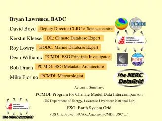
Metadata of the NERC DataGrid. Kevin O’Neill CCLRC e-Science Centre k.d.o’neill@rl.ac.uk. Project Overview. Resources Funded by NERC and National e-Science Core programme Initially approx 15 sy over 3 years Investigators Bryan Lawrence (PI) – BADC Roy Lowry – BODC

E N D
AHM 2003 – 2 Sept, 2003 e-Science Centre Metadata of the NERC DataGrid Kevin O’Neill CCLRC e-Science Centre k.d.o’neill@rl.ac.uk
AHM 2003 – 2 Sept, 2003 e-Science Centre Project Overview • Resources • Funded by NERC and National e-Science Core programme • Initially approx 15 sy over 3 years • Investigators • Bryan Lawrence (PI) – BADC • Roy Lowry – BODC • Kerstin Kleese van Dam – CCLRC e-Science Centre • Close co-operation with the Earth System Grid in the States
AHM 2003 – 2 Sept, 2003 e-Science Centre Aim • Starting with Atmospheric and Oceanographic data, held in the BADC and BODC, provide a framework for: • Data Discovery • Data Use with format transparency • within the environmental community funded by NERC. • It should be cross-disciplinary (big and small borders!) • Global warming and similar are no respecters of academic boundaries… • Build on existing initiatives and standards • Not a green field site! Much existing work,albeit normally covering limited areas • Particularly important are OGC and ISO programmes
AHM 2003 – 2 Sept, 2003 e-Science Centre Relation of data and metadata models • Provides clear separation of function • Difference between data use and discovery etc. • “Tuning” of metadata to include relevant detail • Allows increased reuse of metadata model • Avoids tie-in to details of a particular field’s data formats • Can plug-in another data model • (and the same applies to the data model…;-)
AHM 2003 – 2 Sept, 2003 e-Science Centre A short taxonomy of the NDG metadata • A - [Archive] • Usage metadata, normally generated with the data, and always accompanying it. (For example, the metadata held in a NetCDF formatted file). • B - [Browse] • Complete set of metadata which covers both semantics, and syntax). This metadata is often built up over time. • C -[Comment] • Ancillary metadata, such as annotations and publications. Usually provided after the ingestion of data into an archive. • D - [Discovery] • The metadata needed to find datasets of interest. Usually produced by managed data centres, e.g. DIF, GEO, CLRC-MDF • E – [Extra] • Metadata specific to a discipline, which is not yet incorporated into the core
AHM 2003 – 2 Sept, 2003 e-Science Centre Using metadata within the NDG • A & B overlap in data summary • D is usually a subset of B, but may be supplemented with E
AHM 2003 – 2 Sept, 2003 e-Science Centre NERC DataGrid Data Model • Data Model
AHM 2003 – 2 Sept, 2003 e-Science Centre NERC DataGrid Data Model • Data Model • nested hierarchies of multidimensional arrays • Data Model • nested hierarchies of multidimensional arrays • aggregation of file-based storage • Data Model • nested hierarchies of multidimensional arrays • aggregation of file-based storage • incorporation of ISO standards
AHM 2003 – 2 Sept, 2003 e-Science Centre Metadata model – conceptual view
AHM 2003 – 2 Sept, 2003 e-Science Centre Top level – UML “sketch” Four types of metadata record: • Activities • Data production tools • Observation stations • Data entities
AHM 2003 – 2 Sept, 2003 e-Science Centre Implementation • Model expressed as an XML Schema • Metadata records to be presented in XML, validated against the schema • Wide range of data sources, XML provides a good intermediate format • XSLT scripts being developed to map metadata into the various discovery formats • GCMD’s DIF format to be the first, then FGDC GEO profile
AHM 2003 – 2 Sept, 2003 e-Science Centre End-to-end – currently…
AHM 2003 – 2 Sept, 2003 e-Science Centre Thank youQuestions?
AHM 2003 – 2 Sept, 2003 e-Science Centre ISO TC211 • Projects: • 19101 (15046-1): Geographic information - Reference model • 19102 (15046-2): Geographic information - Overview (Project deleted, see resolution 192 - Adelaide) • 19103 (15046-3): Geographic information - Conceptual schema language • 19104 (15046-4): Geographic information - Terminology • 19105 (15046-5): Geographic information - Conformance and testing • 19106 (15046-6): Geographic information - Profiles • 19107 (15046-7): Geographic information - Spatial schema • 19108 (15046-8): Geographic information - Temporal schema • 19109 (15046-9): Geographic information - Rules for application schema • 19110 (15046-10): Geographic information - Feature cataloguing methodology • 19111 (15046-11): Geographic information - Spatial referencing by coordinates • 19112 (15046-12): Geographic information - Spatial referencing by geographic identifiers • 19113 (15046-13): Geographic information - Quality principles • 19114 (15046-14): Geographic information - Quality evaluation procedures • 19115 (15046-15): Geographic information - Metadata • 19116 (15046-16): Geographic information - Positioning services Published IS Draft
AHM 2003 – 2 Sept, 2003 e-Science Centre ISO TC211 • Projects: • 19117 (15046-17): Geographic information - Portrayal • 19118 (15046-18): Geographic information - Encoding • 19119 (15046-19): Geographic information - Services • 19120 (15854): Geographic information - Functional standards • 19120/Amedment 1: Geographic information - Functional standards - Amendment 1 • 19121 (16569): Geographic information - Imagery and gridded data • 19122 (16822): Geographic information/Geomatics - Qualifications and Certification of Personnel • 19123 (17753): Geographic information - Schema for coverage geometry and functions • 19124 (17754): Geographic information - Imagery and gridded data components • 19125-1: Geographic information - Simple feature access - Part 1: Common architecture • 19125-2: Geographic information - Simple feature access - Part 2: SQL option • 19125-3: Geographic information - Simple feature access - Part 3:COM/OLE option • 19126: Geographic information - Profile - FACC Data Dictionary • 19127: Geographic information - Geodetic codes and parameters Technical Report
AHM 2003 – 2 Sept, 2003 e-Science Centre ISO TC211 (last) • Projects: • 19128: Geographic information - Web Map server interface • 19129: Geographic information - Imagery, gridded and coverage data framework • 19130: Geographic information - Sensor and data models for imagery and gridded data • 19131: Geographic information - Data product specifications • 19132: Geographic information - Location based services possible standards • 19133: Geographic information - Location based services tracking and navigation • 19134: Geographic information - Multimodal location based services for routing and navigation • 19135: Geographic information - Procedures for registration of geographical information items • 19136: Geographic information - Geography Markup Language (GML) • 19137: Geographic information - Generally used profiles of the spatial schema and of similar important other schemas • 19138: Geographic information - Data quality measures • 19139: Geographic information - Metadata - Implementation specifications • 19140: Geographic information - Amendment to the ISO 191** Geographic information series of standards for harmonization and enhancements
AHM 2003 – 2 Sept, 2003 e-Science Centre Finally… • Many more areas to be considered • Provenance, versioning: mostly seen as part of the “C” metadata • Ontologies, taxonomies, and standard vocabularies • Major problems at the moment are socio-cultural • History of autonomy means that procedures and standards are diverse, and trust must be built from a low base