Download
1 / 18
280 likes | 470 Views
Section 2: Urban Land Use. Preview Objectives Urbanization The Urban Crisis Urban Sprawl Development on Marginal Lands Other Impacts of Urbanization Urban Planning. Section 2: Urban Land Use. Preview, continued Intelligent Design Transportation Open Space

E N D
Section 2: Urban Land Use Preview • Objectives • Urbanization • The Urban Crisis • Urban Sprawl • Development on Marginal Lands • Other Impacts of Urbanization • Urban Planning
Section 2: Urban Land Use Preview, continued • Intelligent Design • Transportation • Open Space • GIS Views of Seattle, Washington
Objectives • Describe the urban crisis, and explain what people are doing to deal with it. • Explainhow urban sprawl affects the environment. • Explainhow open spaces provide urban areas with environmental benefits. • Explainthe heat-island effect. • Describehow people use the geographic information system as a tool for land-use planning.
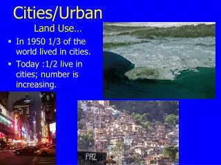
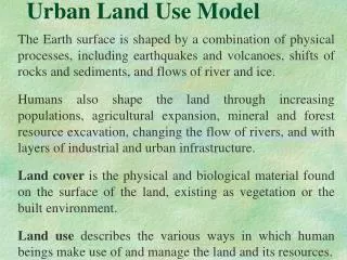
Urbanization • Urbanizationis an increase in the ratio or density of people living in urban areas rather than in rural areas. People usually leave rural areas for more plentiful and better paying jobs in towns and cities. • In developed countries, urbanization slowed in the second half of the 20th century. • As urban populations have grown, many small towns have grown together and formed large urban areas called metropolitan areas. An example would be Washington D.C.-Baltimore.
Urbanization • Urban areas that have grown slowly are often relatively pleasant places to live, in part because roads and public transportation have been built to handle the growth allowing traffic to flow freely. • Buildings, roads, and parking lots are mixed with green spaces that provide these urban areas with much needed ecosystem services such as moderation of temperature, infiltration of rainwater runoff, and aesthetic value.
The Urban Crisis • A rapidly growing population, however, can overwhelm the infrastructure, leading to traffic jams, substandard housing, and polluted air and water. • Infrastructure is the basic facilities of a country or region, such as roads, bridges, sewers, and railroads. • When more people live in a city than its infrastructure can support, the living conditions deteriorate. This growth problem has become so widespread throughout the world that the term urban crisis was coined to describe it.
Urban Sprawl • Urban sprawlis the rapid spread of a city into adjoining suburbs and rural areas. • Much of this growth results in the building of suburbs, or housing and associated commercial buildings on the boundary of a larger town. • Many of these suburbs are built on land that was previously used for food production. In fact, each year suburbs spread over another 1 million hectares (2.5 million acres) of land in the United States.
Development on Marginal Lands • Many cities were first built where there was little room for expansion. As the cities grew, suburbs were often built on marginal land, or land that is poorly suited for building. • For example, Los Angeles was built in a basin, and has expanded onto slopes that are prone to landslides. • Structures built on marginal land can become difficult or impossible to repair and can be expensive to insure.
Other Impacts of Urbanization • Environmental conditions in the center of a city are different from those of the surrounding countryside, as cities both generate and trap more heat. • Heat island is an area in which the air temperature is generally higher than the temperature of surrounding rural areas. • Heat is generated by the infrastructure that makes a city run. Roads and buildings absorb and retain heat longer then vegetation does.
Other Impacts of Urbanization • Scientists are beginning to see that heat islands can affect local weather patterns. Hot air rises over a city, cooling as it rises, and eventually produces rain clouds. • In Atlanta, Georgia, and many other cities, increased rainfall is a side effect of the heat island effect. • The heat-island effect may be moderated by planting trees for shade and by installing rooftops that reflect rather than retain heat.
Urban Planning • Land-use planningis a set of policies and activities related to potential uses of land that is put in place before an area is developed. • The federal government requires developers to prepare detailed reports assessing the environmental impact of many projects, and the public has a right to comment on these reports. • Developers, city governments, local businesses, and citizens often disagree about land-use plans.
Intelligent Design • Land-use planners have sophisticated methods and tools available to them today. • The most important technological tools for land-use planning involve using the geographic information system. • A geographical information system (GIS) is an automated system for capturing, storing, retrieving, analyzing, manipulating, and displaying geographic data.
Intelligent Design • GIS software allows a user to enter different types of data about an area, such as the locations of sewer lines, roads, and parks, and then create maps with the data. • Each image corresponds to a different combination of information. • The power of GIS is that it allows a user to display layers of information about an area and to overlay these layers, like overhead transparencies, on top of one another.
Transportation • Most cities in the United States are difficult to travel in without a car. • Most cities in the United States were constructed after the invention of the automobile. In addition, availability of land was not a limiting issue, so many American cities sprawl over large areas. • By contrast, most cities in Europe were built before cars, and are compact with narrow roads.
Transportation • In many cities, mass transit systems were constructed in order to get people where they wanted to go. Mass transit systems use buses and trains to move many people at one time. • Mass transit systems save energy, limit the loss of land to roadways and parking lots, reduce highway congestion, and reduce air pollution. • Where the construction of mass transit systems is not reasonable, carpooling is an important alternative.
Open Space • Open space is land within urban areas that is set aside for scenic and recreational enjoyment. It also has many environmental benefits and provides valuable functions. • Open spaces include parks, public gardens, and bicycle and hiking trails. • Open spaces left in their natural conditions are often called greenbelts. These greenbelts provide important ecological services.
Open Space • The plants in open spaces absorb carbon dioxide, produce oxygen, filter out pollutants from air and water, and help keep a city cooler in the summer. • Open spaces, especially those with vegetation, also reduce drainage problems by absorbing more of the rainwater runoff from building roofs, asphalt, and concrete resulting in less flooding. • These open spaces also proved urban dwellers with much-needed places for exercise and relaxation.