Download
1 / 15
150 likes | 171 Views
Develop a strategic plan to provide scientific information, conserve habitats, and enhance coastal resources for the benefit of the American public. Utilize geospatial data to manage marine ecosystems and support renewable energy projects.

E N D
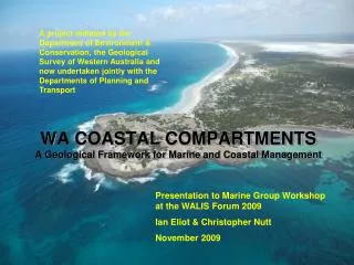
DOI Coastal & Marine Mapping John W. Haines (Roger Johnson, Steve Kopach, Doug Vandegraft)IWG-OCM Strategic Planning 26 February 2008
2 Our Missions Provide the American Public with ocean energy, mineral resources, and resulting economic value in a safe and environmentally sound manner. Working with others to conserve, protect and enhance fish, wildlife, plants, and their habitats for the continuing benefit of the American people. Preserves unimpaired the natural and cultural resources and values of the national park system for the enjoyment, education, and inspiration of this and future generations. Serves the Nation by providing reliable scientific information to describe and understand the Earth; minimize loss of life and property from natural disasters; manage water, biological, energy, and mineral resources; and enhance and protect our quality of life.
74 coastal parks – in 25 states/territories 5100 miles of beaches, reefs, barrier islands etc in over 3 million acres of Ocean and Great Lakes waters • NPS Ocean Park Stewardship Action Plan • Create complete benthic habitat maps for ocean parks (w/ NOAA, USGS, academia) • Create digital boundaries of ocean parks on charts and maps (w/ NOAA, USGS) Development of a systematic Marine Inventory Program
177National Wildlife Refuge System coastal and insular holdings • 20 million coastal acres • 30,000 coastal miles • Over 7 million tidally-influenced acres, of which • ~ 3 million acres are in coral reef ecosystems • Over 250,000 acres of tidally influenced Congressionally-designated wilderness • Geospatial data to meet management needs includes: Seabird colony locations, Seabird-at-sea transects, Marine mammal surveys, Forage fish surveys, Kelp and eel grass locations, Coastal wind generation projects, Coastal erosion studies, Offshore water depth, temperature, and salinity
Responsible for 1.76 billion OCS acres • (Lease issuance to decommission) • ~7,500 leases • ~40 million acres leased • ~30% of oil;~20% natural gas • ~3,900 production platforms • ~33,000 miles of pipeline • ~42,000 OCS personnel • ~125 operating companies “The primary objective behind the development of a “Multipurpose Marine Cadastre” is to provide for a comprehensive spatial data infrastructure whereby rights and interests, restrictions, and responsibilities in the marine environment can be assessed, administered and managed”.
6 A Mapping Agency, A Research Agency “Integrated Mapping”: Many tools, many needs Mapping is not solely a data collection/data publication activity, but a data integration and interpretation activity Mapping is not the product of a single “tool” or “platform” Mapping results in multiple products for multiple applications: • Resource Characterization and Assessment – living and non-living • Hazard Assessments • Contaminant Inventory & Mitigation • The framework for models of coastal and ecosystem change • Navigation and Sediment Management • Research and Applications • Sea-bed Use Including Alternative Energy Mappingto meet the mission needs of our respective bureaus and others with shared needs and objectives; and as a research tool.
7 Mapping requires diverse tools – tailored to needs Data have diverse applications – when appropriately collected and broadly available Research is required to translate (diverse) data to meaningful application to meet user-specified needs – maps translate knowledge as well as data Application-driven mapping – data and analysis needs driven by application and “system” requirements; which exceed capacity and capability of any single “provider” and require shared effort/priorities. The issues, the locales, and the needs of DOI agencies overlap/intersect needs of States, other federal agencies, academics – requiring an end-to-end coordinated approach.
8 Where is a “systematic/operational” approach (with standards) appropriate? Common data needs, common product needs – common processes and procedures Where is a “tailored/research” approach appropriate? How do we transition from “research” to “operational” and ensure maximum value and application of our mapping efforts? A successful strategy will cross-cut these categories and recognize they can not be effectively pursued as separate and distinct.
9 No brainer # 1: Elevation (including the shoreline) - building on current partnerships - building on “operational” programs (Hydrographic Charting, NED/Topographic Mapping) Merging topography and bathymetry to provide seamless elevation – the most critical variable for research, management, and response Addressing the datum issue Filling the “gap” and capturing all relevant data. Ensuring Currency Adapting to changing technologies ? Setting priorities ? Maximizing Effectiveness/Application
10 No brainer # 1: Elevation (including the shoreline) - building on current partnerships - building on “operational” programs (Hydrographic Charting, NED/Topographic Mapping) Enhancing the systematic efforts
11 No brainer # 2: Maximizing access to foundational data (ensuring appropriate standards, search & discovery, access, tools, needs & priorities) The “Inventory” GOS – Marketplace The Marine Cadastre NED/Digital Coast NLCD/C-Cap NGDC Broad communities, Shared interests ? Commitment & Investment
12 After that it gets much harder – 1) Mapping for “Ecosystem-based management” Habitat Mapping/Habitat Geoscience 2) Mapping Vulnerability/Resilience Requires research Requires more “interdisciplinary” effort (including social sciences) Where standards don’t exist – users and providers and researchers must work together to define process and products How can we garner the benefits of “systematic” as our understanding and objectives evolve (i.e. research continues?) Useful products are needed NOW.
Sidescan Sonar Seismic Reflection Swath Bathymetry Bottom Video, Photographs and Samples Sediment Core and Grab Samples 13 1) Data should be developed/managed in light of “ambitious” application beyond a single immediate objective With SC-DNR, USACOE, ECU
Swath Bathymetry Sidescan-Sonar Backscatter Seismic Reflection Photos and Samples 14 2) Collaboration allows for multiple objectives to be met effectively – roles may vary (MA vs CA vs FL) With Mass CZM (cooperative effort to map Mass state waters)
15 Planning together is the first and most important step:Integrated Mapping to meet multiple applications: Cooperative mapping in California Santa Barbara-Ventura mapping project • Benthic habitats, marine protected areas • Coastal erosion and sediment management • Sediment & contaminant budgets and transport • Matilija Dam removal • Infrastructure (platforms, pipelines, LNG, etc.) • Tsunami hazards • Earthquake hazards • Oil seeps