Download
1 / 38
380 likes | 494 Views
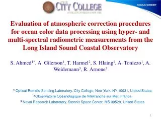
Uncertainties assessment and MODIS validation from multi- and hyperspectral measurements in coastal waters at Long Island Sound Coastal Observatory (LISCO). S. Ahmed, T. Harmel , A. Gilerson , S. Hlaing , A. Tonizzo Optical Remote Sensing Laboratory of the City College, New York

E N D
Uncertainties assessment and MODIS validation from multi- and hyperspectral measurements in coastal waters at Long Island Sound Coastal Observatory (LISCO) S. Ahmed, T. Harmel, A. Gilerson, S. Hlaing, A. Tonizzo Optical Remote Sensing Laboratory of the City College, New York R. Arnone and A. Weidemann Naval Research Laboratory, Stennis Space Center, MS ahmed@ccny.cuny.edu
Coastal Water Ocean Color Remote Sensing • Constituents of the water (phytoplankton biomass, sediment, …) can be estimated through Ocean Color Radiometry (OCR)… • …makes possible the atmosphere-ocean interaction quantification, the sediments, pollutants fluxes and ecosystem monitoring … • …at a global scale thanks to satellite observation. • Need for reliable ocean color satellite data MODIS 2011, Science Team Meeting
Coastal Water Ocean Color Remote Sensing Ocean Color Satellite Sensors Current missions • SeaWIFS (NASA) on GeoEye's satellite (8 spectral bands (from 412 to 865 nm) with 1.1 km resolution) • MODIS (NASA) on Terra and Aqua satellite (36 spectral bands (from 412 to 15 μm) with 250m - 1km resolutions) • MERIS (ESA) on ENVISAT satellite (16 spectral bands (from 412nm to 14.4 um) with 250m - 1km resolutions) • HICO (NASA) Hyperspectral Imager for the Coastal Ocean • PARASOL, MISR, OCM2, … Future missions • VIIRS (NASA) future replacement of MODIS, planned to launch in 2011 (22 Spectral bands (370nm to 12.5 um) with 650m resolution) • OLCI (ESA) next generation of MERIS on Sentinel-3 MODIS 2011, Science Team Meeting
Validation of the Ocean Color Satellite Sensors Ocean Color Satellite Validation Complex atmosphere over coastal area and non zero water signal in the near-infrared gives difficulties in the atmospheric correction procedures Satellite data must be validated against in situ measurements, especially in coastal water area MODIS 2011, Science Team Meeting
Validation of the Ocean Color Satellite Sensors Ocean Color Satellite Calibration Vicarious Calibration accounts for : • systematic biases in the atmospheric correction algorithm • changes to the prelaunch calibration resulting from the transfer to orbit. Calibration at MOBY site provides only ~15 matchup points per year need for alternative sources of ground-truth data Biases in the atmospheric correction algorithm are different in open ocean and coastal area need for sources of ground-truth data in coastal area Long Island Sound Coastal Observatory (LISCO) unique site in the world continuously providing multi and hyperspectral data from collocated instrumentation in coastal water area LISCO as reference site for validation/calibration of Ocean Color Satellite mission MODIS 2011, Science Team Meeting
Long Island Sound Coastal Observatory Contents • Long Island Sound Coastal Observatory (LISCO) characteristics • Multispectral (SeaPRISM) and hyperspectral (HyperSAS) data processing • LISCO Data Uncertainty of the collocated SeaPRISM and HyperSAS measurements • LISCO Ocean Color Radiometry Product Quality and application to MODIS • LISCO high quality data: Towards a Satellite Cal/val Site • Conclusion and perspectives MODIS 2011, Science Team Meeting
LISCO Site Characteristics LISCO Multispectral SeaPRISM system as part of AERONET – Ocean Color network LISCO [Zibordi et al., 2006] • Identical measuring systems and protocols, calibrated using a single reference source and method, and processed with the same code; • Standardized products of exact normalized water-leaving radiance and aerosol optical thickness MODIS 2011, Science Team Meeting
LISCO Site Characteristics Location and Bathymetry Depth in meters (GEBCO data) Water type: Moderately turbid and very productive (Aurin et al. 2010) Bathymetry : plateau at 13 m depth MODIS 2011, Science Team Meeting
LISCO site Characteristics Platform: Collocated multispectral SeaPRISM and hyperspectral HyperSAS instrumentations since October 2009 LISCO Tower Instrument Panel Retractable Instrument Tower 12 meters MODIS 2011, Science Team Meeting
SeaPRISM instrument LISCO Instrumentation HyperSAS Instrument • Sea Radiance • Sky Radiance • Downwelling Irradiance • Linear Polarization measurements • Hyperspectral: 180 wavelengths [305,900] nm • Sea Radiance • Direct Sun Radiance and Sky Radiance • Bands: 413, 443, 490, 551, 668, 870 and 1018 nm Data acquisition every 30 minutes for high time resolution time series MODIS 2011, Science Team Meeting 10
Multispectral (SeaPRISM) and hyperspectral (HyperSAS) data processing MODIS 2011, Science Team Meeting
Comparison of SEAPRISM and HyperSAS Above Water Signal decomposition LT=Lw+ ρ(W) Li+ Lg Li Total radiance Sky radiance Sun glint radiance θ Li Sun θ Water leaving radiance Sea surface reflectance factor Lw MODIS 2011, Science Team Meeting
Comparison of SEAPRISM and HyperSAS Above Water Signal Processing • LT=Lw+ ρ(W) Li+ Lg • measured by numerous acquisitions within 2-minute time window (11 for SeaPRISM and > 44 for HyperSAS) • The lowest 20% are taken, to minimize Lg(~ 0) impact • Liis measured • ρiscalculated for a givenwind speed [Mobley et al., 1999] • Lwis corrected for the bi-directional effect (BRDF, [Morel et al., 2002]) and for the atmosphere transmittance to get: • LWNthe exact normalized water-leaving radiance • (i.e. radiance for a nadir view and the sun at the zenith without atmosphere ) MODIS 2011, Science Team Meeting
Comparison of SeaPRISM and HyperSAS systems Technical Differences between HyperSAS and SeaPRISM Two Geometrical Configurations Instrument Set Up Looking Down on Instruments Instrument Panel HyperSAS SeaPRISM
SeaPRISM and HyperSAS data intercomparison MODIS 2011, Science Team Meeting
Comparison of SEAPRISM and HyperSAS data Example of data derived from HyperSAS and SeaPRISM measurements Example of the November 4th 2009 HyperSAS SeaPRISM • Agreement between the two datasets • HyperSAS data contain significant hyperspectral information not sensed by SeaPRISM HyperSAS data Possibility of satellite spectral band matching by spectral integration MODIS 2011, Science Team Meeting
Intercomparison of SEAPRISM and HyperSAS data • from October 2009 up to January 2011 • HyperSAS data integrated on the SeaPRISM bandwidth • Satisfactory agreement over more than one year period encompassing a large range of environmental conditions • Consistency of the multi- and hyper-spectral datasets MODIS 2011, Science Team Meeting
Comparison of SEAPRISM and HyperSAS • SeaPRISM(parametrization) Differences between HyperSAS and SeaPRISM Two Atmospheric Transmittance(Td) Computations Optical thickness: Rayleigh Aerosol Ozone • HyperSAS(direct measurement) Needs to improve the SeaPRISM model MODIS 2011, Science Team Meeting
Collocated SeaPRISM and HyperSAS Data Comparison Uncertainty Estimation • Strong Correlation • Regression Line Slope ~1 • Dispersion induced by • Sun glint: 2.5% • Sky glint: 6% • Bidirectionality: -1.5% • Atm. Transmittance: 5% • Positive Bias in HyperSAS induced by the different Atmospheric Transmittance Derivations of the two systems [Harmel et al., Appl. Opt., In Rev.] MODIS 2011, Science Team Meeting
Hyperspectral (HyperSAS) data quality and uncertainty SPIE Defense, Orlando 2011 20
HyperSAS data processing Data Quality Process Ratio of the irradiance measured at 443 nm by HyperSAS to its theoretical clear-sky value Relative standard deviation of sky radiances Ls having passed the Irradiance ratio filter Values in shaded area pass the data quality process Elimination of overcast conditions Elimination of fast sky variation: scattered clouds, birds… SPIE Defense, Orlando 2011 21
HyperSAS data Intrinsic Uncertainties Uncertainty estimation scheme 20% of the lowest Sea Radiance Direct Measurements Exact Normalized Water-leaving Radiance Data Processing Input variance Output variance • Data Processing applied to each direct measurements of a sequence separately • Intrinsic Uncertainty = Output Standard Deviation SPIE Defense, Orlando 2011 22
Multispectral Satellite Data Validation at LISCO Site MODIS 2011, Science Team Meeting
Satellite Validation Satellite Pixel Selection for Matchup Comparison Validation of MERIS, MODIS-Aqua and SeaWiFS against the LISCO Data Satellite Data Processing: Standard NASA Ocean Color Reprocessing 2009 3km×3km pixel box for matchup comparison Exclusion of pixel box if presence of cloud-contaminated pixels in this 9km×9km pixel box Also exclusion of any pixel flagged by the NASA data quality check processing (Atmospheric correction failure, sun glint contamination,…) MODIS 2011, Science Team Meeting
Satellite Validation Aerosol Optical Thickness Validation 1:1 line AERONET Uncertainty Regression Line Strong Correlation and most of the matchup points are within the AERONET uncertainty for all satellite (best performance for MODIS-AQUA) Representativeness of LISCO site - suitable for aerosol retrieval MODIS 2011, Science Team Meeting
Satellite Validation Time Series of Water Remote Sensing Reflectance (Rrs) [sr-1] Consistency in seasonal variations observed from the platform and from space MODIS 2011, Science Team Meeting
Satellite Validation LISCO Data used for Satellite validation Mean value Mean value ± Std deviation Hyperspectral and multispectral spectra exhibit similar patterns over 1.5-year period MODIS 2011, Science Team Meeting
Satellite Validation MODIS Rrs MODIS Rrs • Same order of Absolute Percentage Difference (APD) and Absolute Difference (AD) as the other sites of AERONET-OC [Zibordi et al., 2009] • indicating reliable use of the hyperspectral information to validate satellite data is possible MODIS 2011, Science Team Meeting
Satellite Validation LISCO Data Merging • Time coincident HyperSAS and SeaPRISM spectra are averaged • Minimization of respective biases • Powerful data filtering • Provide high quality data for calibration of Ocean Color Satellite MODIS 2011, Science Team Meeting
Satellite Validation Use of merged in situ data: Improve correlation and regression Reduce dispersion in comparison to the two datasets taken separately HyperSAS APD=23.6% SeaPRISM=23.7% Merged APD =18.1% (APD is driven by very low values, but the Absolute Diff. stays very low in respect to the radiometric resolution of the satellite) MODIS Rrs Collocated instruments permit data quality assurance Very high-quality data for calibration purposes MODIS 2011, Science Team Meeting
Use of hyperspectral data MODIS-Aqua Bands HyperSAS SeaPRISM MODIS Ocean Bands MODIS Land Bands Data of the November 4th 2009 HyperSAS data provide supplementary bands for the MODIS data validation Especially for the MODIS Land Bands at 469 and 645 nm MODIS 2011, Science Team Meeting
Use of hyperspectral data Validation of MODIS-Aqua Land Bands HyperSAS data have been convolved with the MODIS Spectral Response functions • Satisfactory agreement at 555 and 645nm, but MODIS underestimates the water-leaving radiance at 469nm. • Important use of hyperspectral data for : (i) making match-up for MODIS data out of the SeaPRISM bands; (ii) taking into account the specific Spectral Response functions MODIS 2011, Science Team Meeting
Conclusions • LISCO unique site in the world with collocated multi and hyperspectral instrumentation for coastal waters monitoring • Comparison between multi and hyperspectral data of SeaPRISM and HyperSAS shows excellent consistency. • Collocated instruments give us the quality assurance data to compare with the satellite remote sensing data. Data merging very high-quality data potentially for calibration purposes • Co-located Hyperspectral instrument gives us the advantage in making match-up for multiple satellites data with different center wavelengths. • Results, over 1.5-year time series, proved that the LISCO site is appropriate for effective validation & potentially calibration of the current and future ocean color remote sensing sensors in coastal water area as a key element of the AERONET-OC network MODIS 2011, Science Team Meeting
Ongoing work • Improvement of the bi-directionality models for the normalized water-leaving radiance derivation by using radiative transfer calculation for typical coastal waters • Measurements of the polarization properties of coastal waters • Development of a web tool designed for near-real-time comparison of satellite and LISCO data (Collaboration with NRL) • Application to the validation and calibration of hyperspectral satellite imagery of HICO • LISCO as a basis for the validation scheme of the future VIIRS satellite mission • Satellite Vicarious Calibration from high-quality LISCO data • Acknowledgment • Partial support from: • Office of Naval Research • National Oceanographic and Atmospheric Administration MODIS 2011, Science Team Meeting
HyperSAS data Intrinsic Uncertainties Intrinsic Uncertainty (in grey when < 5%) in respect to the sensor viewing configuration Sun Glint Contamination Solar Zenith Angle [deg] Consistency with theoretical results [Mobley, 1999] Satisfactory data quality for large azimuth range [60°;200°] regardless of Sun elevation SPIE Defense, Orlando 2011 35
HyperSAS data Intrinsic Uncertainties Intrinsic Uncertainty (in grey when < 5%) during Spring and Winter • uncertainties are below 5% for the spectral range of 330 to 750 nm until 2pm • after 2:30pm the contribution of the sun glint is strongly increasing and no data remain sufficiently accurate in Spring • Satisfactory Data Quality for Satellite spectral range and time overpass SPIE Defense, Orlando 2011 36
HyperSAS data Intrinsic Uncertainties Intrinsic Uncertainty (in grey when < 5%) in respect to the sensor viewing configuration Sun Glint Contamination Solar Zenith Angle [deg] Consistency with theoretical results [Mobley, 1999] Satisfactory data quality for large azimuth range [60°;200°] regardless of Sun elevation SPIE Defense, Orlando 2011 37
HyperSAS data Intrinsic Uncertainties Intrinsic Uncertainty (in grey when < 5%) during Spring and Winter • uncertainties are below 5% for the spectral range of 330 to 750 nm until 2pm • after 2:30pm the contribution of the sun glint is strongly increasing and no data remain sufficiently accurate in Spring • Satisfactory Data Quality for Satellite spectral range and time overpass SPIE Defense, Orlando 2011 38